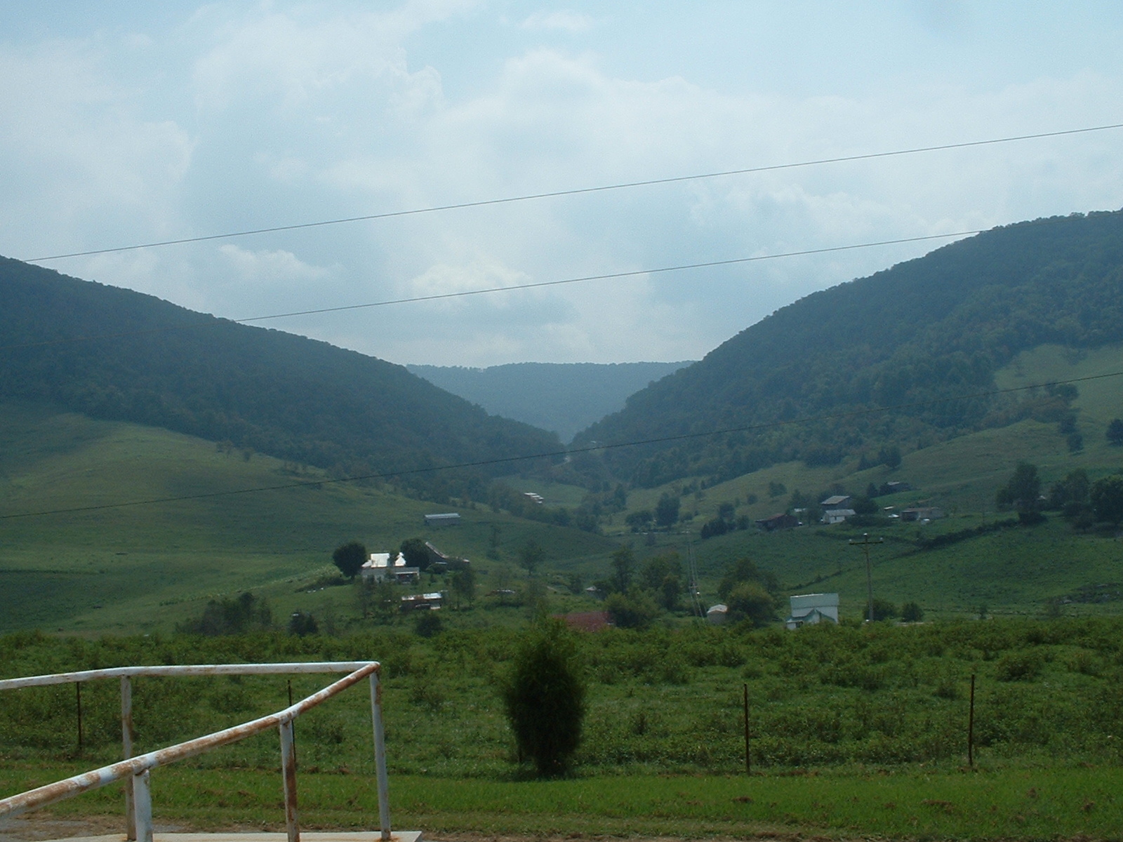
Mulberry from the old
Mulberry Gap school. Photo by Phillip A. Walker
9/2/2005. Click photo for a larger view.
The Mulberry Gap area, primarily in Hancock County,
Tennessee, currently falls into the Sneedville Post
Office area. As a geographic feature, it is a gap in
Powell Mountain; the ridge on the other side of it in
the photo here is Newman's Ridge, a major ancestral
home to the Melungeons.
Sarah (Crumley) Walker, the widow of Edward Jr., called
the place where she lived "near Mulberry Gap".
The exact location is on the southwestern end of Mulberry
Gap Road near the intersection with Little Sycamore
Road; in an earlier era, Little Sycamore Road was also
considered part of the Mulberry road, and Walkers lived
on Little Sycamore Road as well. Other names for the
region in question and closely-surrounding areas are
or have been:
Yellow Springs
Hoop/Hoop Creek
New Salem
Howard's Quarter
Generally, both this site and my Family
File
use "Mulberry Creek" to refer to the area
where Edward Jr. lived and exact modern street names
whenever known.
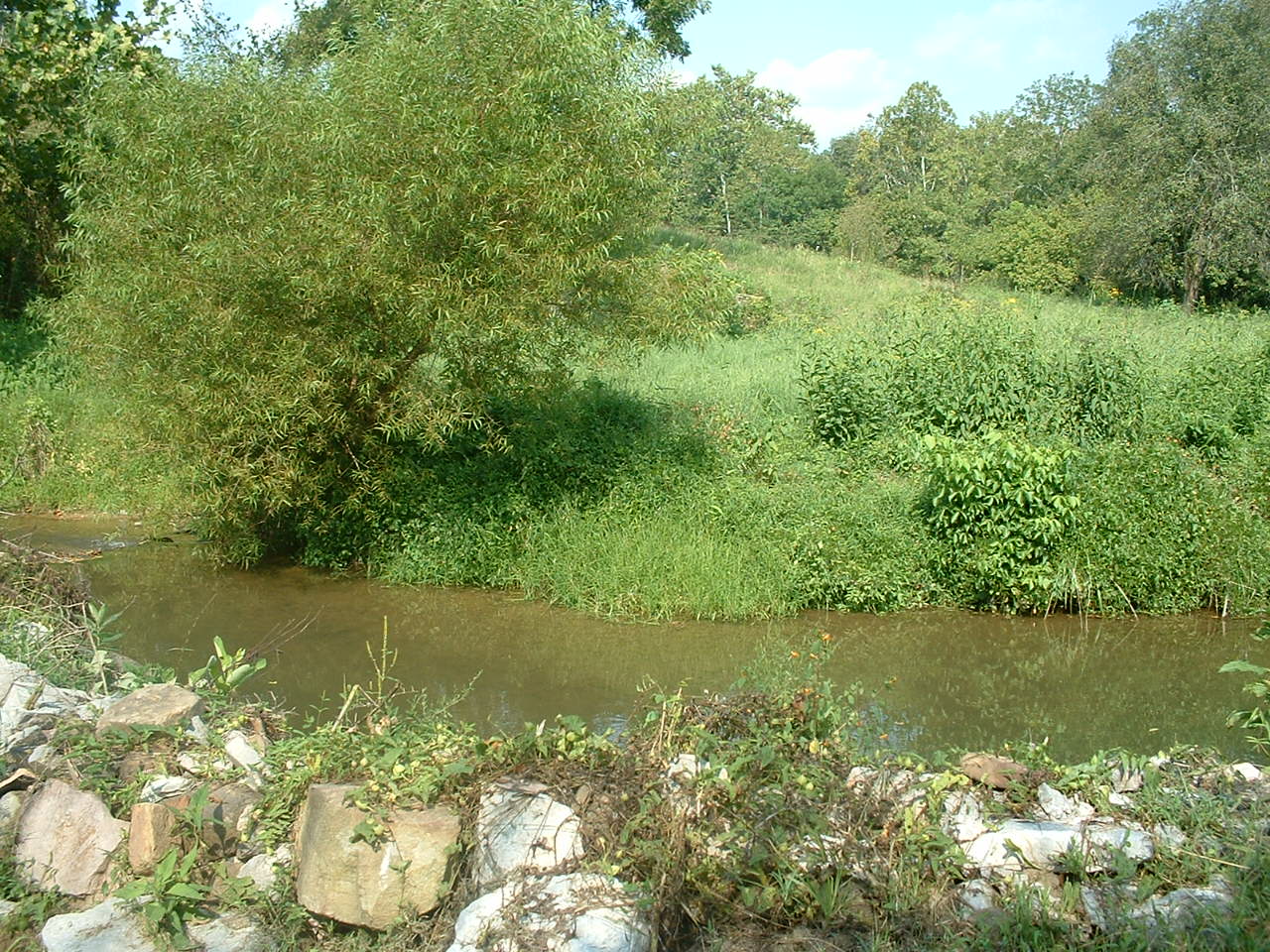
Mulberry Creek in front
of Edward Walker, Jr.'s, home. Photo taken by
Phillip A. Walker 9/2/2005.
The Mulberry area was settled early and was a thriving
settlement by 1803. The Walkers seem to have settled
the area around 1816 or 1817, although some perhaps
a little earlier. Certainly, some friends and in-laws
had moved to the area no later than 1802.
Bordered on one side by Powell's Mountain and on the
other by Little Ridge, the area is a narrow, rocky valley
typical of East Tennessee. Today, practically no one
passes through the area on the way to anywhere; it is
quite far from major roads and towns. It is a beautiful
but isolated valley where farming is still common but
not usually very profitable, and some new and some very
old houses, including Edward, Jr.'s, can still be found.
But when the Walkers moved to the area and for many
years thereafter, the area was a thriving community
which was not particularly isolated at all. The Mulberry
road, including what is now called Little Sycamore Road,
was once a much more travelled path, and the Powell
River is nearby. The transportation paths and modes
of an earlier area gave area residents easy access to
markets in Tennessee, Kentucky, Virginia, and even North
Carolina, by land and by water. Among other things,
a number of merchants would have been nearby to supply
both locals and travelers.
Apparently in both the 1920s and the 1960s, portions
of what is now Mulberry Gap Road have moved a little
one way or another. While the current road is not exactly
as the Walkers would have known it, the path is close.
Near the home of Edward Walker, Jr., for instance, the
road appears to have run directly next to the creek.
Using modern names, just to the north is Lee County,
Virginia, and not far to the west is Bell County, Kentucky.
This sliver of Hancock County is very near the Claiborne
County border and was part of that county until
Hancock County was established.