
Hague, Warren Co., NY
The roads and other sights
Date Last Updated: 06/07/2007
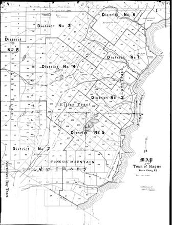
Below is a version 1910 map of the town of Hague, drafted by Water Watts and approved by R. J. Bolton. The original map had grid-work outlining the parcels of land within the various tracts and contained the outline of the 8 districts within the town. The parcel grid-work and district outlines were digitally removed. The roads were traced with red to enhance clarity.
Below the map are some postcards from Mike De Larm's collection from the early 1900s that show what the town looked like during that timeframe. Postmarks on a large number of the cards let us know the when scene was photographed "prior to". Other postcards have vehicles in the background that are from that timeframe.
The postcards are grouped by road and area:
"Hague Road" adjacent to Lake George, traveling North from the village
"Hague Road" adjacent to Lake George, traveling South from the village
"Graphite Road", traveling West from the villageAs you trace the roads on the map using your mouse, you will notice your pointer will change and allow you to view the scene from that point. Currently, this feature works best using Microsoft's Internet Explorer. Remember to click on the "Back" button in your browser to return to this page.
There are a few scenes "just off" the main road - have fun exploring!
©2007, Bruce De Larm. These records are protected by copyright laws
and may not be copied or reproduced without permission.
(Home)
"Hague Road, traveling North from the Village of Hague.
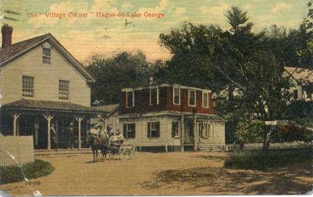 The village corner - Postmarked 1920
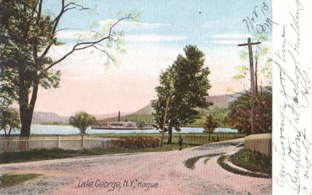
 The mouth of Hague Brook - Postmarked 1909
 "Hague Road" North from Burgess's store - Postmarked 1908
 "Hague Road" looking South - Postmarked 1908 (not on map)
 "Hague Road" looking North at the Rising House
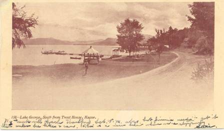 Looking South from the Trout House - 1908 (not on map)
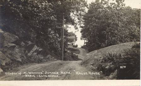 The "Hague Road" at the Watrous House near Island Harbor
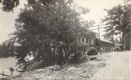 The road at the Island Harbor House
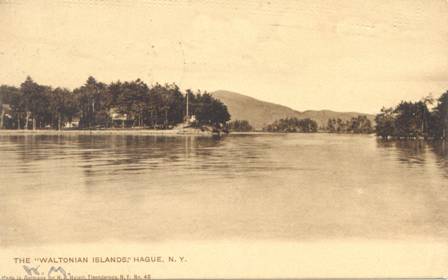 The Waltonian Islands - Postmarked 1906
 The road between Hague and Baldwin (heading toward the Roger's Rock Hotel) - Postmarked 1909
"Hague Road", traveling South from the Village of Hague.
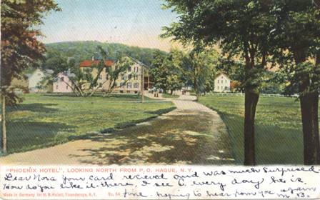 "Hague Road" North to the Phoenix - Postmarked 1907
 "Hague Road" Near The Boat-Dock - Postmarked 1908
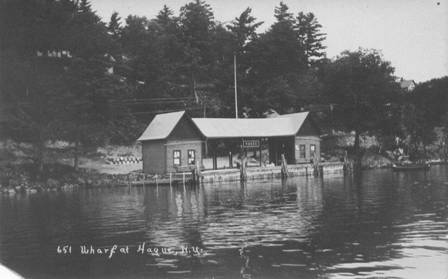 Hague Boat-Dock
 "Hague Road" North to the Boat-Dock - Postmarked 1908
 Road along the lake - Postmarked 1907 (not on map)
 The view at Jabes Pond - Postmarked 1915
 Split Rock - Postmarked 1910
![]() Looking North at Silver Bay - Postmarked 1910
Looking North at Silver Bay - Postmarked 1910
 Silver Birches at Sliver Bay - Postmarked 1910
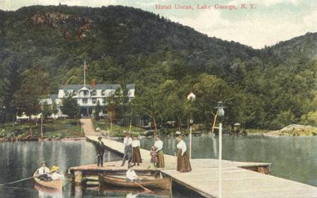
 The road near the Uncas Hotel - Postmarked 1908
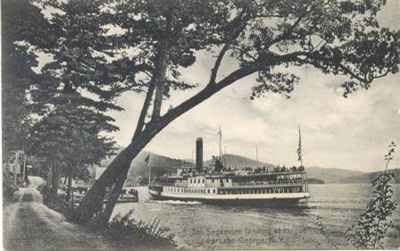
 The dock at the Hotel Uncas - Postmarked 1909
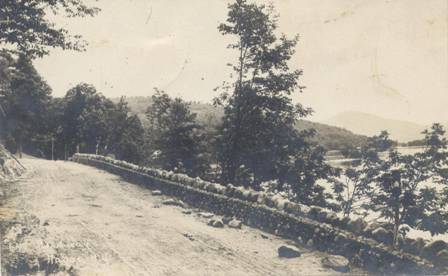
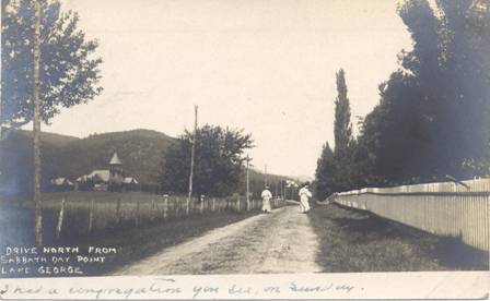
 The road heading south to Sabbath Day Point
 Looking North on the road near the Grace Memorial Chapel - Postmarked 1908
 Sabbath Day Point - Postmarked 1910
 The road near Sabbath Day Point - Postmarked 1907
 Deer Leap from a steamer on the lake - Postmarked 1903
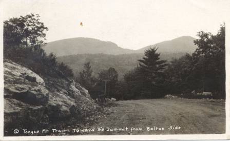 Tongue Mountain Trail toward the summit from the Bolton side - Postmarked 190?
"Graphite Road" traveling West from the Village of Hague
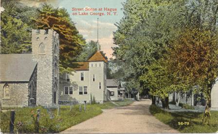 "Graphite Road" looking West in the village
 "Graphite Road" heading West at the Wesleyan Methodist Church
 The road from Hague to Graphite (AKA: The Fenimore Cooper Trail - looking East, just West of the village)
 The road from Hague to Graphite, (AKA "The Fenimore Cooper Highway" - looking East toward the village of Hague)
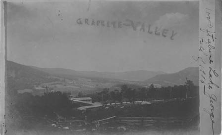 Graphite Valley (as seen from the Graphite Mill in 1905)
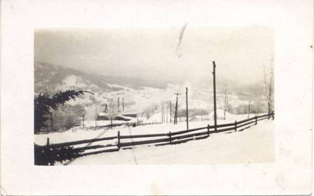 Graphite Valley (in 1911 - Brrrr!)
 Graphite Mill - Postmarked 1908
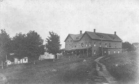 Graphite Boarding House - Postmarked 1912
 "Haying-Time" On the Smith Farm on the road to Lake George, N. Y. - Postmarked 1907 (not on map)
 The road from Graphite to Brant Lake (AKA: The Fenimore Cooper Trail)