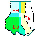
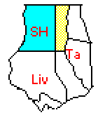
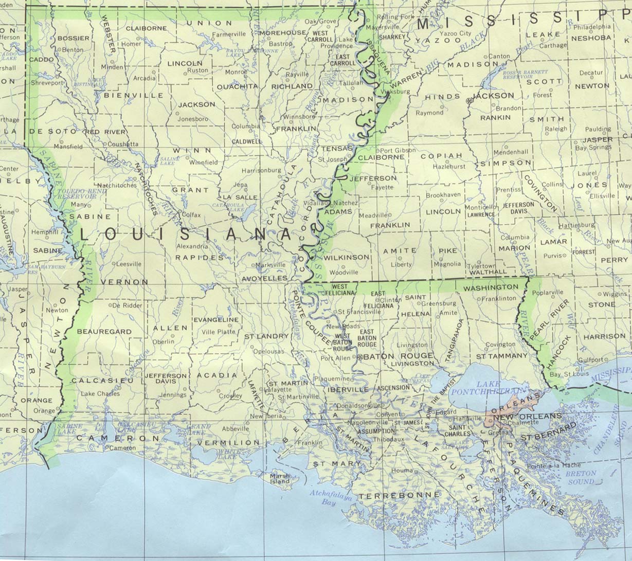
LA Historical County Lines
Return to HISTORICAL COUNTY LINES home page
AL AK AR AZ CA CO CT DE DC FL GA HI ID IL IN IA KS
KY LA ME MD MA MI MN MS MO MT NE NV NH NJ NM NY NC
ND OH OK OR PA RI SC SD TN TX UT VT VA WA WV WI WY
Archive.org Off-line site accessed via Archive.org. Note: These are not live sites.

LA flag

LOUISIANA

  • County Formation Maps from Southeastern Genealogy Online.

  • USGenWeb Digital Map Library for Louisiana. Maps showing counties for 1828, 1835, 1855, 1860, 1863, 1866, 1895, 1899, and 1907 plus many other maps of interest.

  • UA From Univ. of Alabama Historical Map Index:

  • Missouri USGenWeb page District of Louisiana 1804.

  • St.Helena Parish, LA. AniMap note.

    • 1810. Following the ouster of Spanish officials following a rebellion by residents, the U.S. assumed control of this area although it was still claimed by Spain. St. Helena Parish was formed at that time (colored area). It is shown in comparison to the modern parishes of St.Helena, Livingston, and Tangipahoa.

    • 1832,1869. In 1832, the area that was formerly St. Helena Parish was divided into St. Helena and Livingston. The remaining St. Helena Parish (colored area) is shown in comparison to modern parishes of St. Helena, Livingston, and Tangipahoa..

      In 1869, Tangipahoa was formed and St. Helena took its final form (shown in blue).

  • St.Tammany Parish, LA. AniMap note.

    • 1810. St. Tammany was formed at the same time that St. Helena was, above. It (colored area) is shown in comparison to the modern parishes of Tangipahoa, Washington and St. Tammany.

    • 1819,1869. In 1819, the area that was formerly St. Tammany Parish was divided into St. Tammany and Washington parishes. The remaining St. Helena Parish (colored area) is shown in comparison to modern parishes of St. Tammany, Washington and Tangipahoa.

      In 1869, Tangipahoa was formed and St. Tammany took its final form (shown in blue).

  • Washington Parish LA as formed in 1819 from St. Tammany as it existed at that time. Washington Pr. (in color) is shown in relation to modern parishes of Washington, Tangipahoa and St. Tammany.

    In 1869, Tangipahoa was formed and Washington Parish took its final form (shown in blue). AniMap note.

  • Livingston Parish, LA. AniMap note.

    • 1832. Livingston was formed from the existing St. Helena Parish in 1832. Livingston (colored area) is shown in comparison to modern parishes of Livingston and Tangipahoa.

    • 1843. Livingston gained territory (dark blue) from what was then Ascension Parish, but what is in the present-day Livingston Parish.>

    • 1869. In 1869, Tangipahoa was formed and Livingston Parish took its final form (shown in light and dark blue)

  • Tangipahoa Parish LA (shown in color) as formed in 1869 from St. Helena, Washingon, Livingston and St. Tammany as they existed at that time. The colors show which portion came from which parish. AniMap note.

  • LA and eastern AR 1835 Large (184K) from Thomas Bradford atlas published in Boston. From The Maps Our Ancestors Followed A TNGenWeb genealogy history project.

  • Hargrett Collection, U. of GA Large (493K), 1839, AR, TN, w.NC, SC, GA, AL, MS, and LA. Click "back" to return here.

  • From Pam Rietsch's 1895 Atlas site

  • From Univ. of Texas Library Louisiana maps.

Continue to Maine     State menu     Main page

Your suggestions for links are most welcome. Send email to John Robertson.
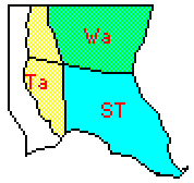
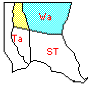
LinkChecker All links verified with LinkChecker FireFox extension
2/7/2007 10:39AM