 Off-line site accessed via Archive.org. Note: These are not live sites. Off-line site accessed via Archive.org. Note: These are not live sites.
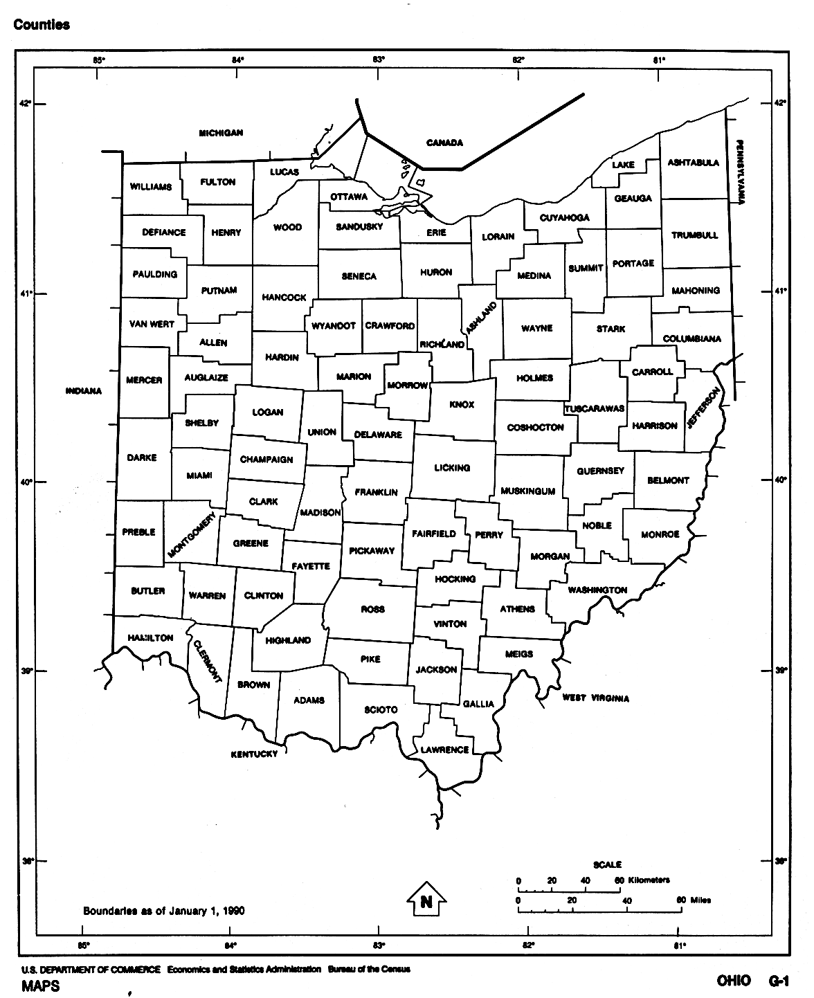
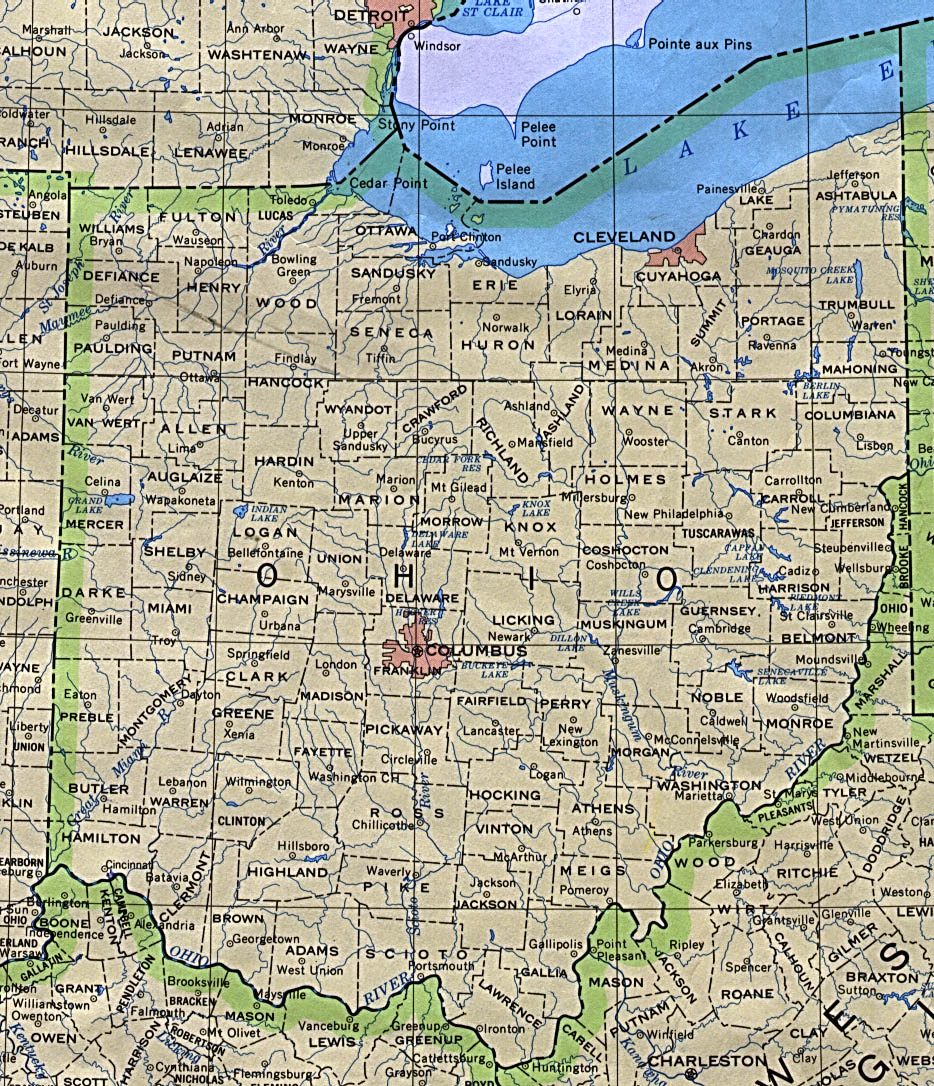
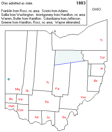
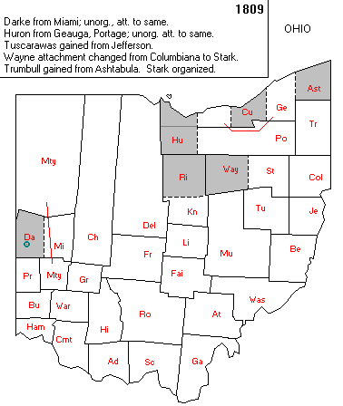
OHIO
- County Formation Maps
from Northeastern Genealogy Online.
 From Univ. of Alabama Historical Map Index: From Univ. of Alabama Historical Map Index:
- USGenWeb Digital Map Library for Ohio. Indiana & Ohio 1835, Ohio 1873. More interesting maps here.
 From American Memory at Library of Congress: From American Memory at Library of Congress:
- Jackson
Co. USGenWeb page Jackson Co. Boundary changes: 1800, 1810, 1816,
1818, 1839, 1843, 1850. You will need to click on "back" to
get back here.
- Harrison Co.
OH USGenWeb pag OH 1813, 1833 (Gold
Bug). You will need to click on "back" to get back here.
To get to the host page, you need to go here.
- From the old Muskingum Co.
USGenWeb page OH Boundary changes: 1804, 1808, 1810, 1813 and 1833
(Gold Bug). You will need to click on
"back" to get back here.
-
From Scioto.Org
- Scioto County OH:
Pre-Statehood,
1797,
1798,
1803,
 1804,
Feb 1815,
Dec 1815,
1816,
1826,
Today
1804,
Feb 1815,
Dec 1815,
1816,
1826,
Today
- Adams County OH:
Pre-Statehood,
1797,
Aug 1798,
Sep 1798,
1803,
1805,
1818 to present
- Pike County OH:
Pre-Statehood,
1803,
1815. Becomes county.
1843,
Today
- Ross County OH:
Pre-Statehood,
1797,
1798,
1800,
Apr 1803,
May 1803,
1805,
1810,
1815,
1816,
1834,
1850,
Today
- Lawrence County OH
Pre-Statehood,
1815,
1818,
1826,
Today
 From Pam Rietsch's 1895 Atlas site From Pam Rietsch's 1895 Atlas site
 From Univ. of Texas Library Ohio maps. From Univ. of Texas Library Ohio maps.
- From How They Got to Darke County:
1803, 1809. AniMap.
Continue to Oklahoma
State menu
Main page
Your suggestions for links are most welcome.
Send email to John Robertson.
|
