| |
|
|
|
| Now I get to tell you where to go. ;) |
| |
 |
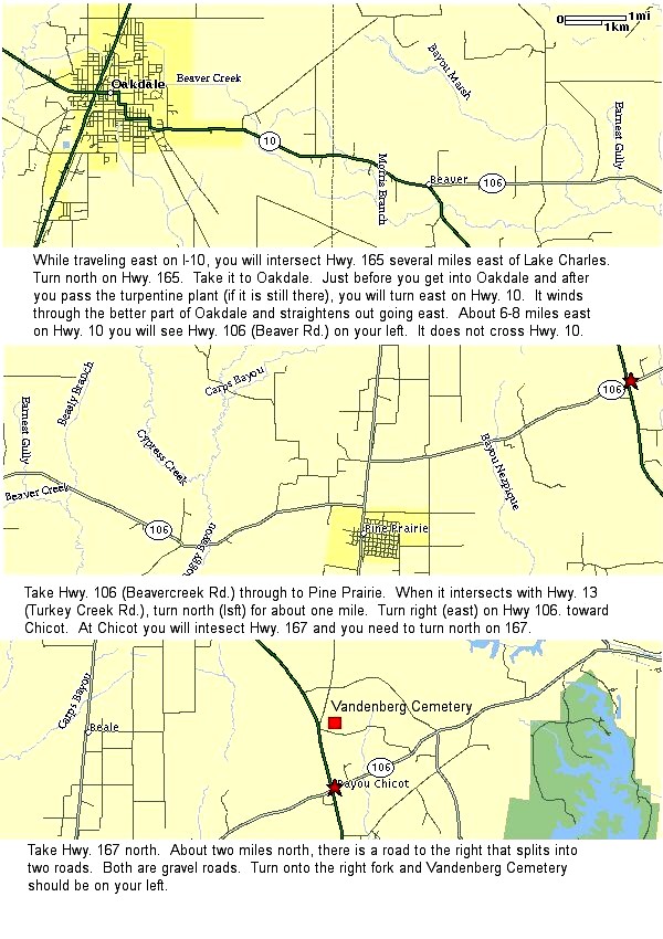
This is a great set of route maps Bryant Walker made for me (Hi Dad!). He even included a text description of the route. Take note that this is a VERY scenic route. The drive in the hills is awesome! BUT it can also be a bit long especially if Jimbo knew you were coming and figures it's the perfect time to cruise the hills on his John Deer tractor. If it's your first trip on this route you might avoid going at night. Lots of twists and turns. :) |
| |
 |
This is a set I put together using major interstates. Not nearly as pretty as the route above but after 500 trips you might feel the need for speed! Interstates 10 and 49 will bring you to Bayou Chicot from any direction so these work well for most everyone. |
| |
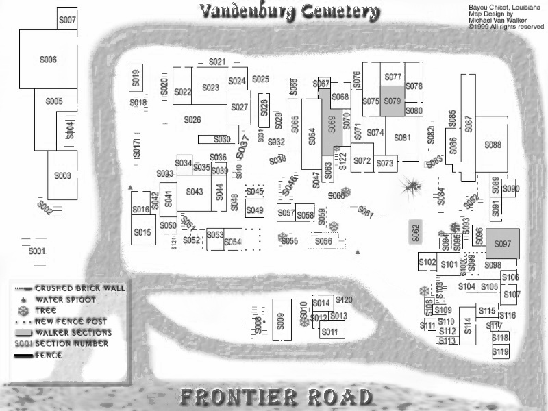
| Next you'll find the map (and I use the term VERY loosely) I made of the actual cemetery. There are two sizes and I included greyscale versions of both. |
| |
| I know it's cheezy but it worked for me! The cemetery is laid out in a very haphazard fashion. Once you find a plot of interest in the data tables you can use this map to easily find the physical location using the SECTION number. |
| |
 |
This is the big color one I use. It's 1024 x 768 and is naturally the easiest to read. And don't laugh at my trees! I needed some object to associate the plot locations with so I tried to mark the biggest trees in area. |
| |
 |
This is the 800 x 600 version of the one above. I created this one since scaling it down from the original image gives you a better quality smaller print. |
| |
 |
Finally finished making greyscale versions. This one is 1024 x 768. |
| |
 |
This is the 800 x 600 greyscale version. |
| |