SARRETT/SARRATT/SURRATT Families of America (SFA)©
SFA© Profiles ~ 1980 Volume V. Missouri

Sorted buy County, then family group! ..prs
Barry Co., Cassville;
Bates Co., Butler;
Benton Co., Warsaw;
Cass Co., Harrisonville;
Cedar Co., Stockton;
Dunklin Co., Kennett;
Howell Co., West Plains;
Iron Co., Ironton;
Jackson Co., Kansas City;
McDonald Co., Pineville;
Platte Co., Cassville;
Related, Families;
Sullivan Co., Milan;
Wayne Co., Greenville;
| |
 Barry, County MO.
was created in 1835 from [791 Sq. Miles] the larger Greene Co.
The County Seat is
Barry, County MO.
was created in 1835 from [791 Sq. Miles] the larger Greene Co.
The County Seat is  <---
Cassville, MO. 65625 It is located in the
Southeastern part of the State: Bounded by Lawrence Co. on
the North; Stone Co., on the East; Benton & Carroll Co's
of Arkansas on the South; with Newton & <---
McDonald Co's, MO.
on the West.(First Census 1840; Their was an error in Survey, rectified in 1876,
established the Western line 2 1/2 miles East of previous Boundary; In 1872, many records in Circuit
Court Office were destroyed by fire. Recorder of Deeds has m. & Land rec.
Clerk Circuit Court has Div. & Civil Court rec. Probate Judge has Probate records. <---
Cassville, MO. 65625 It is located in the
Southeastern part of the State: Bounded by Lawrence Co. on
the North; Stone Co., on the East; Benton & Carroll Co's
of Arkansas on the South; with Newton & <---
McDonald Co's, MO.
on the West.(First Census 1840; Their was an error in Survey, rectified in 1876,
established the Western line 2 1/2 miles East of previous Boundary; In 1872, many records in Circuit
Court Office were destroyed by fire. Recorder of Deeds has m. & Land rec.
Clerk Circuit Court has Div. & Civil Court rec. Probate Judge has Probate records.
<---
See: 1895 County Map!
<---
See: County Stats from Wikipedia, (the free encyclopedia)
|
| Chap. |
FName |
LName |
b. - d. |
Married |
From |
 Bates, County MO.
was created in 1841 from [851 Sq. Miles] the larger Cass, Van Buren, & Jackson Co.'s
Was named after Frederick BATES, the second governor of Missouri.
The County Seat is <---
Butler, MO. 64730 It is located in the
Southeastern part of the State: Bounded by:
<---
Cass County (North);
Henry County (Northeast);
St. Clair County (Southeast);
Vernon County (South);
Linn County, Kansas (West);
Miami County, Kansas (Northwest);
Bates, County MO.
was created in 1841 from [851 Sq. Miles] the larger Cass, Van Buren, & Jackson Co.'s
Was named after Frederick BATES, the second governor of Missouri.
The County Seat is <---
Butler, MO. 64730 It is located in the
Southeastern part of the State: Bounded by:
<---
Cass County (North);
Henry County (Northeast);
St. Clair County (Southeast);
Vernon County (South);
Linn County, Kansas (West);
Miami County, Kansas (Northwest);
Cities and Towns:
Adrian;
Amoret;
Amsterdam;
Butler;
Drexel;
Rich Hill;
Rockville;
(First Census 1850; On Feb 22 1855, the three tier of
Townships in Cass Co. were added to Bates Co. The Courthouse burned in 1861, their are some rec.
prior to 1861; County Clerk has b. & d. rec. from 1883 to 1887; County Recorder Office has m.
rec. from 1860 and Land rec. from 1840; Clerk Circuit Court has Div. from 1860; Probate Judge has Probate rec.
<---
See: 1895 County Map!
<---
See: County Stats from Wikipedia, (the free encyclopedia)
<---See: Adrian, MO. on Google.com Map! GPS Coordinates: Latitude: 38.398855, Longitude: -94.351444
<---See: Butler, MO. on Google.com Map! GPS Coordinates: Latitude: 38.260289, Longitude: -94.330673
|
 Benton, County MO.
was created in 1835 from [752 Sq. Miles] the larger Perris & St
Clair Co.'s. The County Seat is Warsaw, MO. 65355. It is located
in middle of the State; Bounded by: Perris Co. on the North;
Morgan & Camden Co. on the East; Hickory Co., on the South;
with Henry & St Clair Co.'s on the West.
(First Census 1840, Co. Clerk has b. & d. rec from 1883, m.
rec from 1839; Pro Court has pro rec; Co. Clerk has land rec.)
Benton, County MO.
was created in 1835 from [752 Sq. Miles] the larger Perris & St
Clair Co.'s. The County Seat is Warsaw, MO. 65355. It is located
in middle of the State; Bounded by: Perris Co. on the North;
Morgan & Camden Co. on the East; Hickory Co., on the South;
with Henry & St Clair Co.'s on the West.
(First Census 1840, Co. Clerk has b. & d. rec from 1883, m.
rec from 1839; Pro Court has pro rec; Co. Clerk has land rec.)
<---
See: 1895 County Map!
<---
See: County Stats from Wikipedia, (the free encyclopedia)
|
| Sixth Generation!
<---
4th Son of John,16 Jr. & Kizziah (WORLEY) SURRETT
|
| Chap. |
FName |
LName |
b. - d. |
Married |
From |
| 6. |
John M. |
SARRETT |
c1842-1913 |
m. *1864 1) Nancy M. CARLETIN, 3Ch.
m. c1881 2) Nancy Unknown, 2Ch. |
See Buncombe Co., NC. |
 Cass, County MO.
was created in 1835 from [703 Sq.Miles] the larger Jackson Co.
The County Seat is <---
Harrisonville, MO. 64701. It is located in the
Northwestern part of the State, on Kansas state border. Bounded by:
<---
Jackson County (North)
Johnson County (East)
Henry County (Southeast)
<---
Bates County (South)
Miami County, Kansas (Wes)
Johnson County, Kansas (Northwest)
Cass, County MO.
was created in 1835 from [703 Sq.Miles] the larger Jackson Co.
The County Seat is <---
Harrisonville, MO. 64701. It is located in the
Northwestern part of the State, on Kansas state border. Bounded by:
<---
Jackson County (North)
Johnson County (East)
Henry County (Southeast)
<---
Bates County (South)
Miami County, Kansas (Wes)
Johnson County, Kansas (Northwest)
Cities and Towns:
Archie;
Baldwin Park;
Belton;
Cleveland;
Creighton;
East Lynne;
Freeman;
Garden City;
Gunn City
Harrisonville;
Lake Annette;
Lake Winnebago;
(First Census 1850, Was organized as Van Buren Co. in 1835, renamed on Feb 19, 1849
after Michigan U.S. Senator & Presidential Candidate Lewis CASS to to Cass County.
Three Southern tiers of Township relinquished to Bates Co. on Feb 22, 1855;
County Clerk has partial b. rec. 1883 to 1896, m. rec. from 1845, div rec. from 1830's, Probate,
Civil Court rec. from 1800's; Land rec. from 1837)
<---
See: 1895 County Map!
<---
See: 1930 Cass County Township Map!
<---
See: County Stats from Wikipedia, (the free encyclopedia)
<---See: Harrisonville, MO. on Google.com Map! GPS Coordinates: Latitude: 38.654148, Longitude: -94.349213
|
 Cedar, County MO.
was created in 1845 from [499 Sq.Miles] the larger Dade & St Clair Co's.
The County Seat is <---
Stockton, MO. 65785. It is located in the
Southwestern part of the State: Bounded by St Clair Co. on
the North; Polk Co., on the East; Hickory Co. on the South;
with Vernon & Barton Co's, on the West.
(First Census 1850, Co. Clerk has m., div, & Land rec from
1845; pro, & Civil Court records.)
Cedar, County MO.
was created in 1845 from [499 Sq.Miles] the larger Dade & St Clair Co's.
The County Seat is <---
Stockton, MO. 65785. It is located in the
Southwestern part of the State: Bounded by St Clair Co. on
the North; Polk Co., on the East; Hickory Co. on the South;
with Vernon & Barton Co's, on the West.
(First Census 1850, Co. Clerk has m., div, & Land rec from
1845; pro, & Civil Court records.)
<---
See: 1895 County Map!
<---
See: County Stats from Wikipedia, (the free encyclopedia)
|
Fifth Generation!
<---
4th Son of Allen, 2 & Elizabeth Sarrett, ARW Soldier!
<---
(Uncle of Mrs. Salena A. (SARRETT) JAMES)
|
| Chap. |
FName |
LName |
b. - d. |
Married |
From |
7. |
Samuel,11 |
SARRETT |
c1800-1870 |
m. *1827 TN Mary Polly OLDHANCE, 3Ch. |
Spartanburg Co., SC |
Sixth Generation!
<---
(1st Dau of Tyre & Sus-An'Ah (Miller) Sarrett)
<---
(Gran Dau of Allen, 2 & Elizabeth Sarrett) ARW Soldier!
|
| Chap. |
FName |
LName |
b. - d. |
Married |
From |
| 1. |
Salena A. |
SARRETT |
*1815-1893 |
m. *1841 TN Rev. Riley JAMES, 7Ch. |
Sevier Co., SC |
 Dunklin, County MO.
was created in 1845 from [547 Sq. Miles] the larger Stoddard County.
The County Seat is <---
Kennett, MO. 63857. It is located in the Southeast "Bootheel" of the State; Bounded by:
Stoddard Co. on the North;
Ptemiscott Co. on the East;
State Arkansas on the South;
Mississippi Co., Arkansas (southeast)
Craighead Co., Arkansas (south)
Greene Co., Arkansas (southwest)
(First Census 1850, in 1853 a strip of land one mile wide was taken from Stoddard and add to Northern boundary
of Dunklin Co. The Court House was burned in 1872 All Records Were Lost! Recorder Deeds has
m., Land, rec. Clerk Circuit Court has Div, Civil Court res. Probate Judge has Probate records.)
Dunklin, County MO.
was created in 1845 from [547 Sq. Miles] the larger Stoddard County.
The County Seat is <---
Kennett, MO. 63857. It is located in the Southeast "Bootheel" of the State; Bounded by:
Stoddard Co. on the North;
Ptemiscott Co. on the East;
State Arkansas on the South;
Mississippi Co., Arkansas (southeast)
Craighead Co., Arkansas (south)
Greene Co., Arkansas (southwest)
(First Census 1850, in 1853 a strip of land one mile wide was taken from Stoddard and add to Northern boundary
of Dunklin Co. The Court House was burned in 1872 All Records Were Lost! Recorder Deeds has
m., Land, rec. Clerk Circuit Court has Div, Civil Court res. Probate Judge has Probate records.)
<---
See: 1895 County Map!
<---
See: County Stats from Wikipedia, (the free encyclopedia)
|
 Howell, County MO.
was created in 1857, from [928 Sq.Miles] the larger Oregon & Ozark Co.'s; The County Seat is
<---
West Plains, MO. 65775.
It is located in the Southern part of the State. Bounded by:
Texas Co. on the North; Shannon & Oregon Co.'s on the East.
Fulton Co., Arkansaw on the South; With Douglas & Ozark Co.'s
on the West (First Census 1860, CourtHouse was destroyed during Civil War)
Howell, County MO.
was created in 1857, from [928 Sq.Miles] the larger Oregon & Ozark Co.'s; The County Seat is
<---
West Plains, MO. 65775.
It is located in the Southern part of the State. Bounded by:
Texas Co. on the North; Shannon & Oregon Co.'s on the East.
Fulton Co., Arkansaw on the South; With Douglas & Ozark Co.'s
on the West (First Census 1860, CourtHouse was destroyed during Civil War)
<---
1895 Howell Co.
<---
Townships, Howell Co.
<---
1920 Howell Co.
<---
Modern Howell Co.
<---
See: County Stats from Wikipedia, (the free encyclopedia)
|
| Sixth Generation!
<---
2nd Son of: James & Nancy (CAMPBELL) SERRETT of Campbell Co., TN.
|
This "Branch" changed the "SARRETT/SERRETT" to "SURRITTE"
|
| Chap. |
FName |
LName |
b. - d. |
Married |
From |
| 3. |
James H. |
SURRITTE |
*1820-1910 |
m. c1850 MO. Martha J. SPRATT, 8Ch. |
Campbell Co., TN. |
Seventh Generation!
<---
Children of James Hamilton & Martha Jane (SPRATT) SURRITTE
(Need Help on identifying the spouses of the Daughters!)
|
| Chap. |
FName |
LName |
b. - d. |
Married |
From |
| 1. |
John C. |
SURRITTE |
*1850-1914 |
m. c1875 MO. Catherine BROOKS, 1Ch. |
Platte Co., MO. |
| 2. |
Nancy A. |
SURRITTE |
c1853-18?? |
1st Dau, Not Traced! |
Platte Co., MO. |
| 3. |
Louisiana |
SURRITTE |
c1855-18?? |
2nd Dau, Not Traced! |
Platte Co., MO. |
| 4. |
James B. |
SURRITTE |
*1856-1952 |
m. *1889 MO. Martha J. GARRETT, 8Ch. |
Platte Co., MO. |
| 5. |
Missouri |
SURRITTE |
c1858-18?? |
3rd Dau, Not Traced! |
Platte Co., MO. |
| 6. |
David E. |
SURRITTE |
*1860-1915 |
m. c1885 1st Mary S. GARRETT, 4Ch.
m. c1901 2nd May Unknown, 0Ch.
m. c1905 3rd Mary E. CALLAHAN, 6Ch. |
Platte Co., MO. |
| 7. |
Sterling N. |
SURRITTE |
c1862-18?? |
4th Son, Not Traced! |
Platte Co., MO. |
| 8. |
Abole |
SURRITTE |
c1869-18?? |
5th Son, Not Traced! |
Platte Co., MO. |
 Iron Co., Missouri
was created 1857, from [552 Sq.Miles] the larger Dent, Madison, Reynolds, St francis, Washington and Wayne Co.'s
It is located in the Southeastern part of the State, The County Seat is
<---
Ironton, MO. 63560. It is Bounded by:
Crawford Co., on the Northwest;
Washington Co., on the Northeast;
St Francois Co., on the East (North);
Madison Co., on the East (South);
<---
Wayne Co. on the South;
Reynolds Co., on the Southwest; With
Carter Co., on the West.
(1st Census 1860, County Clerk has b. rec. from 1883 to 1885, m., Div., Probate & Land Records)
See: 1895 County Map!
<---
See: County Stats from Wikipedia, (the free encyclopedia)
Iron Co., Missouri
was created 1857, from [552 Sq.Miles] the larger Dent, Madison, Reynolds, St francis, Washington and Wayne Co.'s
It is located in the Southeastern part of the State, The County Seat is
<---
Ironton, MO. 63560. It is Bounded by:
Crawford Co., on the Northwest;
Washington Co., on the Northeast;
St Francois Co., on the East (North);
Madison Co., on the East (South);
<---
Wayne Co. on the South;
Reynolds Co., on the Southwest; With
Carter Co., on the West.
(1st Census 1860, County Clerk has b. rec. from 1883 to 1885, m., Div., Probate & Land Records)
See: 1895 County Map!
<---
See: County Stats from Wikipedia, (the free encyclopedia)
|
 Jackson Co., Missouri
was created 1826, from [616 Sq.Miles] the larger Lafayette Co.
It is located in the Northwest part of the State, along the Kansas State border. County Seat is
<---
Kansas City, MO. 64106. It is Bounded by:
Clay Co., on the North;
Ray, Lafayette & Johnson Co.'s on the East;
Cass Co. on the South; With
Johnson & Wayandotte Co.'s Kansas on the West.
(1st Census 1830, Recorder of Deeds has m. rec; Pro Judge had pro rec)
See: 1895 County Map!
<---
See: County Stats from Wikipedia, (the free encyclopedia)
Jackson Co., Missouri
was created 1826, from [616 Sq.Miles] the larger Lafayette Co.
It is located in the Northwest part of the State, along the Kansas State border. County Seat is
<---
Kansas City, MO. 64106. It is Bounded by:
Clay Co., on the North;
Ray, Lafayette & Johnson Co.'s on the East;
Cass Co. on the South; With
Johnson & Wayandotte Co.'s Kansas on the West.
(1st Census 1830, Recorder of Deeds has m. rec; Pro Judge had pro rec)
See: 1895 County Map!
<---
See: County Stats from Wikipedia, (the free encyclopedia)
|
| Ninth Generation!
<---
(5th Son of Samuel H. & Martha Ann (ATCHLEY) SARRATT, od Sevier Co., Tennessee
|
| Chap. |
FName |
LName |
b. - d. |
Married |
From |
| 5. |
Hugh Ezekiel |
SARRETT |
*1875-1954 |
m. c1914 Mary C. SMITH, 2Ch. |
See Sevier Co., TN. |
| Tenth Generation!
<---
Children of Hugh E. & Mary C. (SMITH) SARRATT, of Kansas City, Missouri
|
| 1. |
Mary Angela |
SARRETT |
*1915-1979 |
m. c1939 1st
Ernest DeVASHER, 1Ch.
m. c1970 2nd Al IRWIN, 0Ch. |
Kansas City, MO. |
| 2. |
Paul R. Sr. |
SARRETT |
*1917-1968 |
m. *1937 M. Lucille WILSON, 6Ch. (Div) |
Kansas City, MO. |
| Eleventh Generation!
<---
Children of Paul R. Sr. & M. Lucille (WILSON) SARRATT, of Kansas City, Missouri
|
| 1. |
Patricia A. |
SARRETT |
*1938-Living |
m. *1958 C.W. Skip EADS, 3Ch. |
Kansas City, MO. |
| 2. |
Barbara L. |
SARRETT |
*1939-Living |
m. 1st *1961 Don L. KENEAGY, 2Ch.
m. 2nd *1979 James M. JESTER, 0Ch. |
Kansas City, MO. |
| 3. |
Paula Sue |
SARRETT |
*1940-1940 |
d. Infant, 23days |
Kansas City, MO. |
| 4. |
Paul R. Jr. |
SARRETT |
*1941-Living |
m. *1961 Roselle E. JAYNE, 4Ch. |
Kansas City, MO. |
| 5. |
E.H. Rich |
SARRETT |
*1943-Living |
m. *1963 Carolyn CHRESTMAN, 2Ch. |
Kansas City, MO. |
| 6. |
Janet Lee |
SARRETT |
*1938-Living |
m. *1966 Charles R. BOOTS, 2Ch.(Div.) |
Kansas City, MO. |
 McDonald, County MO.
was created in 1849
[550 Sq.Miles] from Newton County
The County Seat is <---
Pineville City, MO. 64856. It is located in the
Southwest corner of the State, on the Kansas, Oklahoma, Arkansas state line. Bounded by:
Newton County (North);
<---
Barry County (East);
Benton County, Arkansas (South);
Delaware County, Oklahoma (West);
Ottawa County, Oklahoma (Northwest);
(1st Census 1850, In 1876 and Error in Survey was corrected, establishing a new Eastern line which
annexed a 2 1/2 mile strip previously included in Berry Co.; In 1863 Courthouse & Records were burned
Recordor of Deeds has m. rec.; Clerk Circuit Court has Div. rec., Civil Court & Land rec.; Probate Judge
has Probate Records)
McDonald, County MO.
was created in 1849
[550 Sq.Miles] from Newton County
The County Seat is <---
Pineville City, MO. 64856. It is located in the
Southwest corner of the State, on the Kansas, Oklahoma, Arkansas state line. Bounded by:
Newton County (North);
<---
Barry County (East);
Benton County, Arkansas (South);
Delaware County, Oklahoma (West);
Ottawa County, Oklahoma (Northwest);
(1st Census 1850, In 1876 and Error in Survey was corrected, establishing a new Eastern line which
annexed a 2 1/2 mile strip previously included in Berry Co.; In 1863 Courthouse & Records were burned
Recordor of Deeds has m. rec.; Clerk Circuit Court has Div. rec., Civil Court & Land rec.; Probate Judge
has Probate Records)
<---
See: 1895 County Map!
<---
See: County Stats from Wikipedia, (the free encyclopedia)
|
 Platte, County MO.
was created in 1838
[427 Sq.Miles] from the "Platte Purchase"
The County Seat is Platte City, MO. 64079. It is located in the
Northwest part of the State, on the Kansas state line. Bounded by:
Buchanan Co., MO. on the North; Clinton & Clay Co.'s on the East;
Wyandotte Co., KS. on the South; with Atchison & Leavenworth Co.'s
KS. on the West.
(1st Census 1840, was attached to Clay Co. for Civil & Mil purpose
from Dec 1836 to Dec 31, 1838; Co. Clerk has b. rec from 1883 to
1887, d. rec from 1888; Recorder of Deeds has m. & Land rec.)
Platte, County MO.
was created in 1838
[427 Sq.Miles] from the "Platte Purchase"
The County Seat is Platte City, MO. 64079. It is located in the
Northwest part of the State, on the Kansas state line. Bounded by:
Buchanan Co., MO. on the North; Clinton & Clay Co.'s on the East;
Wyandotte Co., KS. on the South; with Atchison & Leavenworth Co.'s
KS. on the West.
(1st Census 1840, was attached to Clay Co. for Civil & Mil purpose
from Dec 1836 to Dec 31, 1838; Co. Clerk has b. rec from 1883 to
1887, d. rec from 1888; Recorder of Deeds has m. & Land rec.)
<---
See: 1895 County Map!
<---
See: County Stats from Wikipedia, (the free encyclopedia)
|
 Sullivan, County MO.
was created in 1843 from [651 Sq.Miles] the larger Linn Co.
The County Seat is Milan MO. 63556. It is located in the
Northeast part of the State. Bounded by Putman Co. on the North;
Adair Co. on the East; Linn Co., on the South; Grundy Co. on
the Southwest; with Mercer Co., on the Northwest.
(first Census 1850, Co. Recorder has b. from 1867 to 1895,
m. record from 1845; Pro Judge has pro rec from 1845)
Sullivan, County MO.
was created in 1843 from [651 Sq.Miles] the larger Linn Co.
The County Seat is Milan MO. 63556. It is located in the
Northeast part of the State. Bounded by Putman Co. on the North;
Adair Co. on the East; Linn Co., on the South; Grundy Co. on
the Southwest; with Mercer Co., on the Northwest.
(first Census 1850, Co. Recorder has b. from 1867 to 1895,
m. record from 1845; Pro Judge has pro rec from 1845)
<---
See: 1895 County Map!
<---
See: County Stats from Wikipedia, (the free encyclopedia)
|
| ????? Generation!
<---
Son of M/M SARRATT of NC., IL.
|
| Chap. |
FName |
LName |
b. - d. |
Married |
From |
| 1. |
John R. |
SARRATT |
c1831-18?? |
m. *1850 IL. America BROWN, 2Ch. |
Davidson Co., NC. |
 Wayne, County MO.
was created 1818 from [774 Sq.Miles] the larger Cape Giradeau Co.,
the County Seat is Greenville, MO. 63944. It is located in the
Southeastern part of the State. Bonded by: Iron & Madison Co.'s
on the North; Bollinger on the Northeast; Stoddard Co. on the
Southeast; Butler Co. on the South; Carter Co. on the Southwest
and Reynolds Co. on the Northwest.
(First Census, 1830; Courthouse was burned with all records in
1854; Co. Clerk has b. & d. rec to 1854 to 1940; Co. Recorder
has m. rec; Pro Judge has pro rec.)
Wayne, County MO.
was created 1818 from [774 Sq.Miles] the larger Cape Giradeau Co.,
the County Seat is Greenville, MO. 63944. It is located in the
Southeastern part of the State. Bonded by: Iron & Madison Co.'s
on the North; Bollinger on the Northeast; Stoddard Co. on the
Southeast; Butler Co. on the South; Carter Co. on the Southwest
and Reynolds Co. on the Northwest.
(First Census, 1830; Courthouse was burned with all records in
1854; Co. Clerk has b. & d. rec to 1854 to 1940; Co. Recorder
has m. rec; Pro Judge has pro rec.)
<---
See: 1895 County Map!
<---
See: County Stats from Wikipedia, (the free encyclopedia)
|
| Second Generation!
<---
1st Son of: Benjamin SERRETTE & Mother: Elizabeth CRABTREE? of Montgomery, IL.
|
| Chap. |
FName |
LName |
b. - d. |
Married |
From |
| 1. |
Joseph C. |
SERRETTE |
c1824-1900 |
m. *1856 IL. L. Nancy COLE, 5Ch. |
Barren Co., KY |
Some Related Missouri Families!

 These records are part of the "Genealogy Computer Package" *** PC-PROFILE *** Volume - II.
Sarratt/Sarrett/Surratt Family Profile©
Compiled and self Published in Oct. 31, 1989 by Paul R. Sarrett, Jr. with
the assistance of my late mother
Mrs. M. Lucille (WILSON) SARRETT (1917-1987)
These 1989 "Work-Books" were compiled by listing the various families, born, married, died, and a history of that family branch.
In 1996 I started "Up-Loading" this material on the now called SFA© Series...prs
These records are part of the "Genealogy Computer Package" *** PC-PROFILE *** Volume - II.
Sarratt/Sarrett/Surratt Family Profile©
Compiled and self Published in Oct. 31, 1989 by Paul R. Sarrett, Jr. with
the assistance of my late mother
Mrs. M. Lucille (WILSON) SARRETT (1917-1987)
These 1989 "Work-Books" were compiled by listing the various families, born, married, died, and a history of that family branch.
In 1996 I started "Up-Loading" this material on the now called SFA© Series...prs
|
Would like to exchange any information on these SARRATT / SARRETT / SURRATT
Families, contact me at:
 Paul R. Sarrett, Jr., President of SFA©


 <---
See: 1930 Cass County Township Map!
<---
See: 1930 Cass County Township Map!  Howell, County MO.
was created in 1857, from [928 Sq.Miles] the larger Oregon & Ozark Co.'s; The County Seat is
Howell, County MO.
was created in 1857, from [928 Sq.Miles] the larger Oregon & Ozark Co.'s; The County Seat is
 <---
1895 Howell Co.
<---
1895 Howell Co.
 <---
Townships, Howell Co.
<---
Townships, Howell Co.
 <---
1920 Howell Co.
<---
1920 Howell Co.
 <---
Modern Howell Co.
<---
Modern Howell Co. 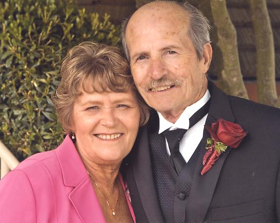 These records are part of the "Genealogy Computer Package" *** PC-PROFILE *** Volume - II.
Sarratt/Sarrett/Surratt Family Profile©
Compiled and self Published in Oct. 31, 1989 by Paul R. Sarrett, Jr. with
the assistance of my late mother
These records are part of the "Genealogy Computer Package" *** PC-PROFILE *** Volume - II.
Sarratt/Sarrett/Surratt Family Profile©
Compiled and self Published in Oct. 31, 1989 by Paul R. Sarrett, Jr. with
the assistance of my late mother
 Feb. 05, 2011;