
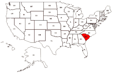
|
Province of Carolina, 1663 to 1729
Provinces of North & South Carolina, 1729 to 1776
 <---
[See: Province of Carolina, From Wikipedia, the free encyclopedia <---
[See: Province of Carolina, From Wikipedia, the free encyclopedia
<---
See: North Carolina Early Maps!]
|
 |
Map of Carolina as claimed under 1665 Charter
Map: Ed Jackson
� Carl Vinson Institute of Government, The University of Georgia
|
 |
NC and SC Boundary Changes: 1734 - 1835
<---
See: History on Boundary Changes.
|
 |
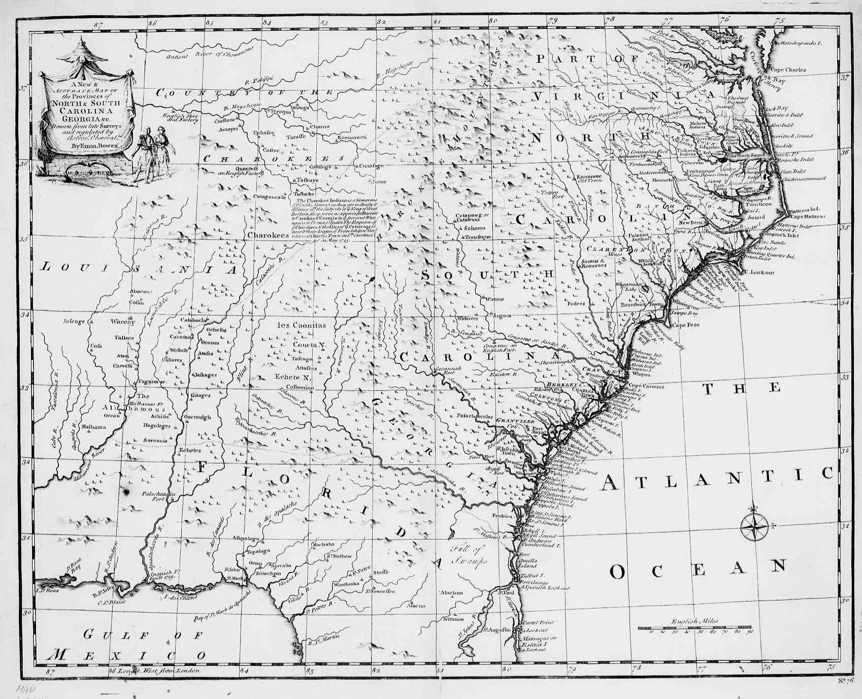
North & South Carolinas, Georgia. 1747
A New and Accurate, Map of the Provinces of:
Drawn from Late Survey & Regulated by Ernie Bowen.
SCGENWEB - sc_1747.jpg 261,689 Bytes 07-23-97
<---
Go to USGW Archives SC 1747 Map!
|
 |
North & South Carolinas, Georgia ~ 1757
Emanuel Bowen's "A New & Accurate Map of the Provinces of
North & South Carolina Georgia c1751;
Source: Library of Congress
<---
http://georgiainfo.galileo.usg.edu/gamaps/ga1751map.htm
|
 |
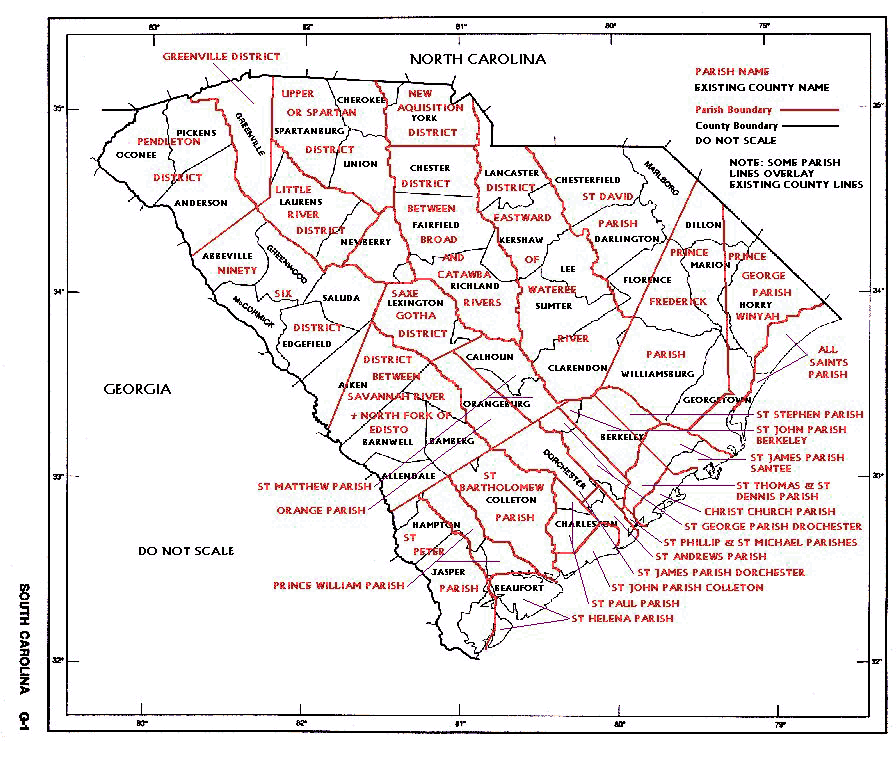
South Carolina With 1769 Judicial Districts
The 1790 South Carolina federal census was prolonged into 1792.
It employed the seven districts then existing, shown as blue lines
on the map. Within the districts were differing census subdivision,
shown as black lines and lettering. The white lines and lettering
show the present day counties:
- 1. Camden District, used their county subdivision. (Red)
- 2. Cheraws District, used their county subdivision. (Dark Green)
- 3. 96th District, used their county subdivision. (Dark Gray)
- 4. Charleston district employed their parish bounds. (Yellow)
Its counties of 1790 never functioned. Do to its size I have created a page
of its own for Charleston.
Goto: <---
http://www.usgwarchives.net/sc/maps/charlstn.gif
- 5. Georgetown District employed their parish bounds. (Light Green)
Their counties of 1790 never functioned.
- c-1. Prince Fredericks Parish.
- c-2. Prince-George - Winyaw Parish.
- c-3. All saints Parish
- 6. Beaufort District (Light Gray)
was not enumerated by subdivisions in 1790.
Its counties of 1790 never functioned.
- 7. Orangeburg district had four active counties, (Purple)
but the census enumerator ignored them.
Orangeburg for the 1790 census was divided into North and
South, shown as a dotted line on the map. This division was the road to
in the forks of the Edisto from Edgefield County to the town of Orangeburg
and then down the North Edisto and Edisto to the Charleston District line.
|
 |
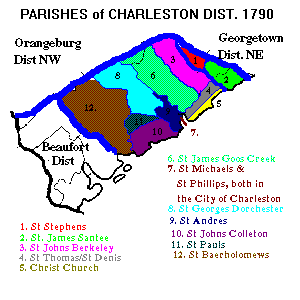
State of SC. Parishes
"Parish" Lines in Red and District lines in Black.
PARISH1.GIF 110,256 Bytes 12-29-97
<---
Go to USGW Archives Parishes SC
|
 |
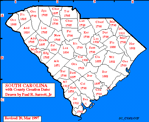
State of SC. District/County Creation Dates
"Creation" dates in Red and District/County lines in Black.
SC_COS2.GIF 11.4 KBytes 03-20-97
<---
Go to USGW Archives SC. District/County Creation
|
 |
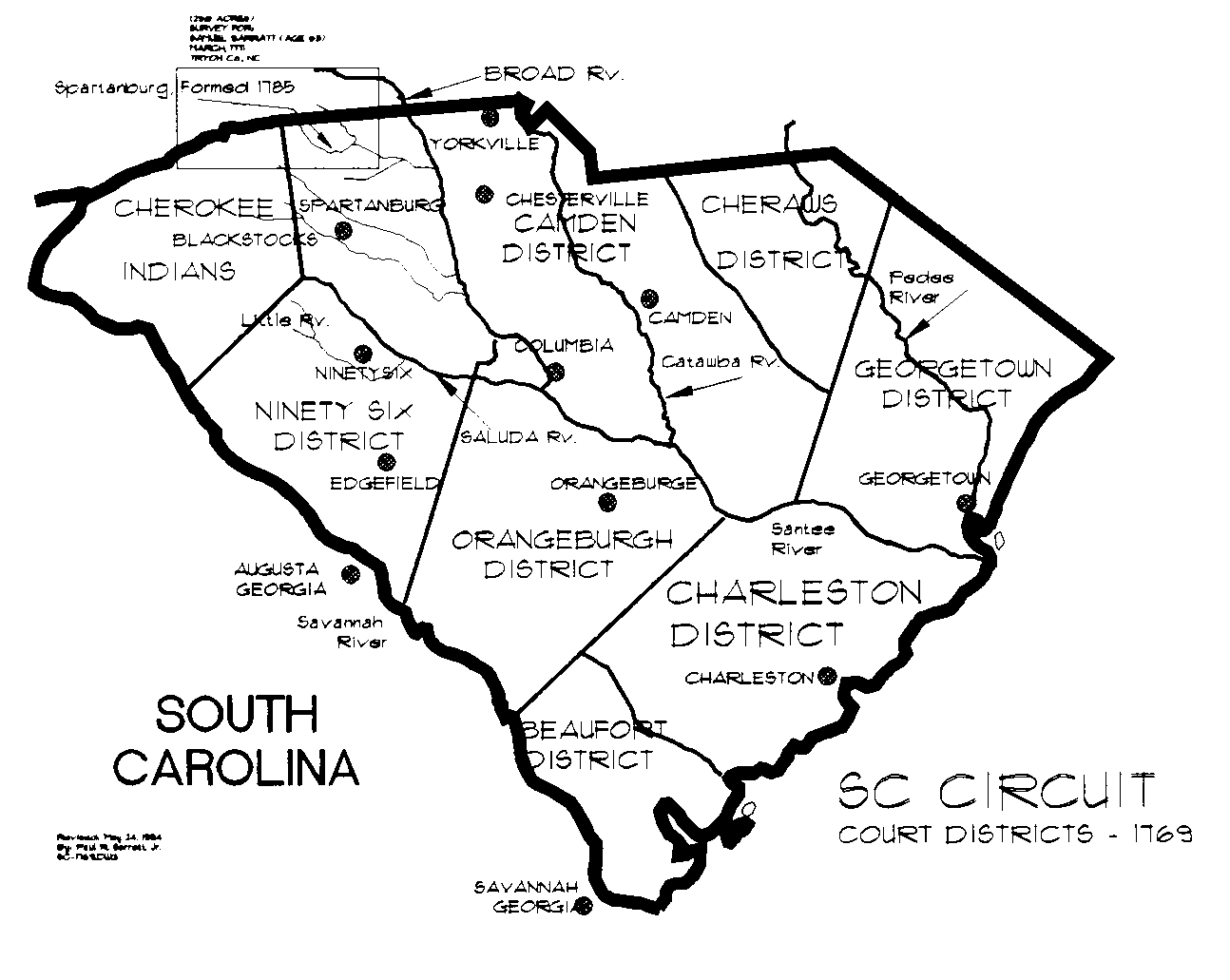
SC Judicial Districts, 1769
A home drawn map of South Carolina by Paul R. Sarrett,
showing the 1769 "Judicial Districts" and major Citys & Towns
SC_1769.GIF 29,585 Bytes 12-20-95
<---
Go to USGW Archives SC. Judicial District
|
 |
James Cook's Map of 1772
The James Cook map was prepared in 1772 and published in London in July 1773.
This map is generally considered to be the most accurate map of the Province of South Carolina
ever published during colonial times. It should be noted that much of the area north of the
Tiger River was considered to lie within the Province of North Carolina
until the official provincial boundary line was finally established by a survey run in June 1772.
Accordingly, many patents to land lying in this area (including much land on
Sarratt's Creek were granted by North Carolina in the years prior to 1772.
<---Click on Thumbnail for Larger Map!
|
 |
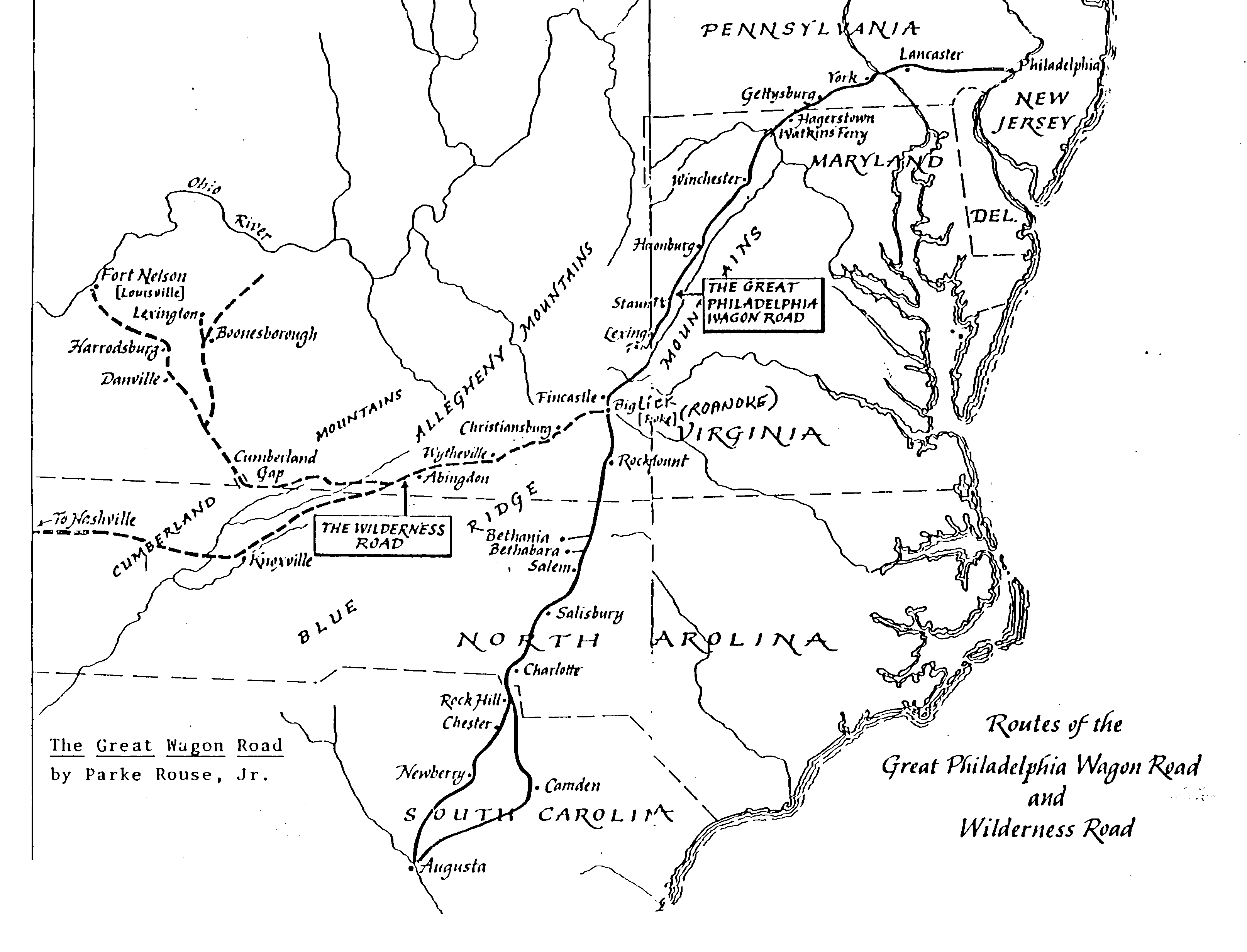
Routes of the Great Philadelpha Wagon Road and Wilderness Road. c1774
By Parke House, Jr. dated Unknown (c1774); Shows the Wagon
Road from Philadelpha, Lancaster, York, down to Charlotte, NC.
on into Rock Hill, Chester, and Newberry, SC onto Augusta, GA.
SC_TRAIL.GIF 130,573 Bytes 10-13-96
<---
Go to USGW Archives SC 1774 Trails
|
 |
ARW - 1775-1780 Battles
Edward W. McCrady, in his book entitled History of South Carolina in the Revolution (published in 1902),
identified a total of 137 battles and skirmishes that took place in South Carolina during the Revolution.
His map, showing the battle sites for the years 1775-1780.
<---Click on Thumbnail for Larger Map!
<---
See: ARW-SC Battles!
|
 |
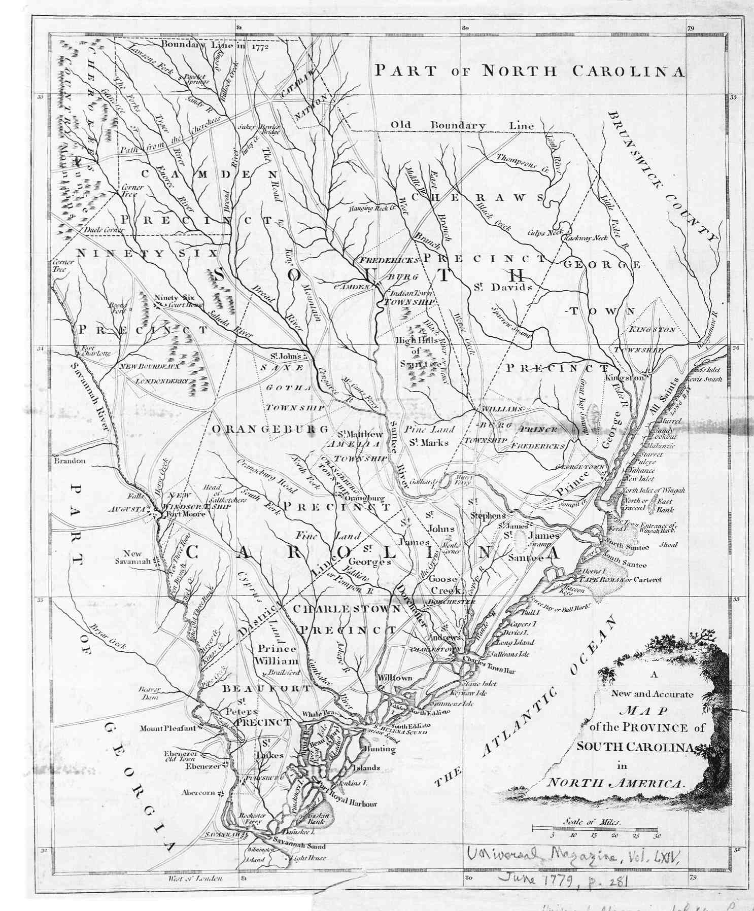
Provinces of South Carolina. Jun 1779
A New and Accurate, Map of the Provinces of South Carolina
in North America.
Enlargement, showing Rivers, Towns, Villages.
Pub. Universal Magazine, Vol. LXIV June 1779, Pg 281
SC_1779.JPG 264,397 Bytes 07-23-97
<---
Go to USGW Archives Provinces SC
|
 |
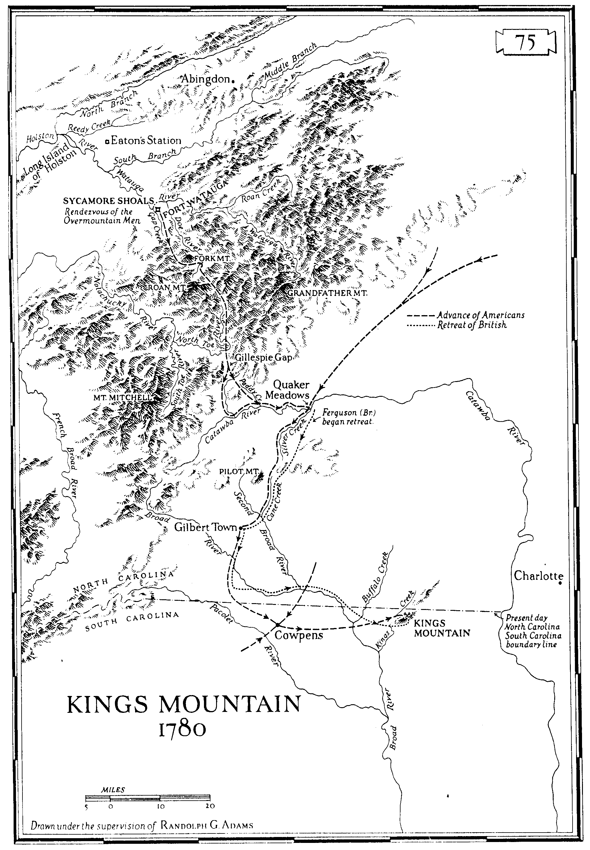
"Kings Mountian" 1780-1782
KINGSMOU.GIF Bytes: 179,762 Date: 02-04-96 Size: 1996x2875x256
Drawn under supervision Randolph G. ADAMS
Enlargement, showing Rivers, Towns, Villages, Advancements of
the Americans and British troops.
<---
Go to USGW Archives Kings Mountian
|
 |
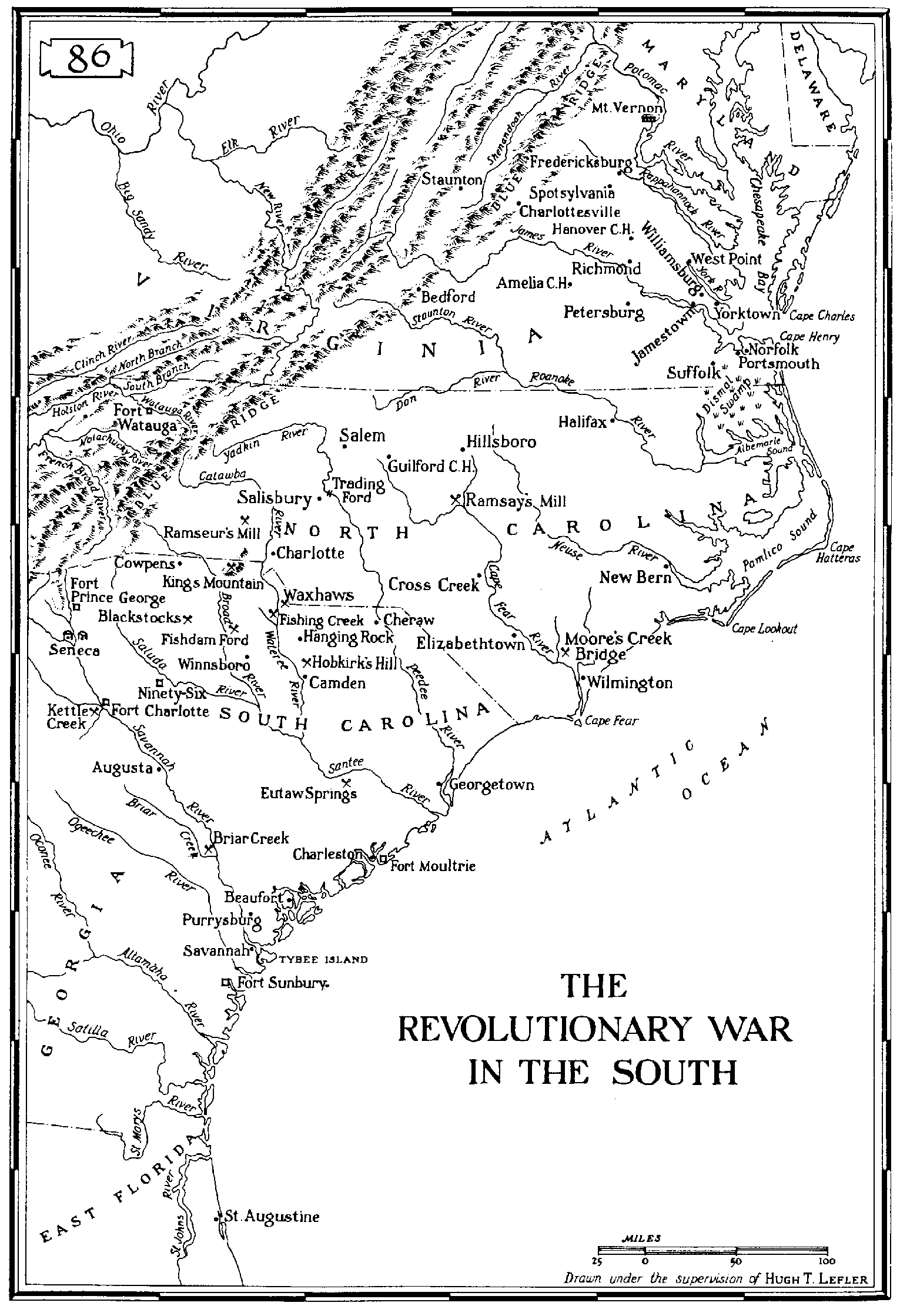
"The Revolutionary War in the South" 1780-1782
REV.GIF Bytes: 120,959 Date: 02-10-96 Size: 1531x2239x256
Drawn under supervision Hugh T. LEFLER, Pg. 86
Enlargement, showing Rivers, Towns, Villages, Advancements of
the Americans and British troops in South and North Carolina.
<---
Go to USGW Archives Revolutionary Map Now!
<---
See: ARW-SC Battles!
|
 |
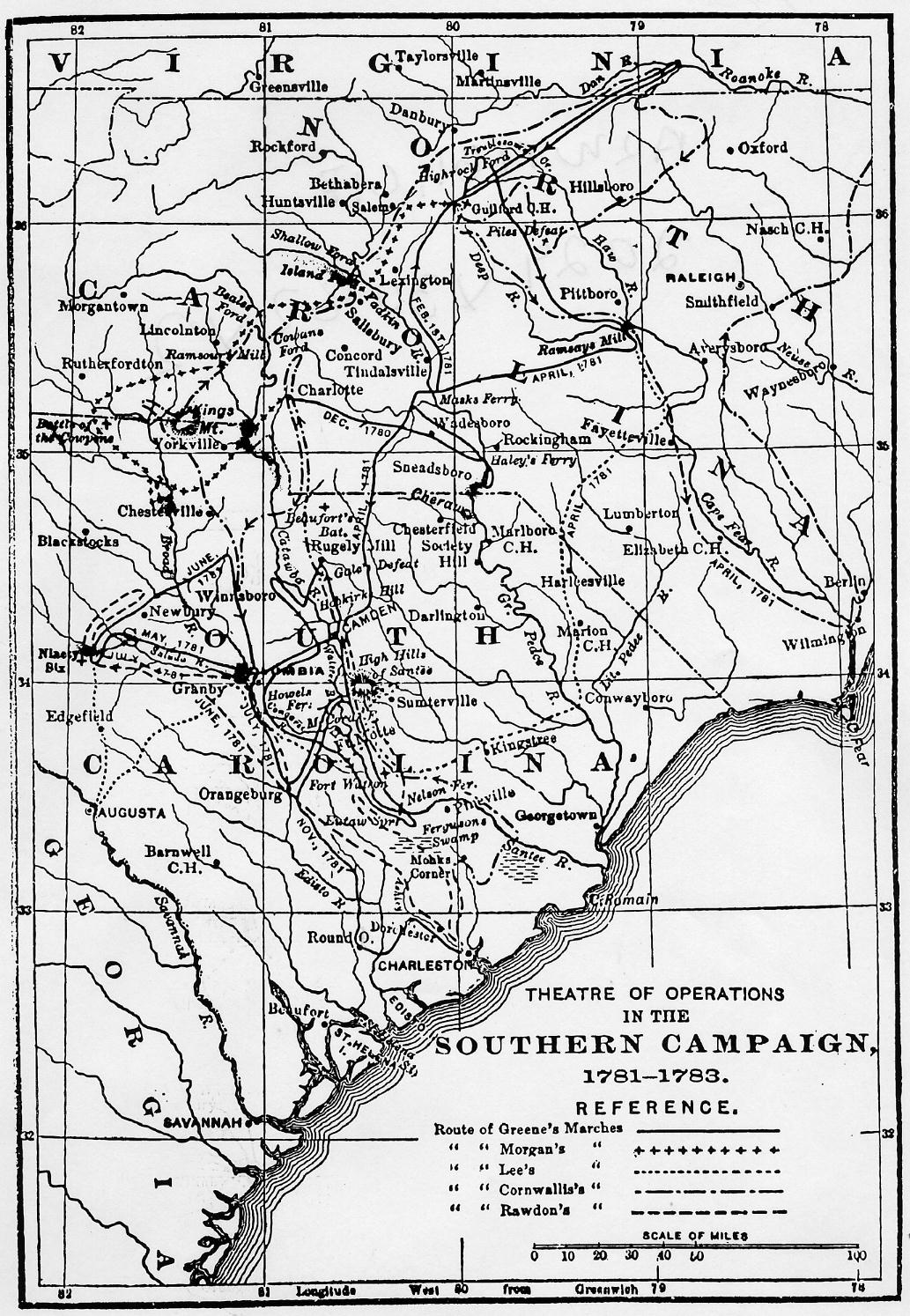
Theater of Operations in the "SOUTHERN CAMPAIGN" 1781-1783
ARW1781.GIF Bytes 213,942 Date: 10-13-96 Size 2029x3082x2
Reference of the Routes of Marches of GREENE, MORGANS, LEE'S
CORNWALLIS'S and RAWDON'S troops. from the History of North
Carolina by Samuel A'Court ASHE, 1908 Greensboro, NC.
<---
Go to Theater of Operations Map Now!
|
 |
Battle Locations in the "SOUTHERN CAMPAIGN" 1781-1783
WCAROLIN.GIF Bytes: 132,334 Date: 10-13-96 Size: 1908x2775x2
Reference of Battle location in Western North & South Carolina.
Map from Jeannette M. Christopher, pg 478
<---
Go to Revolutionary Battle Locations Map Now!
|
 |
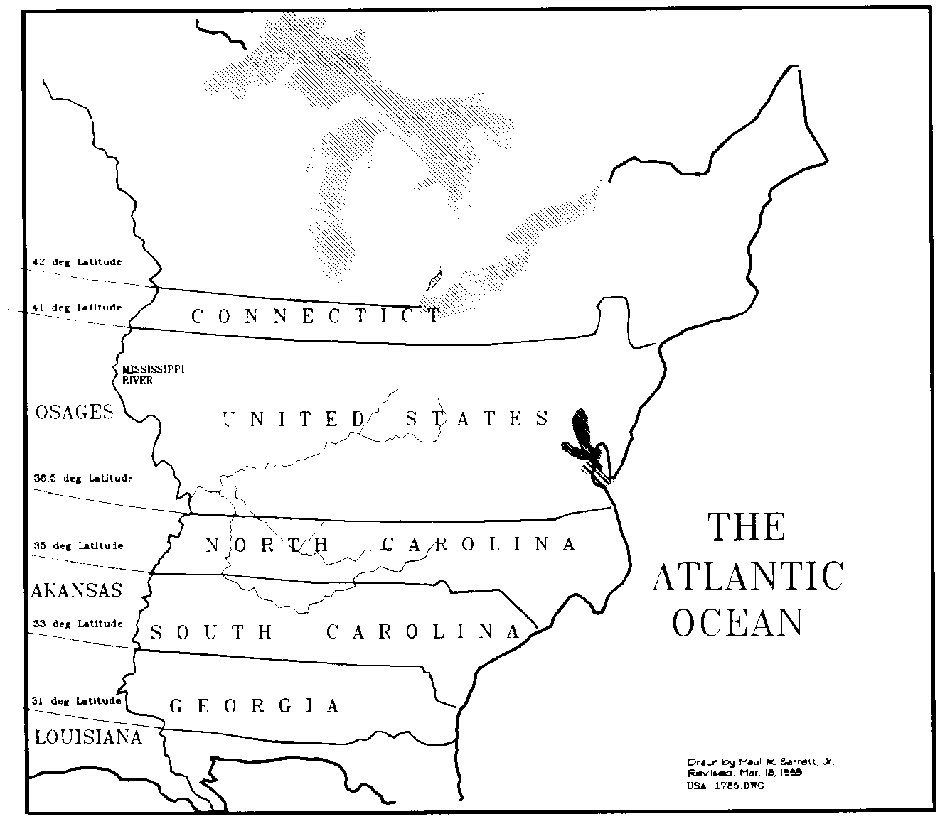
USA_1785.GIF 28,978 Bytes 12-20-95
Home made map by Paul R. Sarrett, Jr. Mar. 18, 1995 showing
the Eastern part of the United States in 1785.
<---
Go to USGW Archives USA 1785 Map Now!
|
 |
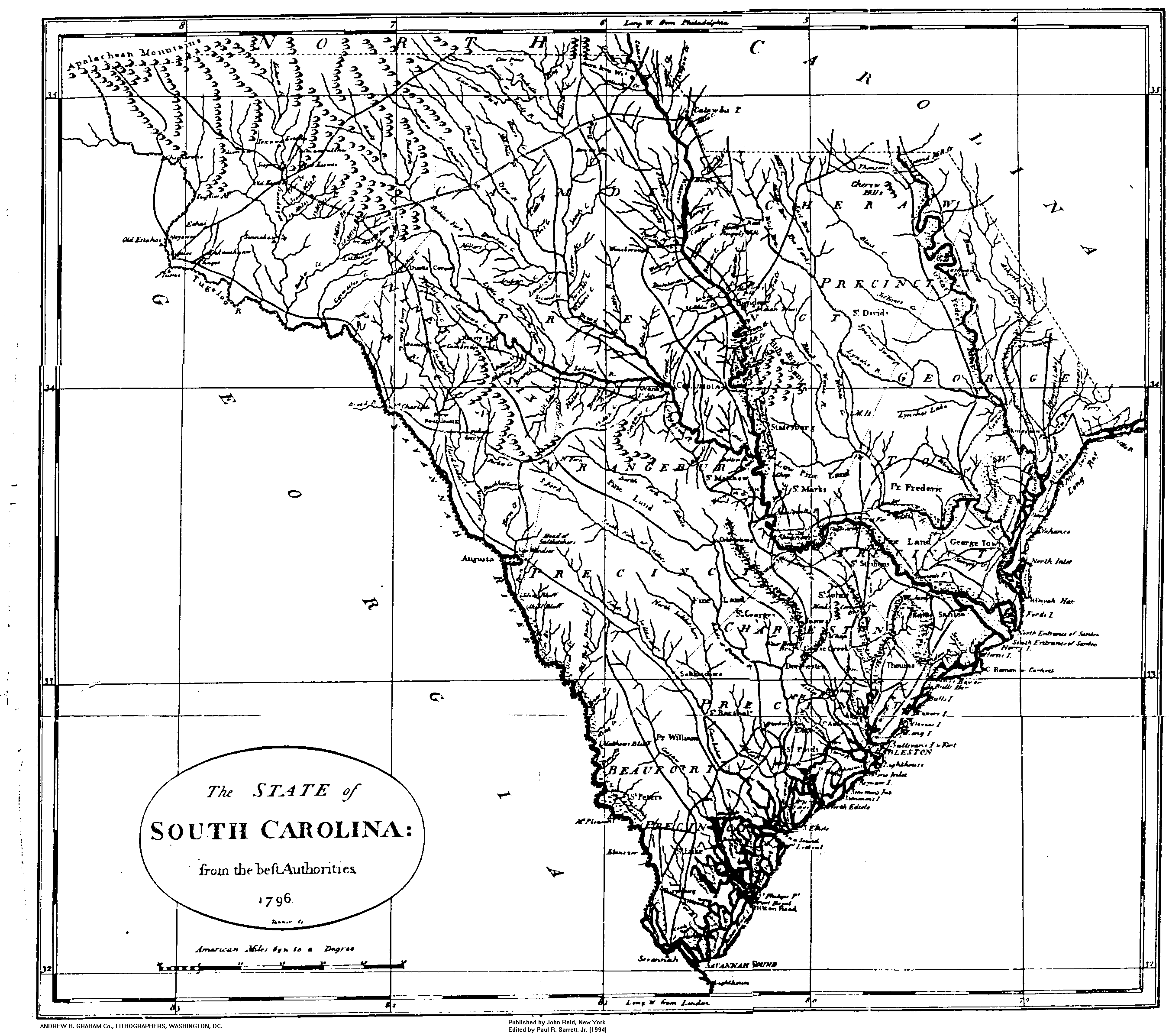
SC_1796.GIF 223,255 Bytes 10-13-96
The State of South Carolina from "beft AUTHORITIES" 1796
By Andrew B. Graham, Lithographers, Washington, D.C.
<---
Go to USGW Archives SC 1796 Map Now!
|
 |
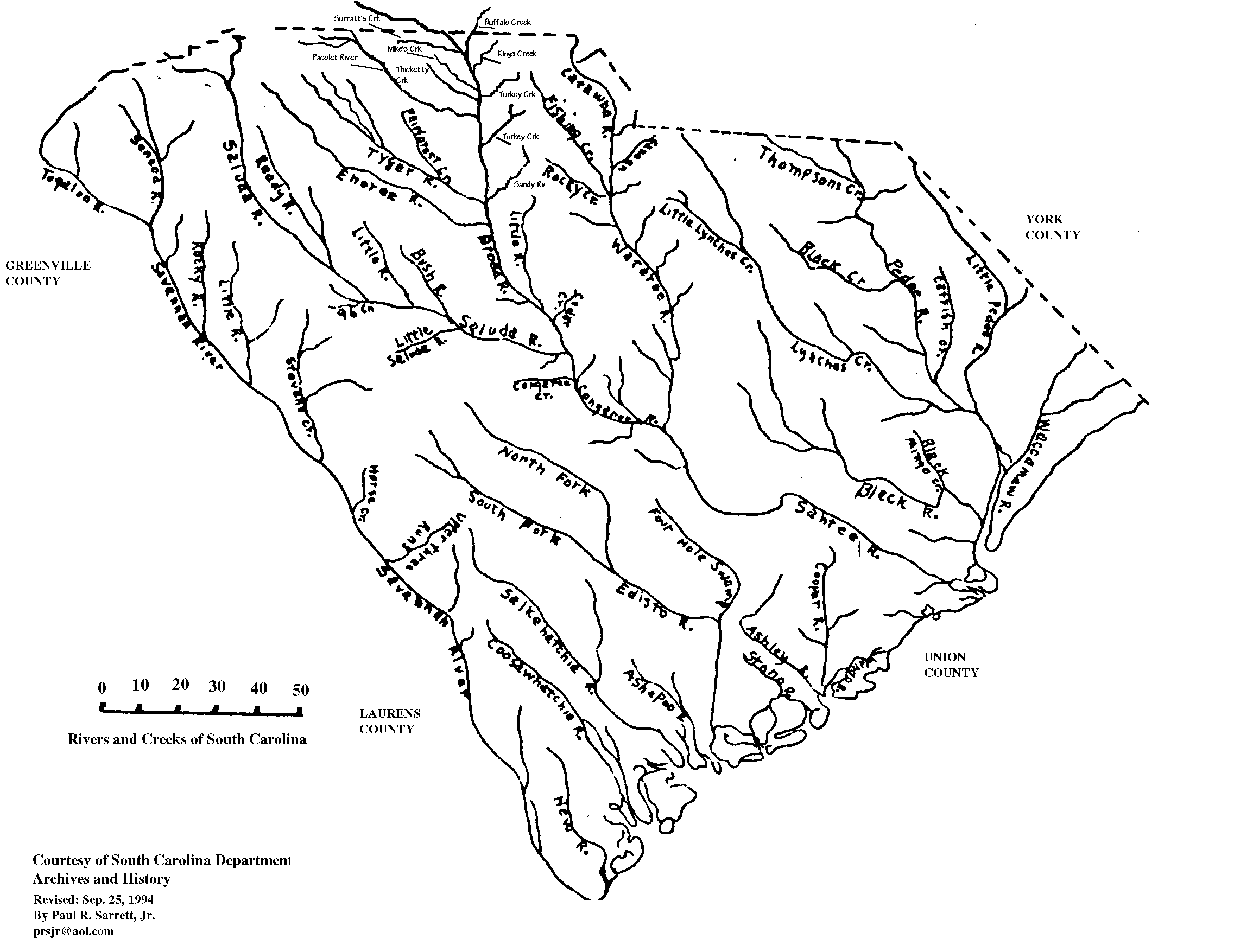
SC_RV.GIF 69,867 Bytes 10-13-96
South Carolina "Rivers & Creeks"
courtesy of S.C. Dept.
Archives and History, dated unknown; Edited by Paul R. Sarrett, Jr. 1994.
<---
Go to USGW Archives SC Rivers & Creeks Map Now!
|
 |
SC_1820.GIF 103,948 Bytes 10-13-96
SPARTANBURG DISTRICT - South Carolina;
Surveyed by J. Whitten, 1820. "Improved for Mills Atlas Bros."
In 1826 Robert Mills submitted to the South Carolina State Senate a copy of his Atlas.
It was the first atlas of an American state. Several dozen individuals had worked
since 1815 to complete the Atlas. At least twenty surveyors had prepared careful
surveys of every District.
The Atlas includes maps of each of the then existing Districts in South Carolina.
Each District map shows place names, waterbodies, roads, and other useful information.
Plantations, farms, mills, ferries, and more are shown usually using the name of
the owner.
SARRATT's Creek is listed
as a branch of "Broad River"
<---
Go to Spartanburg Dist., SC 1820 Map Now!
<---
Go to York Dist., SC 1825 Map Now!
|
 |
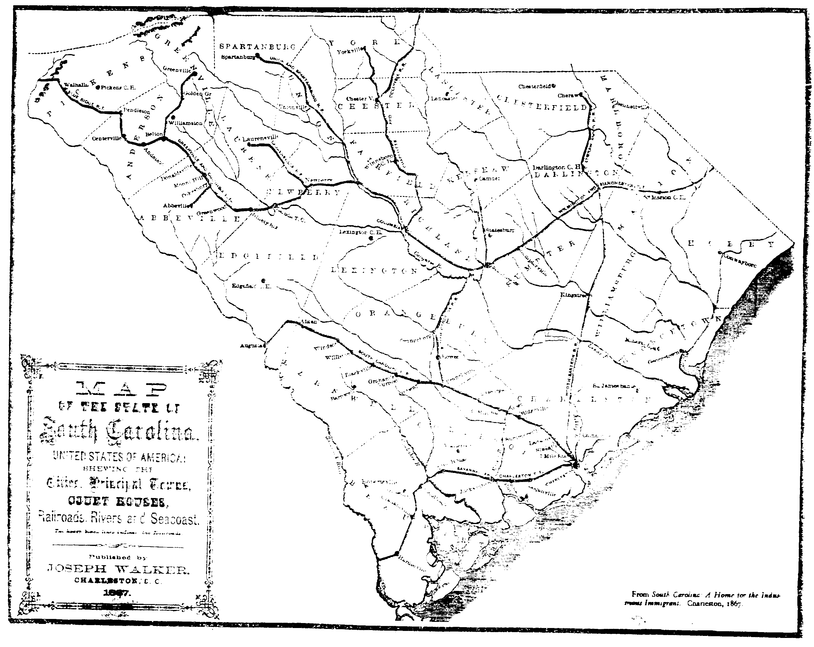
SC_1867.GIF 124,790 Bytes 10-13-96
South Carolina, of United States of America; 1867
Showing the
Cities, Prinicpal Towns, COURT HOUSES, Railroads, Rivers, &
SeaCoast. Published by Joseph Walker, Charleston, SC. 1867.
<---
Go to USGW Archives SC 1867 Map Now!
|
 |
Map of the County SPARTANBURG - 1887
Compiles from Sloan & Eptons's Survey of 1869 - State & U.S. Maps
and other Authentic Sources by. E.H. McCOLLOUGH 1887 Copyrighted
The South Publishing Co., New York
"Spartanburg County, Originally a part of Ninety Six was laid out in 1785.
Made a Judicial District 1789 and changed to Spartanburg
by Reconstruction 1808. Town was incorporated 1831.
Present Townships were laid off under instructions
from County Commissioners in 1869.
<---
Go to Spartanburg Dist., SC 1887 Map Now!
|
|
SC_COS2.GIF 11,679 Bytes 03-24-97
A homemade Map of the State of South Carolina with the creation
dates of each County. by Paul R. Sarrett, Jr.
<---
Go to USGW Archives SC County Creation Map Now!
|
 |
SC_RD1.GIF 67,824 Bytes 12-29-97
A Map of the State of South Carolina with State & Federal Highways.
<---
Go to USGW Archives SC Highway Map Now!
|
 |
SC_UP_CONTRY_TWP.GIF 354 KBytes 12-29-97
A Map of the "Up-Country" Counties with Township formations
Cherokee, Spartanburg, Union, & York Counties.
<---
Go to Up-Country Counties, Township Map Now!
|


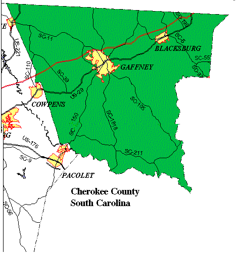 <---
Go to Present-day Cherokee Co. Map Now!
<---
Go to Present-day Cherokee Co. Map Now!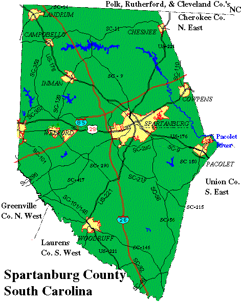 <---
Go to Present-day Spartanburg Co. Map Now!
<---
Go to Present-day Spartanburg Co. Map Now!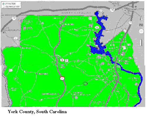 <---
Go to Present-day York Co. Map Now!
<---
Go to Present-day York Co. Map Now!
 These records are part of the "Genealogy Computer Package" *** PC-PROFILE *** Volume - II.
Sarratt/Sarrett/Surratt Family Profile©
Compiled and self Published in Oct. 31, 1989 by Paul R. Sarrett, Jr. with
the assistance of my late mother
These records are part of the "Genealogy Computer Package" *** PC-PROFILE *** Volume - II.
Sarratt/Sarrett/Surratt Family Profile©
Compiled and self Published in Oct. 31, 1989 by Paul R. Sarrett, Jr. with
the assistance of my late mother
 Paul R. Sarrett, Jr., President of SFA©
  Feb 15, 2011;