

by Robert S. Raymond
Some of the earliest men to "plant" settlements on the North Shore of Massachusetts Bay were Roger Conant, John Woodbery, William Trask, John Balch, and Peter Palfrey. The arrival of new colonists and a new governor from the New England company for a Plantation in Massachusetts Bay in 1628 resulted in contention between these "old planters" and the new settlers. The New England company strove to integrate them into the new community. On the 25th of November 1635, a grant of 1000 acres was made to the five old planters mentioned, probably in recognition of their early contributions.
Three of these planters, Conant, Woodbery, and Balch,
settled on the grant. Palfrey sold his share to William Dodge and Trask's grant
passed to Thomas Scruggs. On 24 June 1654, Scruggs estate passed to his
son-in-law, John Rayment. For this reason, the 1000 acre grant is of interest to
the Raymond family, descendents of John Rayment and his brother William.
Please contact me if you have corrections. Please identify the source of any information you give. Copies of the maps cited here are available in the article, "Beverly, Massachusetts Maps." I've provided direct links to medium-size copies of the maps in that article.
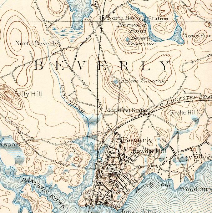
Shorelines, waterways, roads, and swamps were originally taken from the USGS 1893 map of Beverly. Later, I found the USGS 1949 Salem and USGS Marblehead North 1951 maps differed in significant aspects from the 1893 map. While some differences are to be expected as roads change, waterways are filled in or redirected, and other changes take place, I concluded in many instances that the 1949/51 maps were far more accurate and made changes accordingly. Many swamps were added from the 1949/51 maps. The inlet and outlet of Norwood Pond were shown on the 1893 map, but not the 1949/51 maps. Still later, I found from the USGS 1985 maps downloaded from USGS on the web that the 1949/51 maps were slightly rotated when they were scanned. I tried to rotate everything Id done up to that point to match the 1985 maps. (But I wished I had started with the '85 maps.)
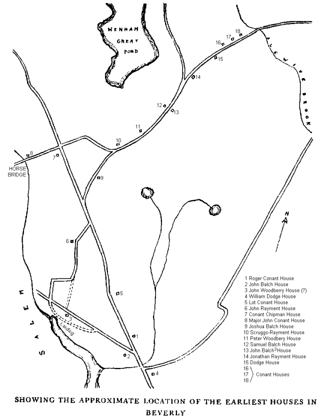
The twin streams running west of Rayment Hill were taken from the Lapham map of early Beverly (The Old Planters of Beverly in Massachusetts and The Thousand Acre Grant of 1635, by Alice Gertrude Lapham, 1930), making particular note of topographical lines, swamps, and the current location of Round Pond. The name "Wenham Great Pond" is also taken from the Lapham map.
House locations for the following are from the Lapham map: William Dodge, John Balch, Roger Conant, John Woodberry, Lot Conant, John Rayment, Joshua Balch, Conant/Chipman, Major John Conant, Scruggs-Rayment, Peter Woodberry, Samuel Balch, John Balch(3), Jonathan Rayment, Dodge, Conant Houses.
The boundary of the Old Planters 1000 acres grant of 1635 is taken from the boundary map in Laphams book.
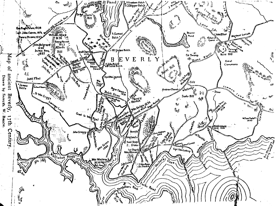
The Danvers River (not shown), is known as the "Wolliston River" on a map drawn by Samuel W. Balch in Genealogy of the Balch Families in America, by Galusha B. Balch.
The names of hills are mostly taken from the Balch map. The topology for hills was taken from the USGS 1893 map. The name of "Rayment Hill" is found on p. 86 of Lapham (where she in turn cites William Rayment's will, Essex County Probate Court Records, book 310, page 100). Hills are shown if they are greater than 100 ft. above sea level and contours are placed every 20 ft. Brimble Hill was also known as Bramble Hill. (Historical Collections of the Essex Institute , Vol. LV, No. 2, "Beverly in 1700," Sidney Perley, p. 81.)
"First Landing" and "Old Planters Path" are taken from a map in Ryal Side from Early Days of Salem Colony, by Calvin P. Pierce, 1931.