 "Reverie"
|
BEAR ISLAND

...a familiar refuge in a storm for those of us who spent time in the Arctic waters between Greenland, and Norway, especially on the "Survey" ships. A foreboding, and miserable place, nevertheless
Bjornoya ( Bear Island in Norwegian ) is uniquely shaped like that of a triangle, providing shelter especially in storms blowing from the NW, or NE. As we proceed with this arm-chair adventure, if you click on the underlined texts, there is a chart ( map ), or photograph to be shown. Click "Back" to return, or you'll be forever lost on the island.
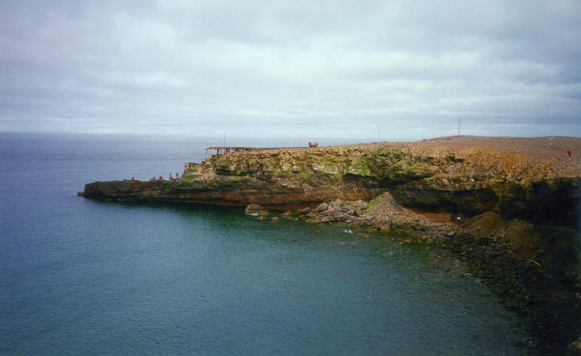
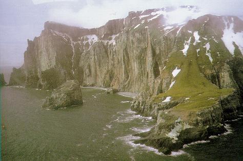
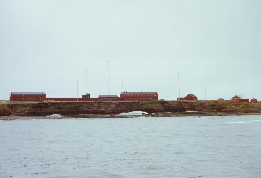
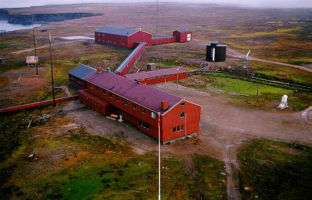
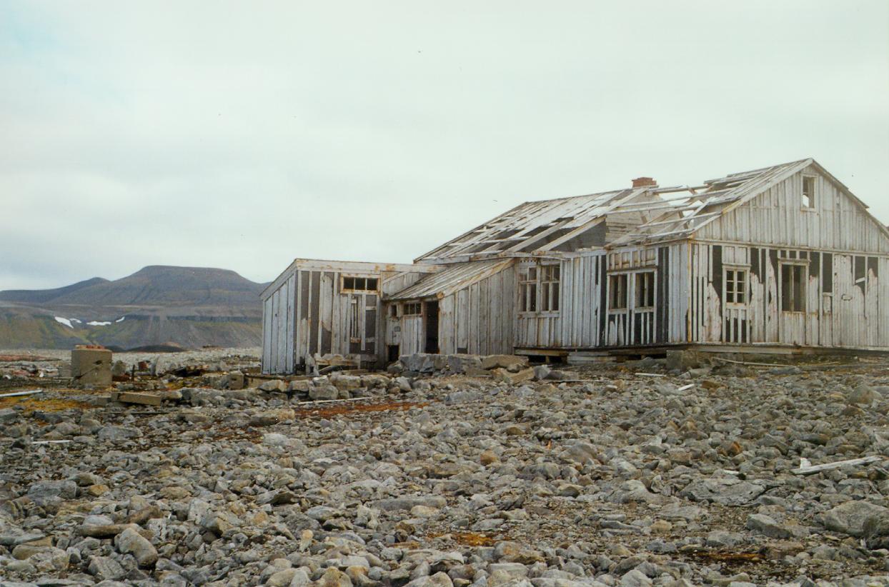
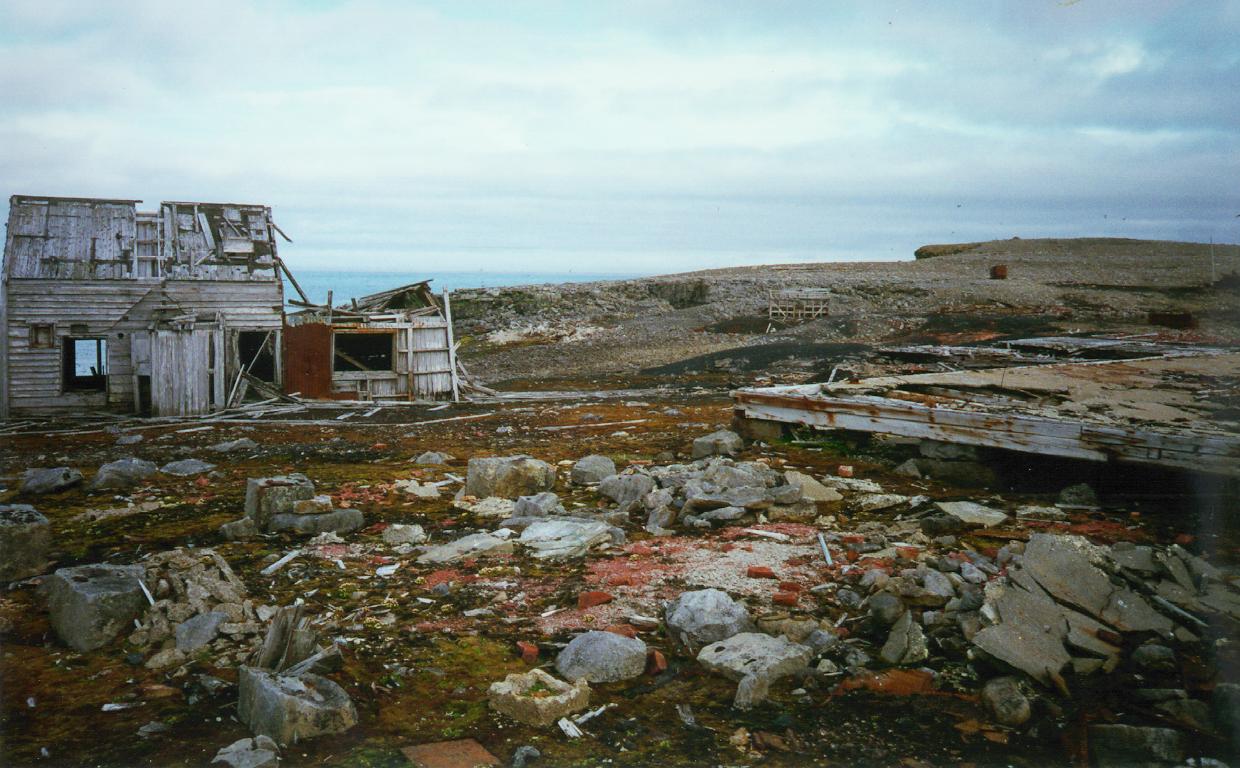
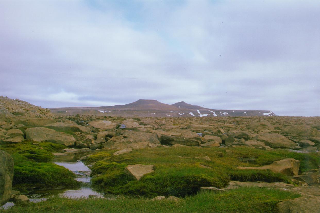
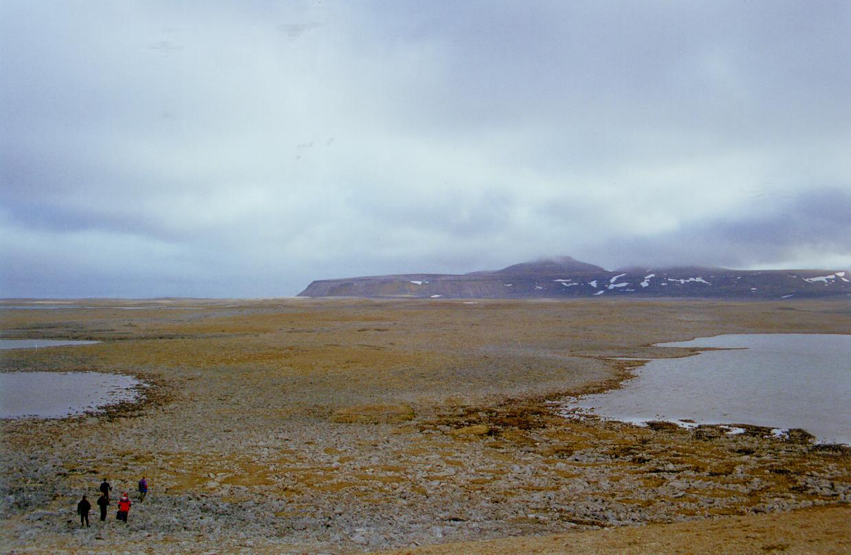
My first visit to the island was as Second Mate on the USNS Michelson, John Ostensen Captain. That was memorable in that after having been hove-to behind the south east coast for several days, Captain Ostensen decided to "take a look", steaming out clear of the point. I could see the immense swell, and sea behind the point before we got clear, but out we went. Having the seas beam on, the Michelson took a roll so heavy Ostensen turned pure white...both of us on the starboard wing holding on lest we just plain fall into the sea. Needless to say we hustled back behind the island, and didn't venture out again until days later when all had subsided. In those days we were working out of Belfast, Northern Ireland, the voyages being a month long, with a week in port. During the winter months we would find ourselves hove to behind islands more than accomplishing any survey work. Covered by clouds in the last photo viewed, is the highest point on the Island, rising to over 500 meters. I returned to Bear Island ten years later, this time with my own command, the USNS Hayes, a catamaran. A smaller, more manueverable ship than the Michelson, I could get right up close to the shore - 500 yards, or so. I was fascinated with the "ghost town" aura of the abandoned coal mine, the rail tresle with the lone rail car. Using binoculars I'd spend hours scanning the spooky place, and shoreline. If the storm blew from the North East, I'd find myself 500 yards, or so, off South West of the point. Jagged, with towering granite spires, home to thousands of sea birds, an ominous place to be close too. Like a moth drawn to a flame, I'd inch up close to find placid waters, and on sunny days, the sun shining in through the large wheelhouse windows, sit in my chair, the bow pointed towards the rocks, and spires, mesmerized by the scenery. As we progress into this saga, I must acknowledge Stein Henrik Olsen of the Norwegian Meteorological Office who took the previous two photos, and Steinar Midtskogen, from who's site we are viewing his photos. Undoubtedly, many similar shots were taken by those aboard the Hayes, but not available. In any event, we couldn't have landed to take photos ashore, as we would have needed diplomatic clearance. So, thanks to Stein, and Steinar...we sincerely hope they don't mind sharing with us less fortunate ship bound sailors. Before we step ashore photographically, and thanks to Stein, and Steinar, here's a view towards shore taken by Steinar at the North end of the island showing the Meteorological ( Weather ) Station. No doubt Stein had access to aircraft, as here's an aerial view of the same place. Evidently, eight people man the station year round. For those into trivia, the most Northern rail system is just North of Bear Island in Svalbad. Though not much of a system today, as you'll see, Bear Island's ranks second as the most Northern. Before revealing the shape of the two locomotives Stein photographed, here's some views about the island taken by Steinar. This Old House has seen better day, the arctic winds, snow, and ice slowly reducing it to fragments. Here again desolation...what a miserable place! Into rocks? Boy...you'd be at home here. This plain of rocks is call Miseryfjellete, or The Plain of Misery....guess so. The view is towards the south, and the high mountains ( hills ) almost covered in clouds. Alright...here we are at probably the most intriquing thing, it was for me - the locomotives, or what's left of them. No doubt used to shuttle the coal gondolars from the mine to ship, or collier. I read someplace where the mine closed in 1916. If interested, search on "bear island norway"...you will find alot more information. For me, this is enough, having only wanted to "revisit" a far away place that did come across as providing a seaman a respite from the relentless North Atlantic in the Winter. Before we leave though, I would just like to touch on the apparent forsakedness of the place by nature, or is there such a thing...probably not. If it is forsaken, it is by man, seeing the garbage we always leave behind. As far as the wildlife is concerned, there's nothing forsaken about the place. Therefore, I presume, it is man that is forsaken. |
 Bear Island is a possession of Norway
|
 ..........
 ..........

|
|
GALLERIES
|