(click on thumbnails to view full images)
?
NEW!! Web Family Cards--detailed information on individuals and family trees
Newspaper and Obituary Archive
Vital Records and Wills Archive
Immigration, Naturalization, Passports, Travel
New! Google Maps showing family locations
?
Hamerschlag and Brummel Families
| Place | Date | Name | Description |
Page Image (may be large file) and Transcription (where applicable) |
|||||||||||||||||||||||||||||||||||||||
|
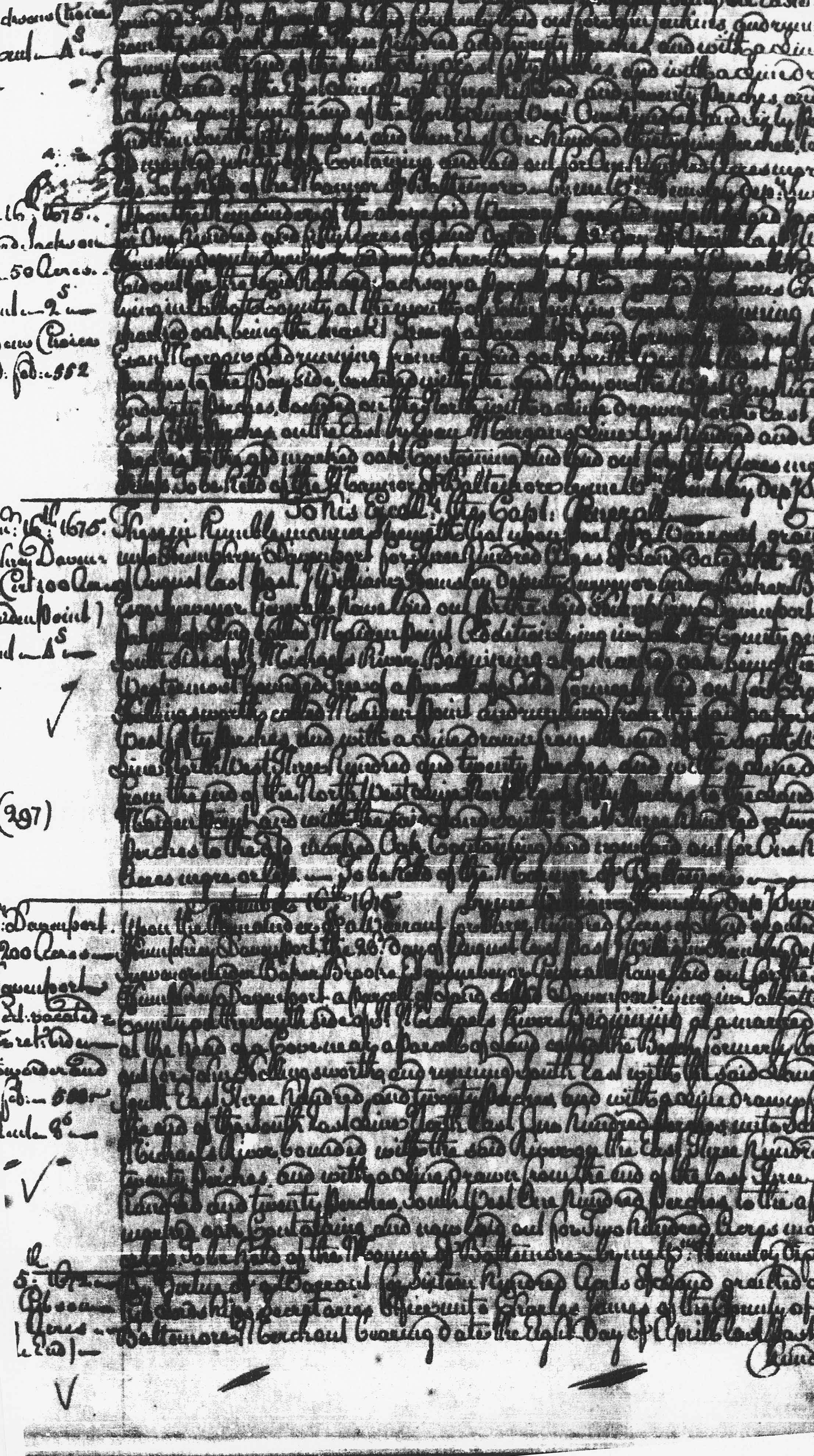
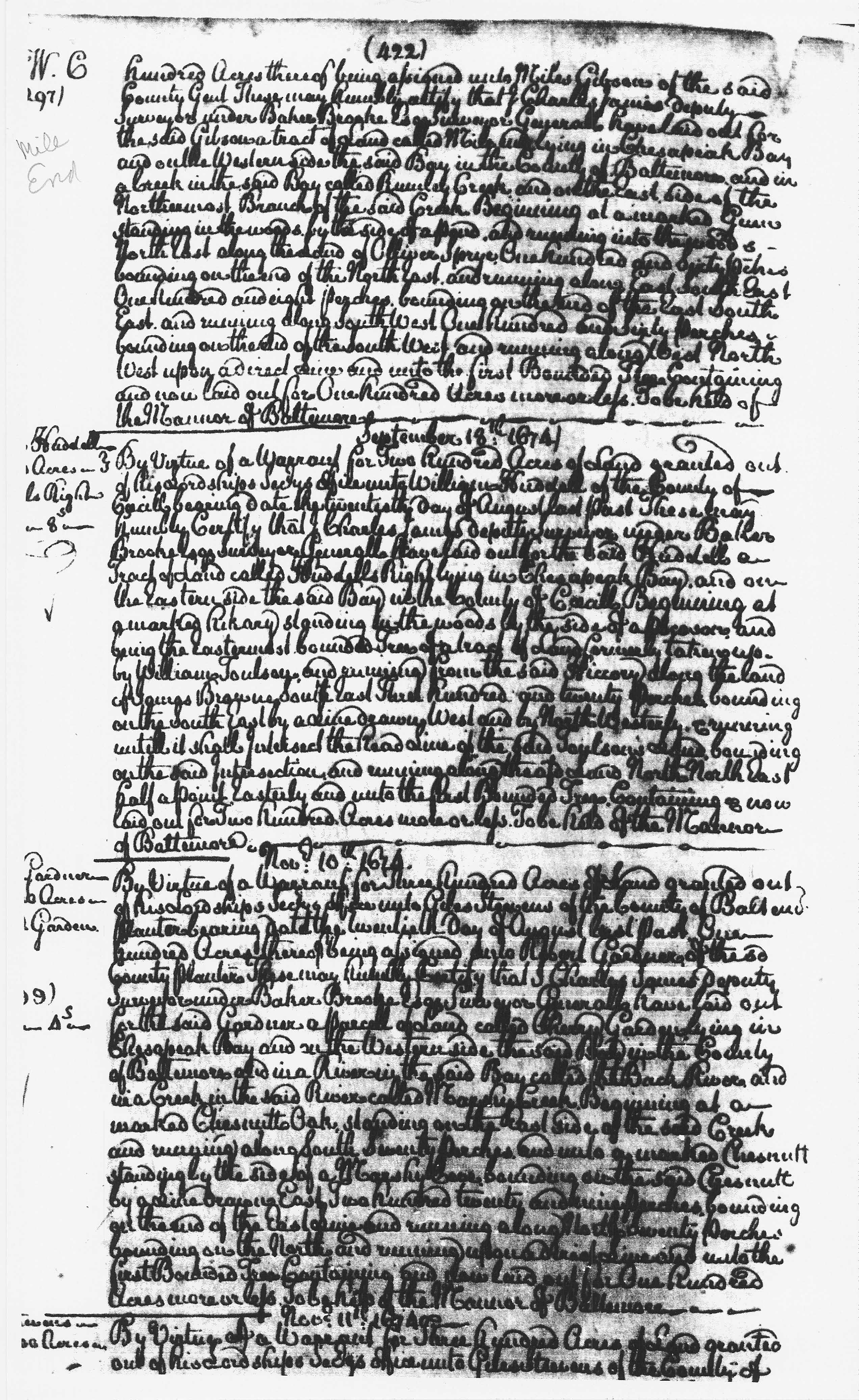
Harford Co., MD on east side of NW branch of Rumley (Romney) Creek (Aberdeen Proving Grounds) |
1672 | Gibson, Miles |
Reference: Patent Record 19, p. 421 Date: 1672
Description: Mile End, 100 Acres; Certificate Developer/Owner: Gibson, Miles Robert Patterson later owned part
|
  |
|||||||||||||||||||||||||||||||||||||||
| Harford Co. | 1695 | Newson, Thomas |
Miles Hill, 100 Acres; Certificate Developer/Owner: 1695 Patent Record C 3, p. 544 Miles Hill, 100 Acres; Patent
|
||||||||||||||||||||||||||||||||||||||||
|
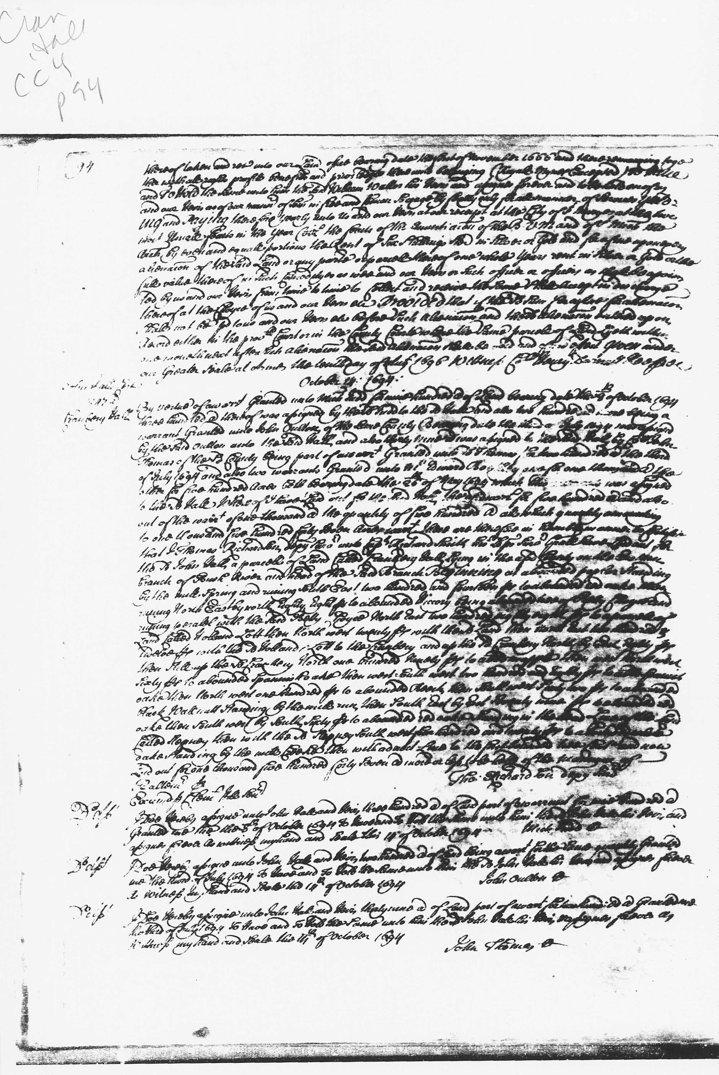
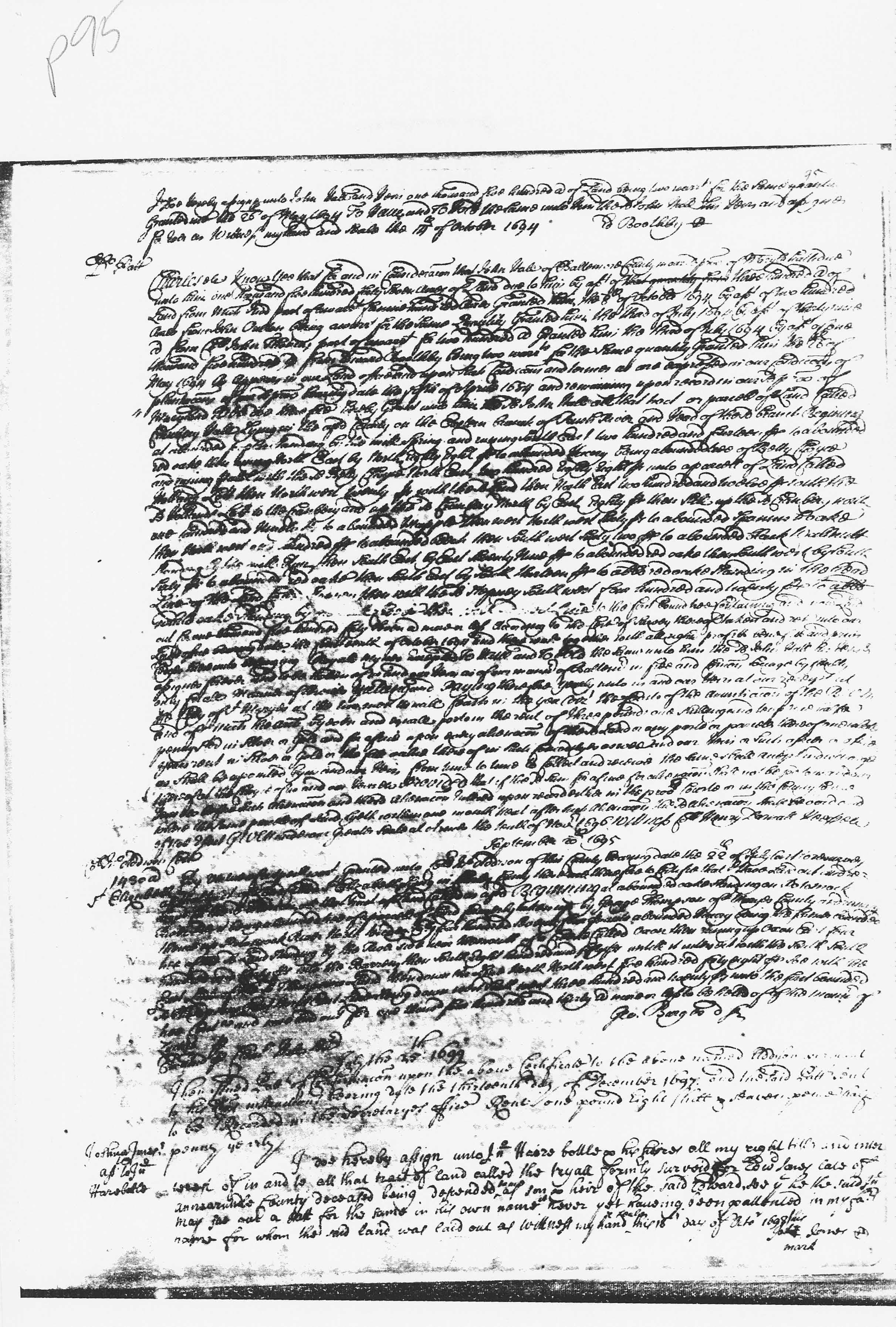
Harford Co., MD Perryman |
Nov. 6, 1696 | John Hall |
Patent of land called Cranberry Hall to John Hall Cranbury Hall, 1547 Acres; Certificate, Patent Record CC 4, p. 94 Cranbury Hall, 1547 Acres; Patent, Patent Record CC 4, p. 95
|
     |
|||||||||||||||||||||||||||||||||||||||
| Harford Co., MD | 1699 | John Hall and Martha His Wife |
Halls Rich
Neck, 400 Acres; Certificate Halls Rich
Neck, 400 Acres; Patent
|
 |
|||||||||||||||||||||||||||||||||||||||
|
Perryman, Harford Co., MD at head of Bush River along Mill Branch (now known as Cranberry Run) |
1702 | Whitacre, John |
Whitacre, John Whitacres Ridge, 250 Acres; Patent
Certificate
Robert Patterson later owned part
|
   |
|||||||||||||||||||||||||||||||||||||||
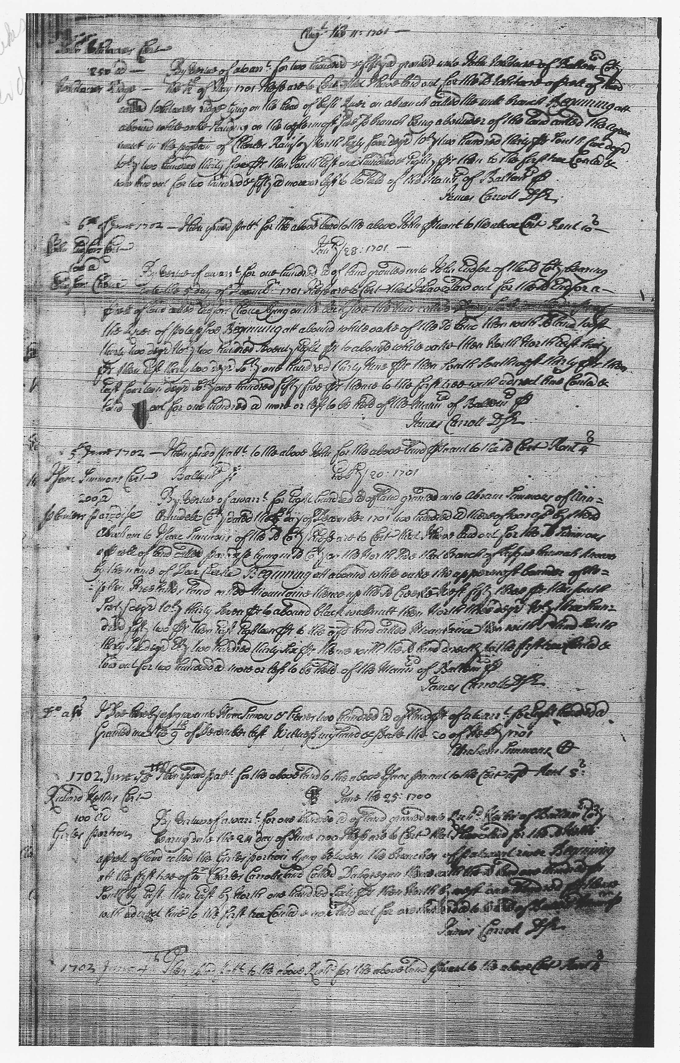
| Harford Co., MD | 1703 | John Hall |
Timber Neck, 471 Acres; Certificate Patent Record DD 5, p. 141 |
  |
|||||||||||||||||||||||||||||||||||||||
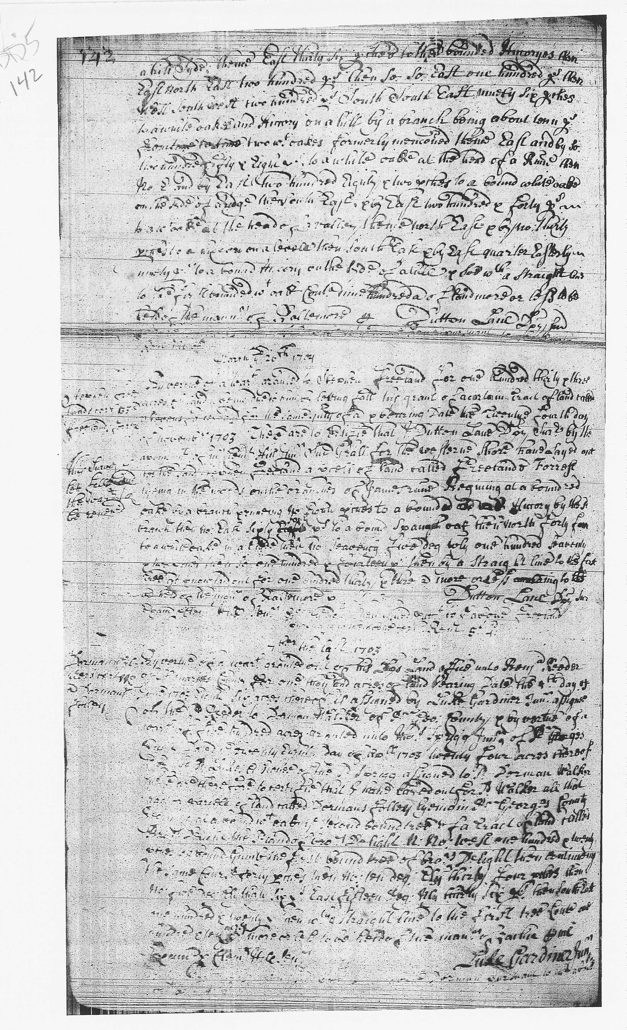
| Harford Co., MD | 1704 | John Hall |
Halls United Addition, 131 Acres; Patent and Certificate Patent Record DD 5, p. 143 Patent Record DD 5, p. 144 |
  |
|||||||||||||||||||||||||||||||||||||||
|
Harford Co., MD between the falls of Gunpowder and Winters Run |
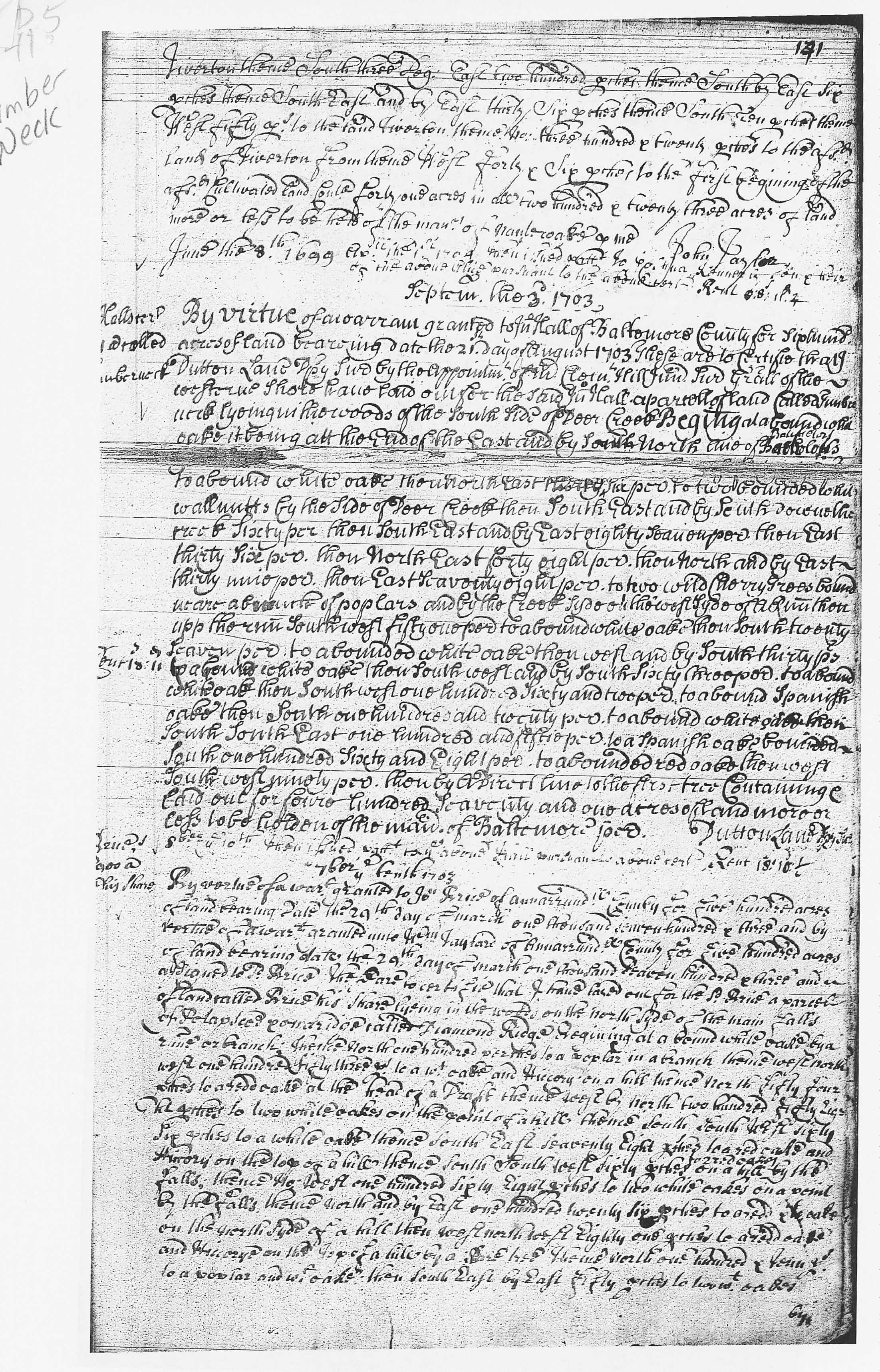
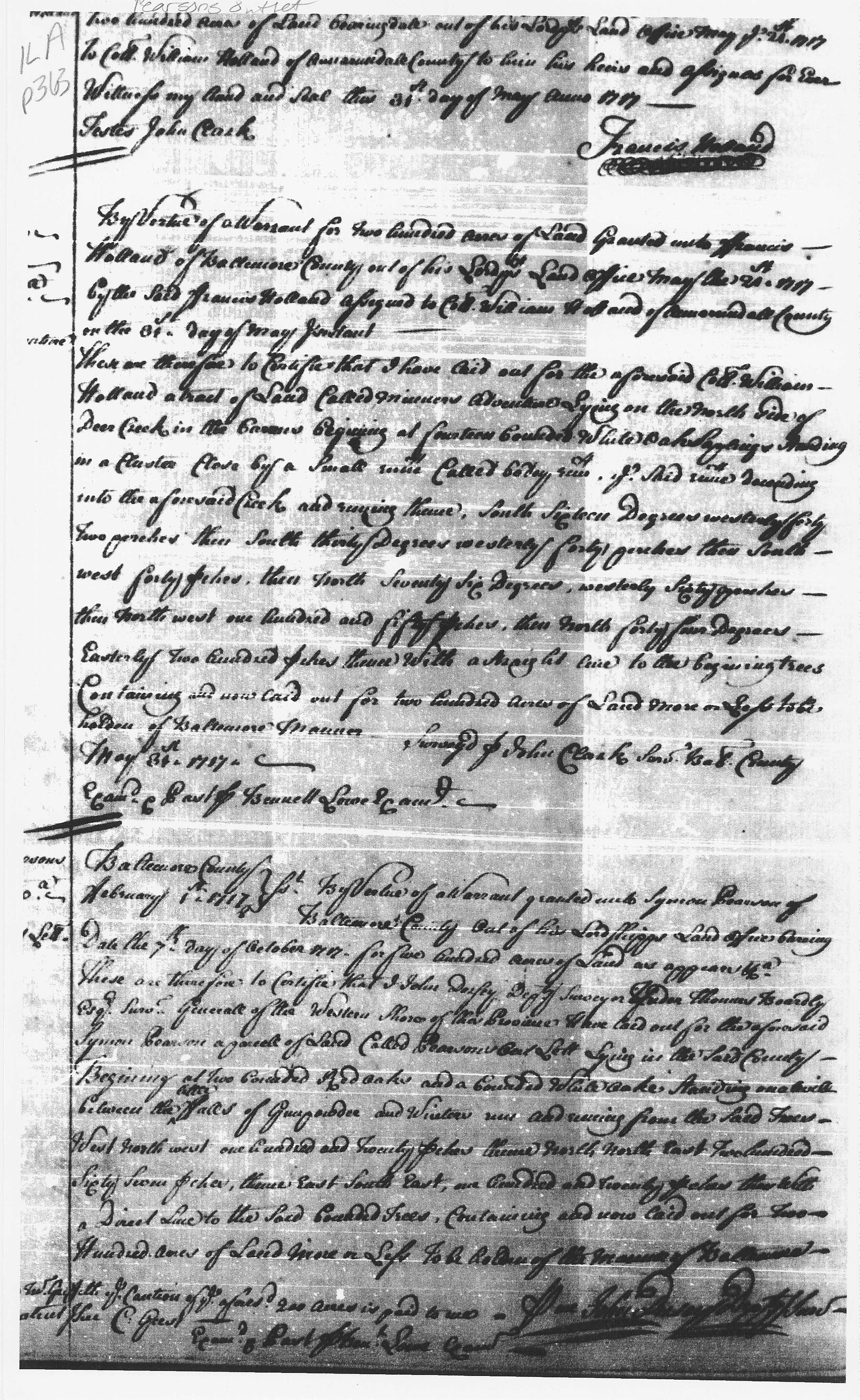
1723 | Pearson, Symon |
Reference: Patent Record IL A, p. 363 Date: 1723
Description: Pearsons Outlett, 200 Acres; Certificate Developer/Owner: Pearson, Symon Reference: Patent Record
PL 5, p. 470 Date: 1723 Description: Pearsons Outlett, 200
Acres; Patent Robert Patterson later owned part |
 |
|||||||||||||||||||||||||||||||||||||||
| Harford Co., MD | 1734 | Wetherall, Henry |
Reference: Patent Record EI 3, p. 290 Date: 1734
Description: Wetheralls Last Addition, 250 Acres; Certificate Developer/Owner: Wetherall, Henry Reference: Patent Record
EI 1, p. 482 Date: 1734 Description: Wetheralls Last
Addition, 250 Acres; Patent Witheralls Last Addition, Henry Witherall, 250 Acres Robert Patterson later owned part |
||||||||||||||||||||||||||||||||||||||||
| Harford Co., MD | 1746 | White, Thomas |
Reference: Patent Record TI 1, p. 284 Date: 1746
Description: Monreal, 2725 Acres; Certificate Developer/Owner: White, Thomas Reference: Patent Record BT
and BY 3, p. 500 Date: 1746 Description: Monreal, 2725
Acres; Patent John Patterson later owned part |
||||||||||||||||||||||||||||||||||||||||
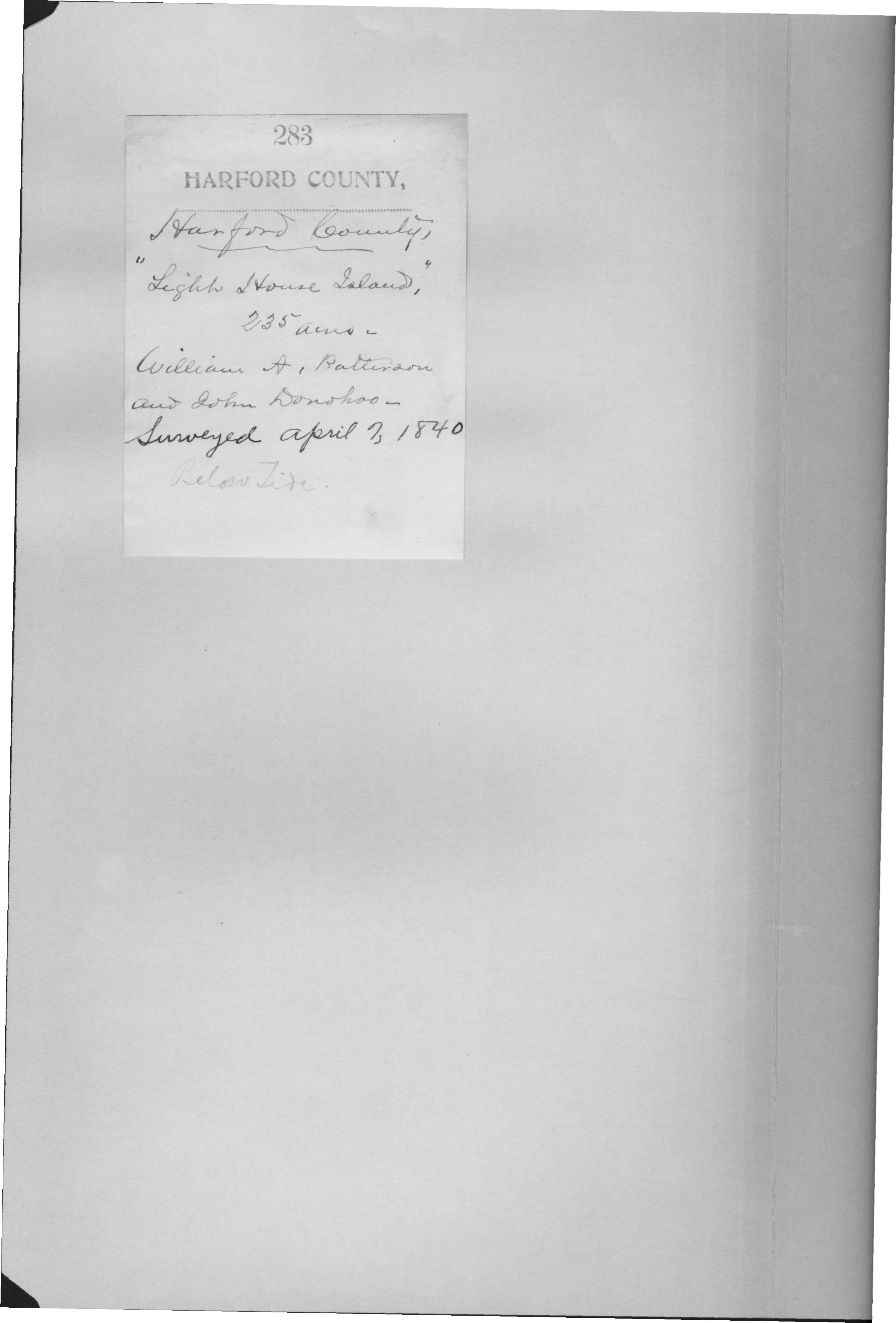
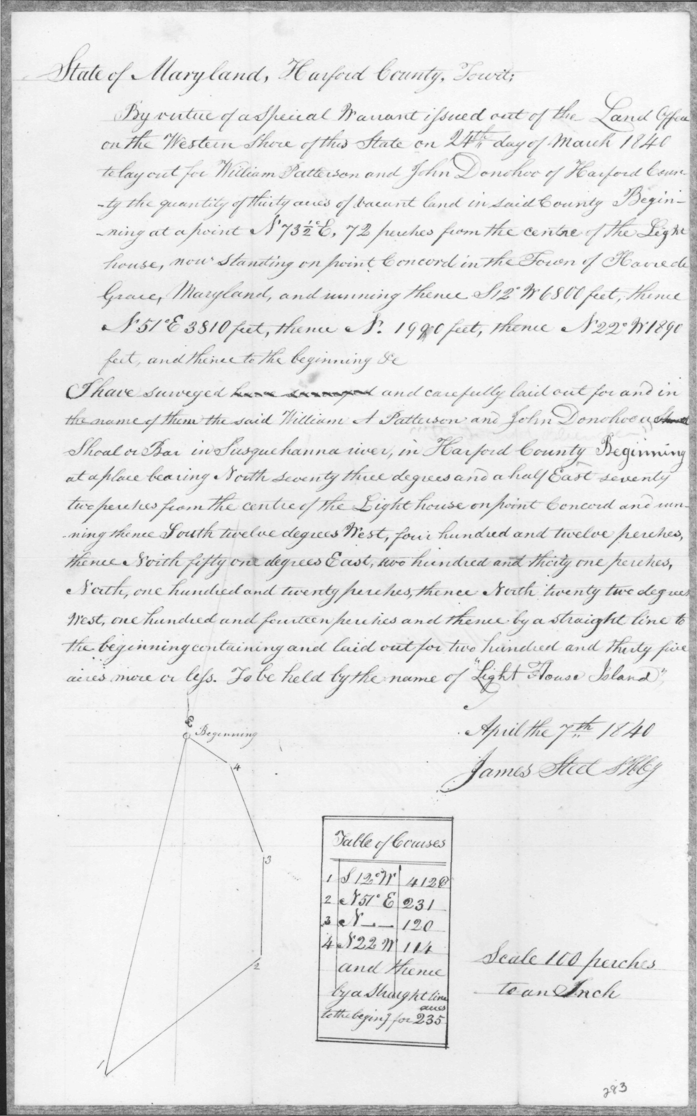
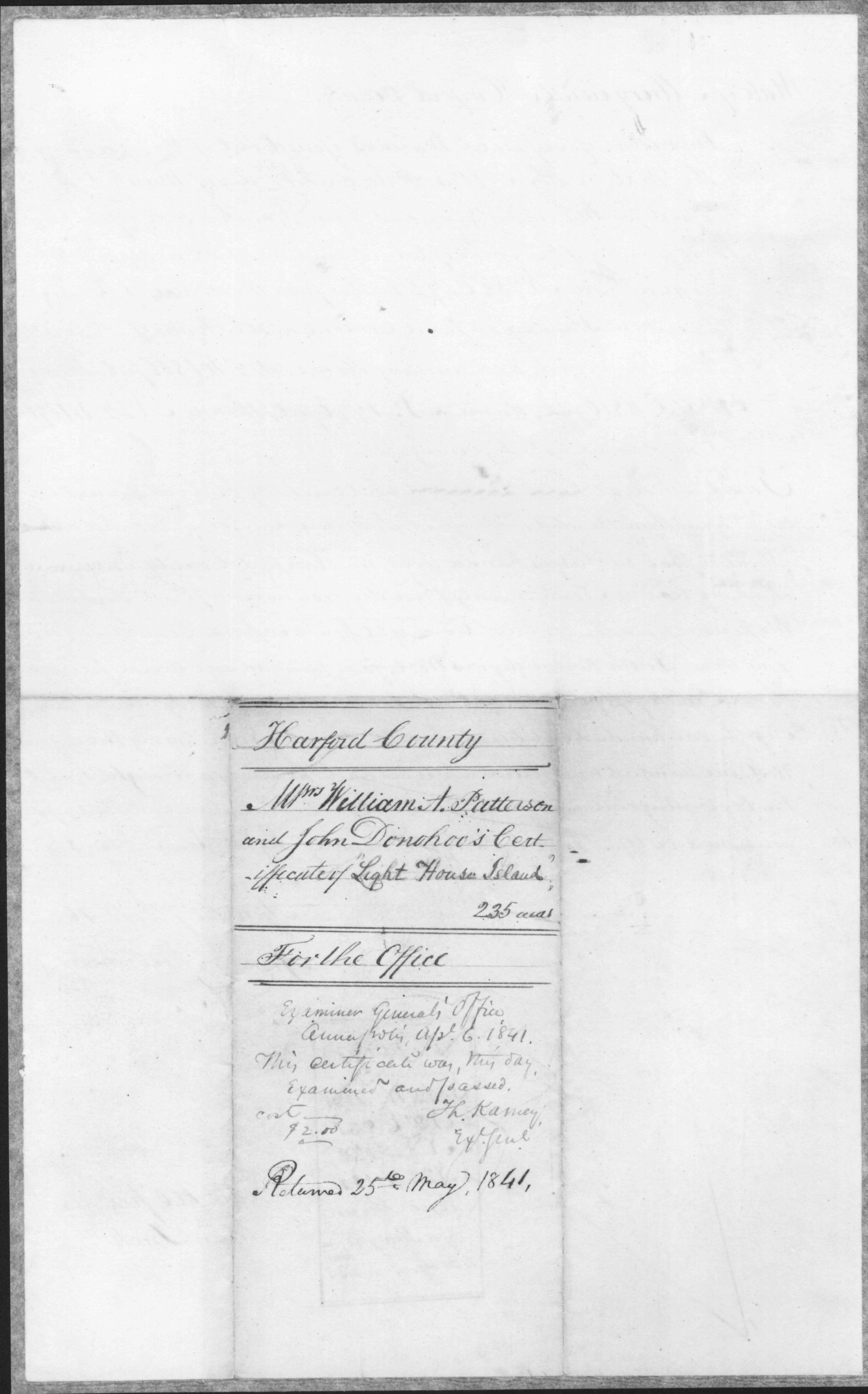
| Harford Co., MD | 1840 | Patterson, William A. |
Light House Island, William A. Patterson and John Donohoo,
235 Acres 1840/04/07 Unpatented Certificate 283
Light House Island, 235 Acres
|
   |
|||||||||||||||||||||||||||||||||||||||
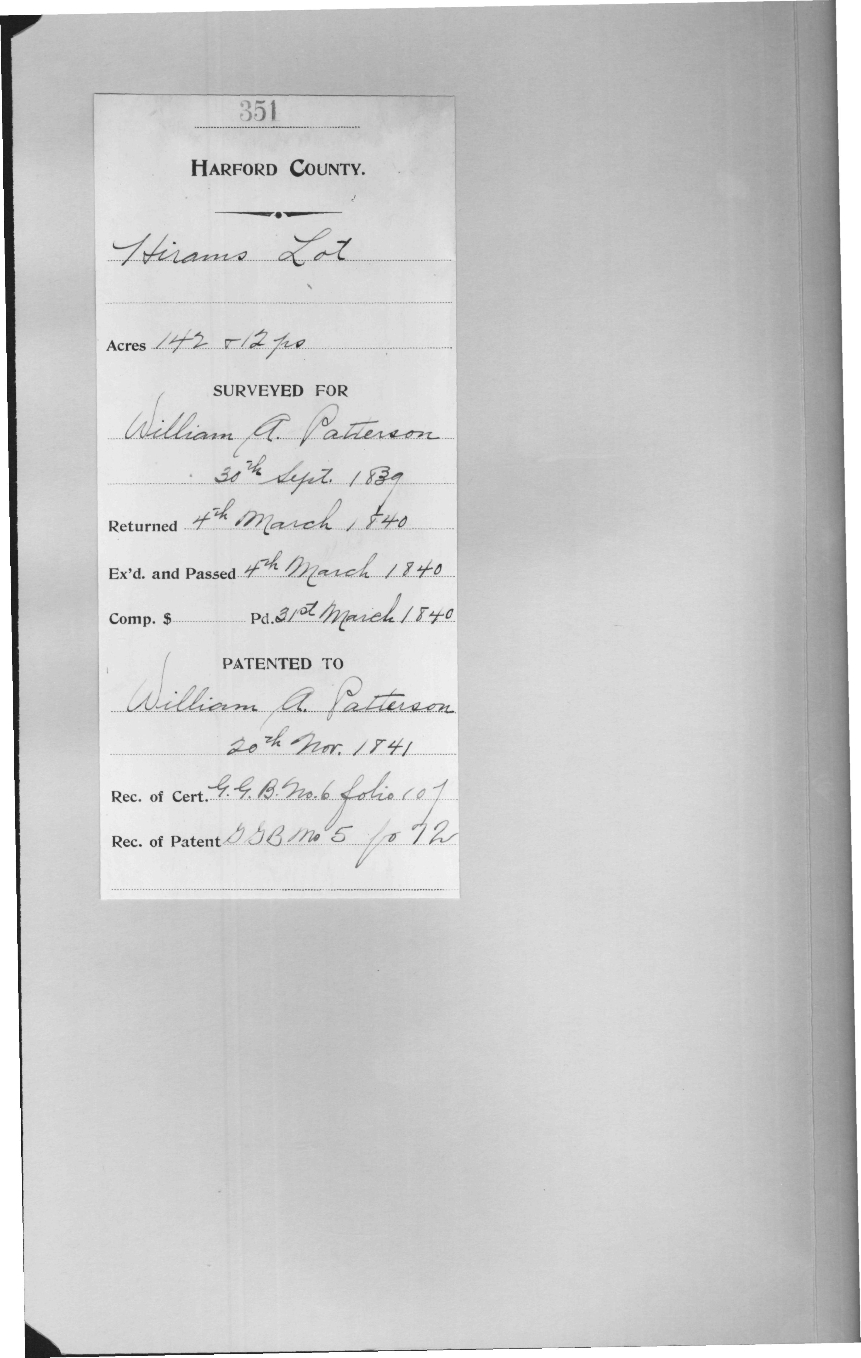
| Harford Co., MD | 1841 | Patterson, William A. |
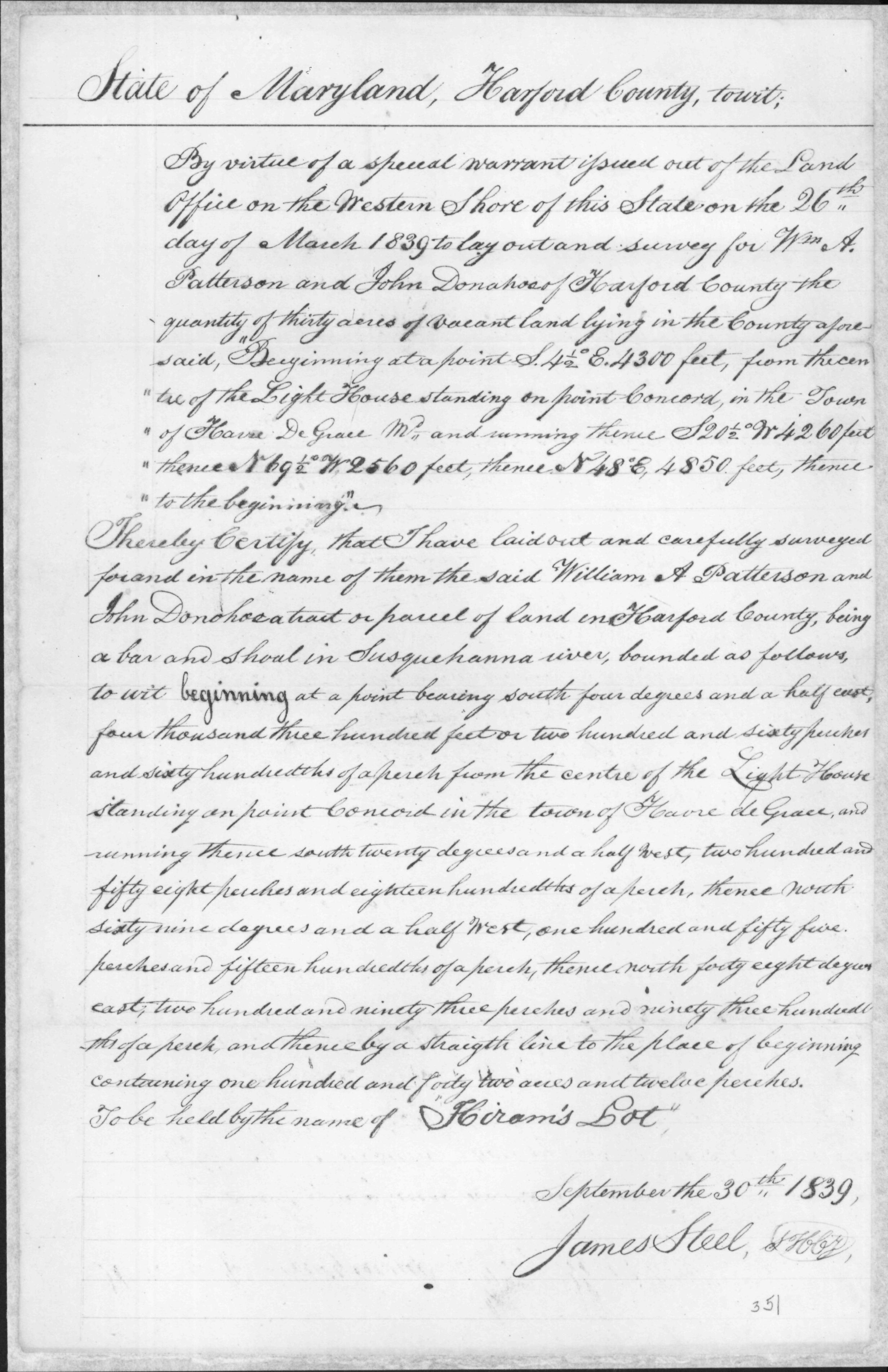
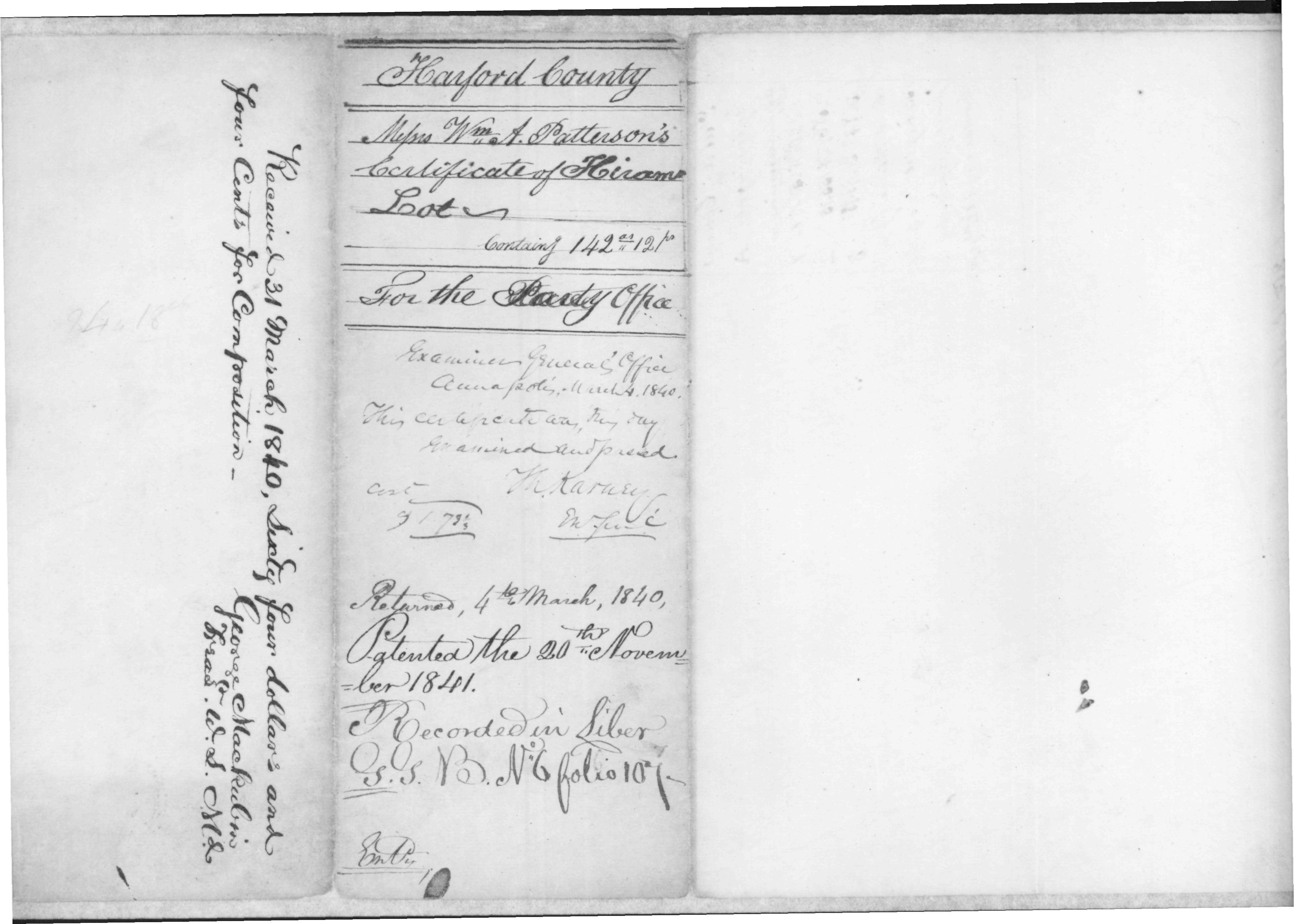
Hirams Lot, William A. Patterson, 142 Acres, 12 Perches
1841/11/20 Patented Certificate 351
Hirams Lot, 142 Acres, 12 Perches; Certificate Hirams Lot, 142 Acres, 12 Perches; Patent |
    |
|||||||||||||||||||||||||||||||||||||||
|
Harford Co., MD Perryman
|
Frederick Patterson (Briarfields) |
|
 |
||||||||||||||||||||||||||||||||||||||||
|
Harford Co., MD Perryman
|
Jay Hugh Stier and Lily Patterson Stier "The Cedars" purchased 1911, sold 1922 |
|
 |
||||||||||||||||||||||||||||||||||||||||
|
Harford Co., MD Perryman
|
Jay Hugh Stier and Lily Patterson Stier |
|
 |
||||||||||||||||||||||||||||||||||||||||
|
Harford Co., MD Perryman
|
Nov. 13, 1931 | Jay Hugh Stier and Lily Patterson Stier | Jay Hugh Stier/Lily Patterson Stier property |
|
|||||||||||||||||||||||||||||||||||||||
| see also Perryman maps | |||||||||||||||||||||||||||||||||||||||||||
|
More Land Records for: Maryland Anne Arundel/Calvert Eastern Shore Frederick Harford/Baltimore Montgomery Prince Georges |
|||||||||||||||||||||||||||||||||||||||||||
