(click on thumbnails to view full images)
?
NEW!! Web Family Cards--detailed information on individuals and family trees
Newspaper and Obituary Archive
Vital Records and Wills Archive
Immigration, Naturalization, Passports, Travel
New! Google Maps showing family locations
?
Hamerschlag and Brummel Families
| Place | Date | Name | Description |
Page Image (may be large file) and Transcription (where applicable) |
|
Montgomery Co., MD Silver Spring
|
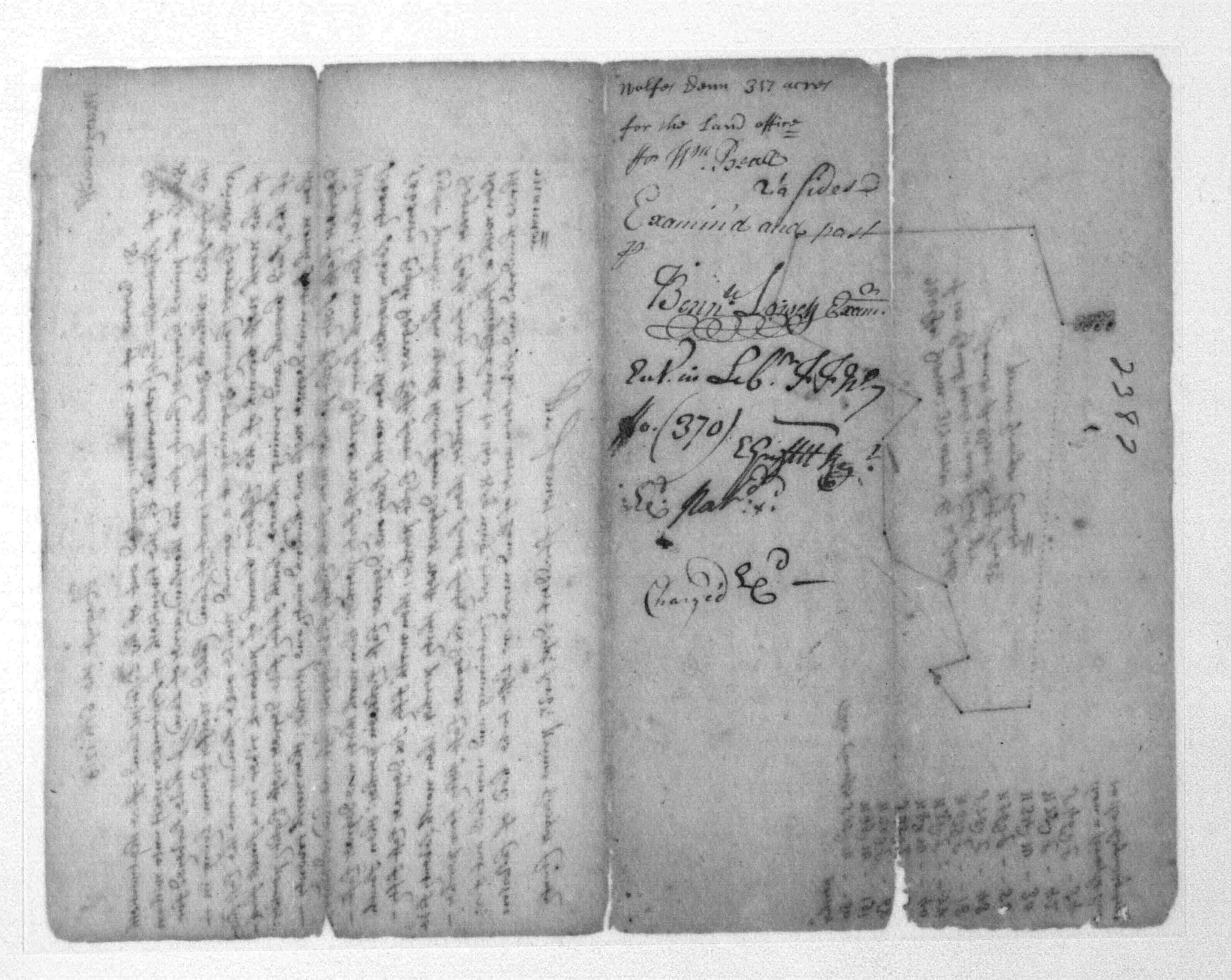
1722 | William Beall | Wolfs Denn, 317 Acres; Patented Certificate 2382 |
   |
|
Montgomery Co., MD Silver Spring
|
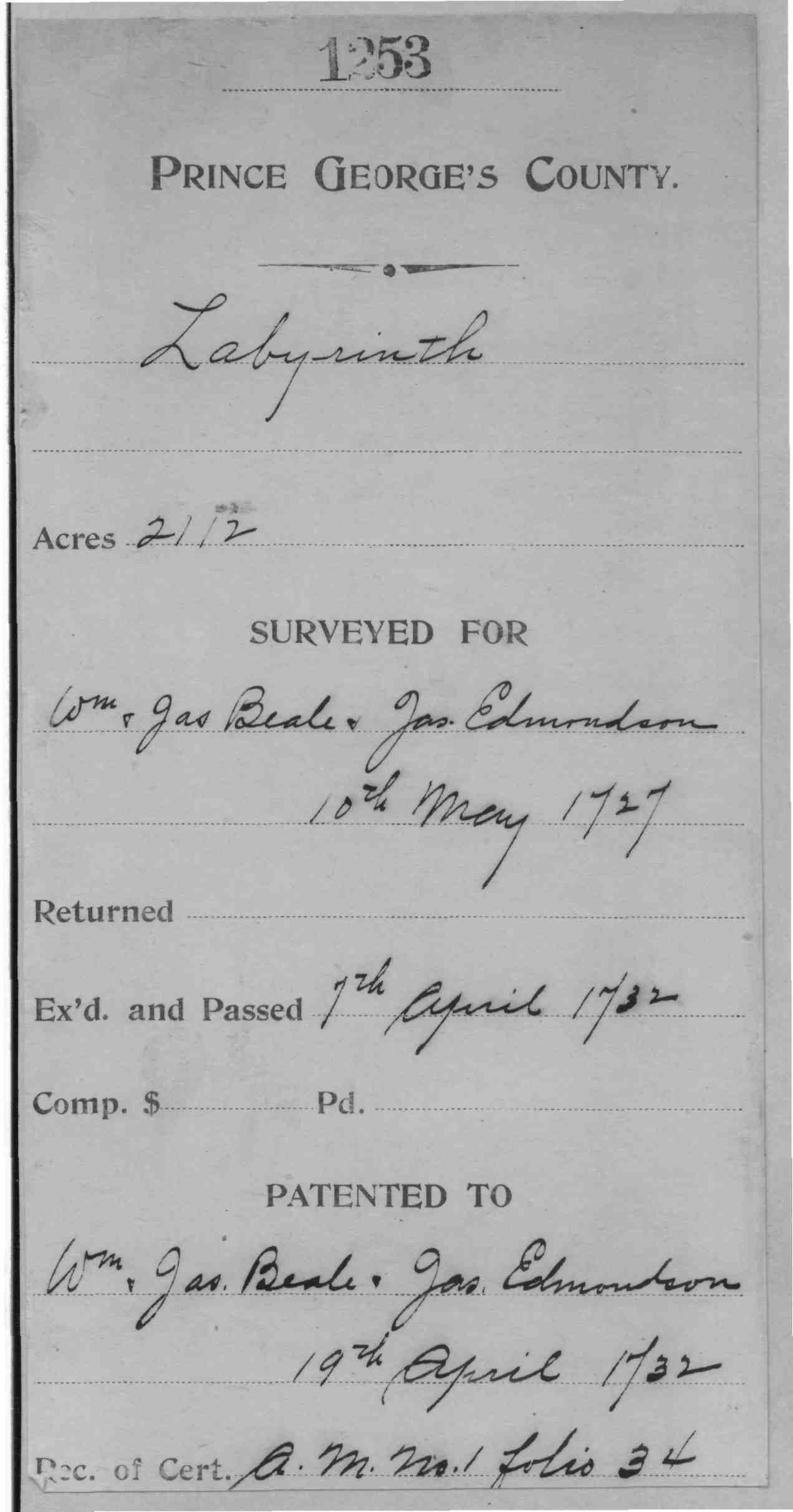
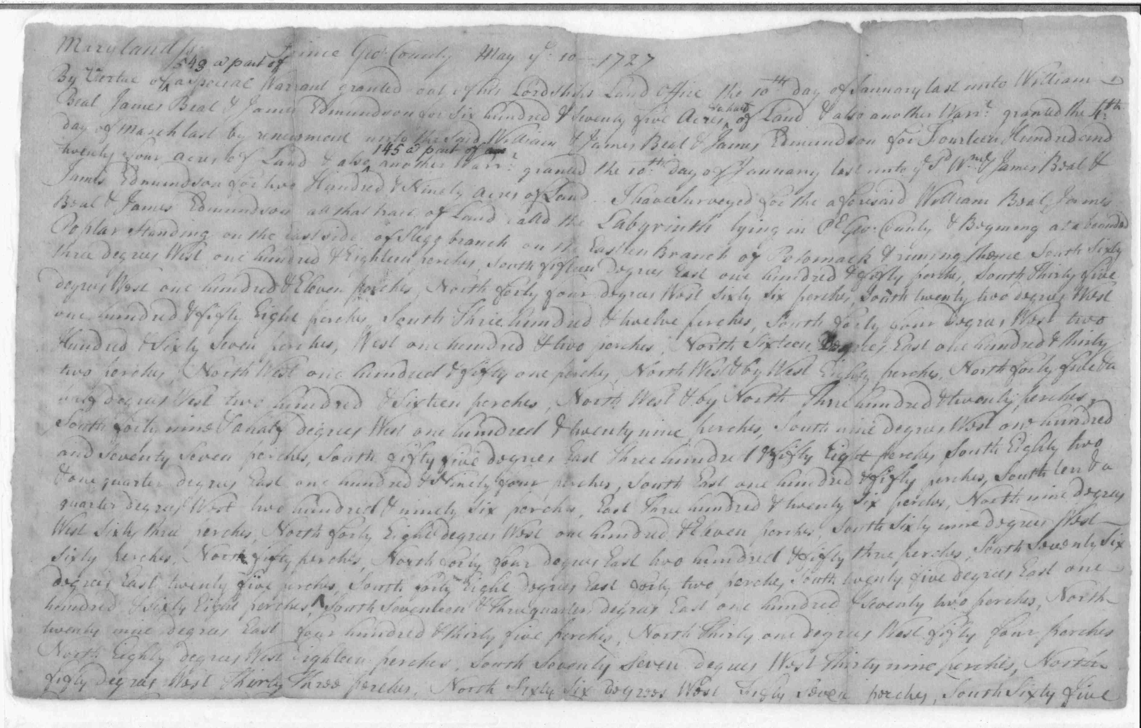
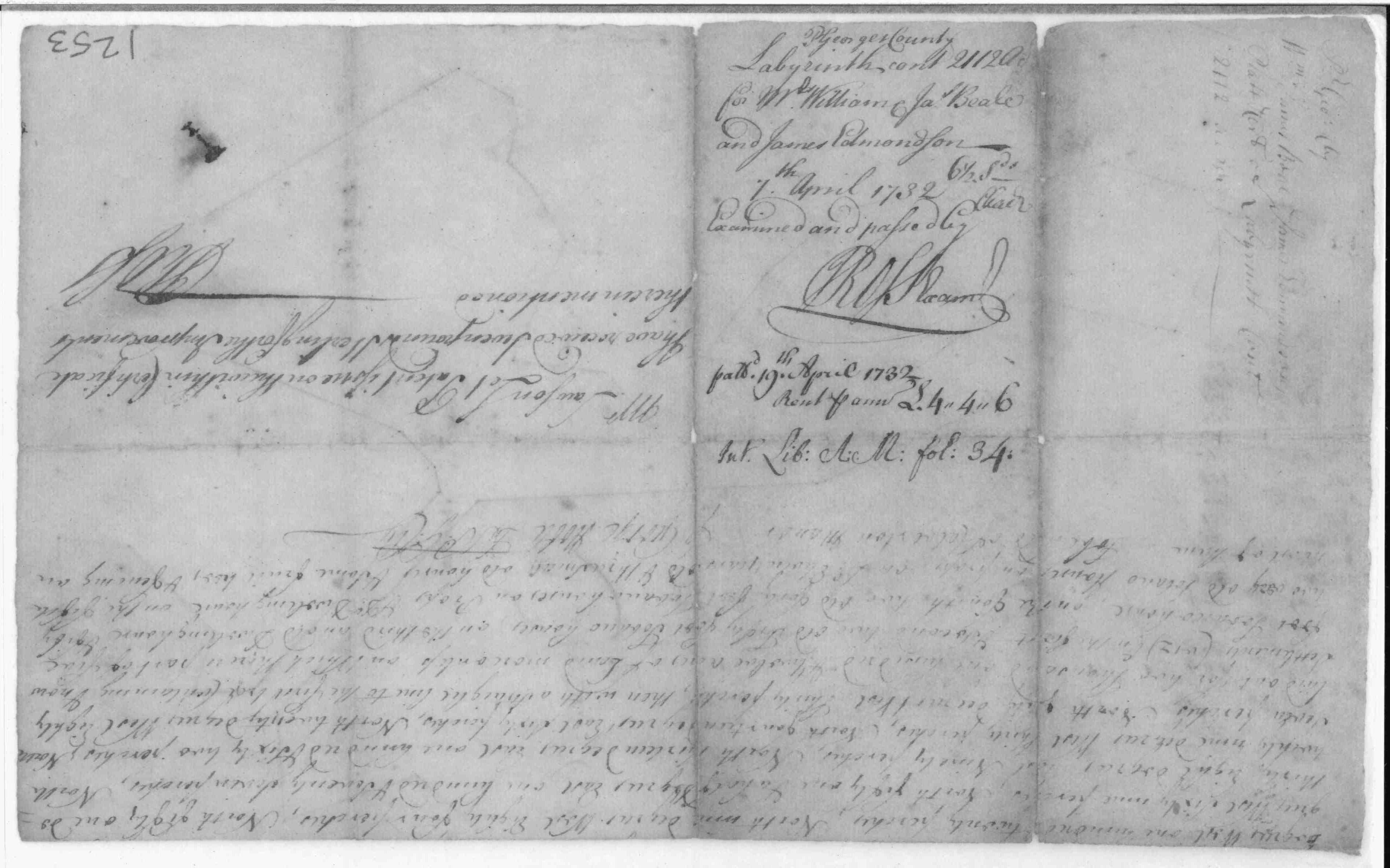
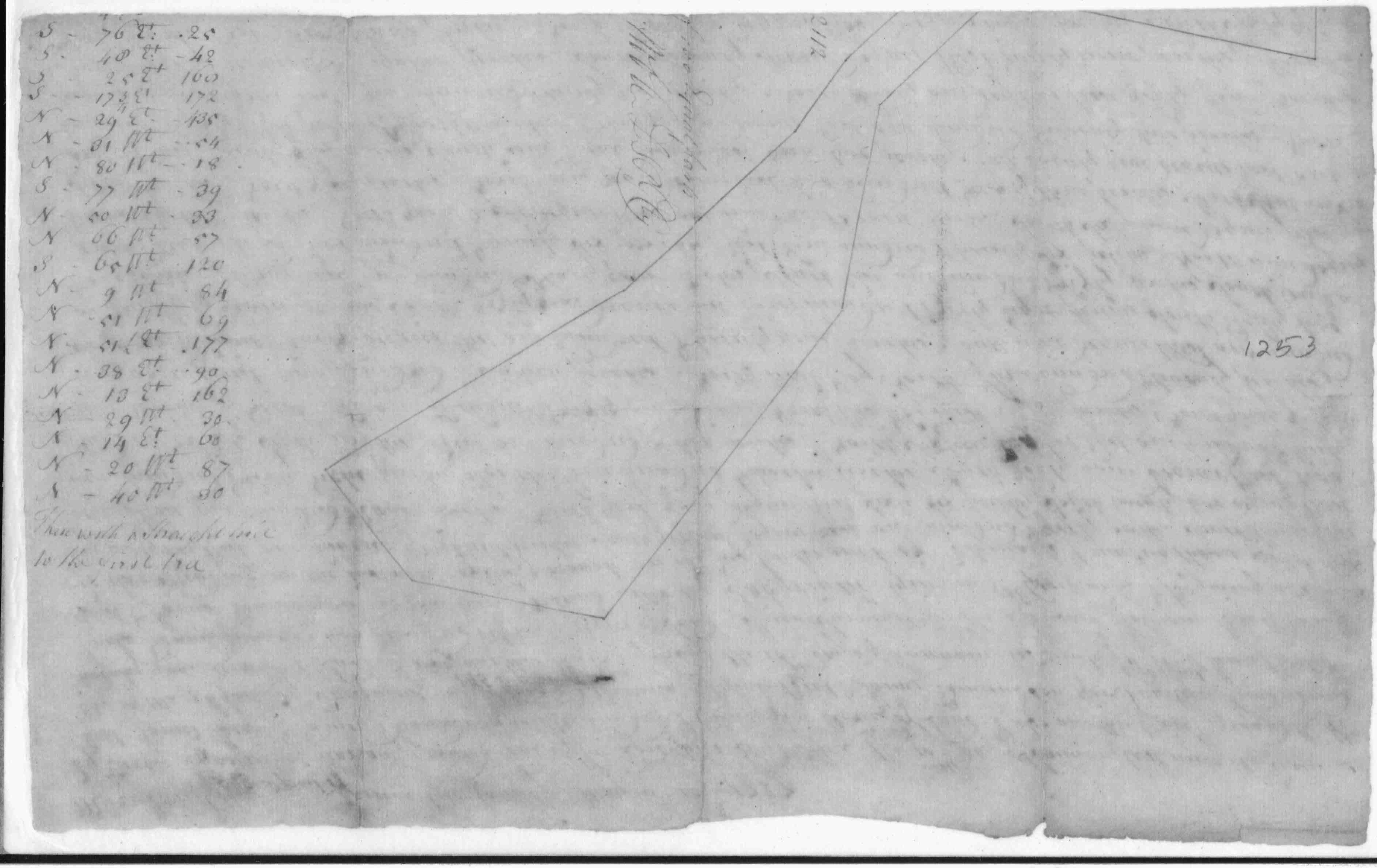
1732 | William Beale, James Beale and James Edmonston |
Labyrinth; 2112 Acres: Patented Certificate 1253
|
     |
|
Montgomery Co., MD Silver Spring
|
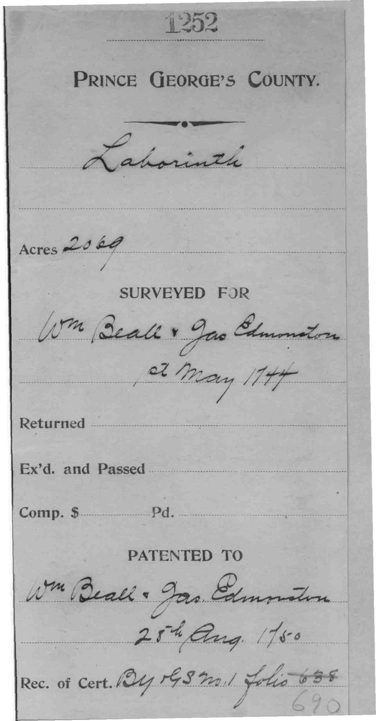
1750 | Beall, William and James Edmonston | Labyrinth; 2069 Acres; Patented Certificate 1252 |
 |
|
Montgomery Co., MD Silver Spring near Four Corners (then Prince George's)
|
1739 | John Harding |
Harding, John; Hardings Choice; 126 Acres 1739/03/13
Patented Certificate 1034 MSA S 1203-1105 Hardings Choice, 126 Acres; Patent Developer/Owner: Harding, John 1739 Patent Record LG B, p. 138 MSA S 1596-2103 Hardings Choice, 126 Acres; Certificate Developer/Owner: Harding, John 1739 Patent Record EI 5, p. 496 |
|
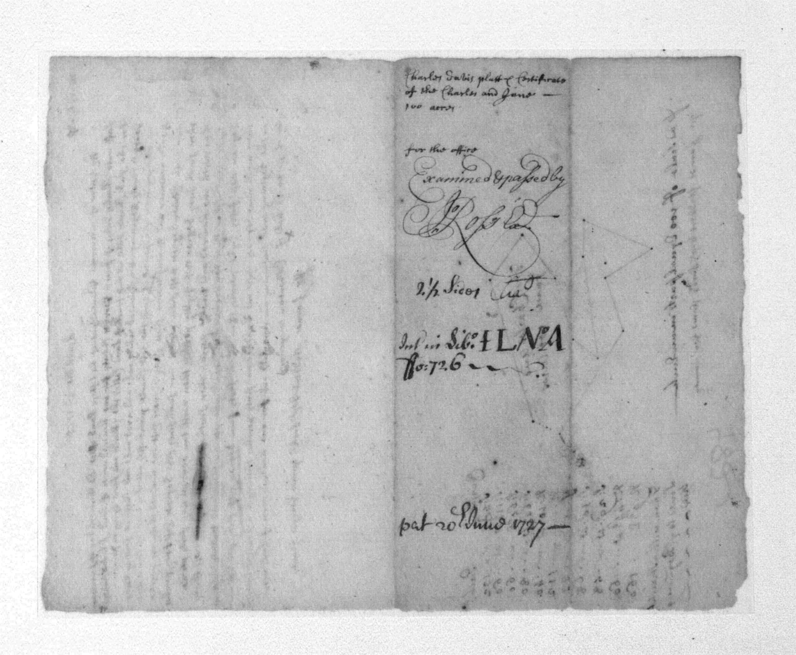
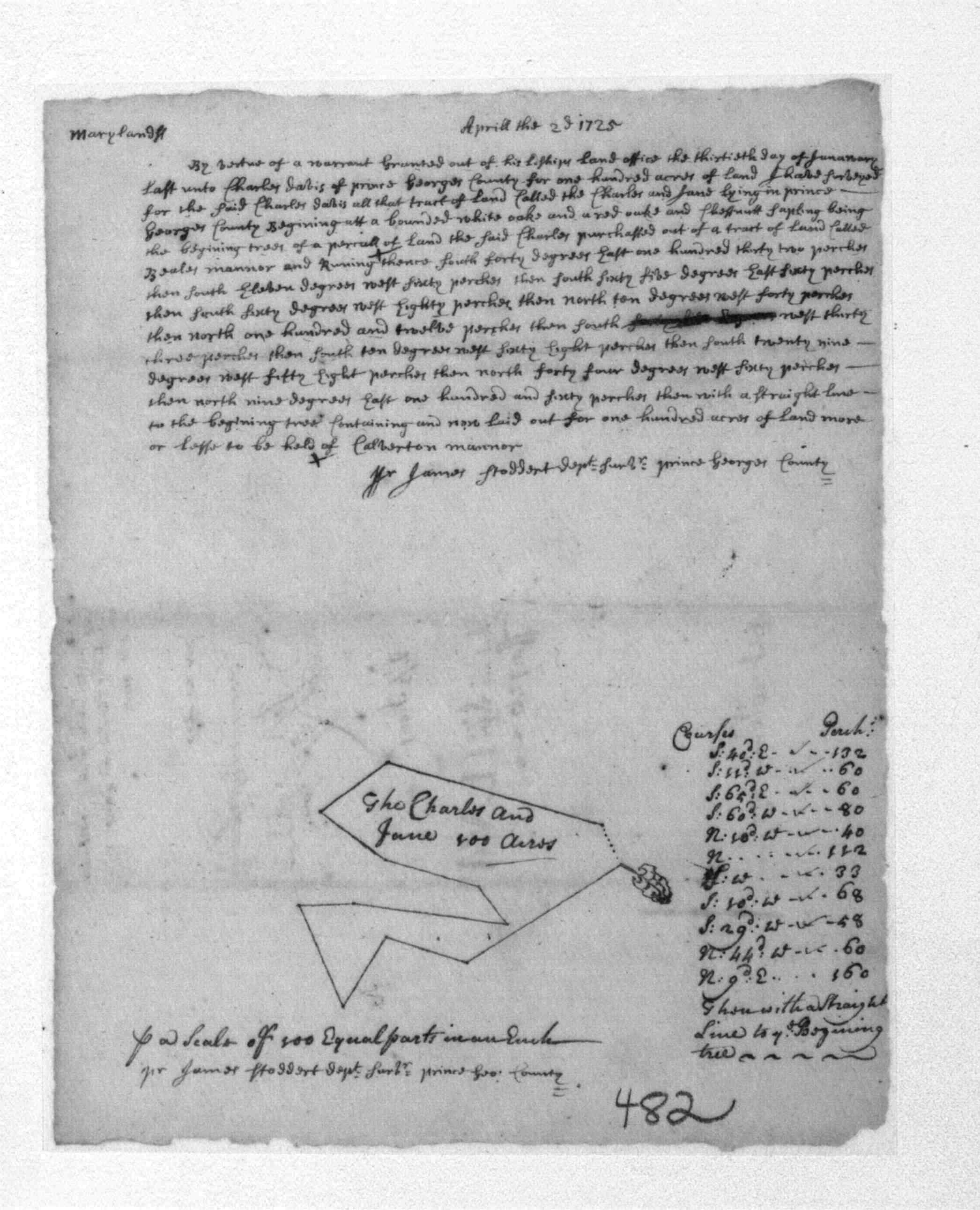
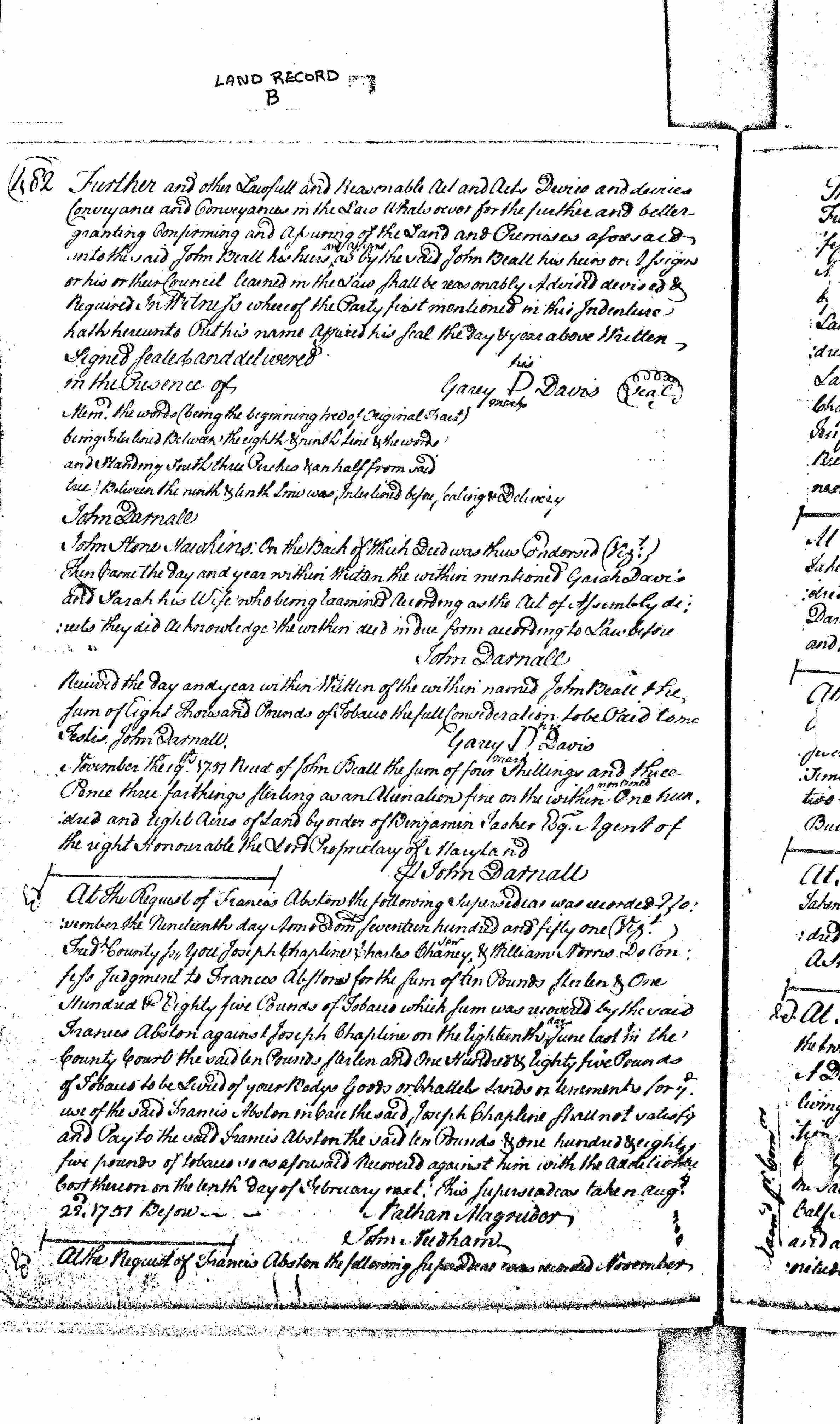
| Montgomery Co., MD | 1727/06/20 | Charles and Jane Davis |
Charles
and Jane; 100 Acres Patented Certificate 482
Patent Record IL A, p. 726 Patent Record PL 6, p. 592 |
   |
|
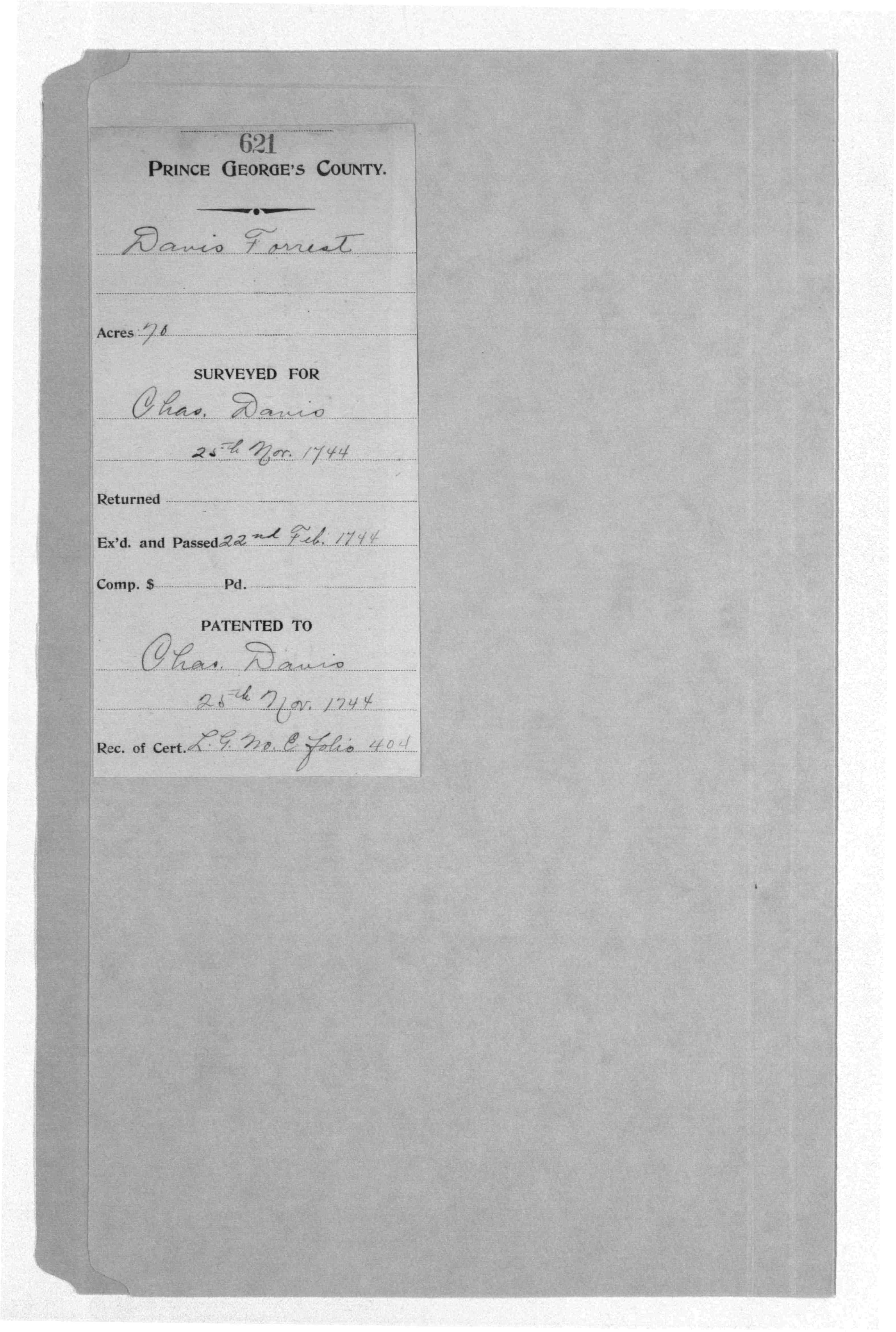
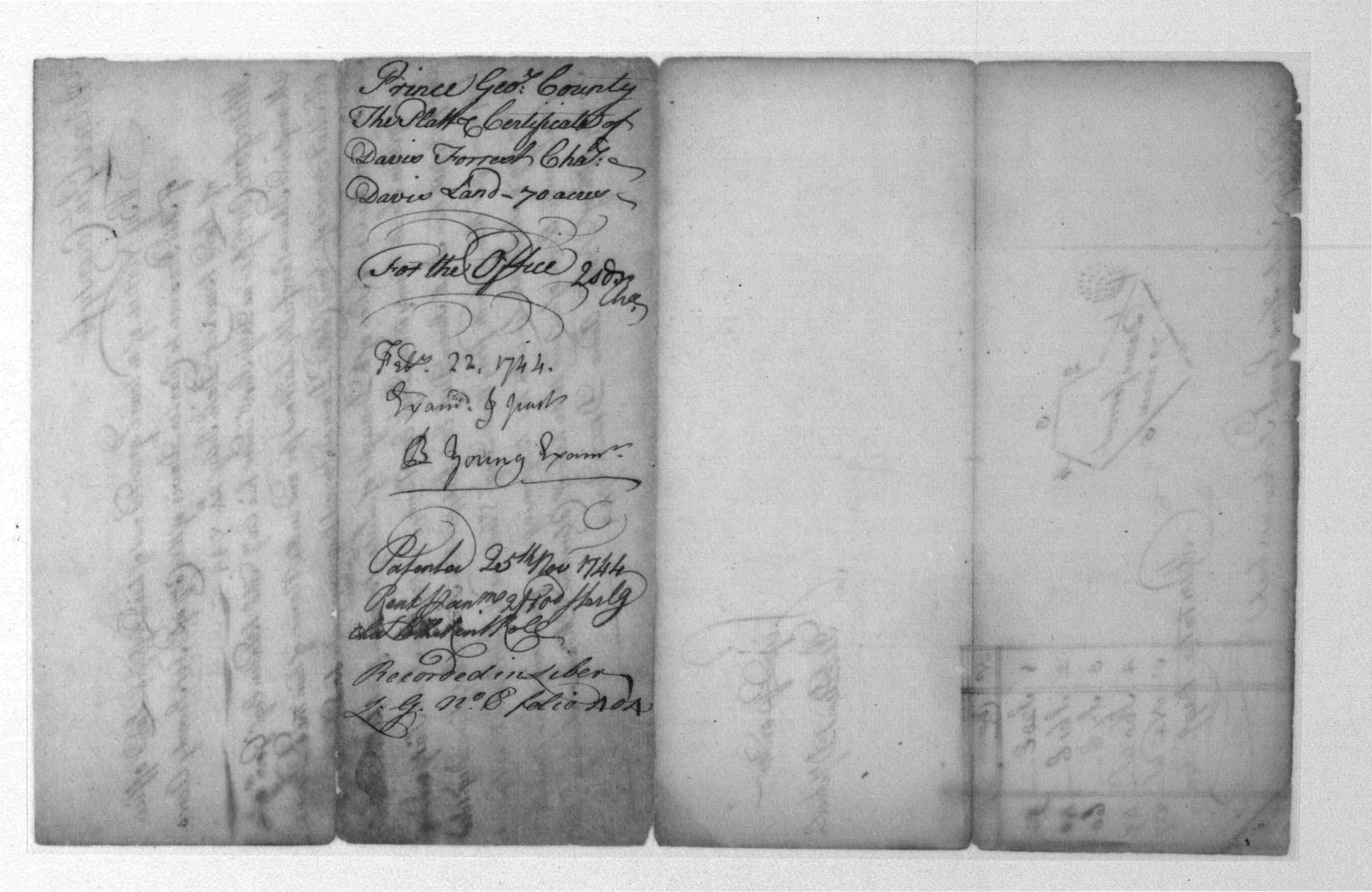
Montgomery Co., MD Gaithersburg near Watkins Mill Rd. |
1744 | Charles Davis | Davis Forrest; 70 Acres 1744/11/25 Patented Certificate 621 |
   |
|
Montgomery Co., MD probably Colesville/Silver Spring |
bef. 1751 | Garah Davis | John And Elizabeth, Part Of Three Bealls Manour (sold to John Beall Nov. 1751) |
  |
|
Montgomery Co., MD Rockville |
1752 | John Harding | on south side of present-day Baltimore Road, across from Rockville Cemetery where he is buried | |
|
Montgomery
County, MD Laytonsville |
1761 | Henry Griffith |
Cow Pasture,
3854 1/2 Acres; Certificate Developer/Owner: Griffith, Henry 1761 Patent Record BC and GS 14, p. 75 0 0 MSA S 1595-874 Cow Pasture, 3854 1/2 Acres; Patent Developer/Owner: Griffith, Henry 1761 Patent Record BC and GS 15, p. 339 0 0 MSA S 1595-875 Cow Pasture, 3854 1/2 Acres; Certificate Developer/Owner: Griffith, Henry 1761 Patent Record BC and GS 14, p. 75 0 0 MSA S 1595-737 Cow Pasture, 3854 1/2 Acres; Patent Develope r/Owner: Griffith, Henry 1761 Patent Record BC and GS 15, p. 339 |
|
|
Montgomery Co., MD Poolesville area |
1762 | Solomon Simpson |
Resurvey on Black Oak Thicket, 565 Acres; Certificate
Developer/Owner: Simpson, Solomon Patent Record liber BC and GS 19,
folio 482
|
|
|
Montgomery Co., MD
Poolesville area |
4 Jan 1762 | Solomon Simpson |
Frederick Co. Land Records Liber G&H Abstracts made 4 jan 1762 between William Wheat jr if FC for 30 plm MD, sells tract Lucks M&B given on west side of small branch that runs into Bucks Lodge near the head of said branch, M&B given for 50 acres.
|
|
|
Montgomery Co., MD Poolesville area |
21 Mar 1763 | Solomon Simpson | sells Wheats Purchase to John Howard, M&B given for 100 acres |
|
|
Montgomery Co., MD Poolesville area (Cabin Branch near Edward's Ferry) |
9 July 1763 | Solomon Simpson |
sells part of Luck All to Stephen Newton Chiswell, M&B
given for 50 acres, wife Darkus Stimpson released dower. sells part of Black Oak Thickett between the head of a spring on the west side of a branch called Wofford Cabbin Branch, M&B for 50 acres wife Darkus Stimpson released dower.
|
|
|
Montgomery Co., MD Black Hills Regional Park, Clarksburg |
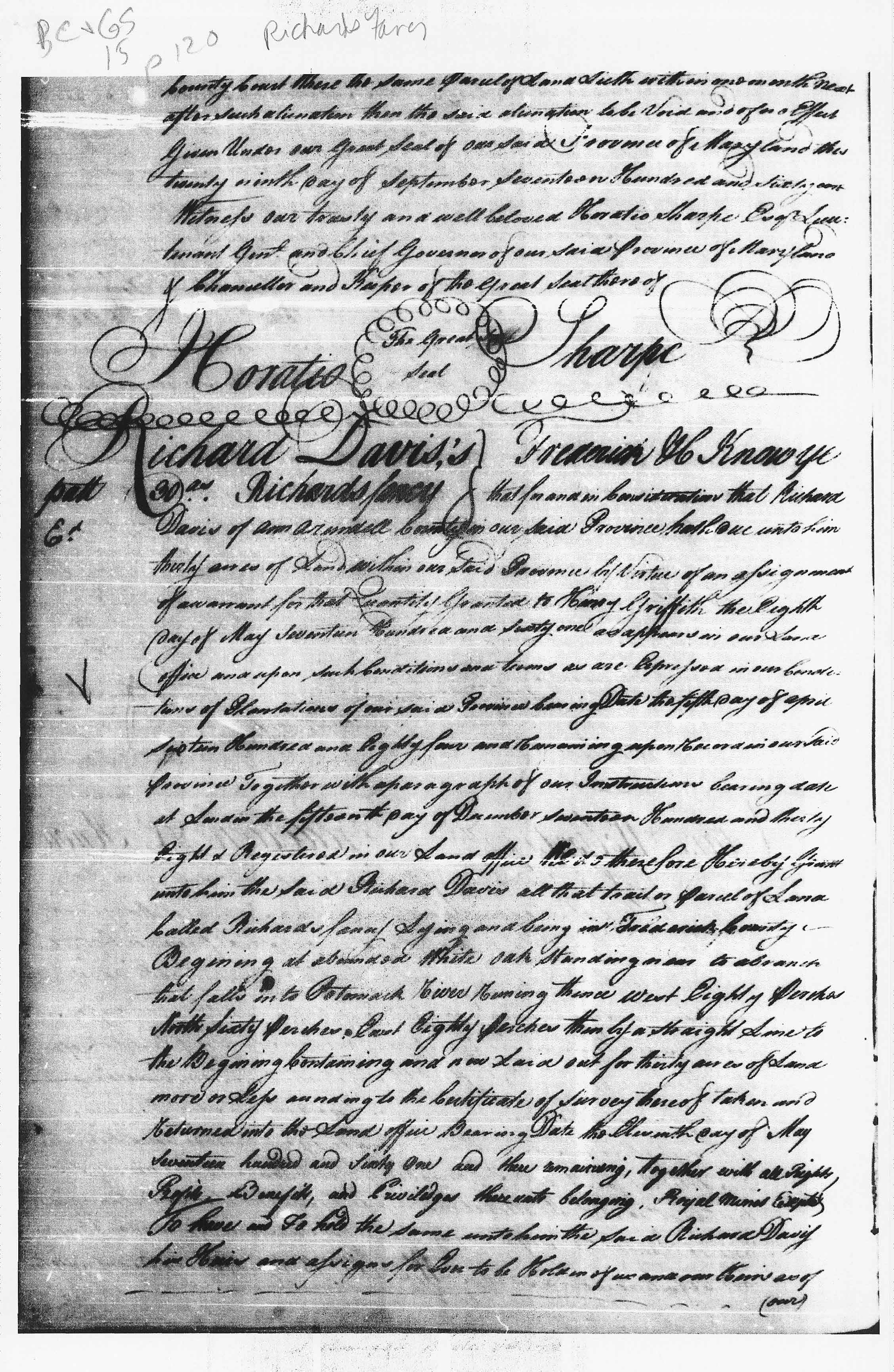
1763 | Richard Davis |
Resurvey on Richards Fancy, 218 Acres; Certificate |
|
|
Montgomery Co., MD Wheaton |
1770 | Charles Harding |
Charles Harding recorded 1 Feb 1770, made 16 Jan 1770
between Jeremiah Stympson 68 lb sells tract Hermitage on Watry Branch of
Rock Creek, to corner of Richard Condel's land, containing 100 acres.
Signed Jeremiah Stympson before David Lynn, Frederick Kemp. Ack. and
Rachel wife of Jeremiah Stympson released dower rights. Hermitage possibly purchased by Elias Harding, 1765 (adj. to Richard Condel's land)
|
|
|
Montgomery Co., MD
Poolesville area |
1773 | Solomon Simpson | Johnny And Molly's Conclusion (later became part of Mount Pleasant on road to White's Ferry in Poolesville) |
|
|
Montgomery Co., MD
Poolesville area |
1788 | Solomon Simpson |
Simpsons Dwelling Place, 385 3/4 Acres; Certificate Developer/Owner: Simpson, Solomon Patent Record liber IC D, folio 211
|
|
|
Montgomery Co., MD
Poolesville area |
1788 | Solomon Simpson | Simpsons Dwelling Place, 385 3/4 Acres; Patent Developer/Owner: Simpson, Solomon Patent Record liber IC C, folio 356 |

 |
| Montgomery County, MD | 1798 | John Burgess |
MSA S 1202-301 Good Luck, 156 Acres Developer/Owner: Burgess, John 1798 Unpatented Certificate 106 |
|
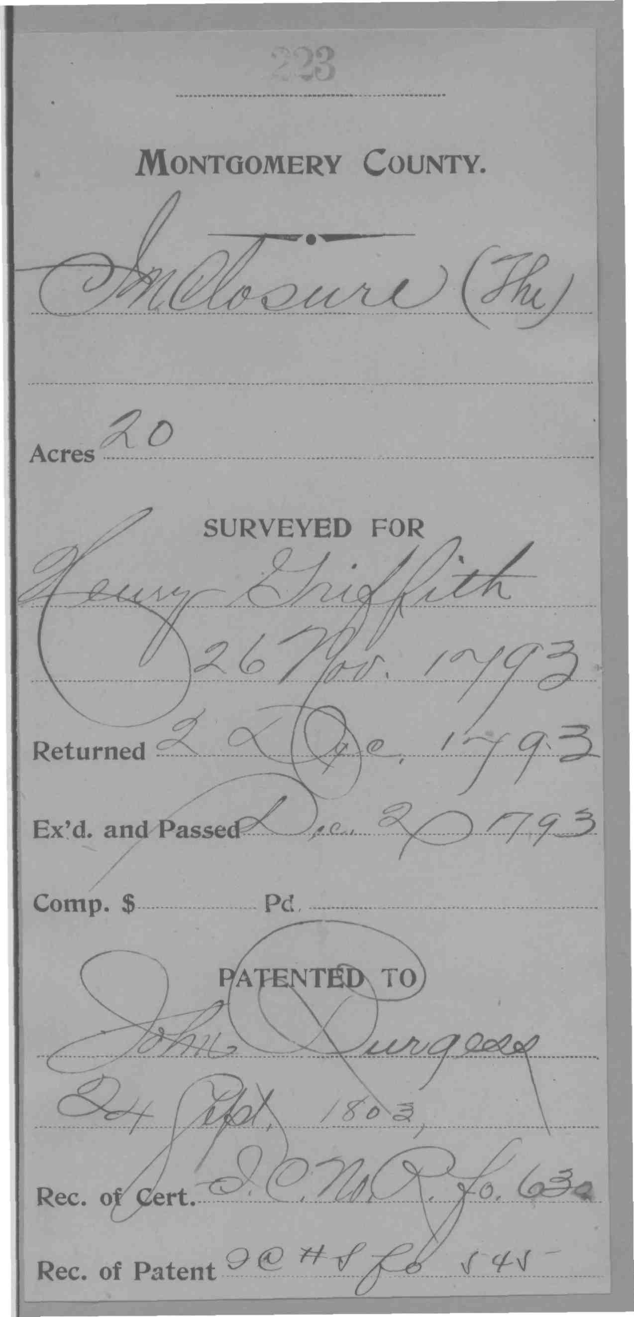
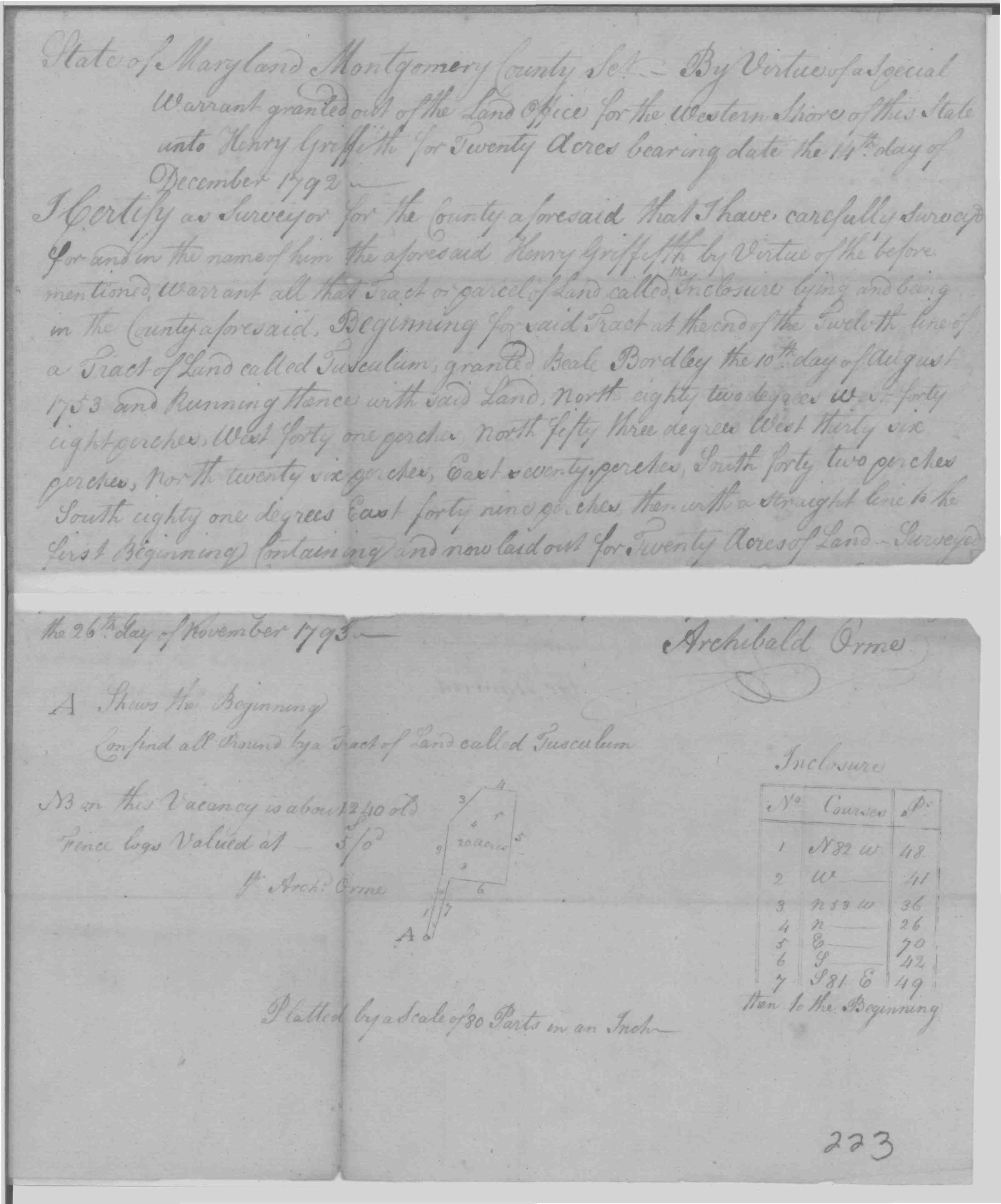
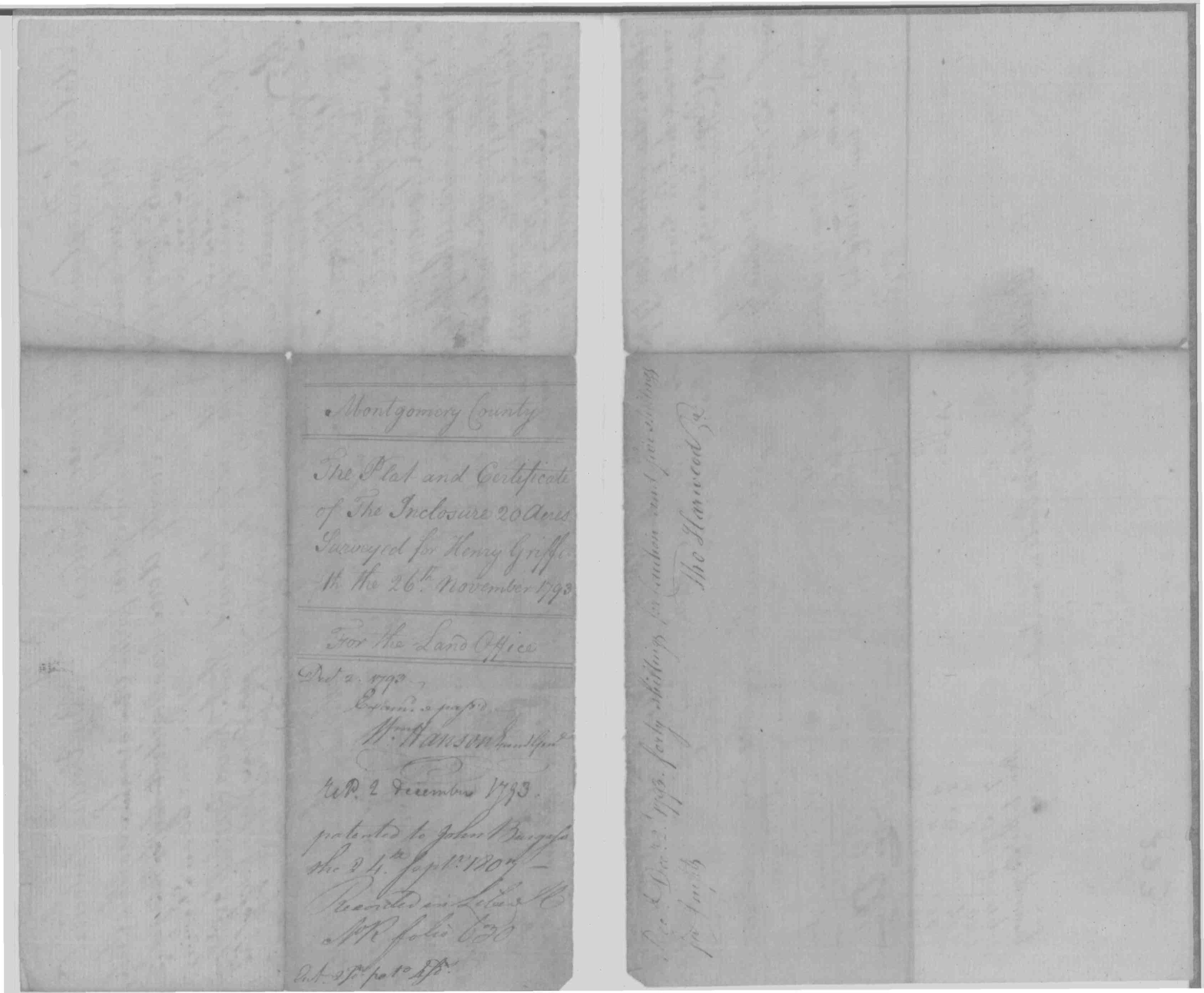
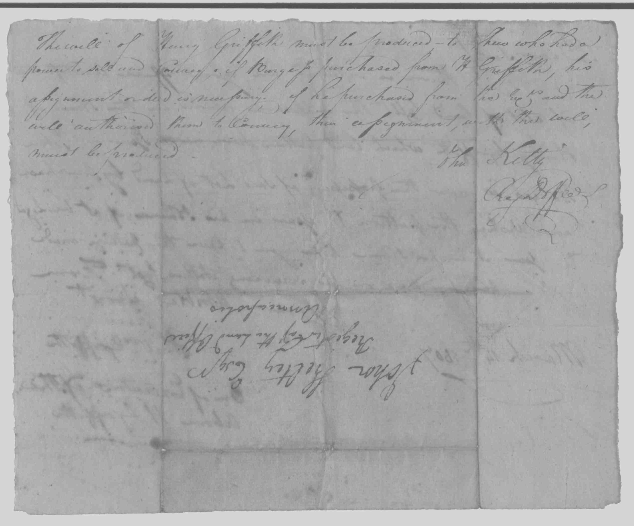
| Montgomery County, MD | 1803 | John Burgess | Burgess, John; Inclosure, The; 20 Acres; 1803/09/24; Patented Certificate 223 |


 |
|
Montgomery Co., MD
Poolesville area |
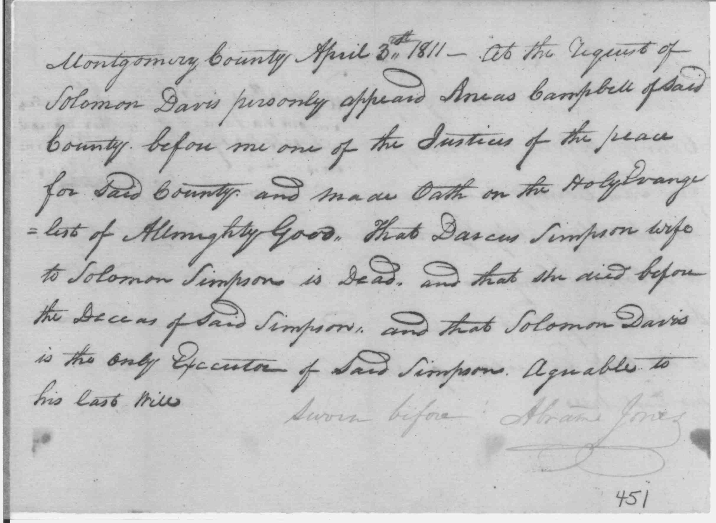
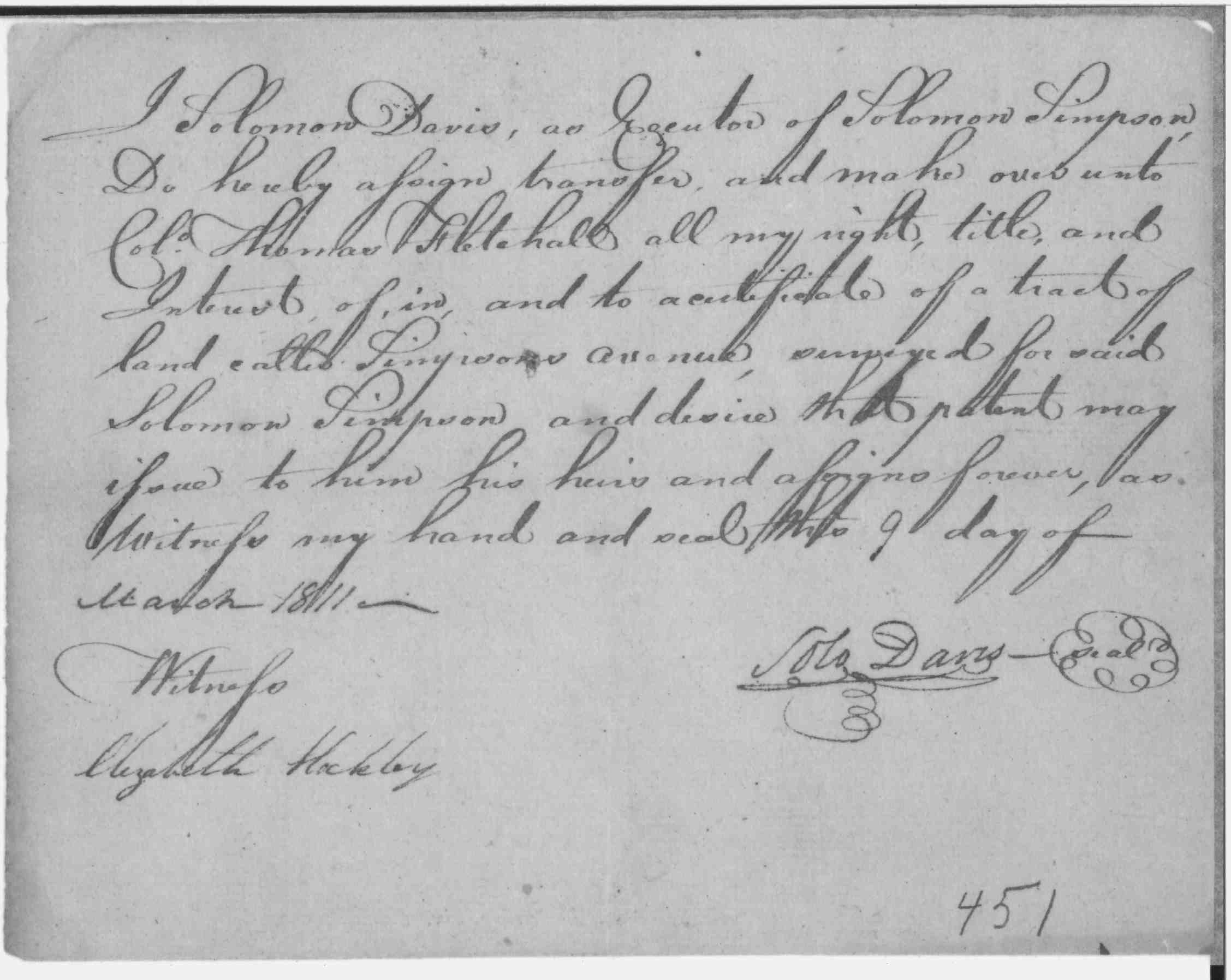
1811 | Solomon Davis |
An Hour's Work 2.8 acres Certificate Liber JK#U folio 520 Patented to Thomas Fletchell, liber JK#T, folio 539 |
|
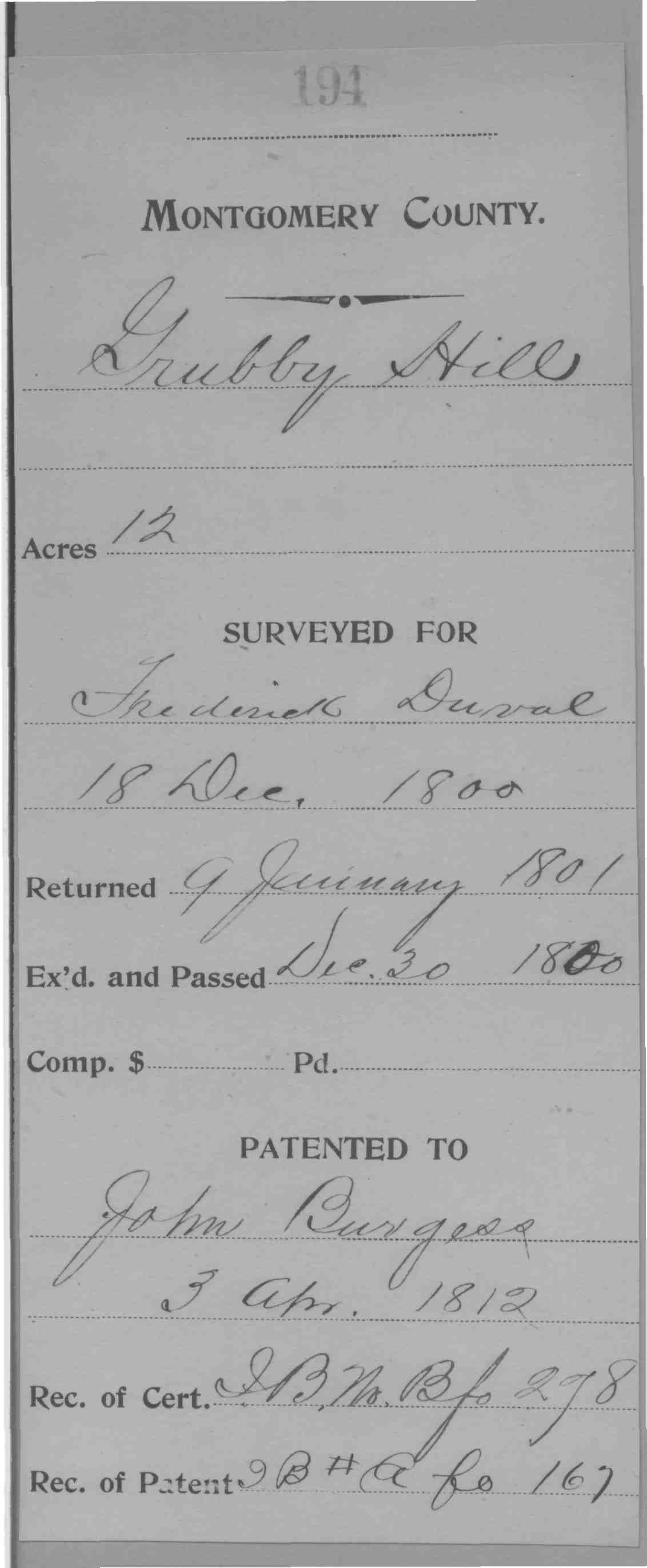
| Montgomery County, MD | 1812 | John Burgess |
Grubby
Hill, 12 Acres; Patent Developer/Owner: Burgess, John; 1812 ; Patent Record IB A, p. 167; MSA S 1595-1490 Burgess, John; Grubby Hill; 12 Acres; 1812/04/03; Patented Certificate 194 |


 |
|
Montgomery Co., MD
Poolesville area |
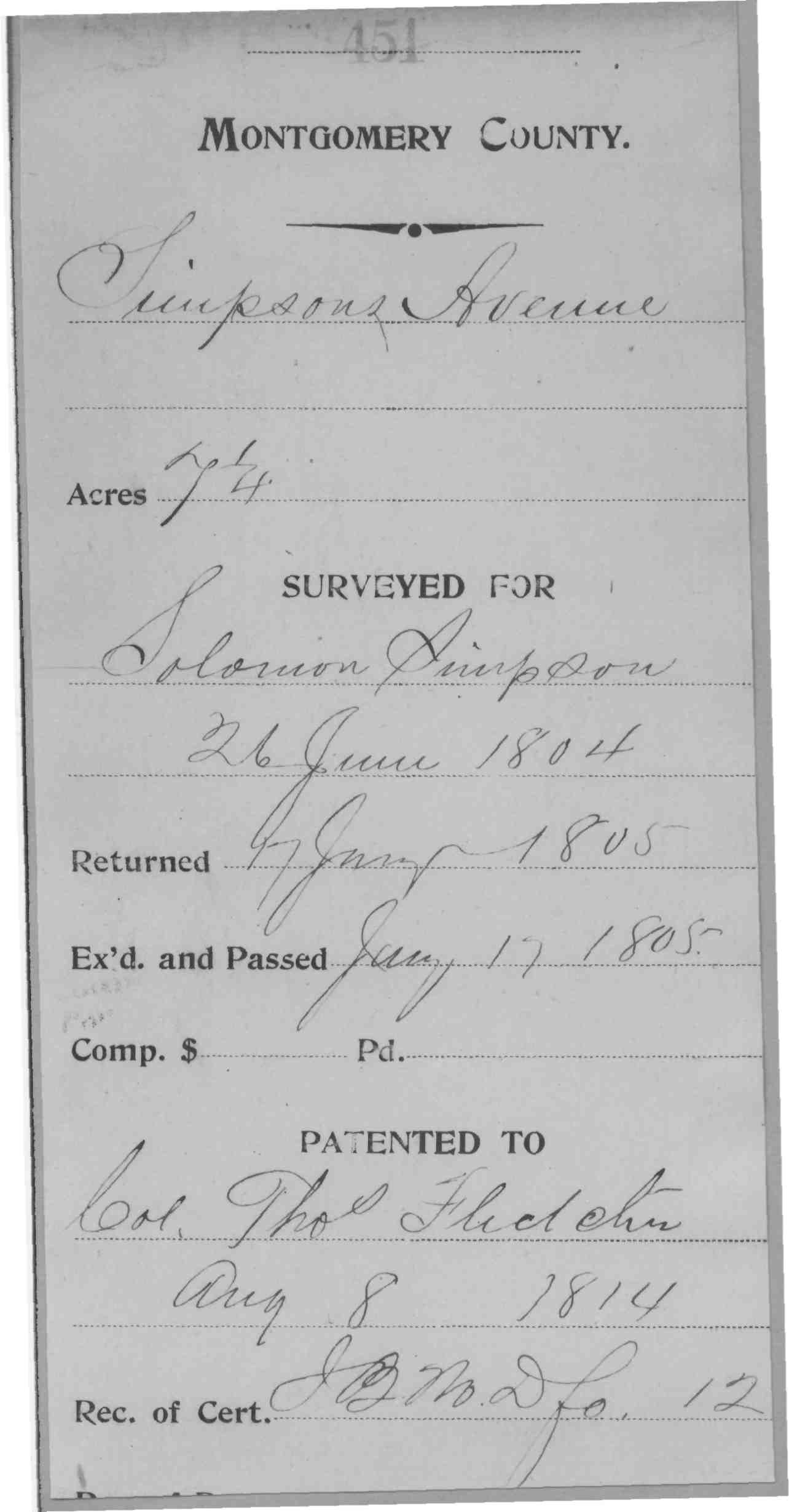
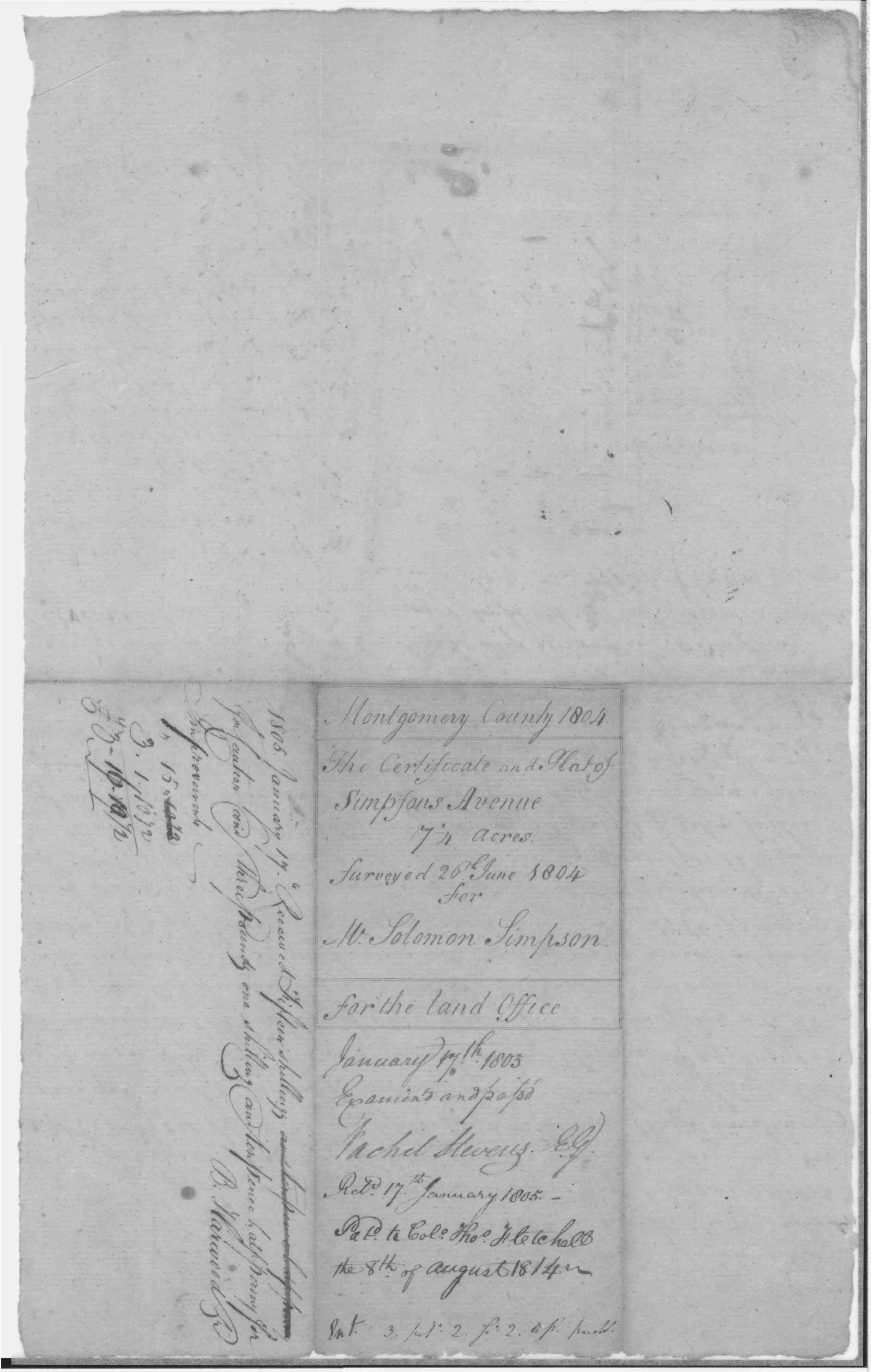
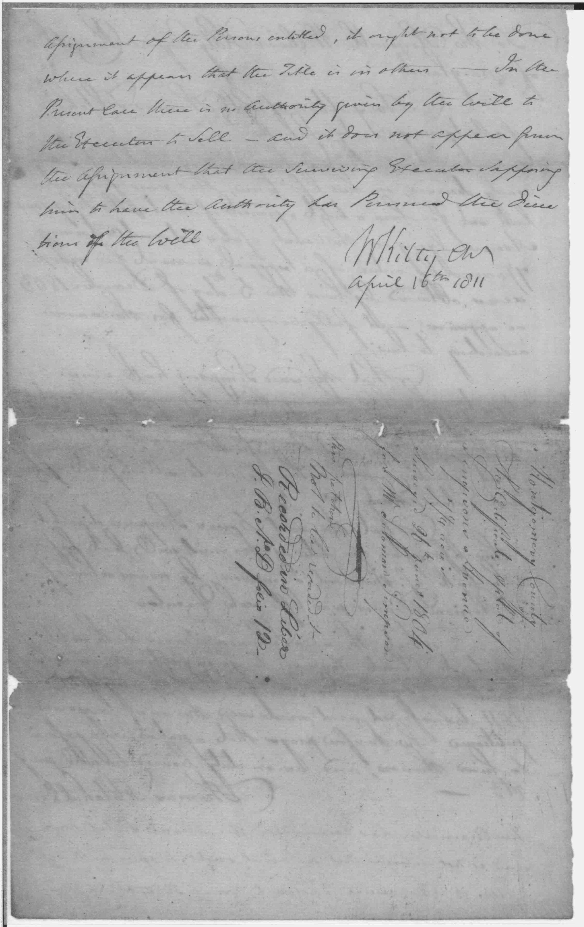
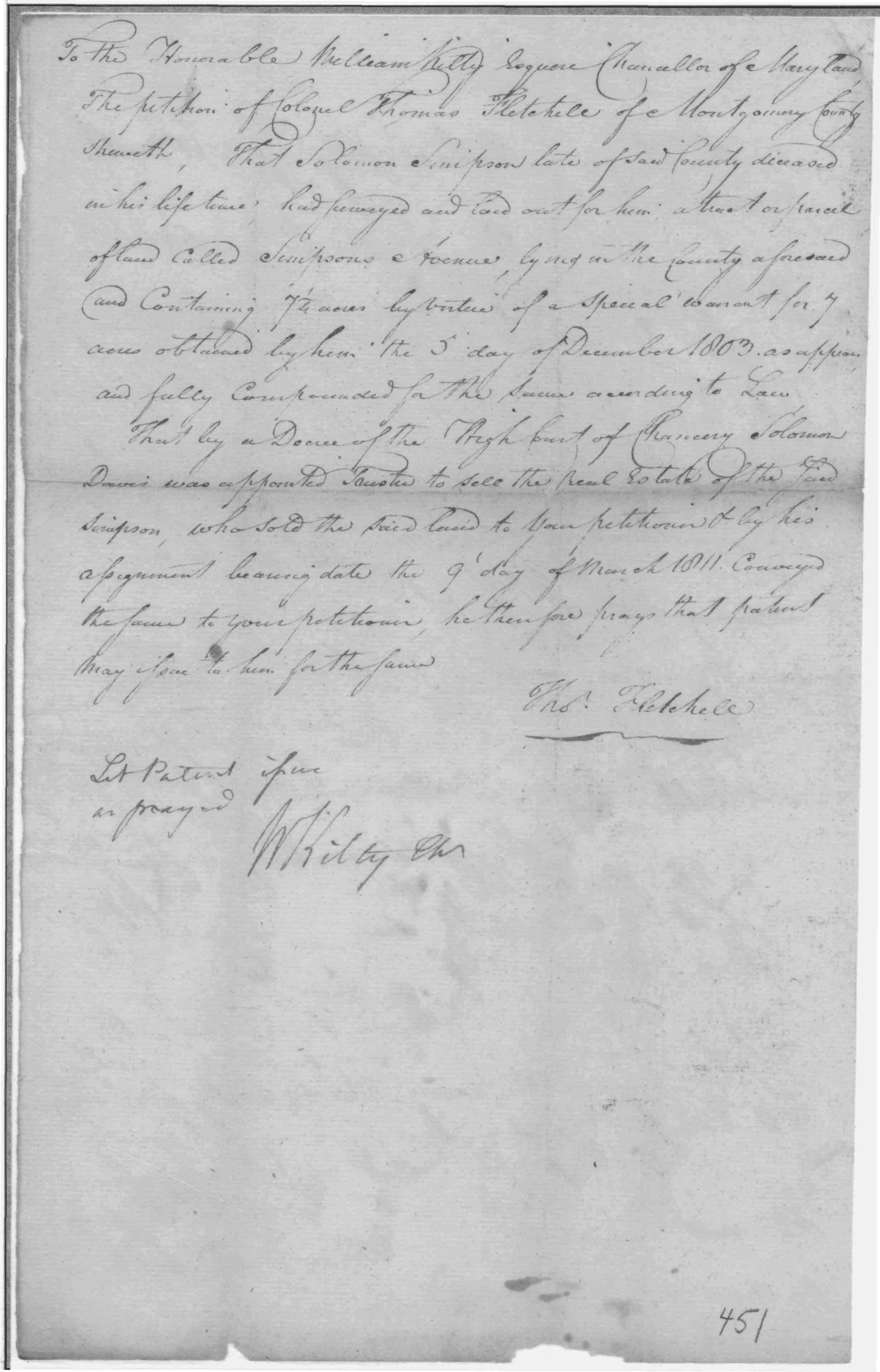
1814 | Solomon Simpson | Simpson's Avenue, 7 1/4 Acres; Certificate Developer/Owner: Simpson, Solomon Patent Record liber IB D, folio 12 |

 |
|
Montgomery Co., MD
Poolesville area |
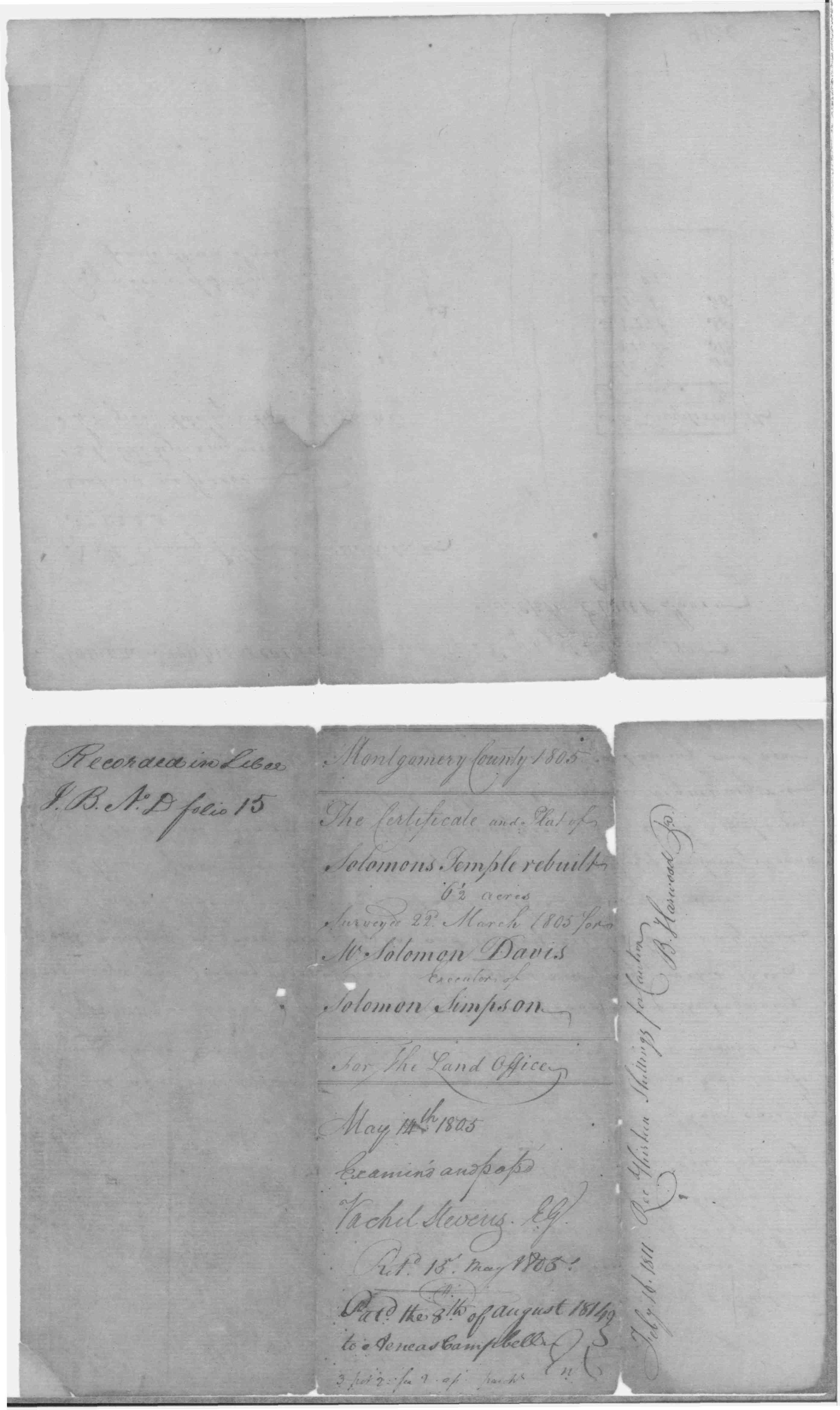
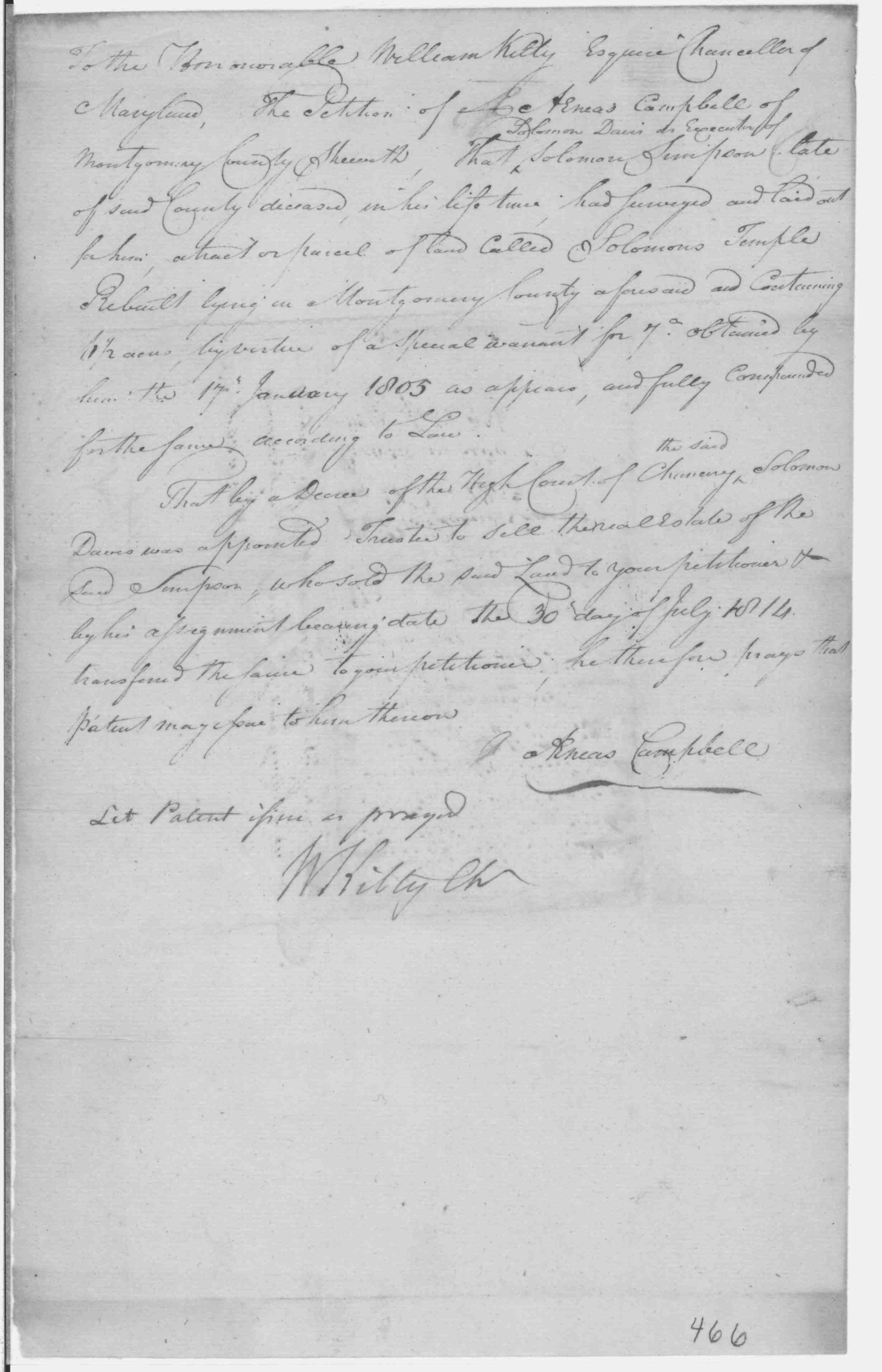
1814 | Solomon Davis as executor of Solomon Simpson |
Solomon's Temple Rebuilt Patent Record IB D, p. 15 and Patent Record IB C, p. 112; Patented Certificate 466 Patented to Aenas Campbell liber IB#C folio 112 |
|
|
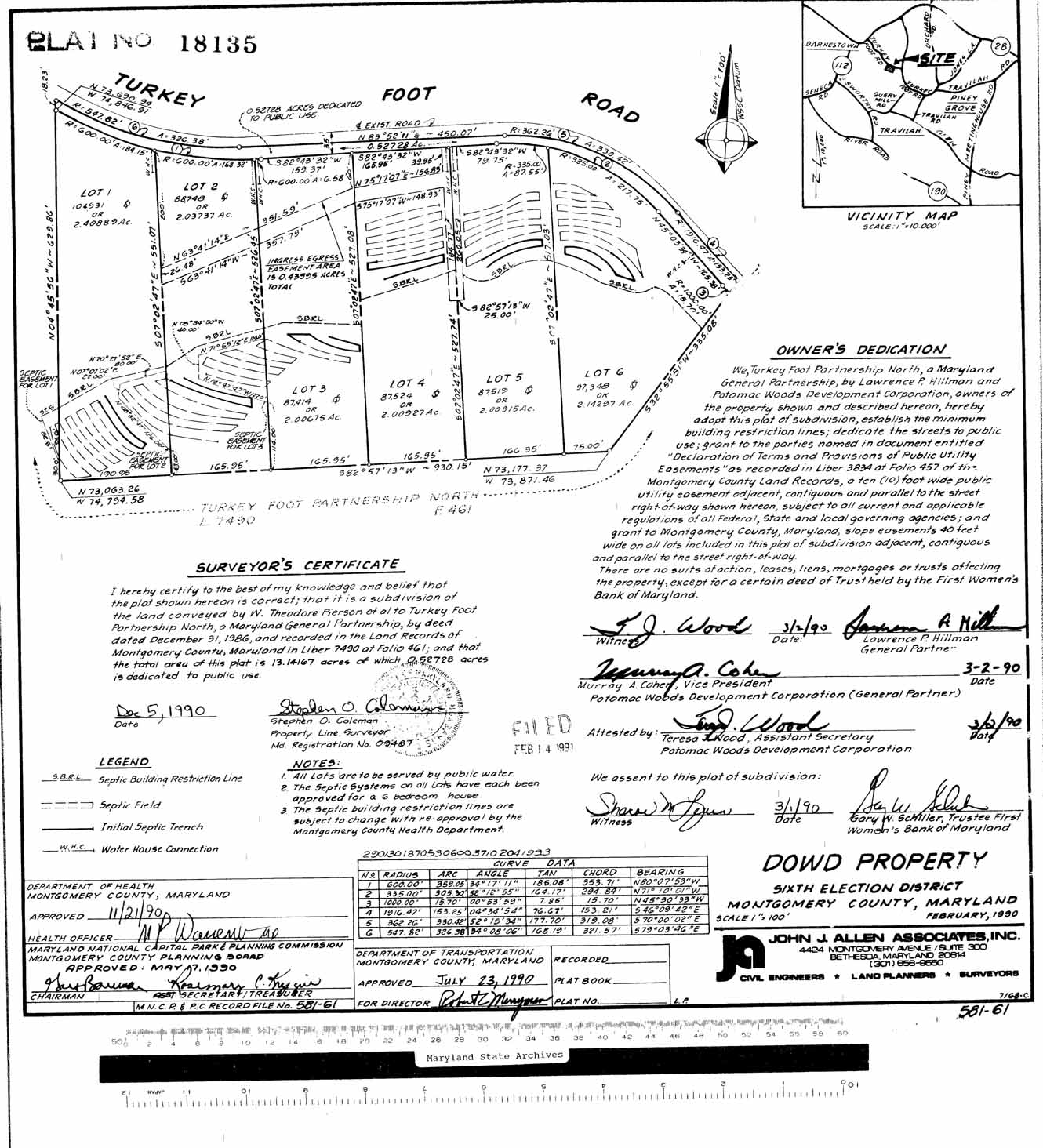
Montgomery Co., MD Darnestown |
March 2, 1990 | Doud?? | "Dowd property" in Darnestown (might have belonged to Rhoda Stier Doud/Dowd's family) |
 |
| See also land tracts on the Montgomery-Frederick line in the Sugarloaf/Dickerson/Monocacy area More Land Records for: Maryland Anne Arundel/Calvert Eastern Shore Frederick Harford/Baltimore Montgomery Prince Georges
|
||||