(click on thumbnails to view full images)
?
NEW!! Web Family Cards--detailed information on individuals and family trees
Newspaper and Obituary Archive
Vital Records and Wills Archive
Immigration, Naturalization, Passports, Travel
New! Google Maps showing family locations
?
Hamerschlag and Brummel Families
| Place | Date | Name | Description |
Page Image (may be large file) and Transcription (where applicable) |
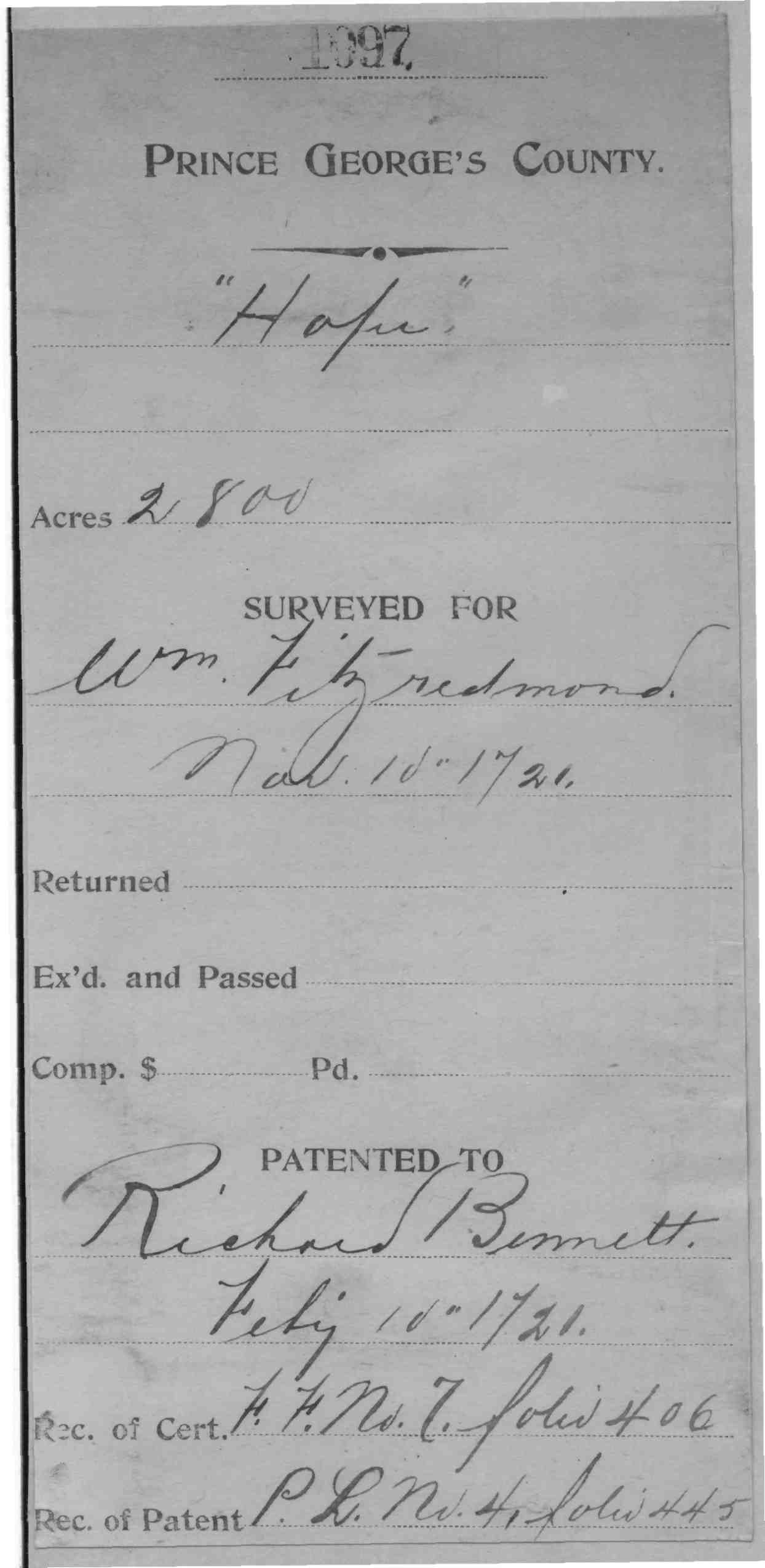
| Frederick Co., MD | 1721 | Richard Bennett |
Hope; 2800 Acres (PG County
records) Hope, 3000 Acres; Patent Hope, 3000 Acres; Certificate
|
 |
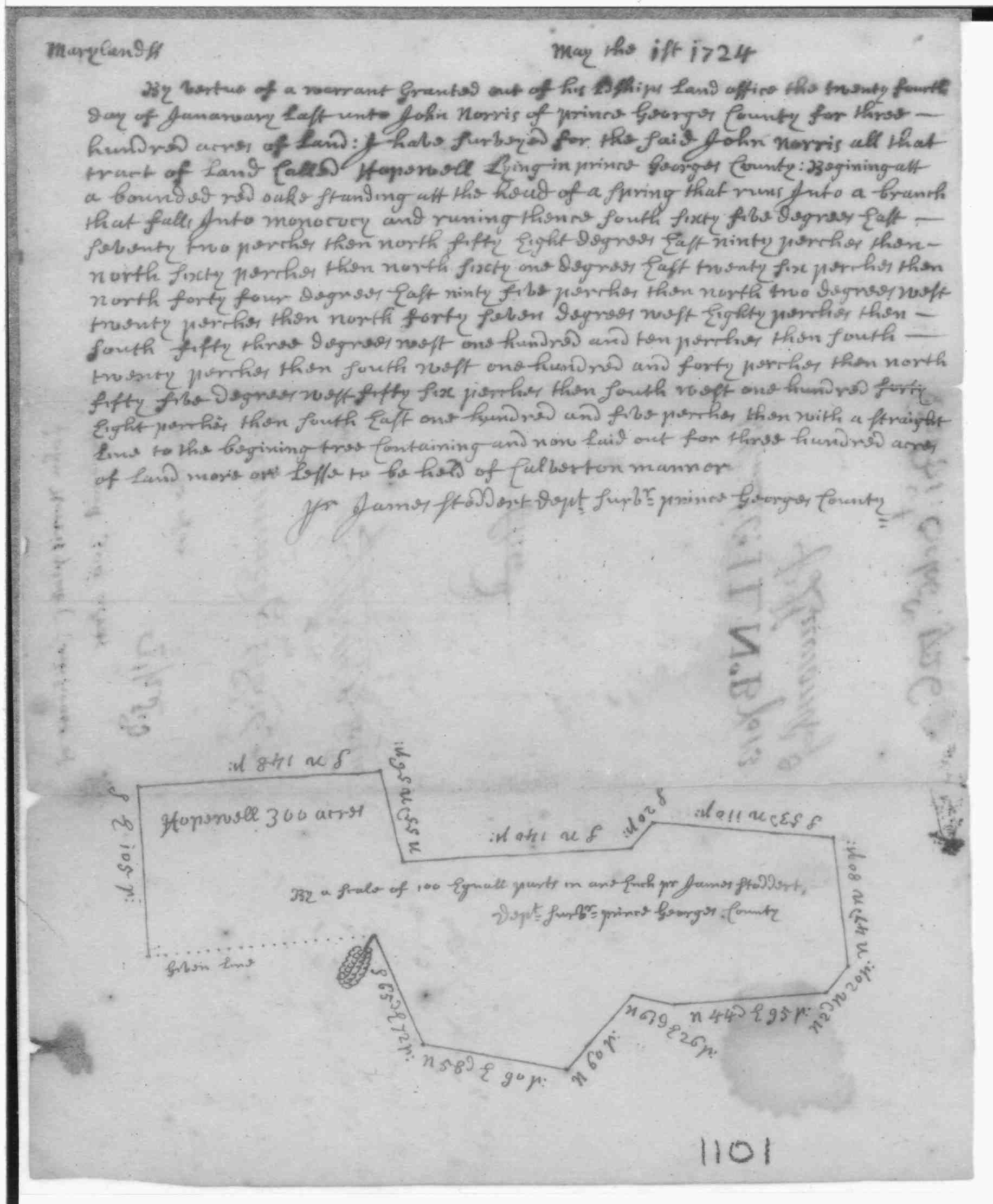
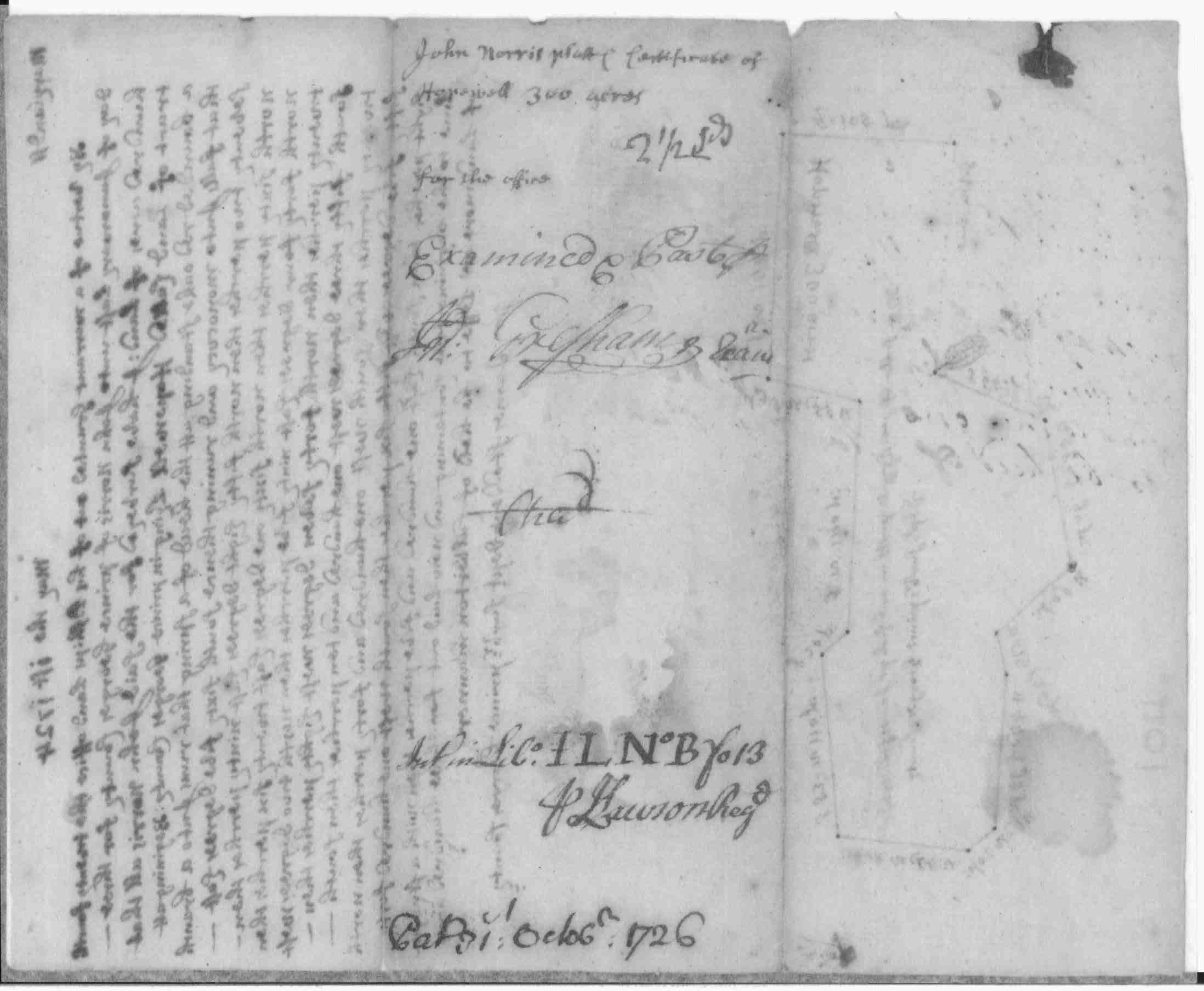
| Frederick Co., MD | 1726 |
John
Norris |
Hopewell 300 acres Certificate Patent Record IL B, p. 13 Patent Patent Record PL 6, p. 499 |
   |
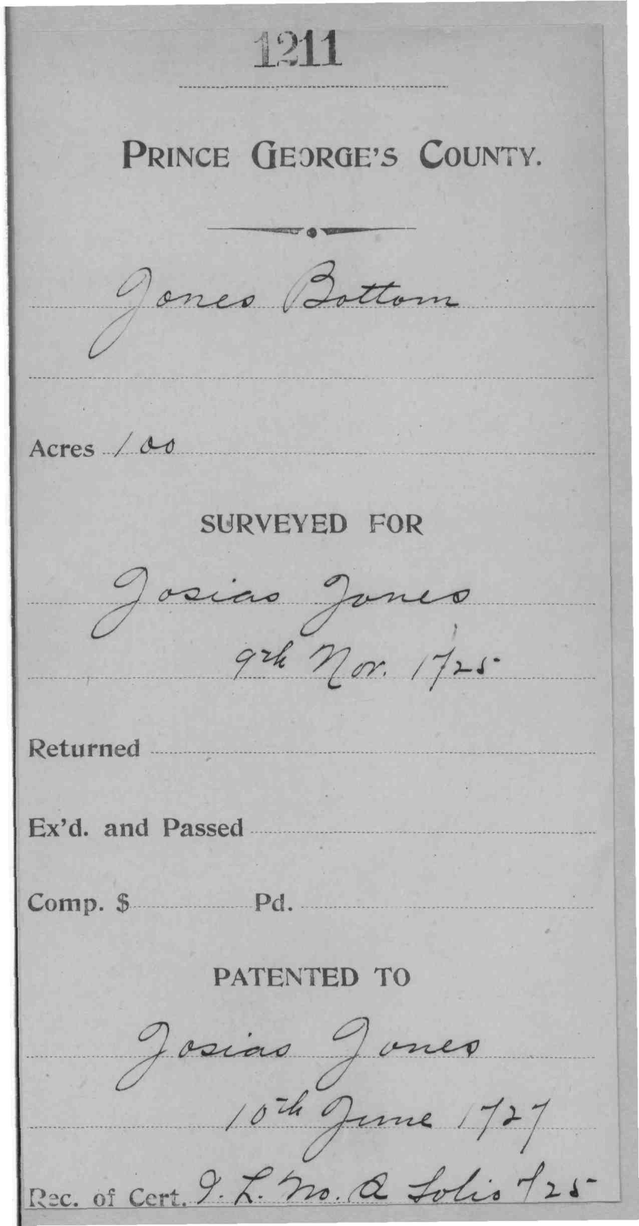
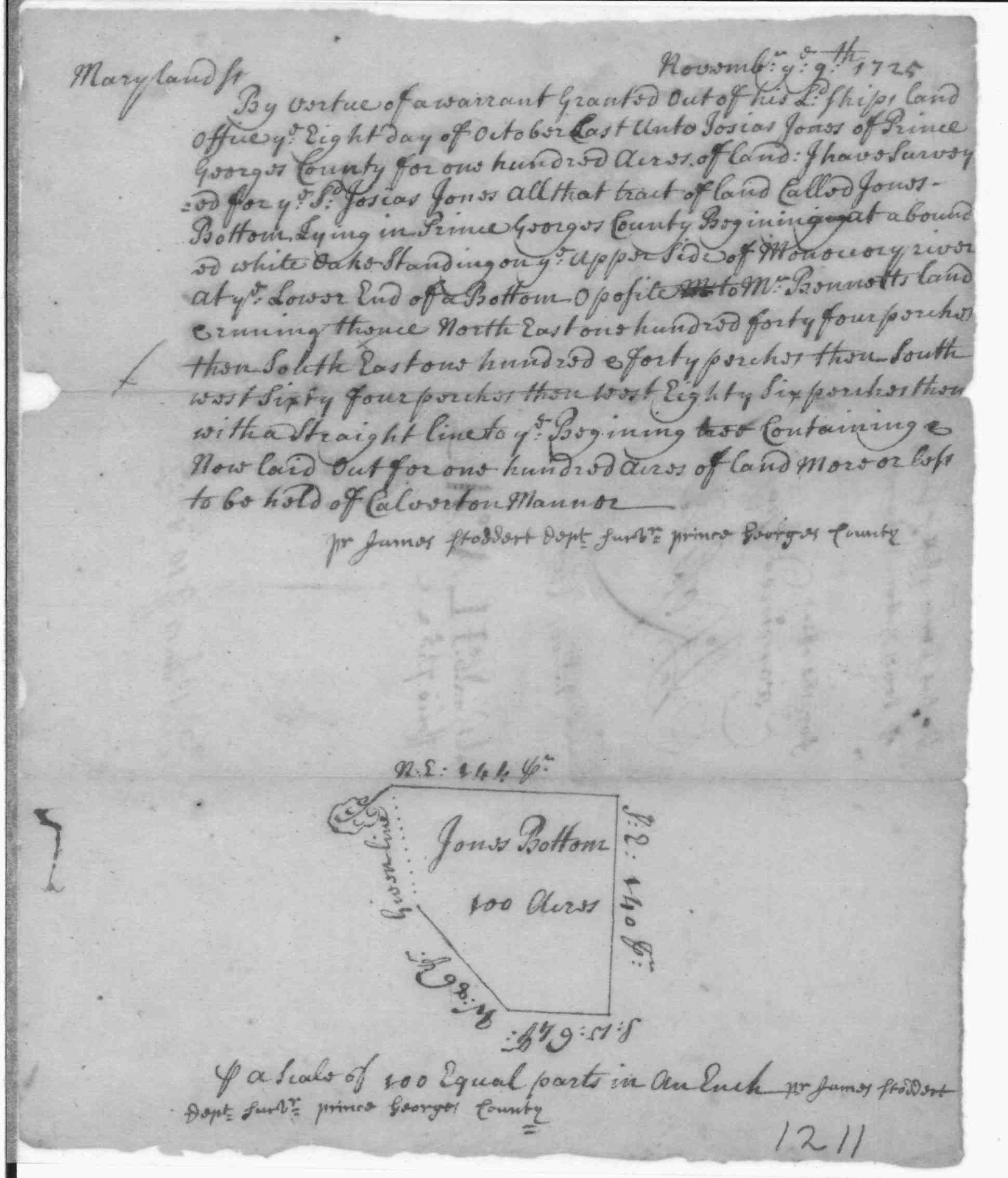
| Frederick Co., MD | 1727 | Jones, Josias |
Jones Bottom Patented Certificate 1211; 1727/06/10; ; 100 Acres |
   |
| Frederick Co. MD | 1727 | Errickson, Gunder |
Gunders
Delight, 200 Acres; Certificate Developer/Owner: Errickson, Gunder Patent Record IL A, p. 732 Gunders
Delight, 200 Acres; Patent
24 Mar
1741/42 Liber Y, Page 640, Frederick Co., MD
|
 |
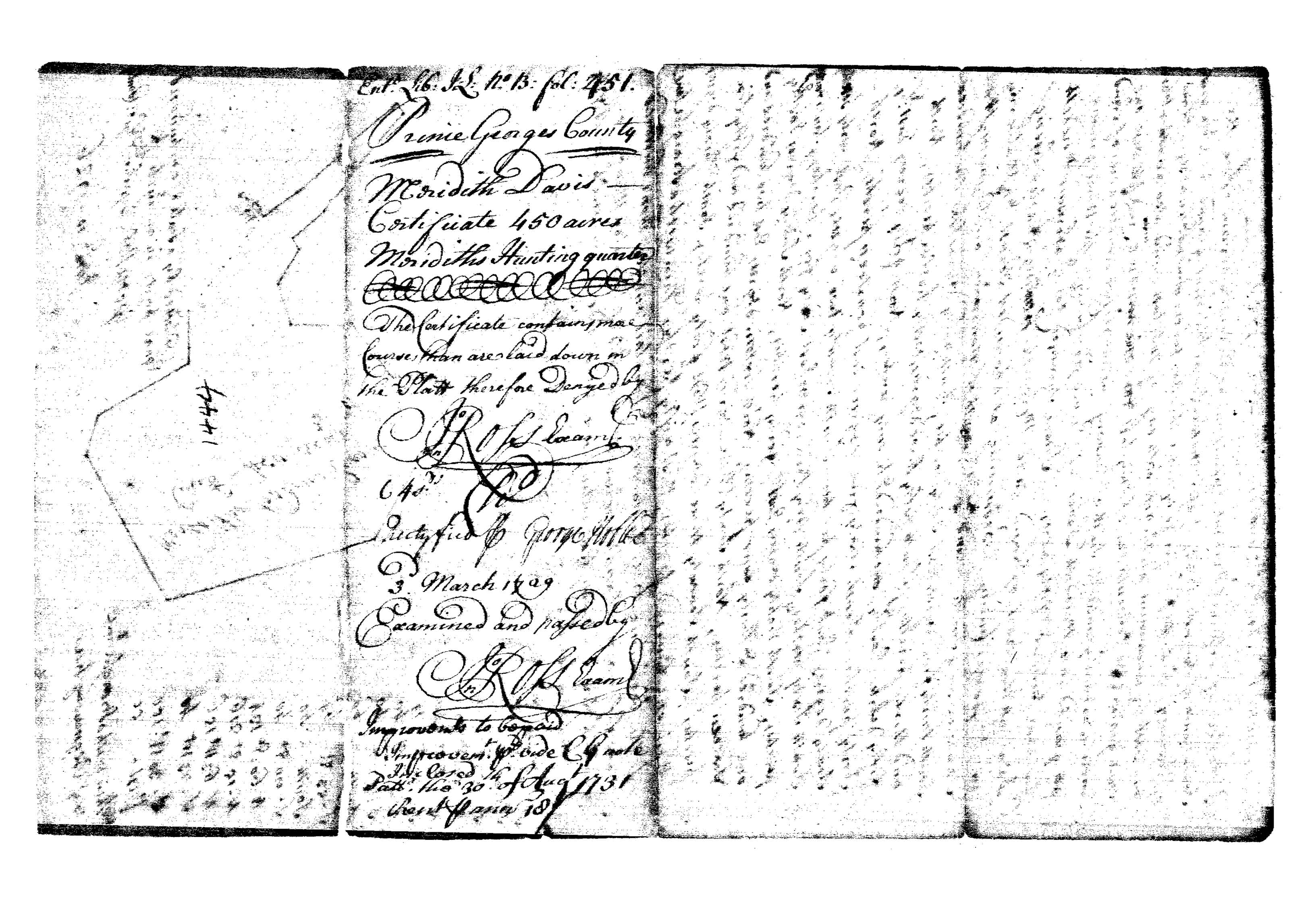
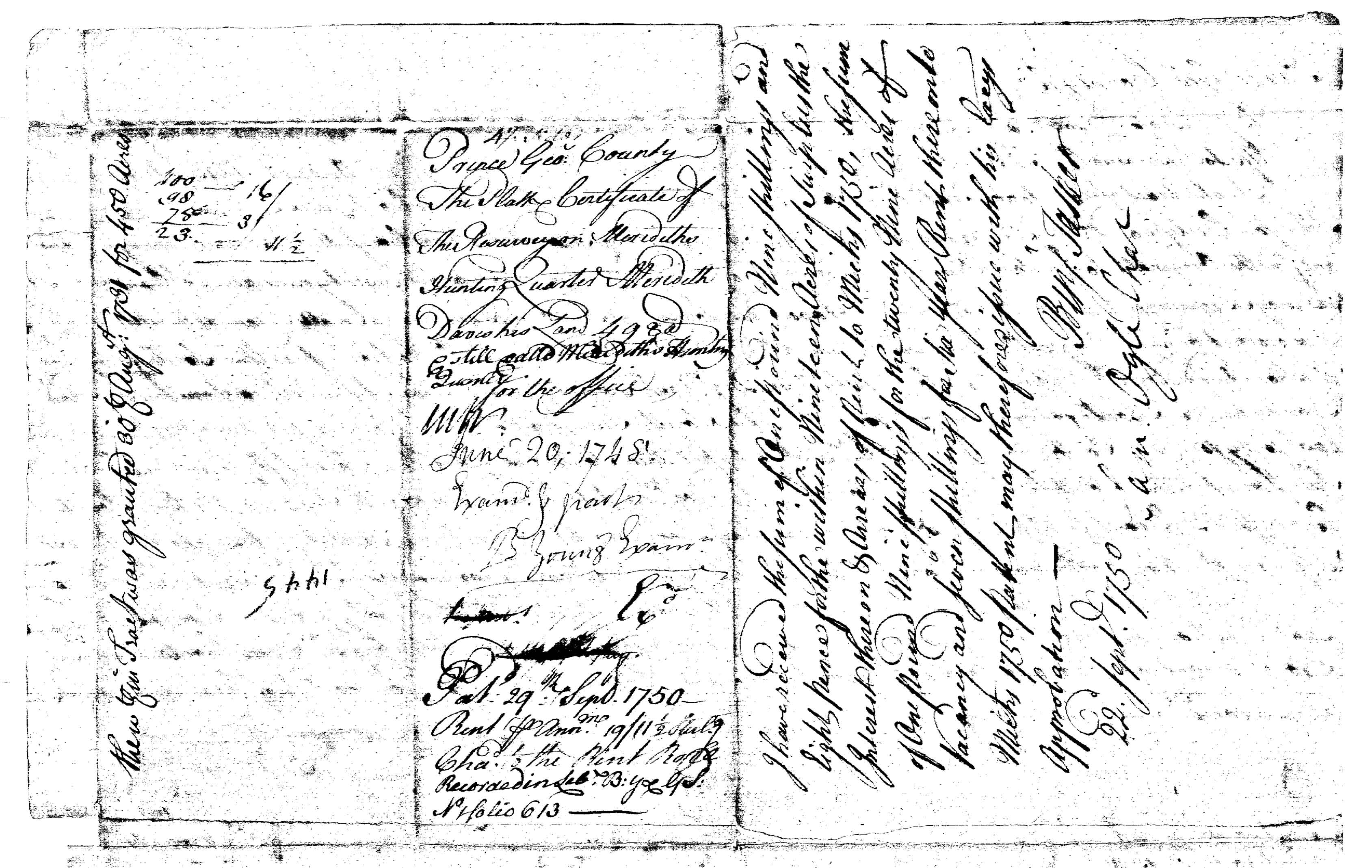
| Frederick Co., MD | 1731 | Davis, Meredith |
Merediths Hunting Quarter, 450 Acres; Certificate Developer/Owner: Davies, Meredith Patent Record IL B, p. 451
|
    |
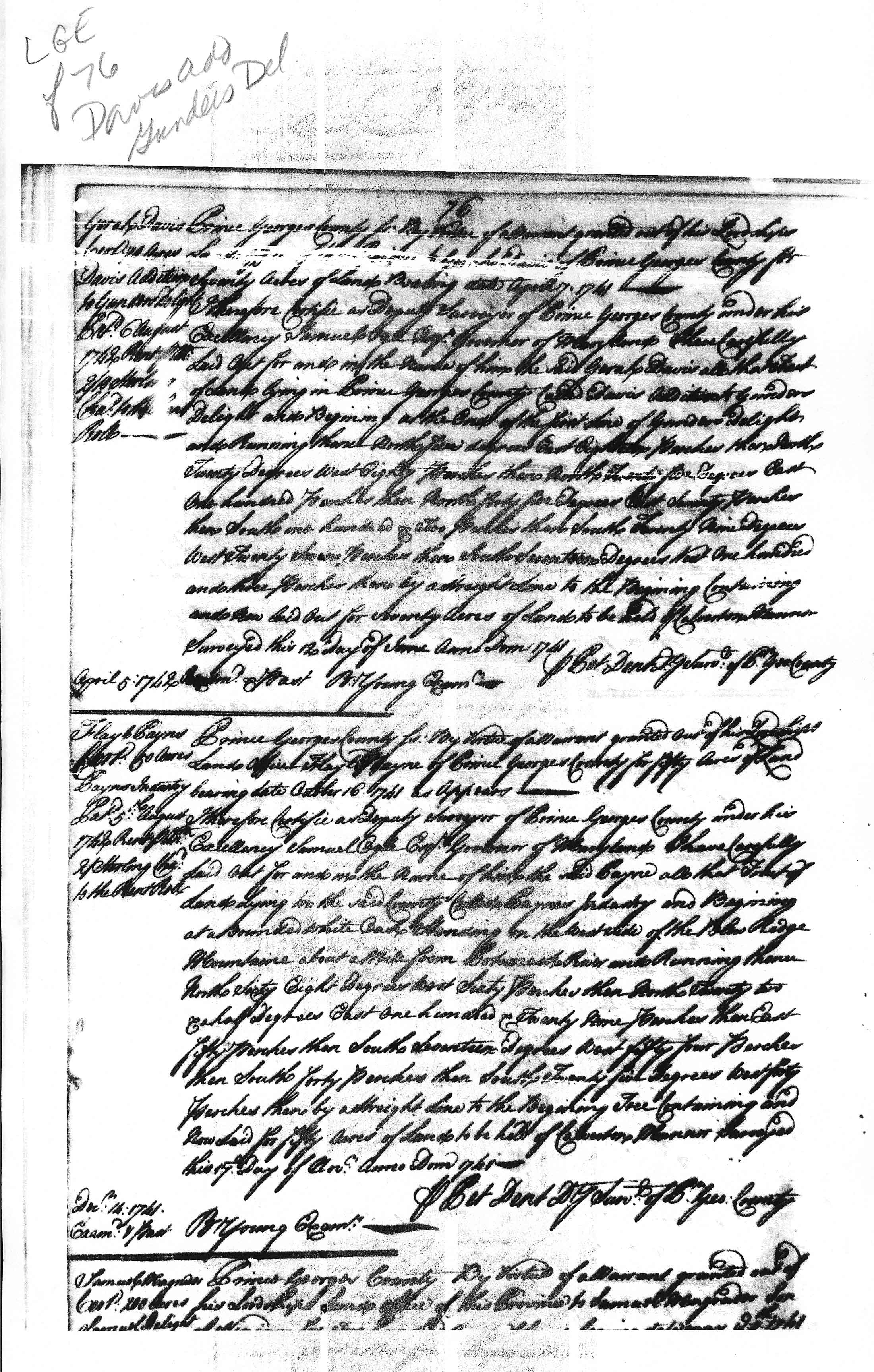
| Frederick Co., MD | 1742 | Garah Davis |
Davis Addition to Gunder's Delight certificate Liber LG#E folio 76 patent Liber EI#6 folio 536 Patented Certificate 616 MSA S1203 |
|
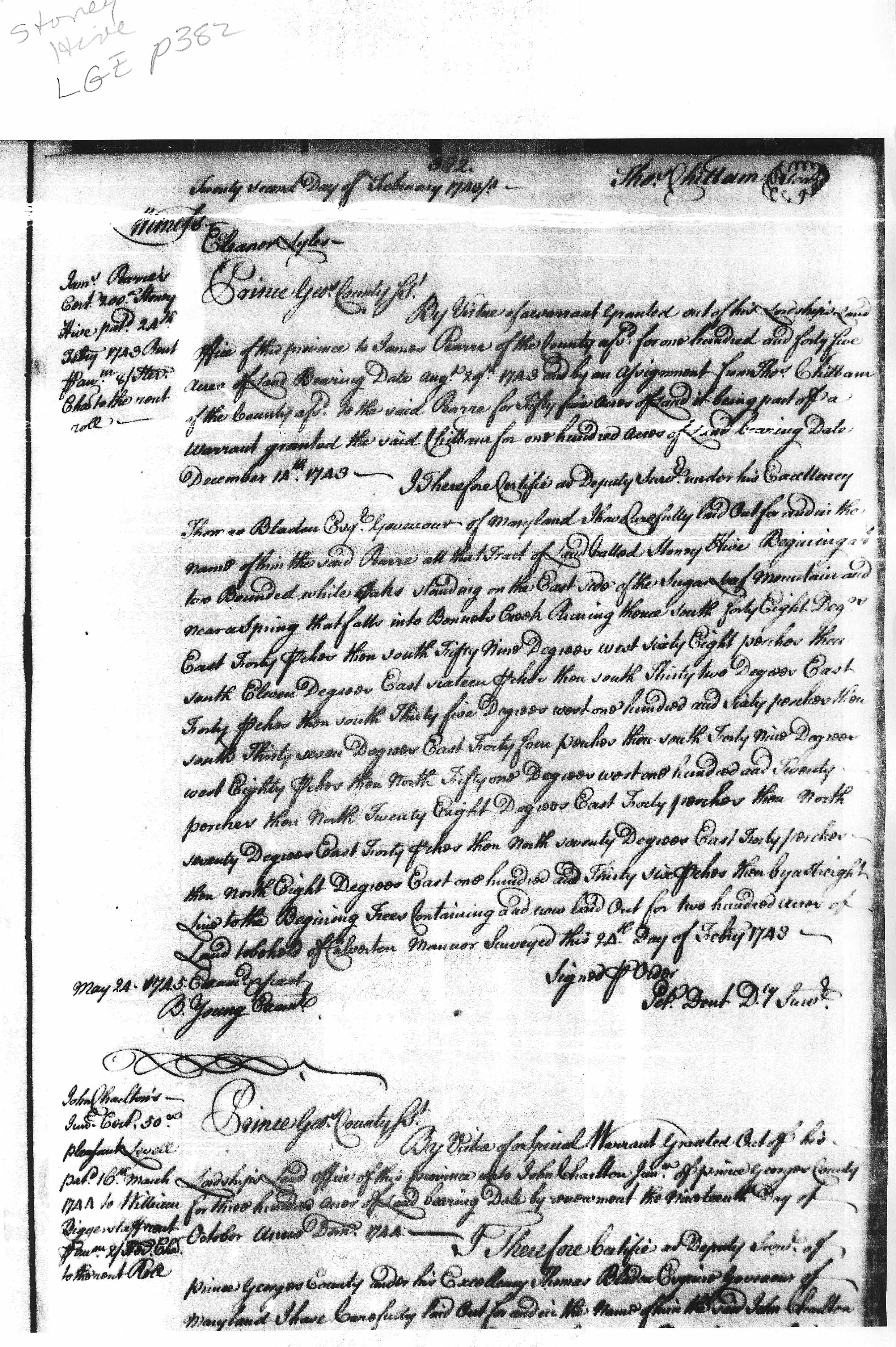
| Montgomery Co., MD | 1743 | Pearre, James |
Stoney Hive,
Acres 200; Patent Stoney Hive, Acres 200; Certificate |
 |
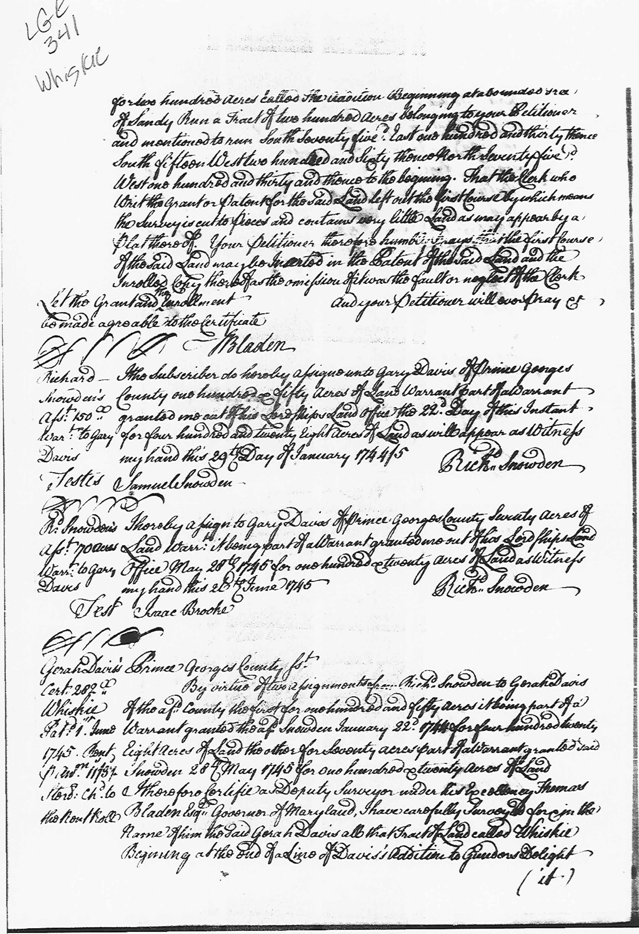
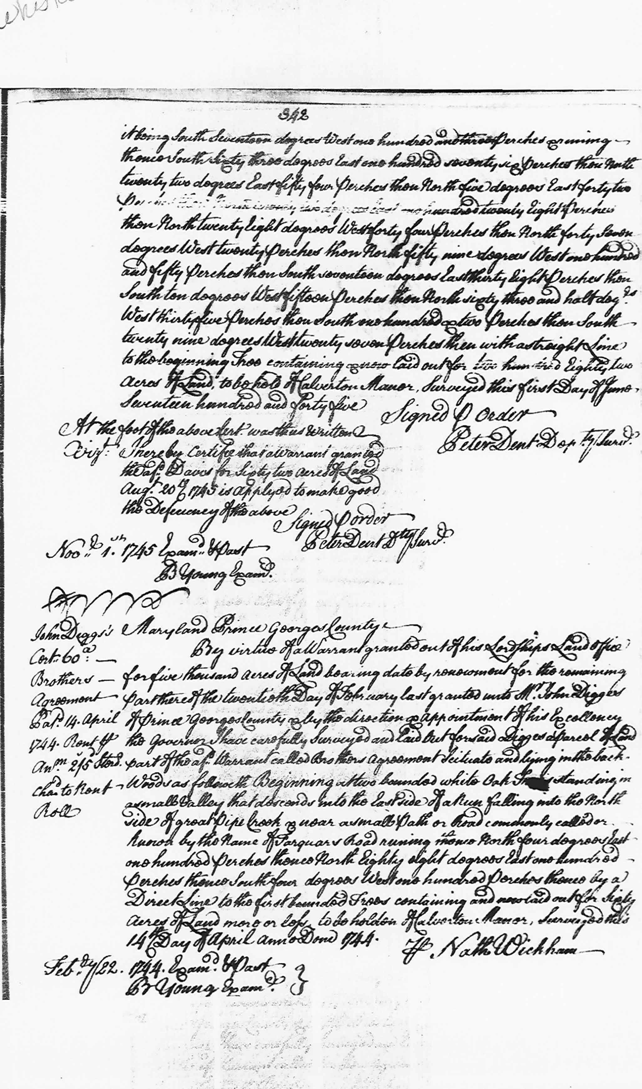
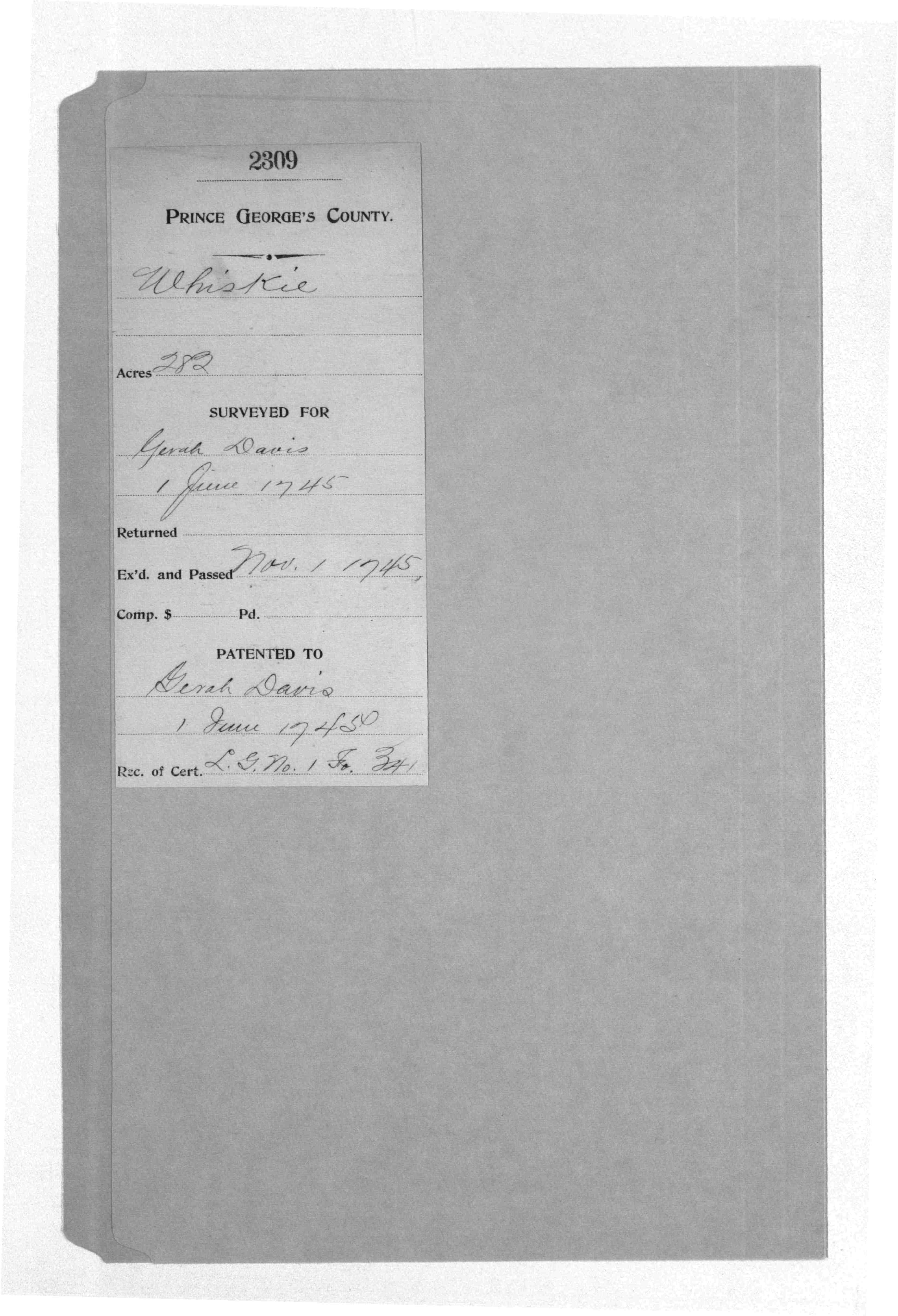
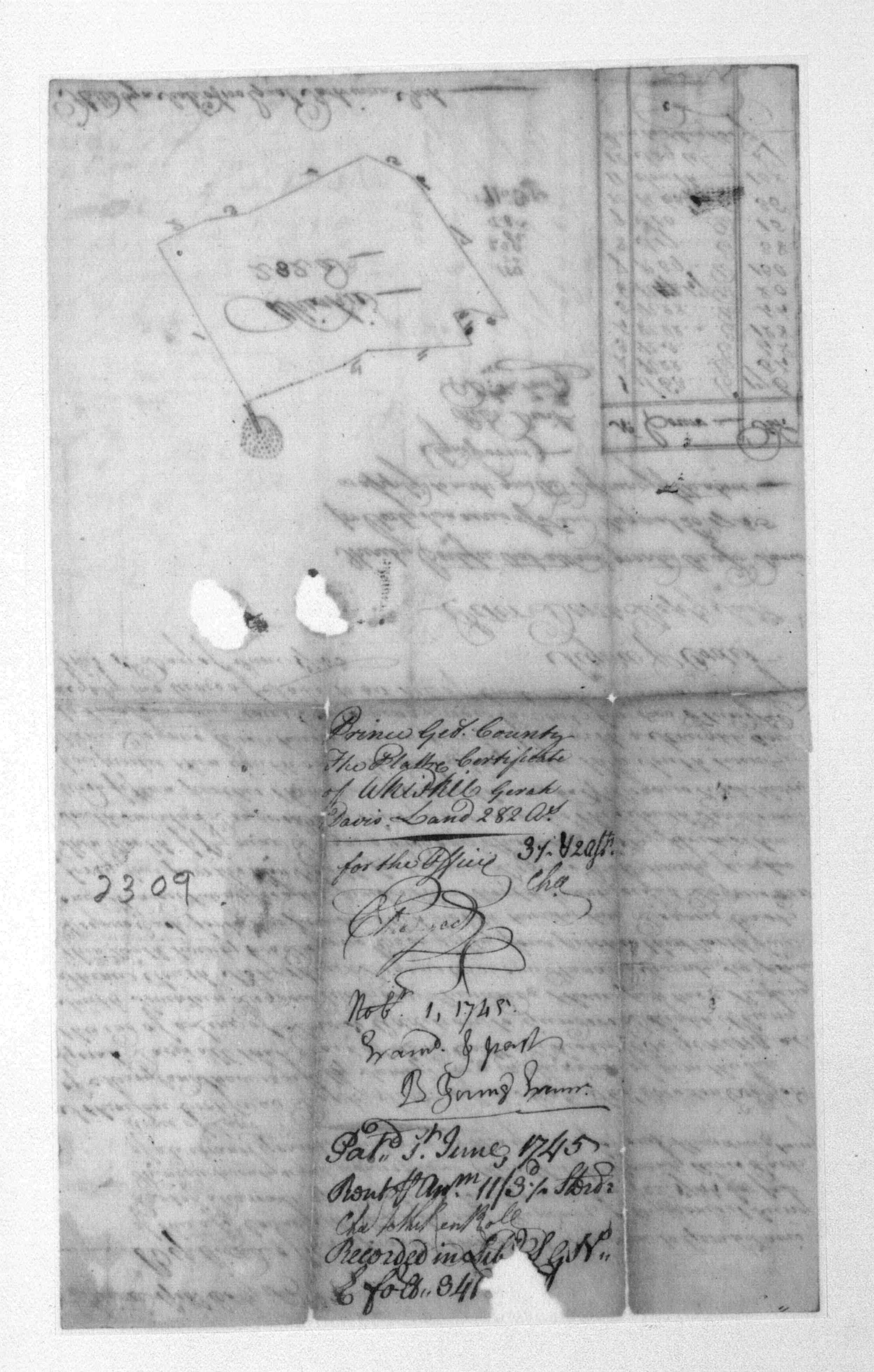
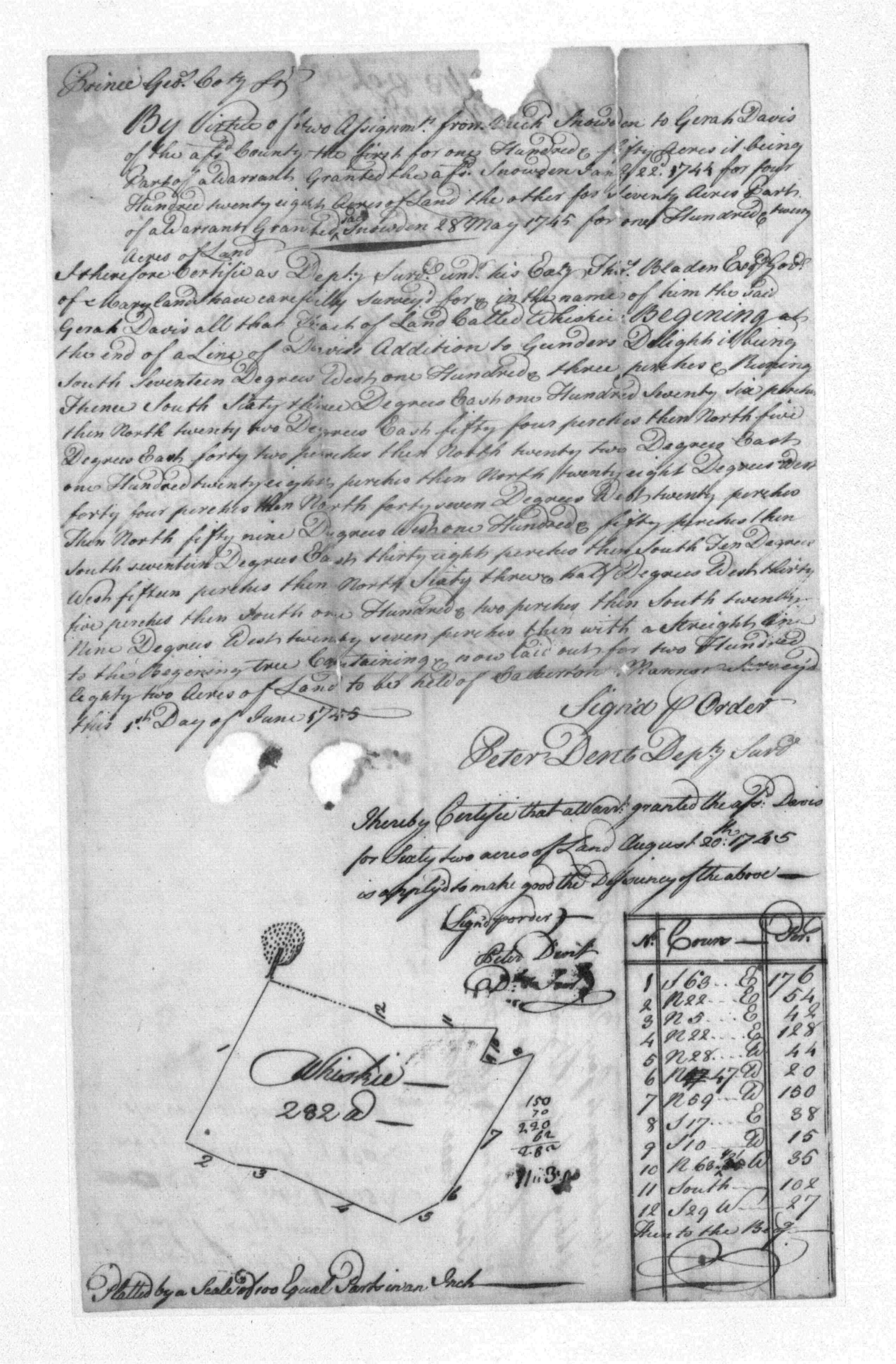
| Frederick Co., MD | 1745 | Garah Davis |
Whiskie Patent Record LG E, p. 341 Patent Record PT 1, p. 195 Patented Certificate 2309 MSA S1203 |
       |
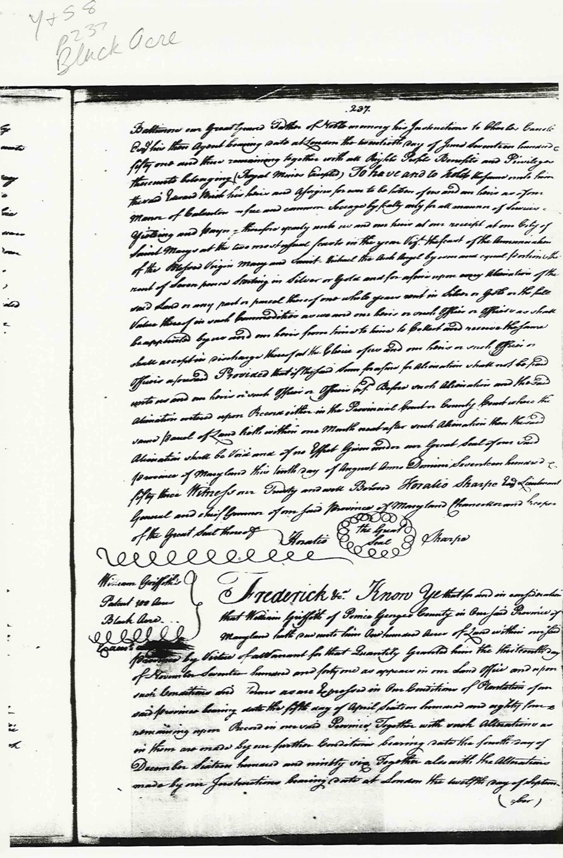
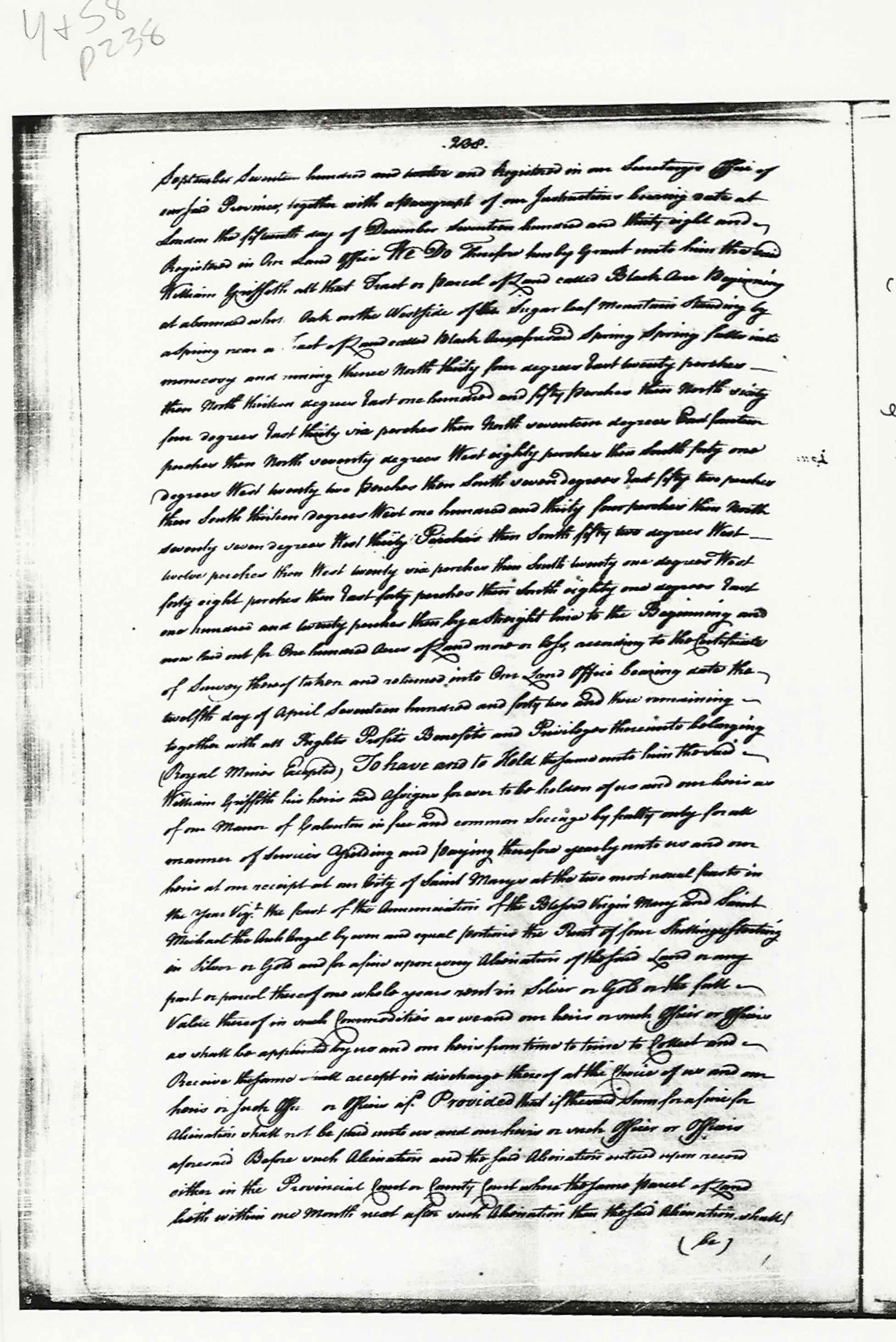
| Frederick County | 1752 | William Griffith |
Black Acre
Black Acre, 100 Acres; Certificate Black Acre, 100 Acres; Patent
|
   |
| Montgomery County, MD |
Bealls Good
Will, 762 Acres; Certificate Developer/Owner: Adamson, John 1753 Patent Record GS 1, p. 50
Bealls Good
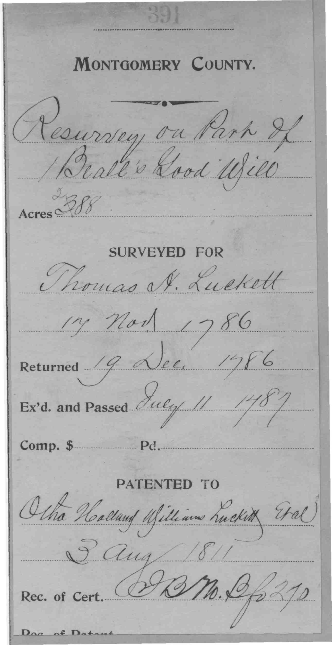
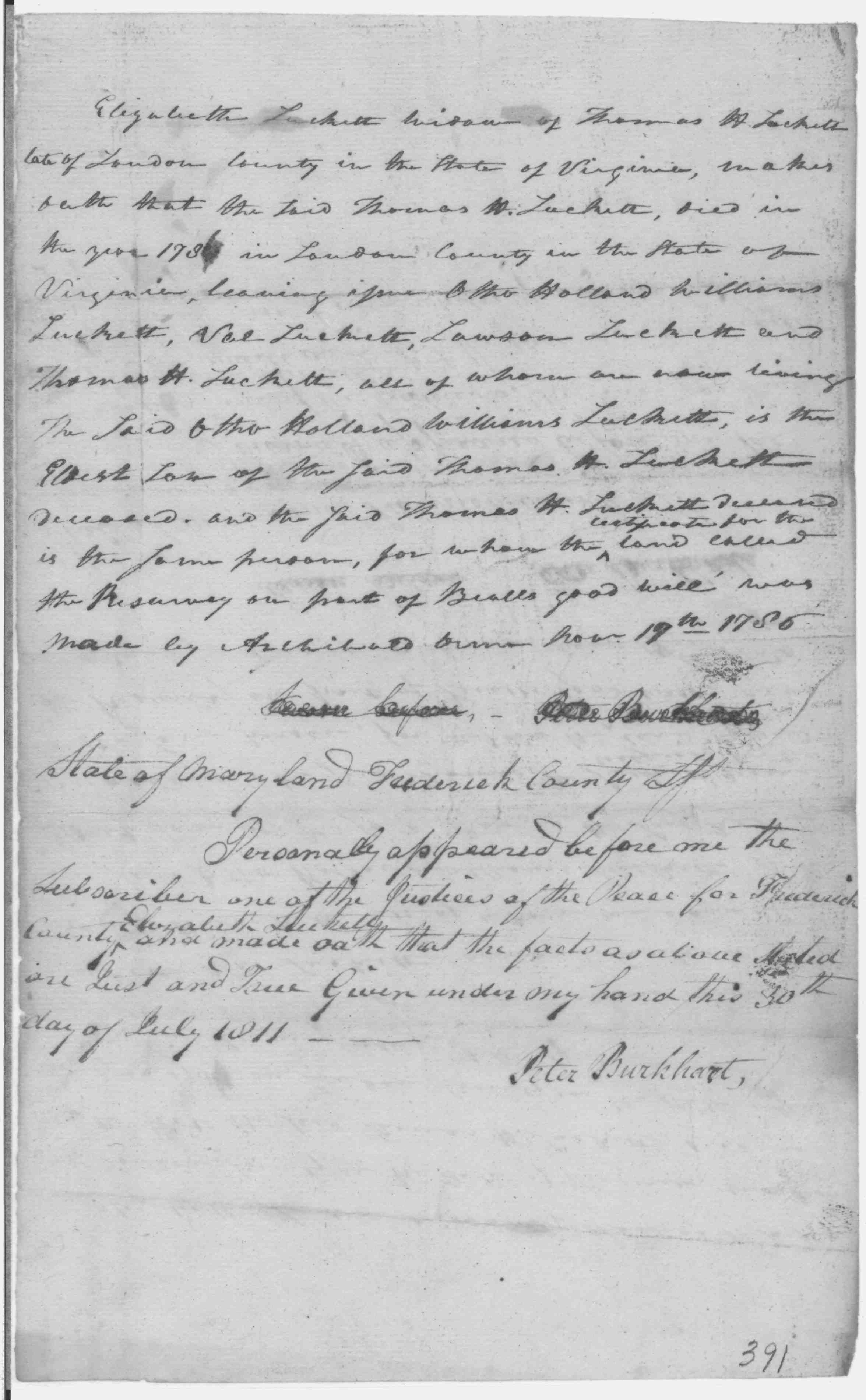
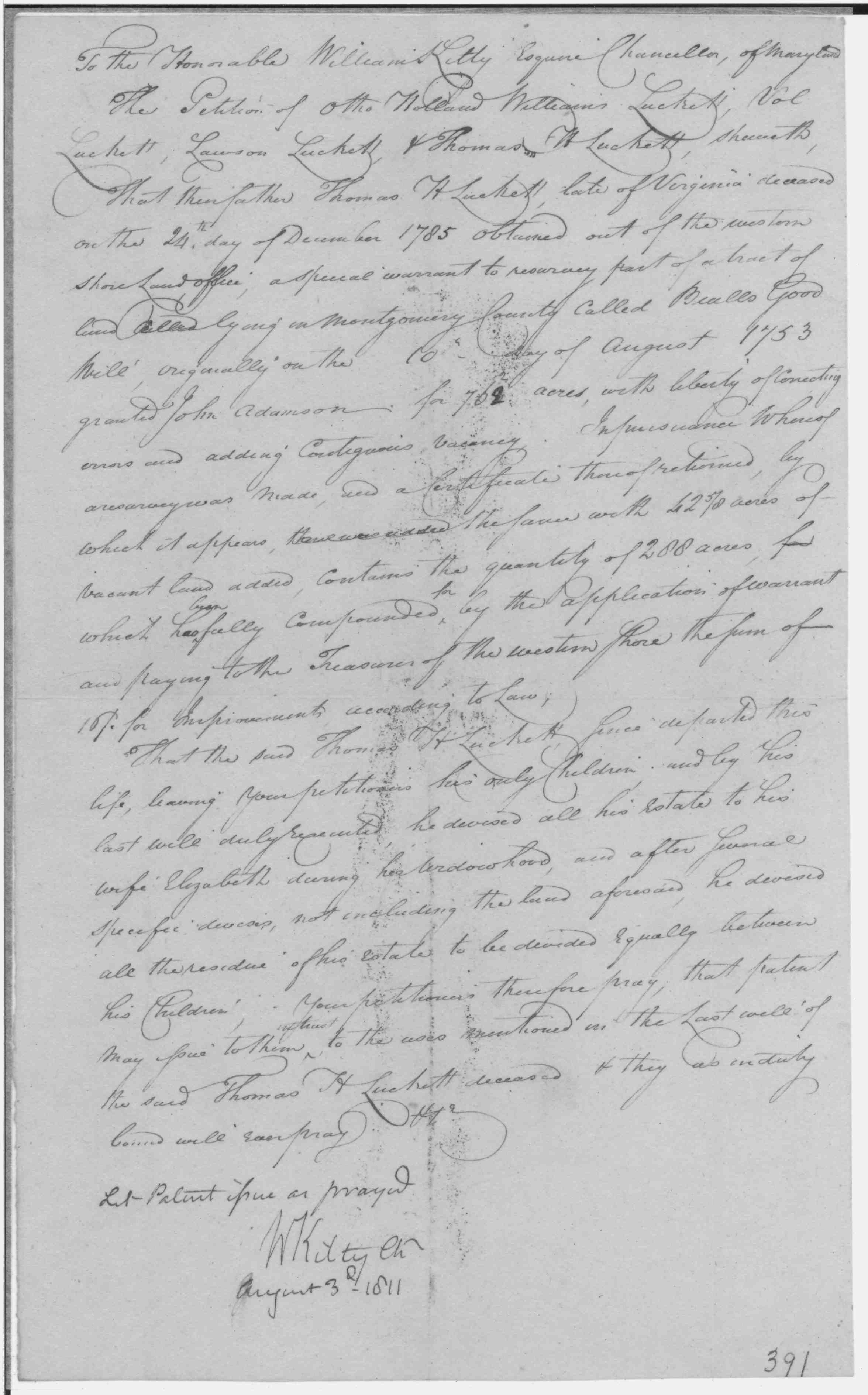
Will, 762 Acres; Patent Bealls Good Will, Shown With Harris Loss 1804 Land Records Luckett, Otha Holland Williams; Resurvey on Part of Bealls Good Will; 288 Acres 1811/08/03 Patented Certificate 391 Dickerson Station and Bealls Good Will; Christy A. Dickerson Estate, Elizabeth E. Dickerson and Heirs 1914/01/08 Plat 163 Dickerson Station and Bealls Good Will; Zachariah G. Cooley, L. A. Chiswell, and Harry C. Meem 1914/01/08 Plat 162 |
|||
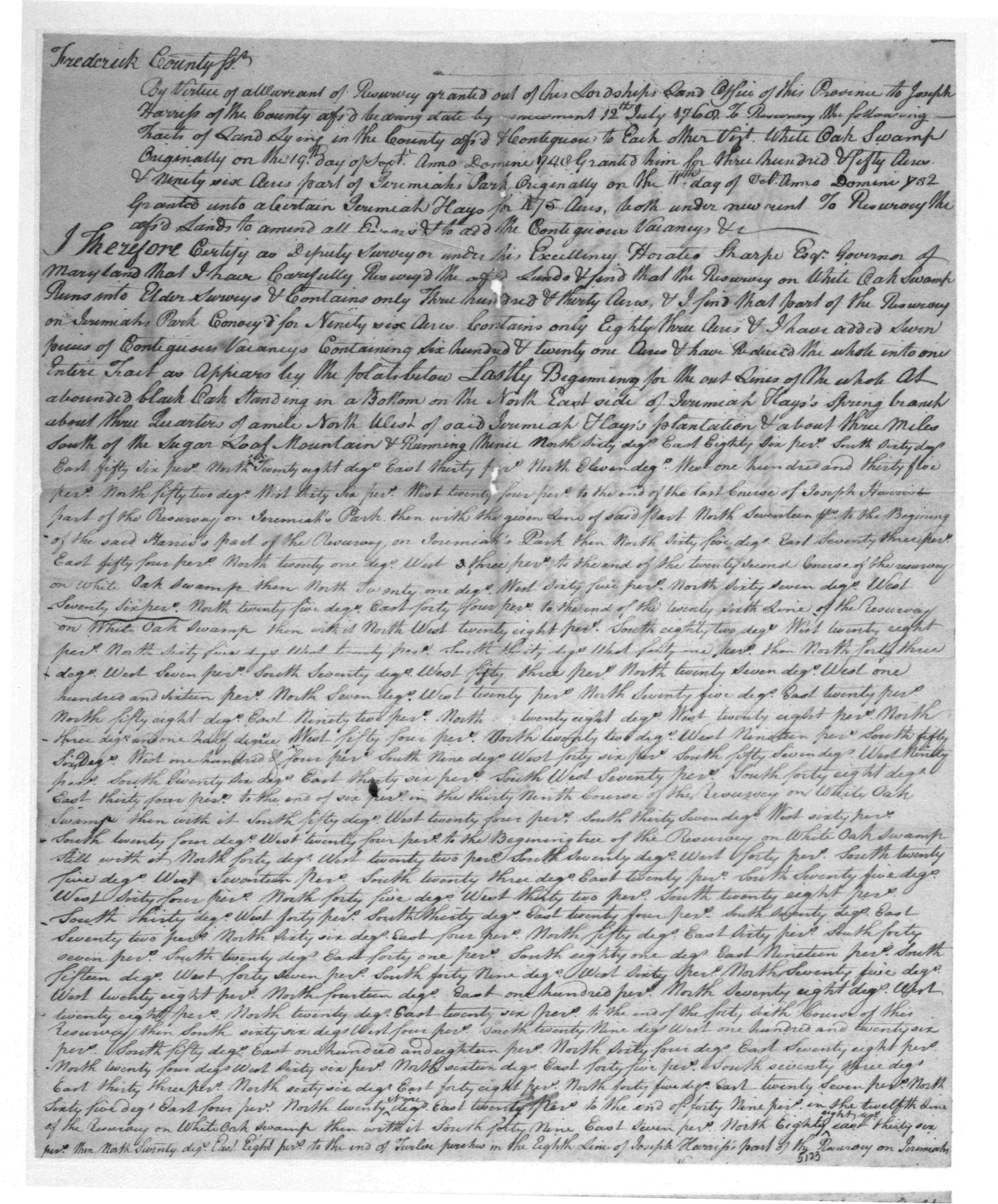
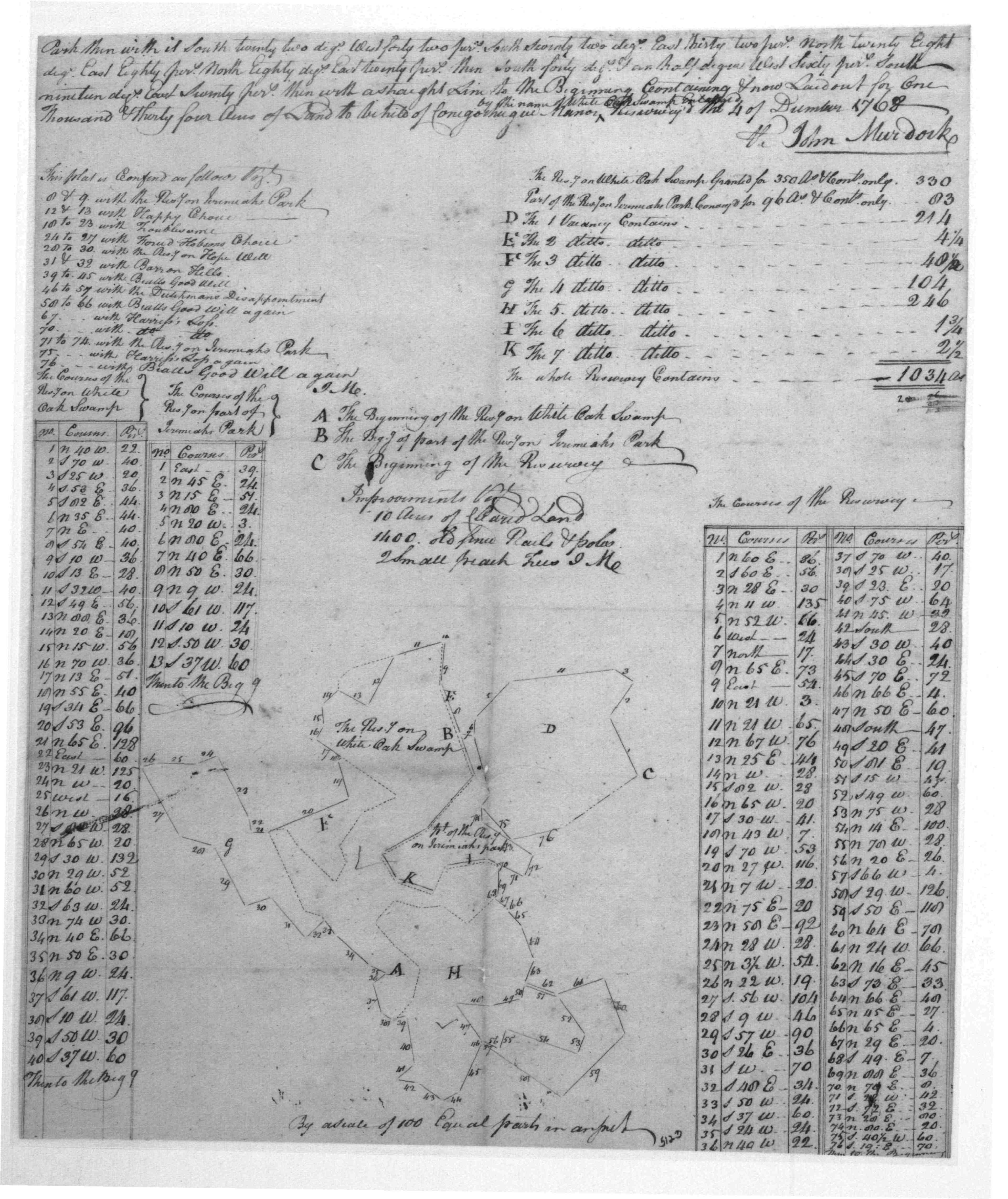
| Frederick COunty | 1770/09/06 | Joseph Harriss |
White Oak
Swamp Enlarged, 1034 Acres Patented Certificate 5123
|
    |
|
Montgomery Co., MD
|
1755 | Chapline, Joseph |
Resurvey on Hopewell Patented Certificate 3521 717 Acres (apparently this is not the same Hopewell tract) |
  |
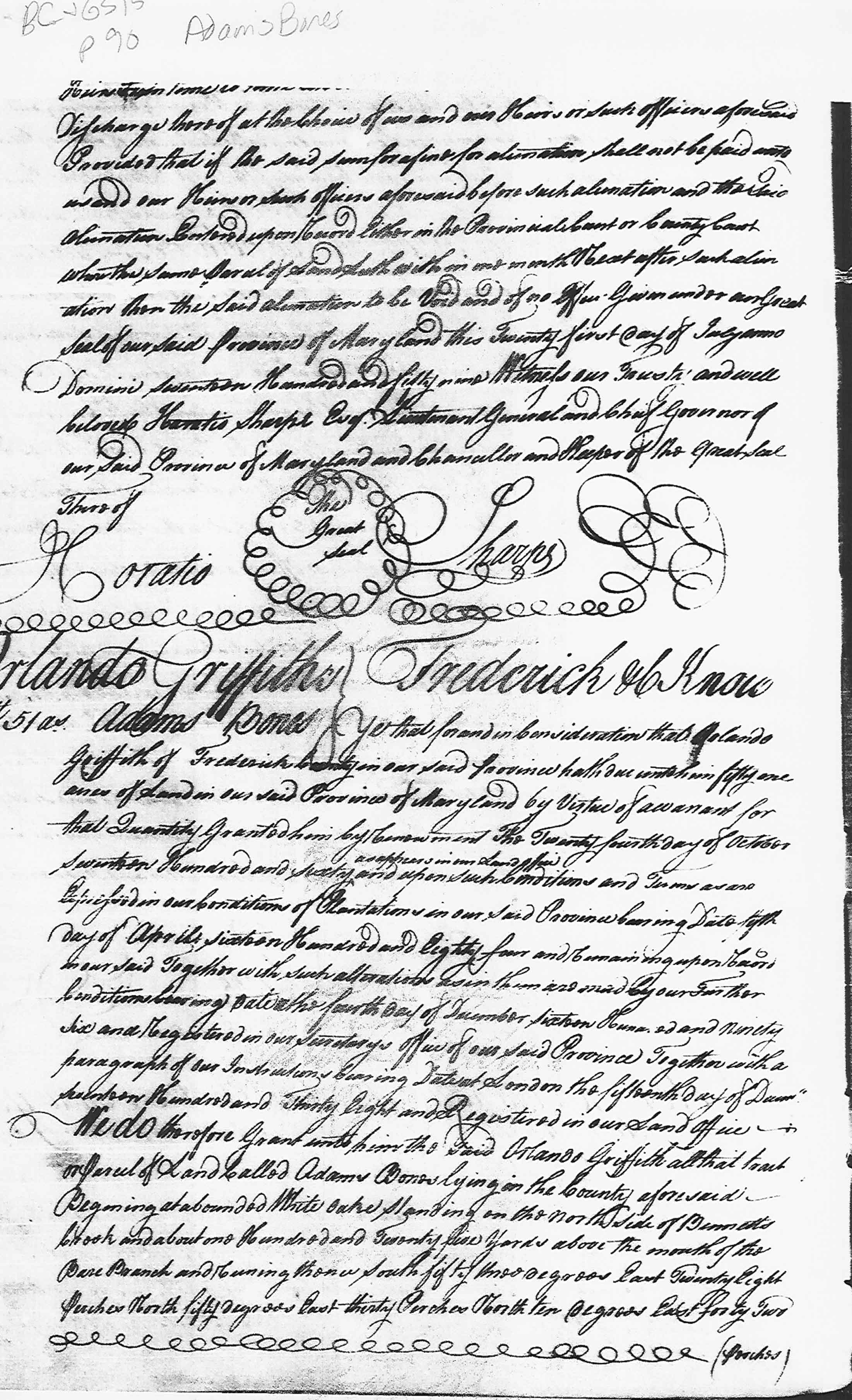
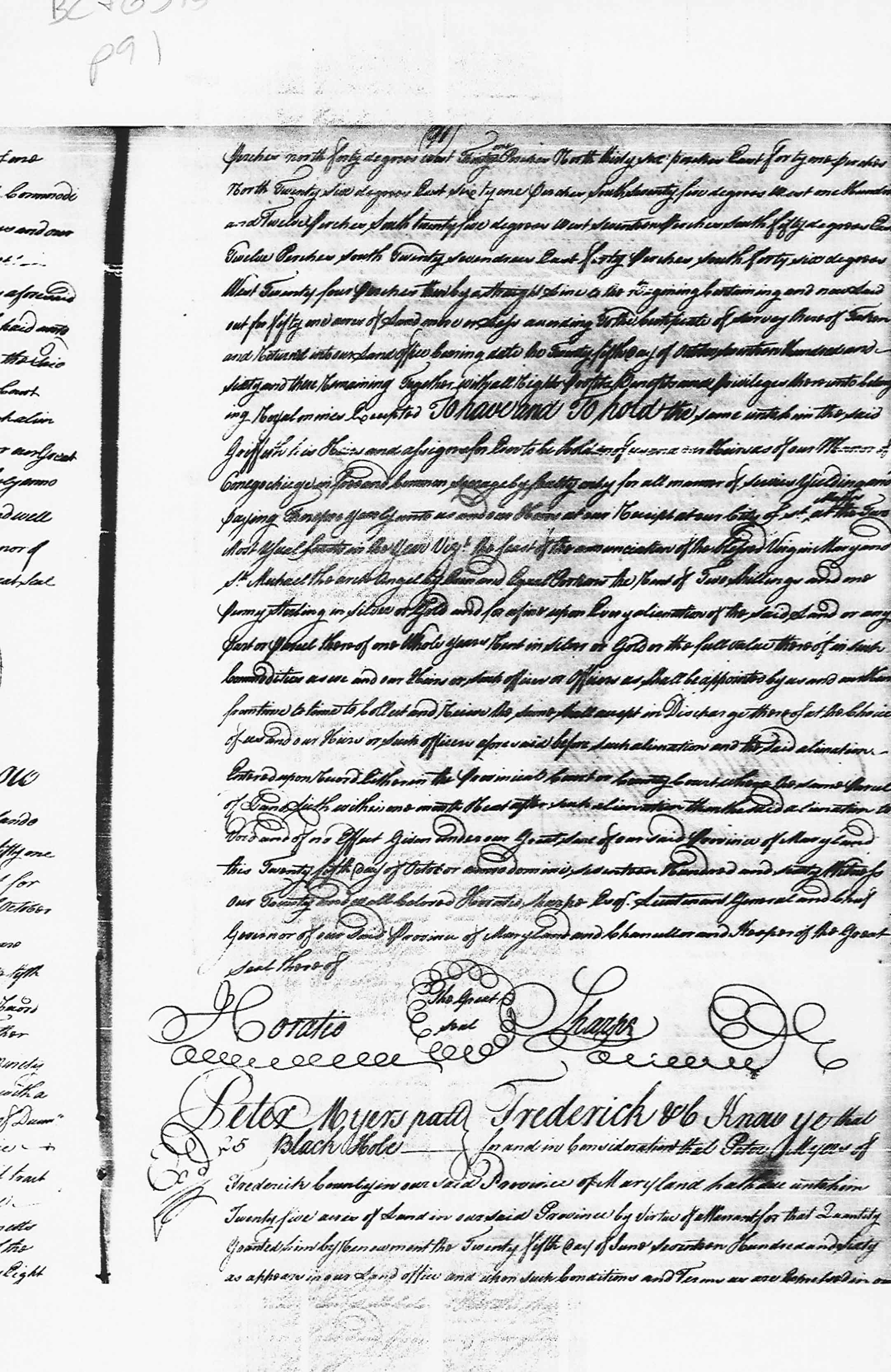
| Frederick Co., MD | 1760 |
Adam's Bones patent
|
  |
|
| Frederick Co., MD | 1762 |
Hilleary, William
|
Sugar Loaf Mountain 310 acres On a ridge a small distance from a spring that runs into Bennetts Creek below the main fork of said creek. |
  |
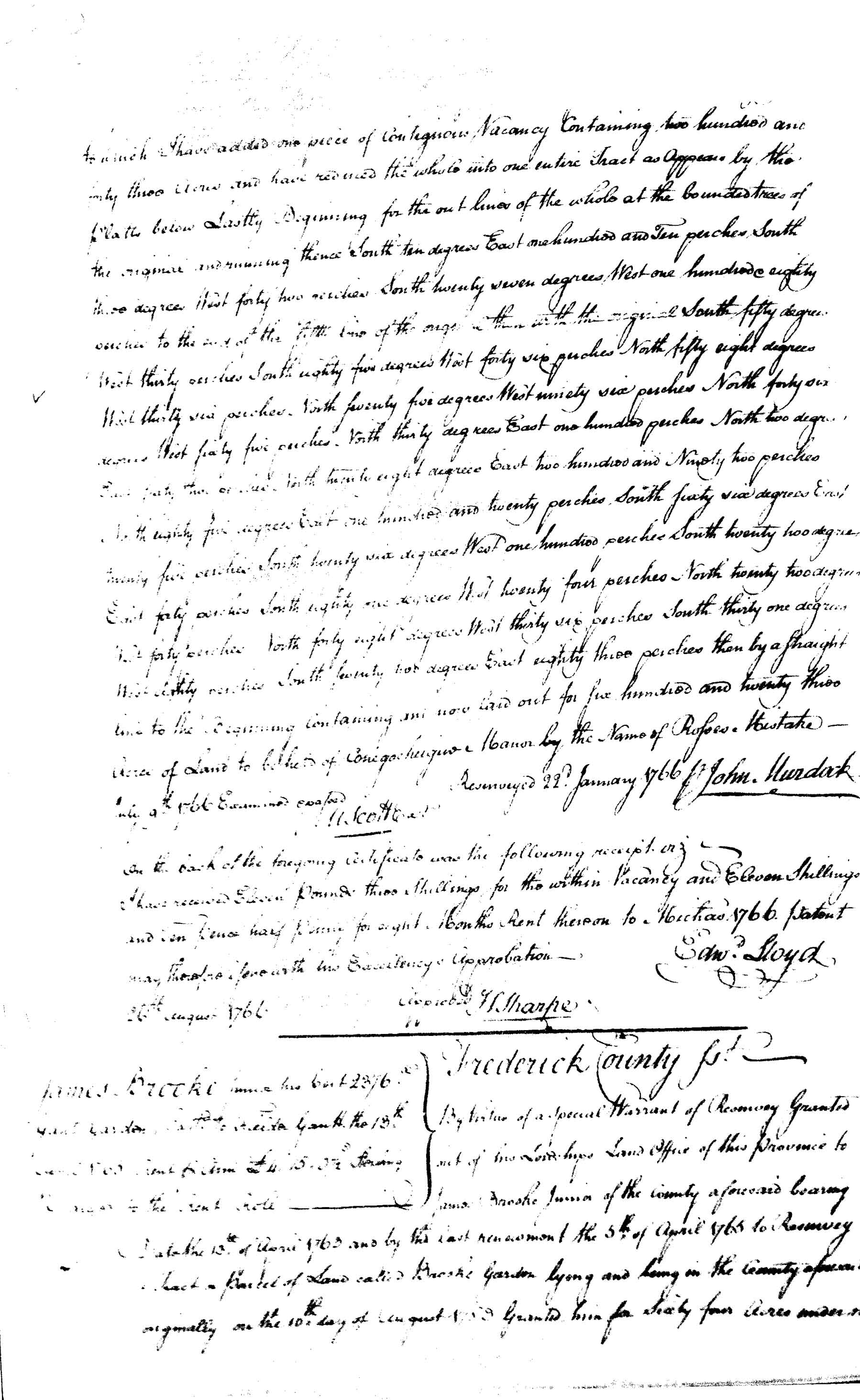
| Frederick Co., MD | 1765 | Gant, Fielder |
Gantt's Garden patent
Gants Garden, 2376 Acres; Patent Gants Garden, 2376 Acres;
Certificate |
   |
|
Frederick Co.
|
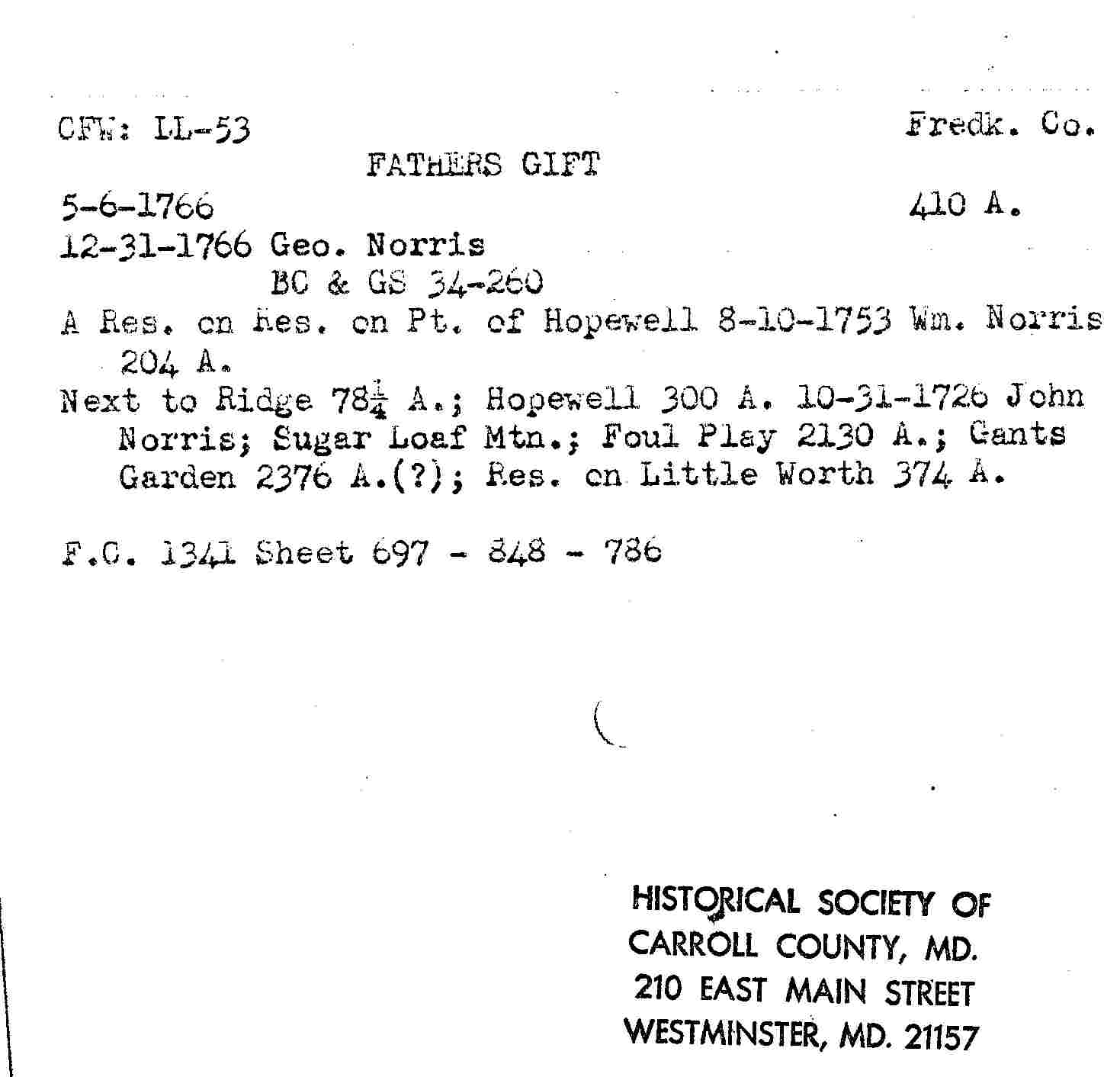
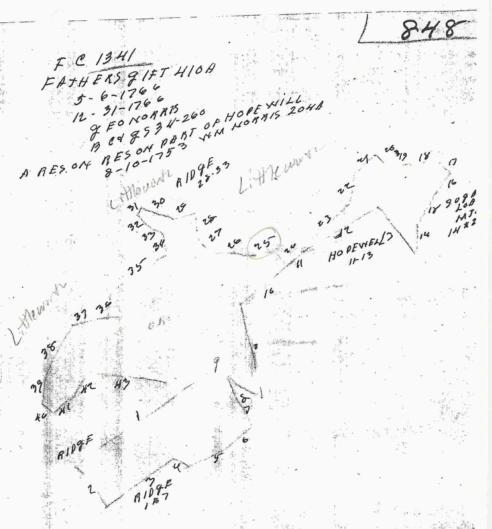
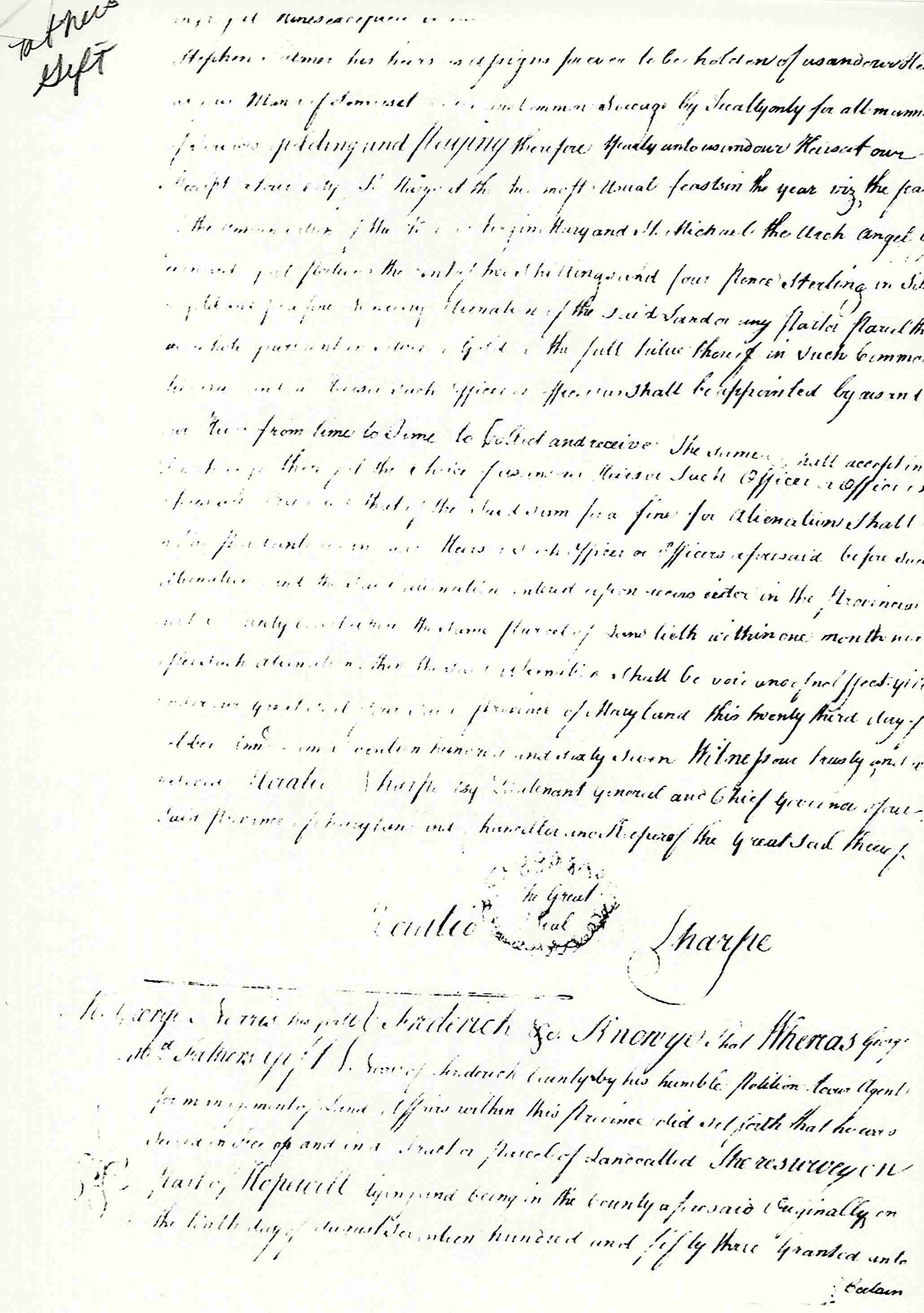
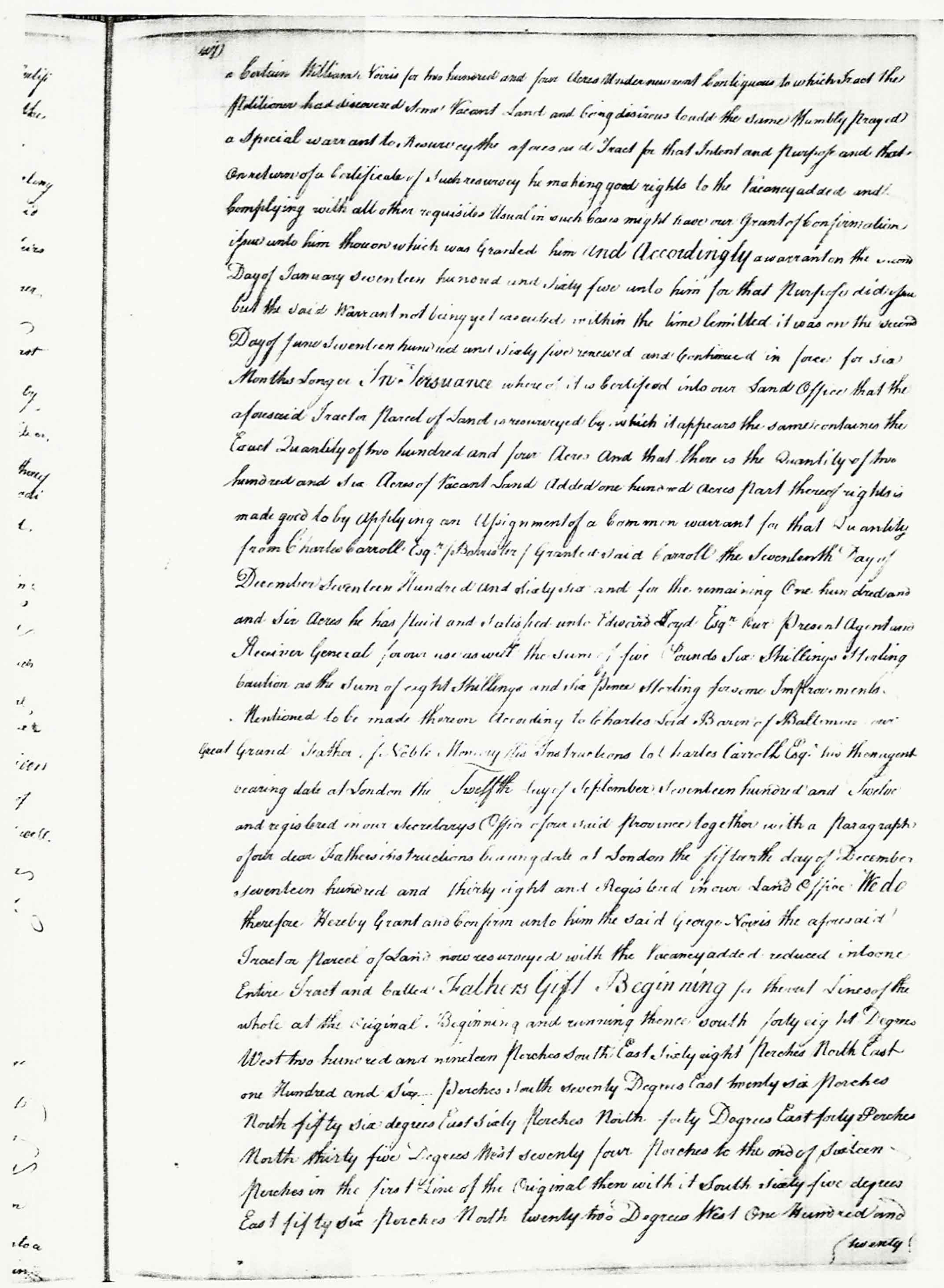
1766 | Wm. and George Norris | Father's Gift 410 acres, a resurvey on part of Hopewell |
from the Tracey Collection at the Carroll County Historical Society: Patent: Certificate:
|
|
Frederick County, MD part of Sugarloaf summit |
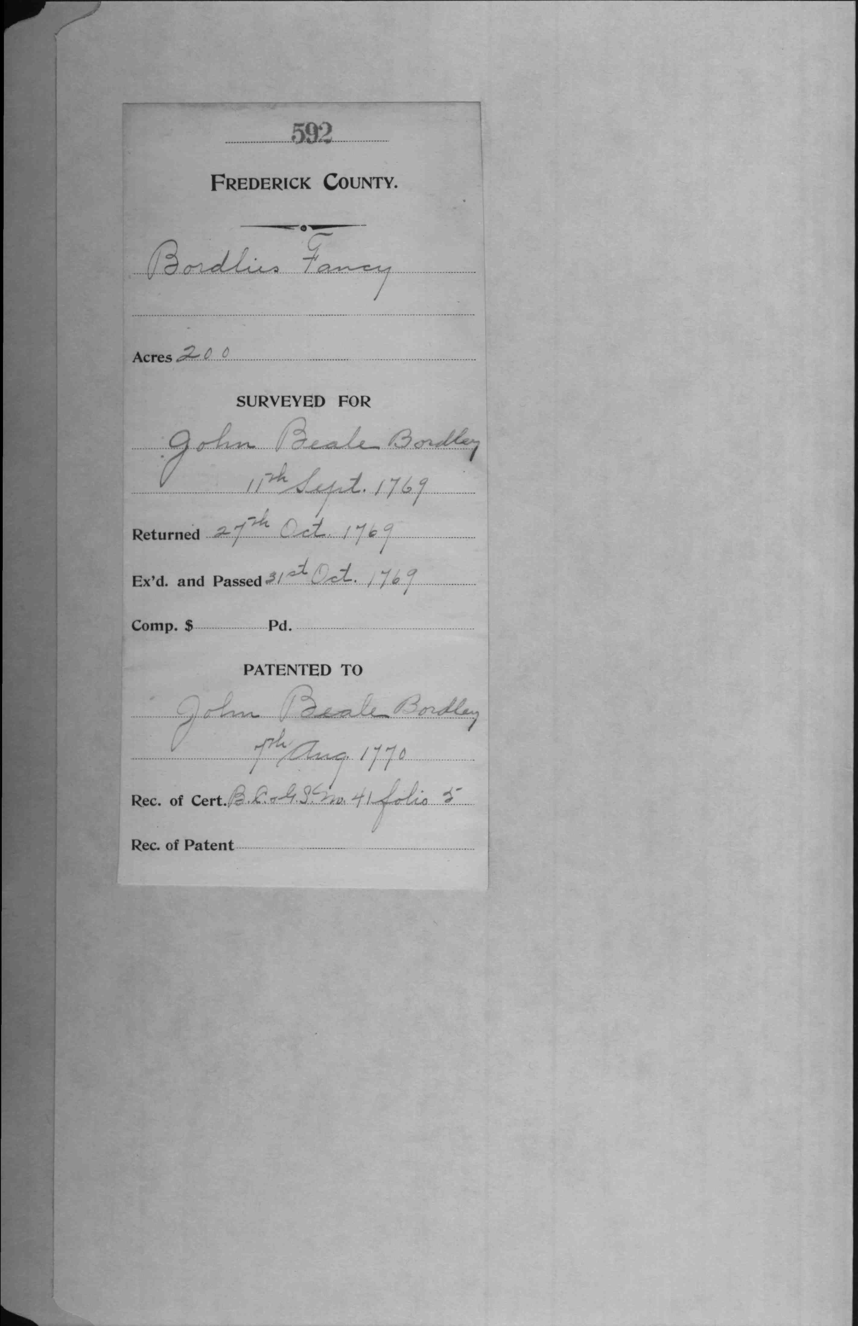
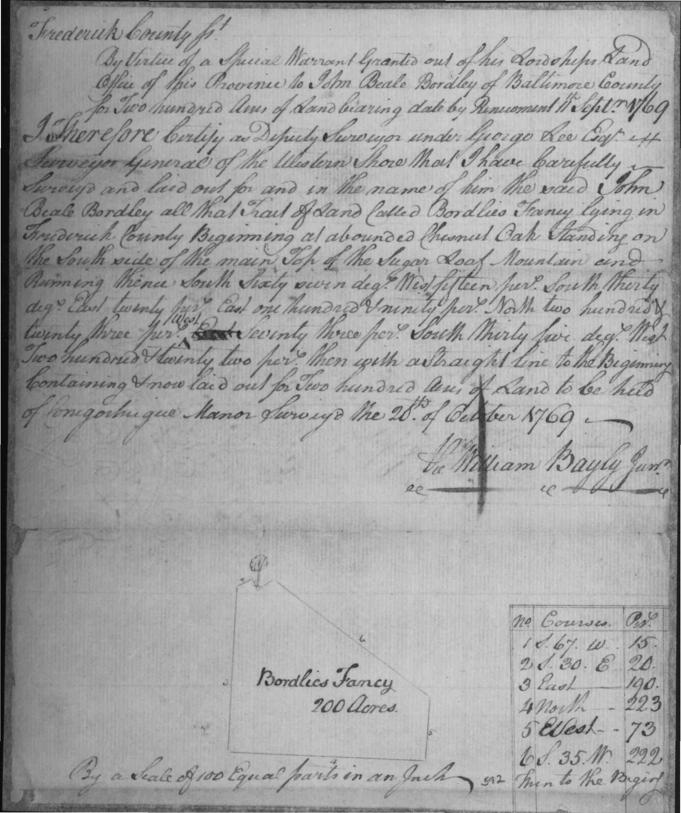
1770 | Bordley, John |
Bordlies Fancy, John Bordley, 200 Acres 1770/08/07 Patented Certificate 592 Bordlies Fancy, 200 Acres; Certificate Bordlies Fancy, 200 Acres; Patent
|
   |
| Montgomery Co., MD | 1774 | Richard Davis |
I Don't Care What Frederick Co., Certificate 102 Liber BC&Gs 47 Folio 425, Patent 102 Liber BC&Gs 44 Folio 327 |
|
| Frederick Co., MD | 1774 | George Silver | Littleworth | This was the Stier ancestral home. |
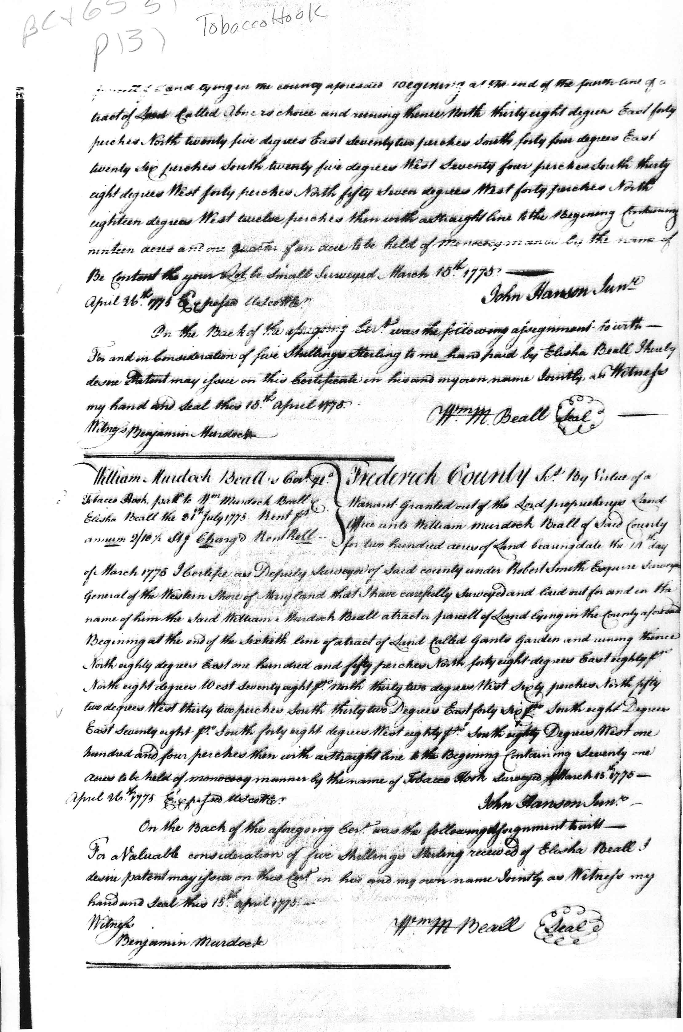
| Frederick Co., MD | 1775 | Beall, William M. |
Tobacco Hook,
Acres 71; Certificate |
 |
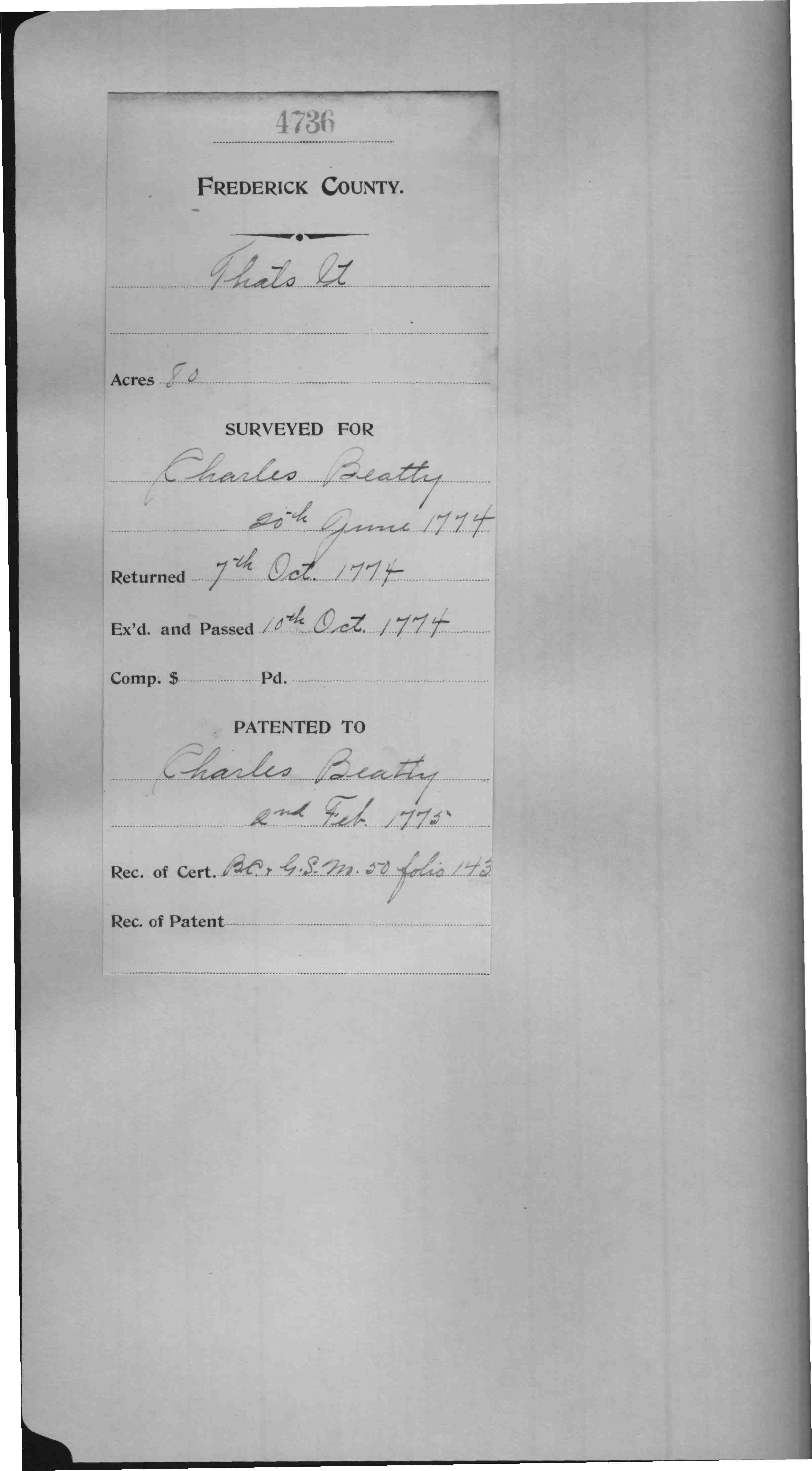
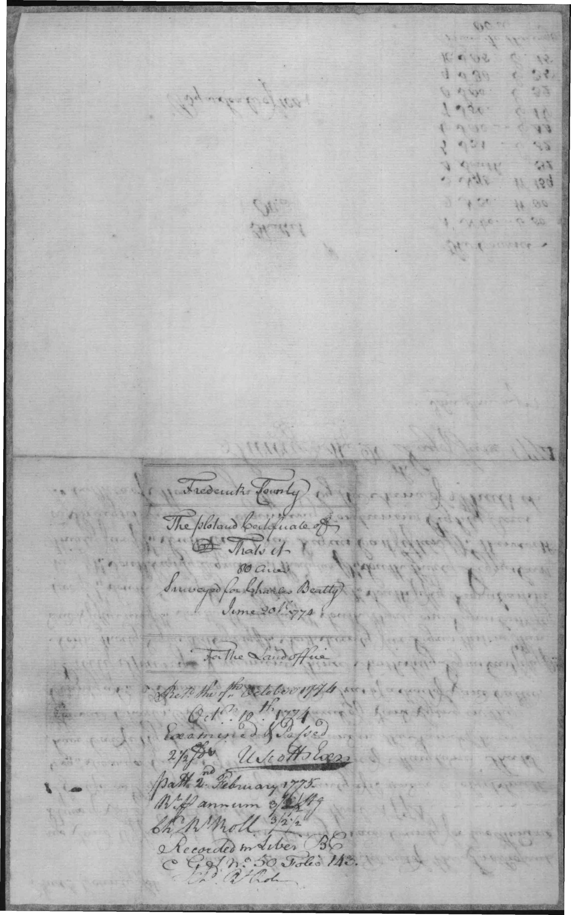
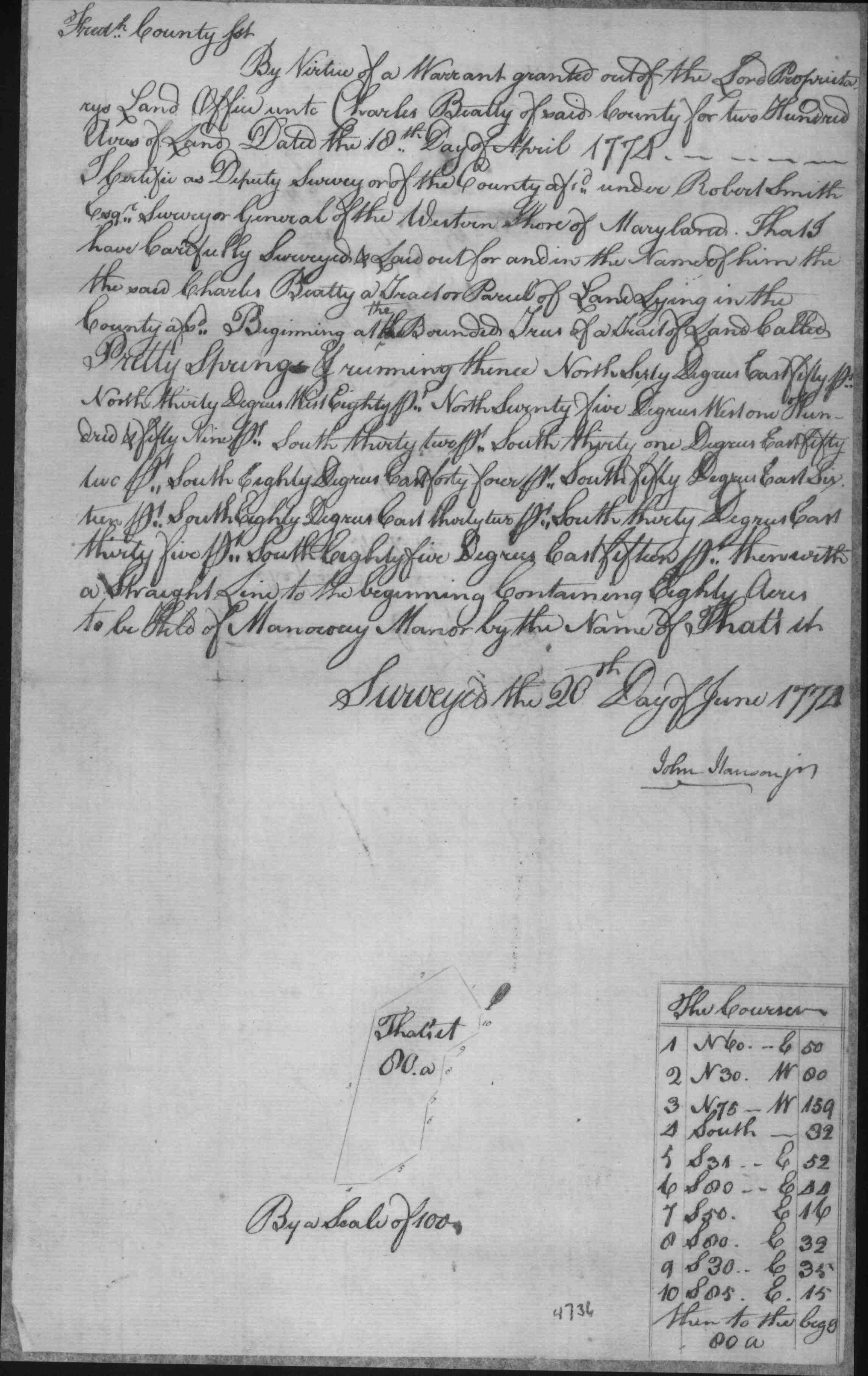
| Frederick Co., MD | 1775 | Beatty, Charles |
That’s It,
Charles Beatty, 80 Acres Patented Certificate 4736 Date: 1775/02/02
|
   |
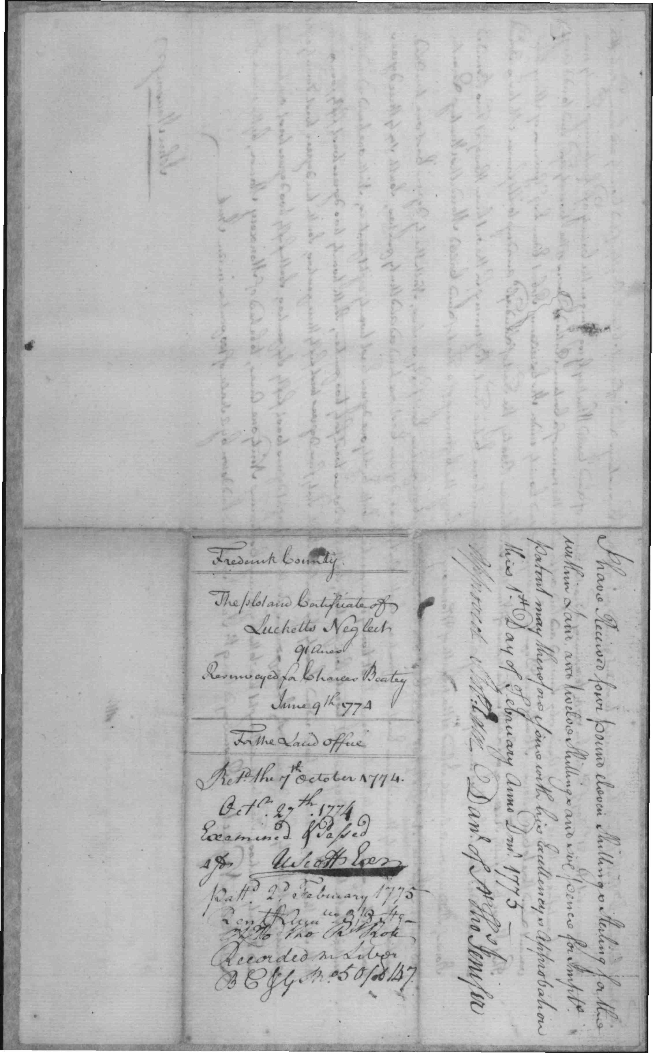
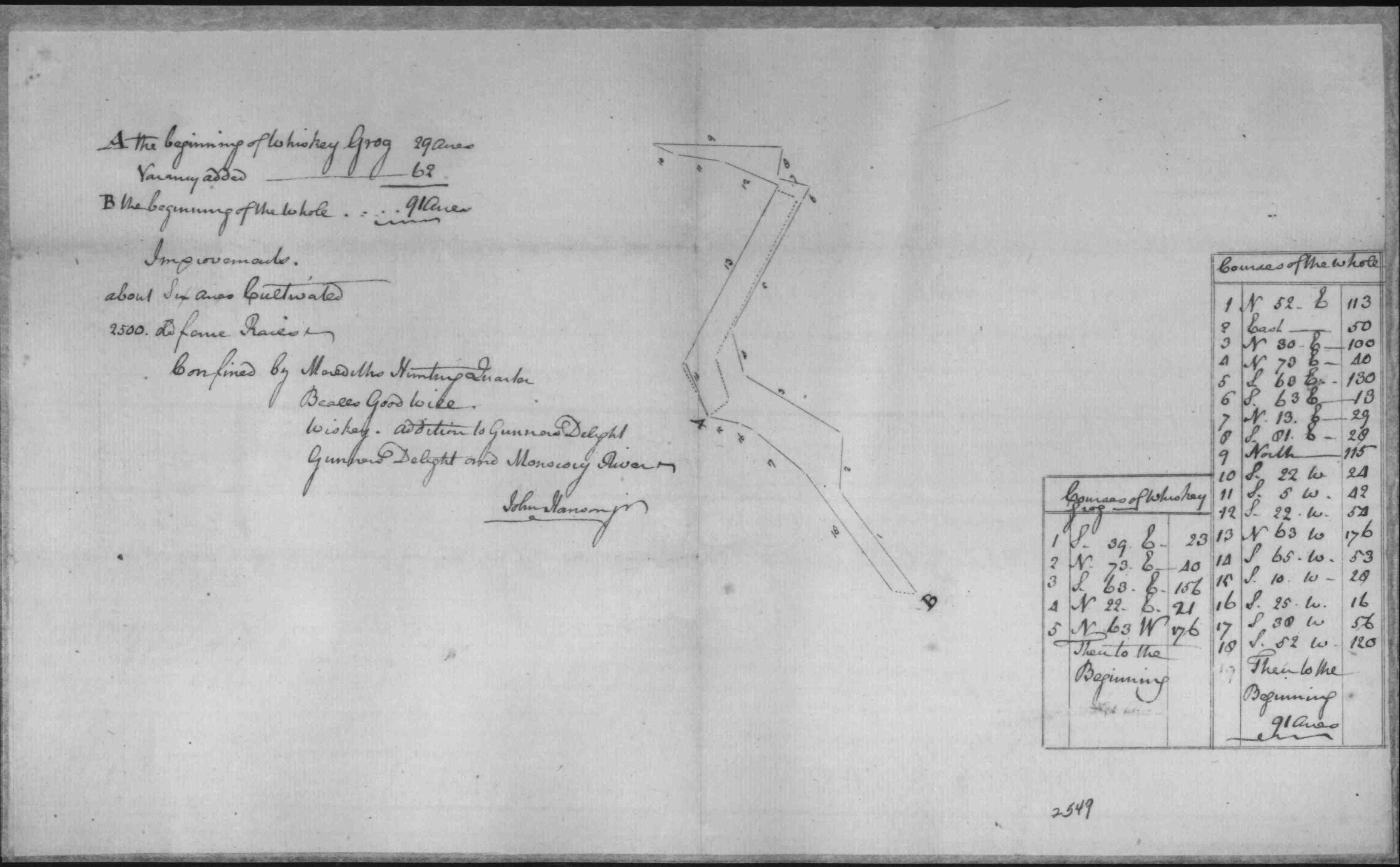
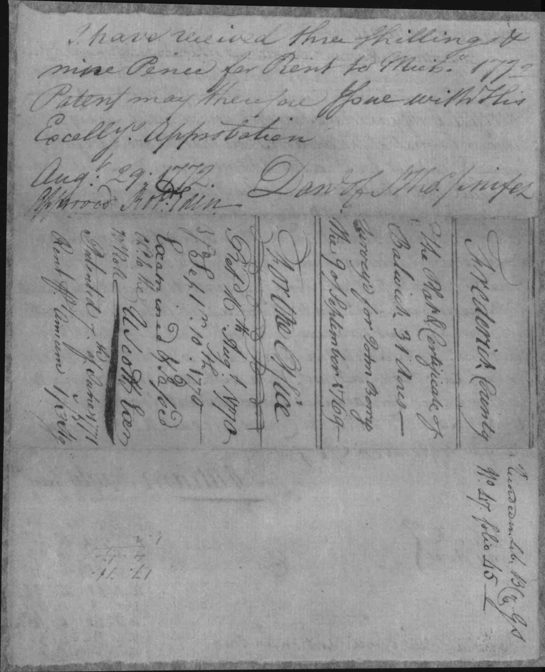
| Frederick Co., MD | 1775 | Beatty, Charles |
Lucketts
Neglect, Charles Beatty, 91 Acres 1775/02/02 Patented Certificate 2549
|
    |
| Frederick Co., MD | 1775 | Deakins, Francis |
Mount Pisgah,
Francis Deakins, 491 Acres 177/02/05 Unpatented Certificate 500 Resurvey On Mount Pisgah, Francis Deakins, 2832 Acres 1786/03/15 Unpatented Certificate 688
|
|
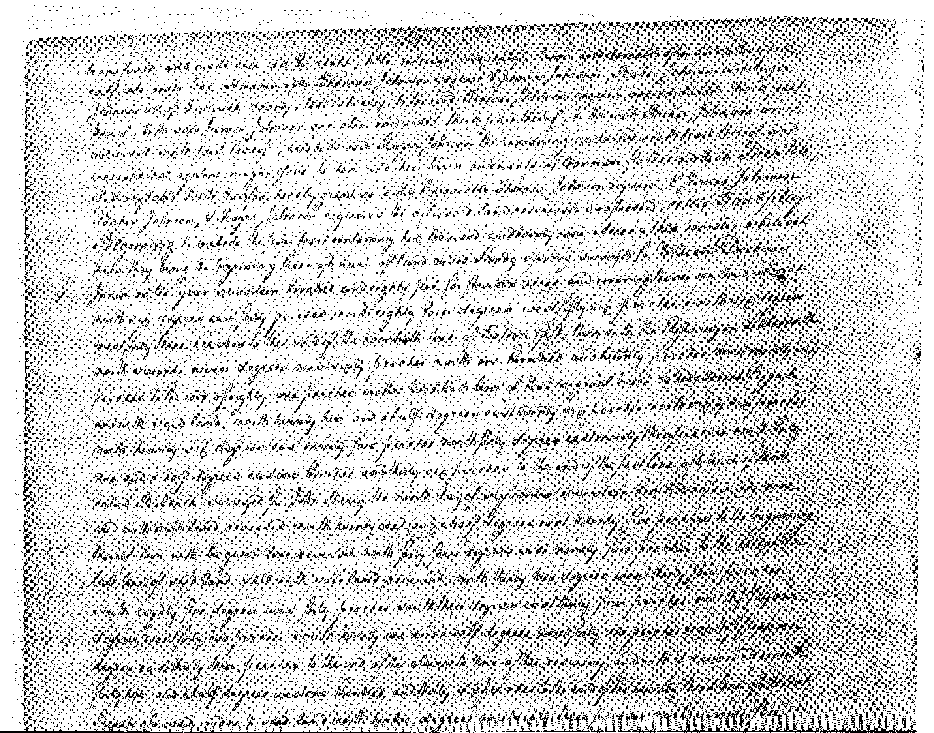
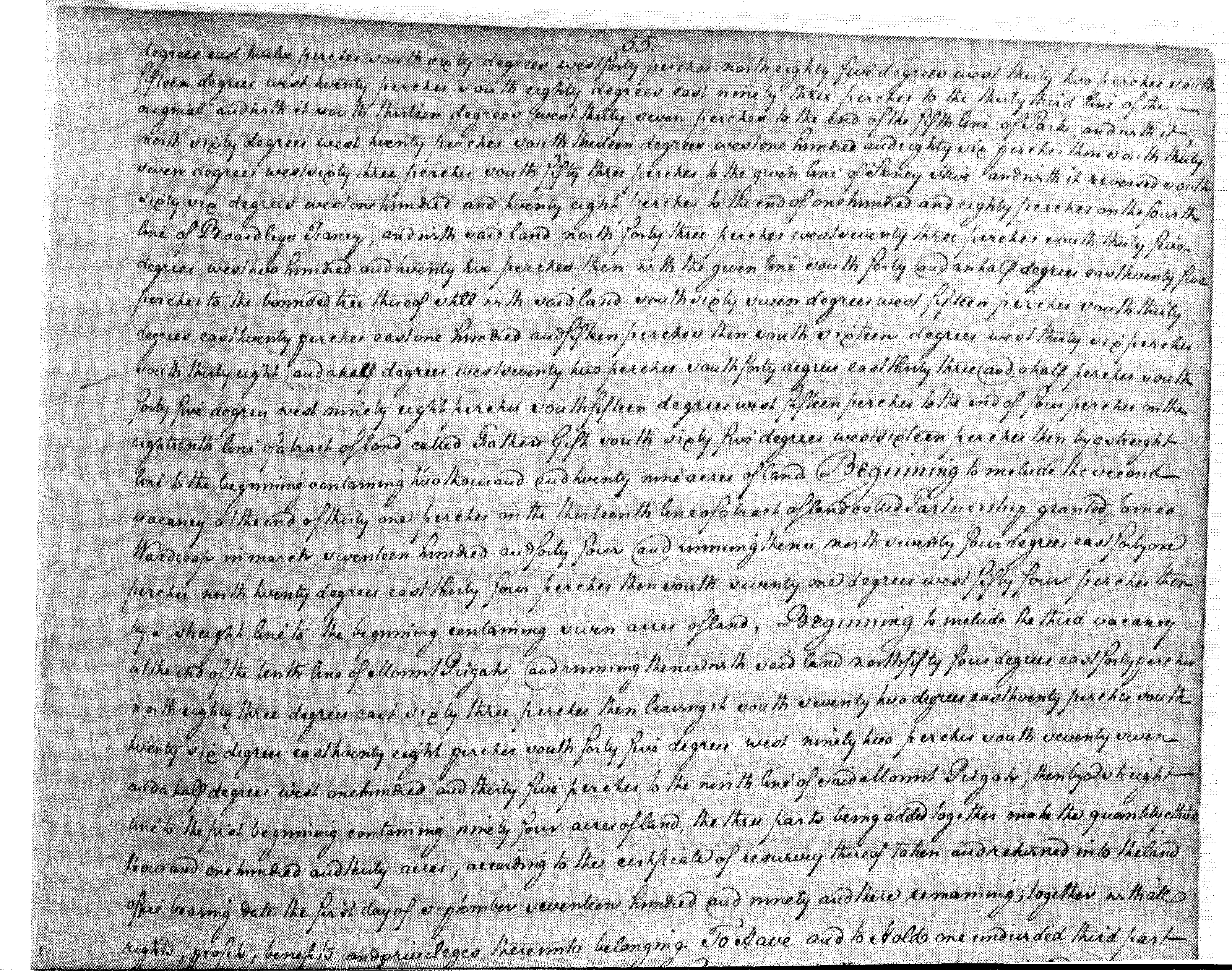
| Frederick Co., MD | 1791 |
Johnson, Thomas
|
Foul Play 2130 acres (Foul Play comprises part of the Sugarloaf summit)
Foul Play, 2130 Acres; Certificate Foul Play, 2130 Acres; Patent Foul Play, Thomas Johnson Et al, 2130 Acres See Portfolio 1791/05/16 Patented Certificate 1442 01/07/ 1845 McAlen and Vermission vs. Hays, Survey of Foul Play near Sugar Loaf Mountain. Case recorded in Equity Record WBT 1, p. 589. |
|
| Montgomery Co., MD | 1797 |
Richard Davis and Solomon Davis
[These tracts would seem to tie Richard and Solomon Davis to the Meredith Davis family, although no relationship has been proven.] Garah Harding also testified at these procedings |
Caveat Papers 256 Gunders Delight, Illustration For Charles Beatty Versus Richard Davis and Solomon Davis Versus Charles Beatty Davis Addition, Gunders Delight, Illustration For Charles Beatty Versus Richard Davis, Solomon Davis Versus Charles Beatty Resurvey, Mount Pisgah, Illustration For Charles Beatty Versus Richard Davis and Solomon Davis Versus Charles Beatty I Dont Care What, Illustration For Charles Beatty Versus Richard Davis, and Solomon Davis Versus Charles Beatty Merediths Hunting Quarter, Illustration For Charles Beatty Versus Richard Davis and Solomon Davis Versus Charles Beatty Whiskey, Illustration For Charles Beatty Versus Richard Davis and Solomon Davis Versus Charles Beatty Thats It, Resurveyed, Illustration For Charles Beatty Versus Richard Davis and Solomon Davis Versus Charles Beatty Luckets Neglect, Illustration For Charles Beatty Versus Richard Davis and Solomon Davis Versus Charles Beatty Mount Pleasant, Illustration For Charles Beatty Versus Richard Davis and Solomon Davis Versus Charles Beatty Pretty Spring, Illustration For Charles Beatty Versus Richard Davis and Solomon Davis Versus Charles Beatty Thats It, Illustration For Charles Beatty Versus, Richard Davis and Solomon Davis Versus Charles Beatty Resurvey, Bealls Good Will, Illustration For Charles Beatty Versus Richard Davis, Solomon Davis Versus Charles Beatty
|
|
|
Ridge 78 1/4 acres
|
listed as a Littleworth neighboring tract in Tracey collection | |||
| Frederick Co. MD | 1771/06/07 | John Berry |
Balwick, 31 a. Patented Certificate 388 Patent Record BC and GS 47, p. 45 Patent Record BC and GS 43, p. 381 |
   |
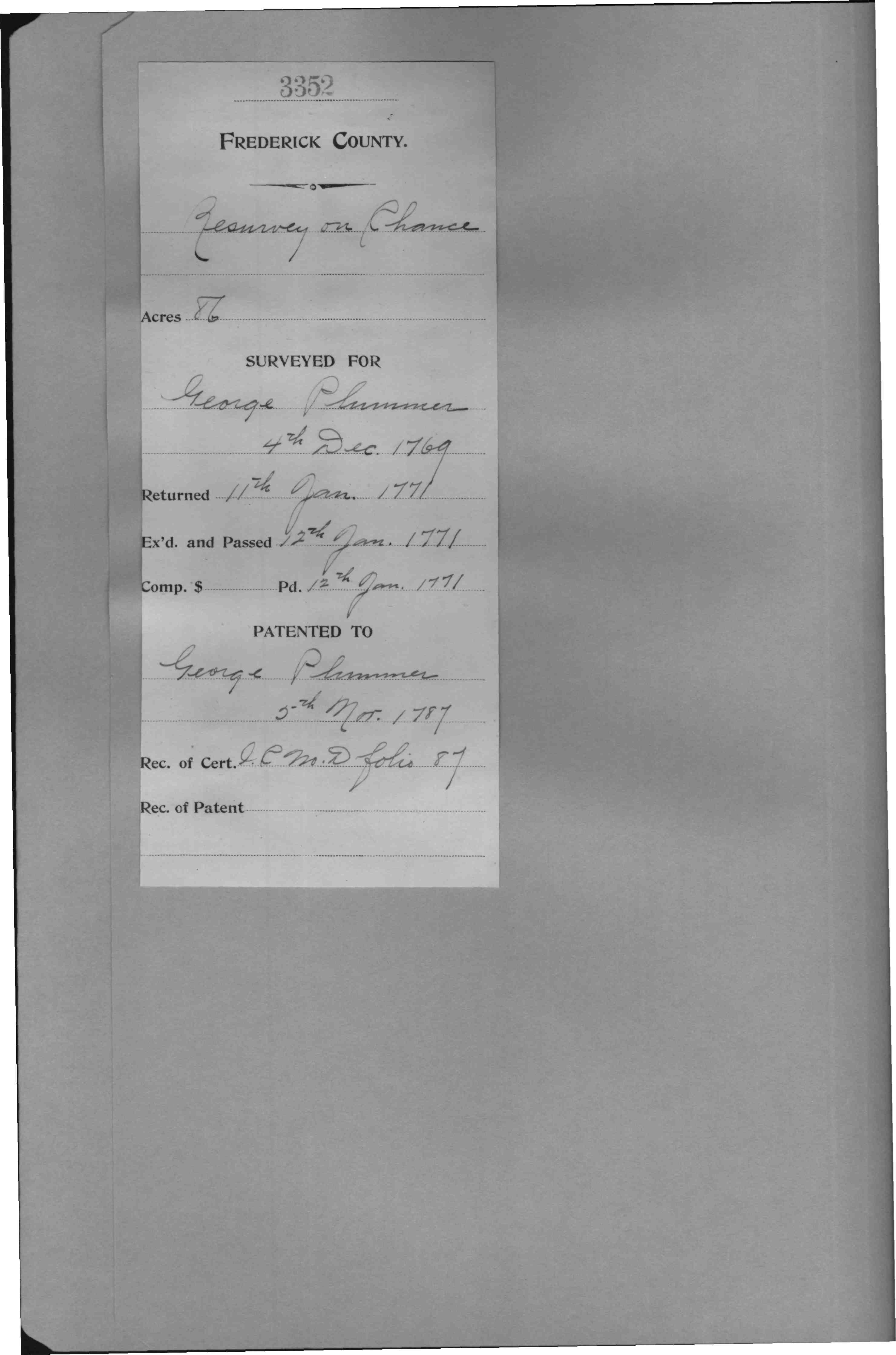
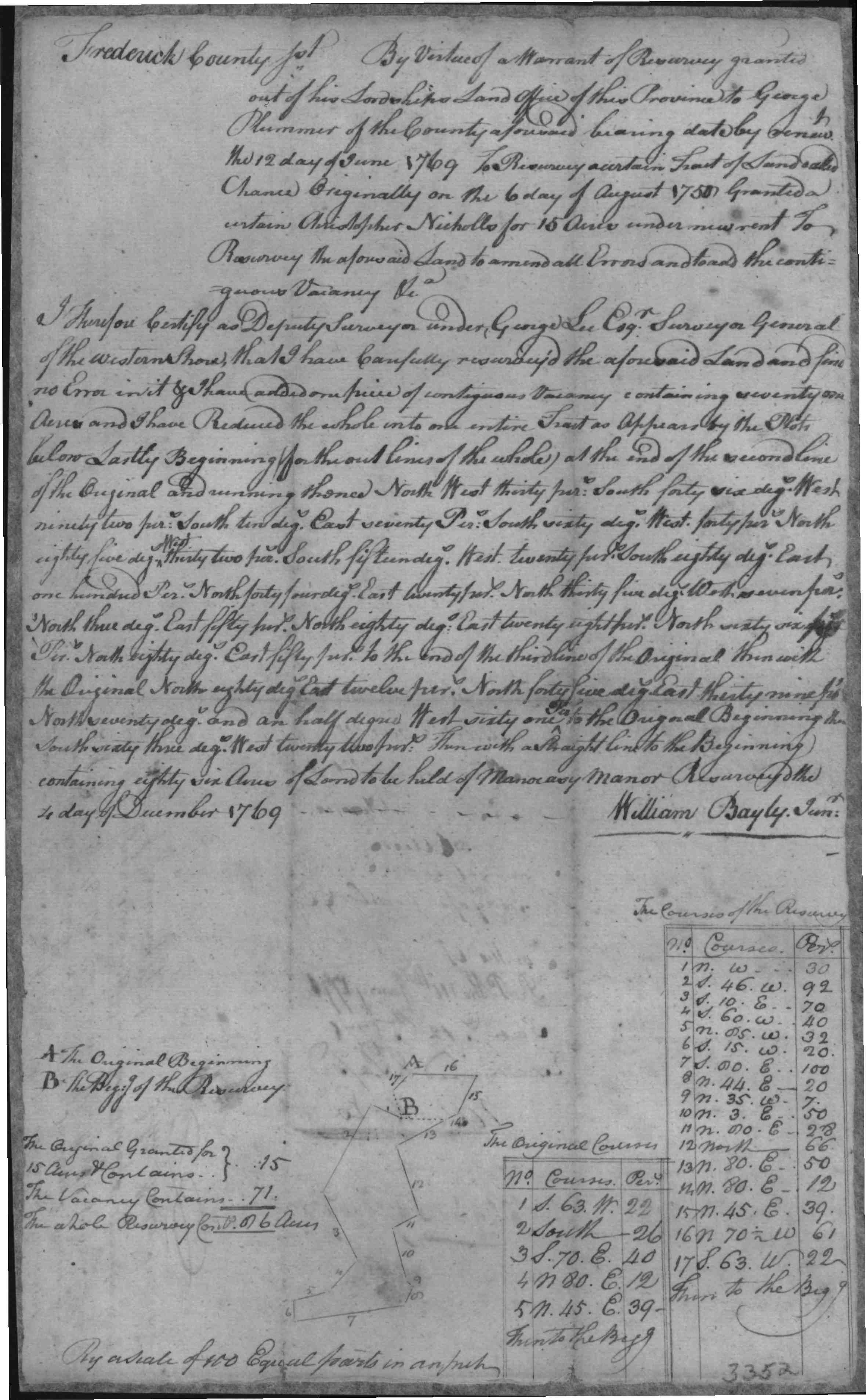
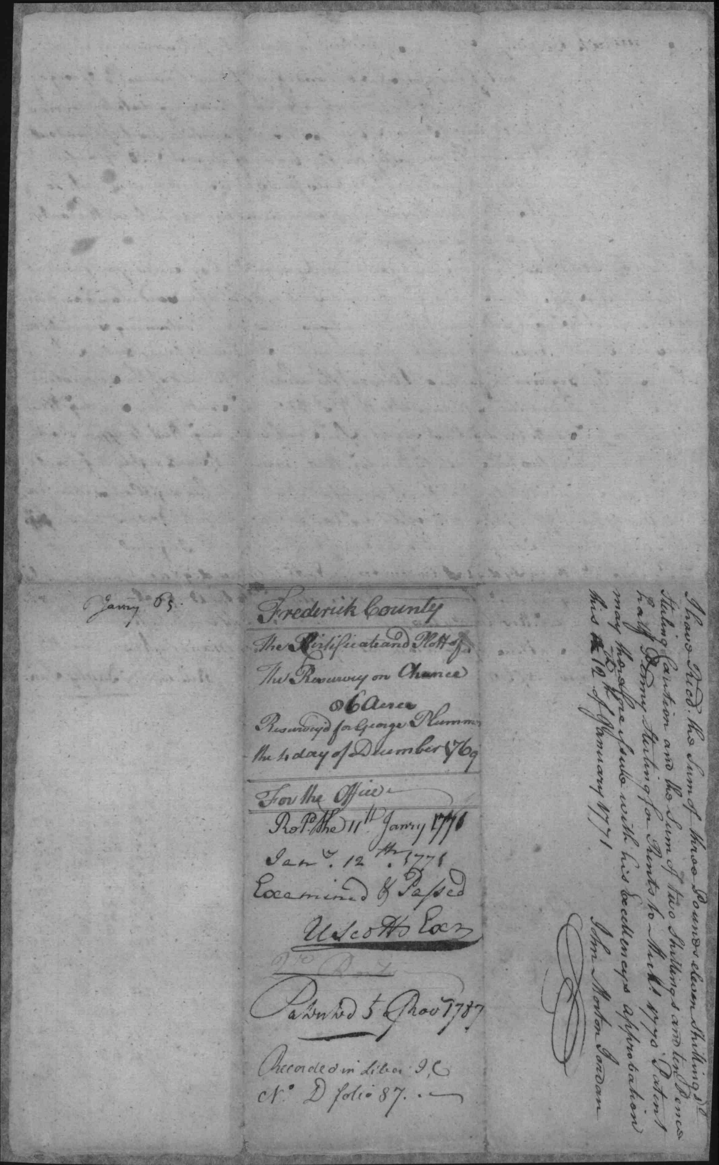
| Frederick Co. MD | 1787/11/05 | George Plummer |
Resurvey On
Chance, 86 Acres Patented Certificate 3352
|
   |
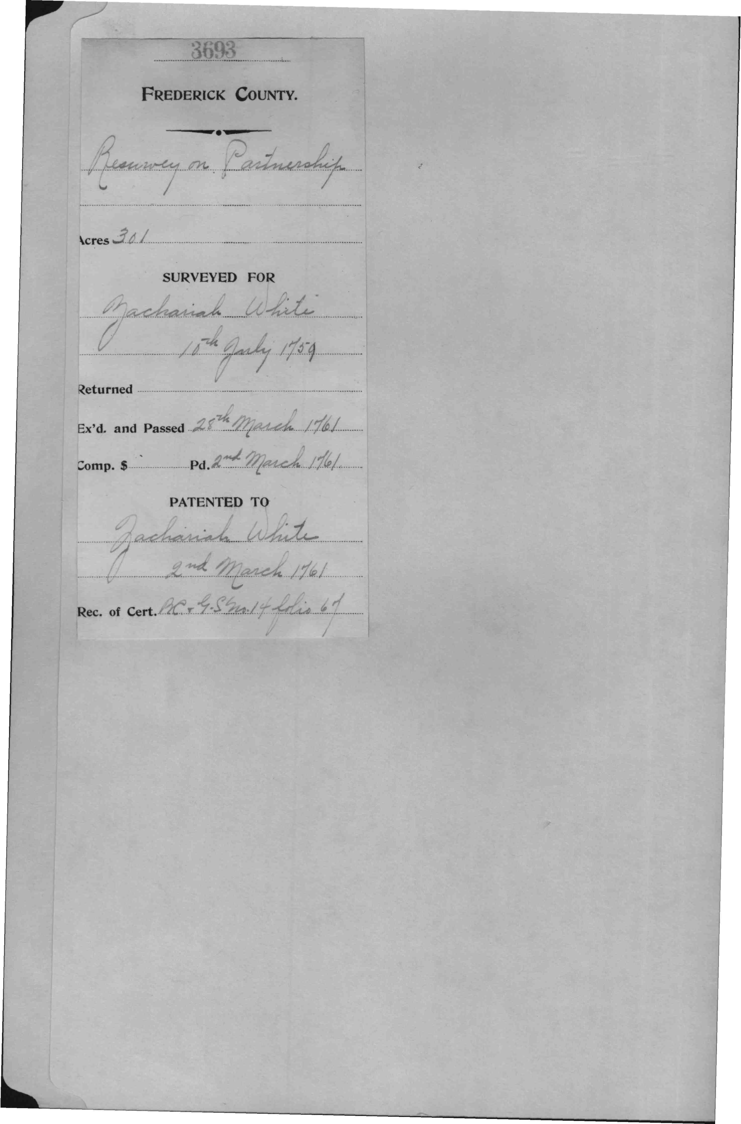
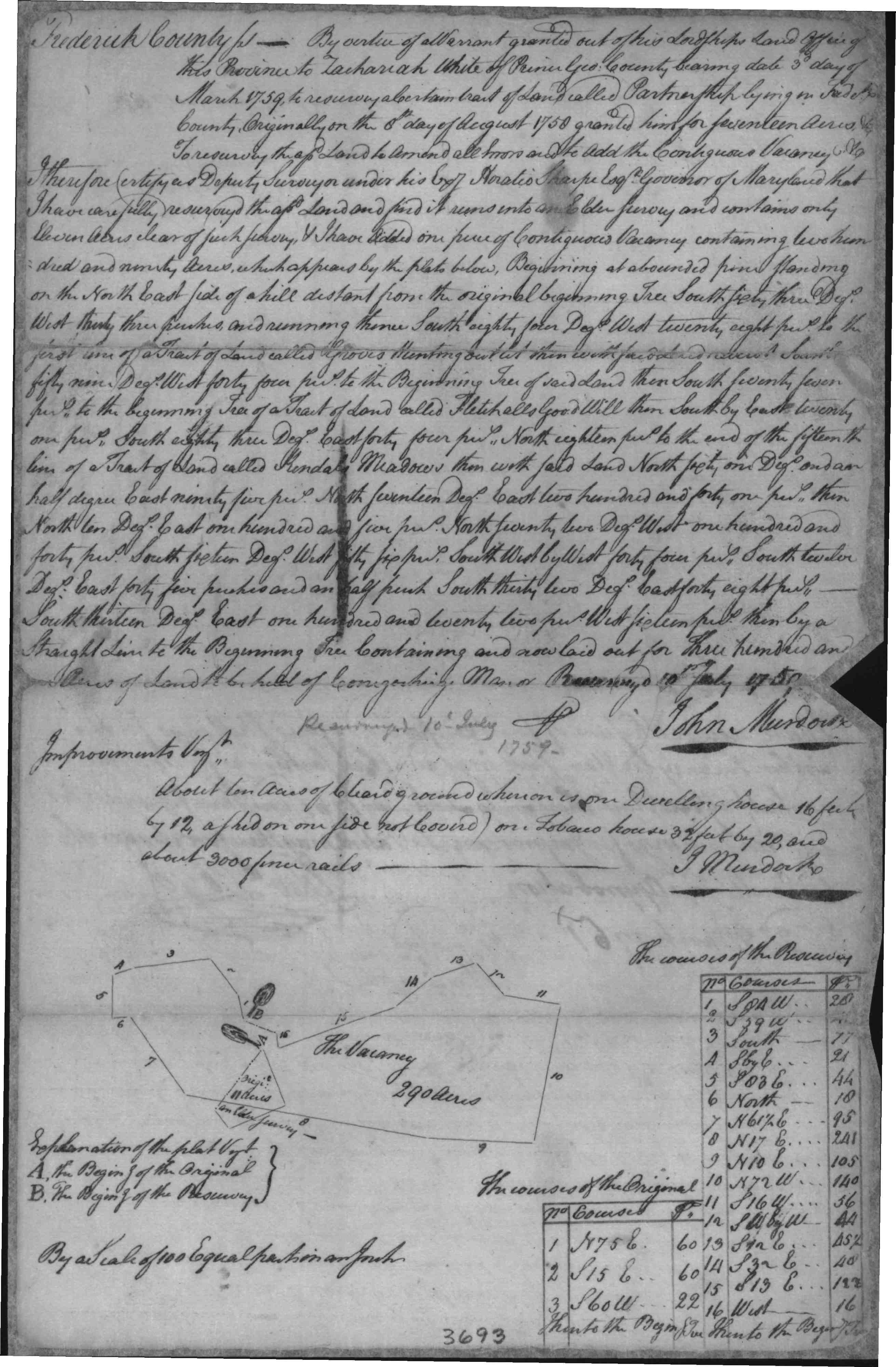
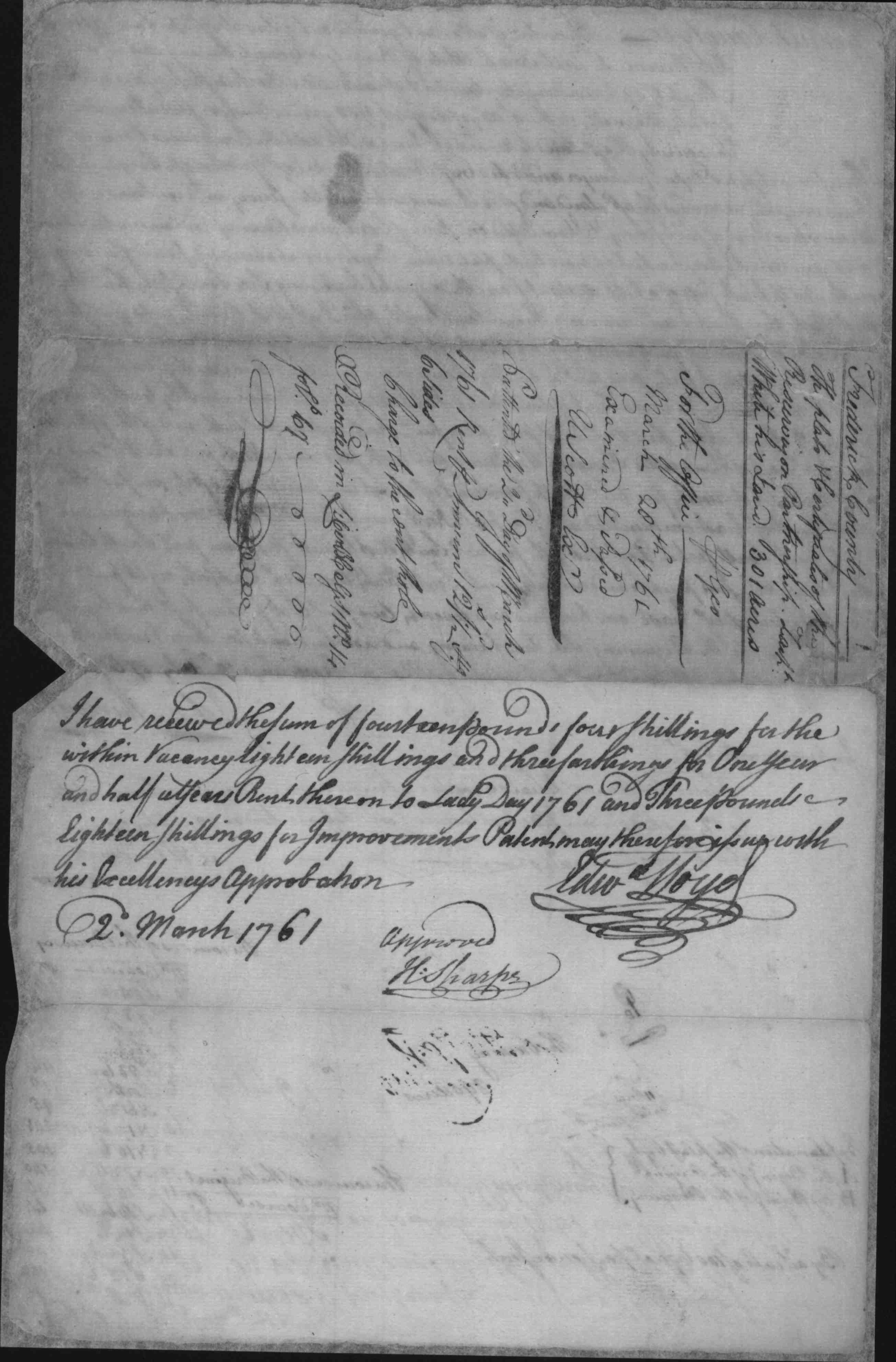
| Frederick Co. MD | 1758 | White, Zachariah |
Partnership,
17 Acres; Certificate Patent Record BC and GS 12, p. 86 Patent Record BC and GS 13, p. 43 Patented Certificate 2912 |
   |
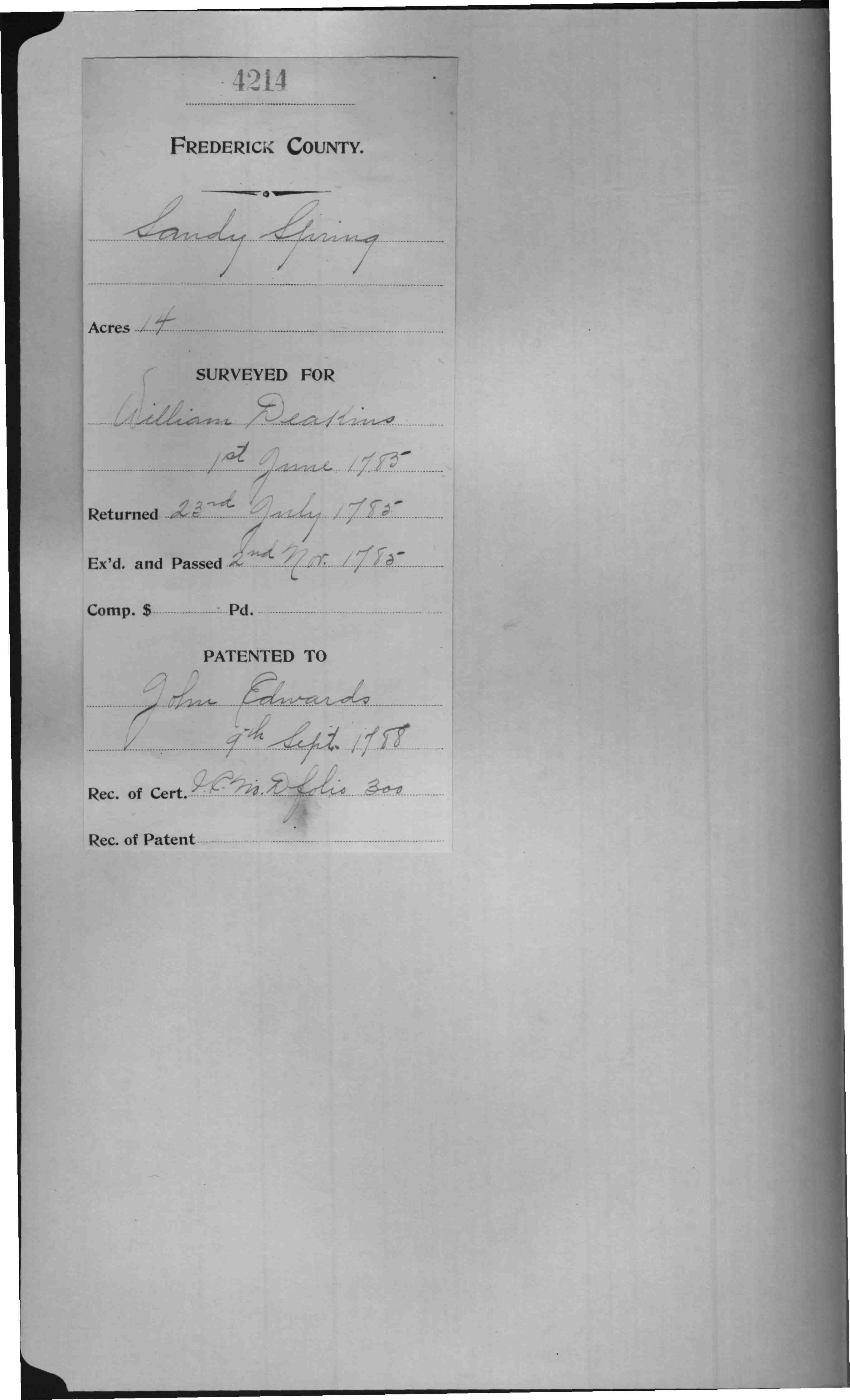
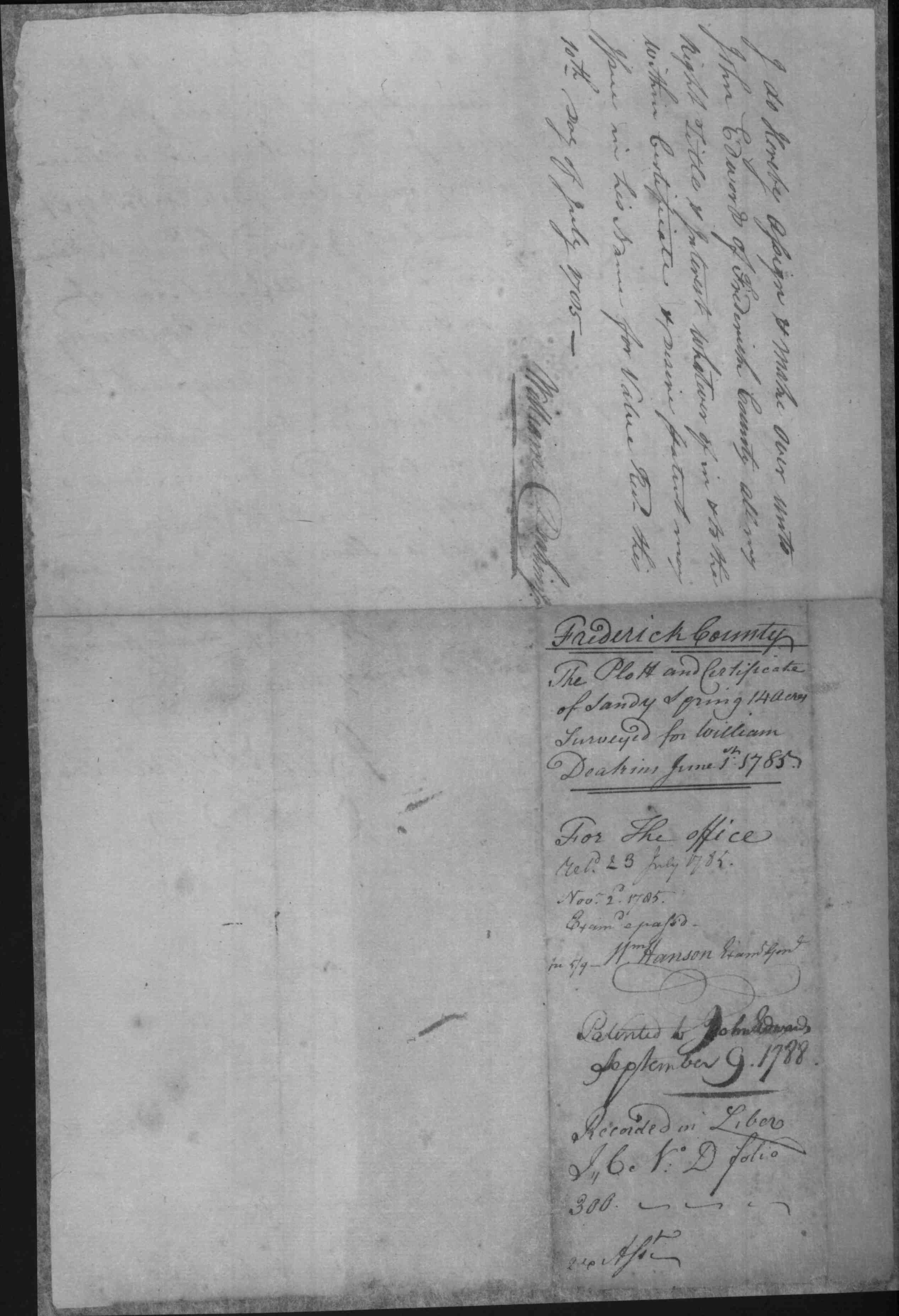
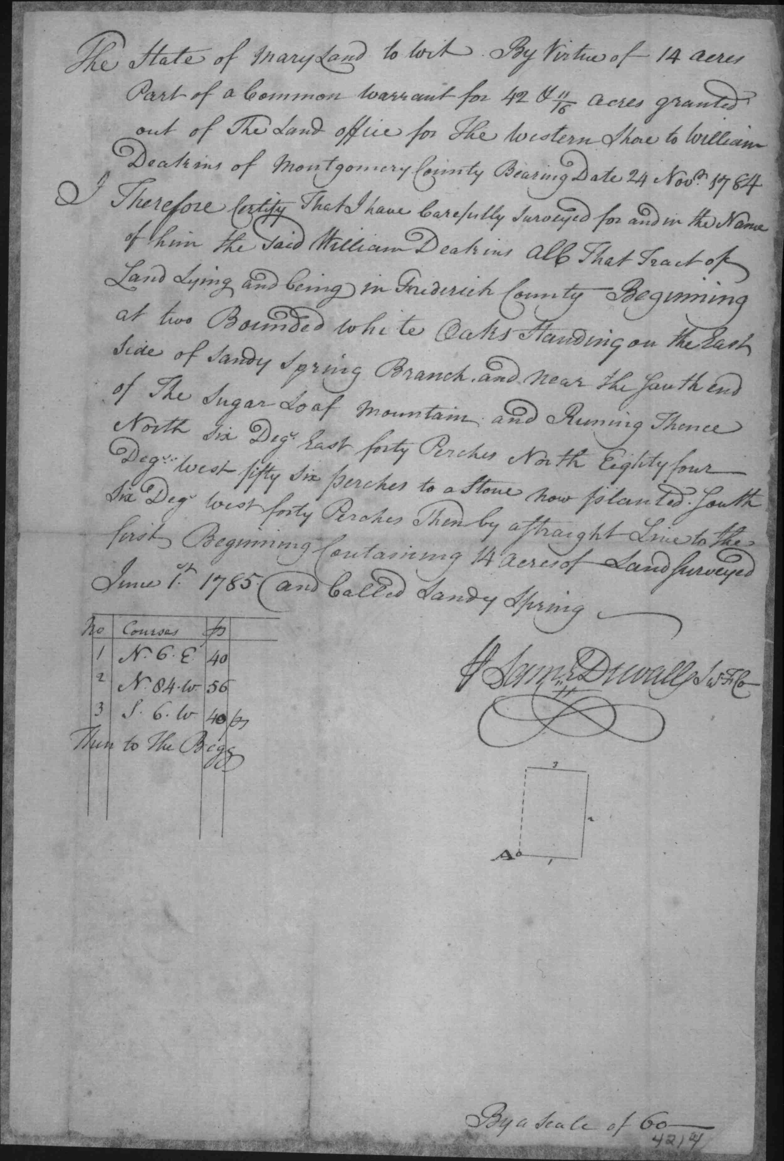
| Frederick Co. MD | 1788/09/09 | John Edwards |
Sandy Spring,
14 Acres Patented Certificate 4214
|
   |
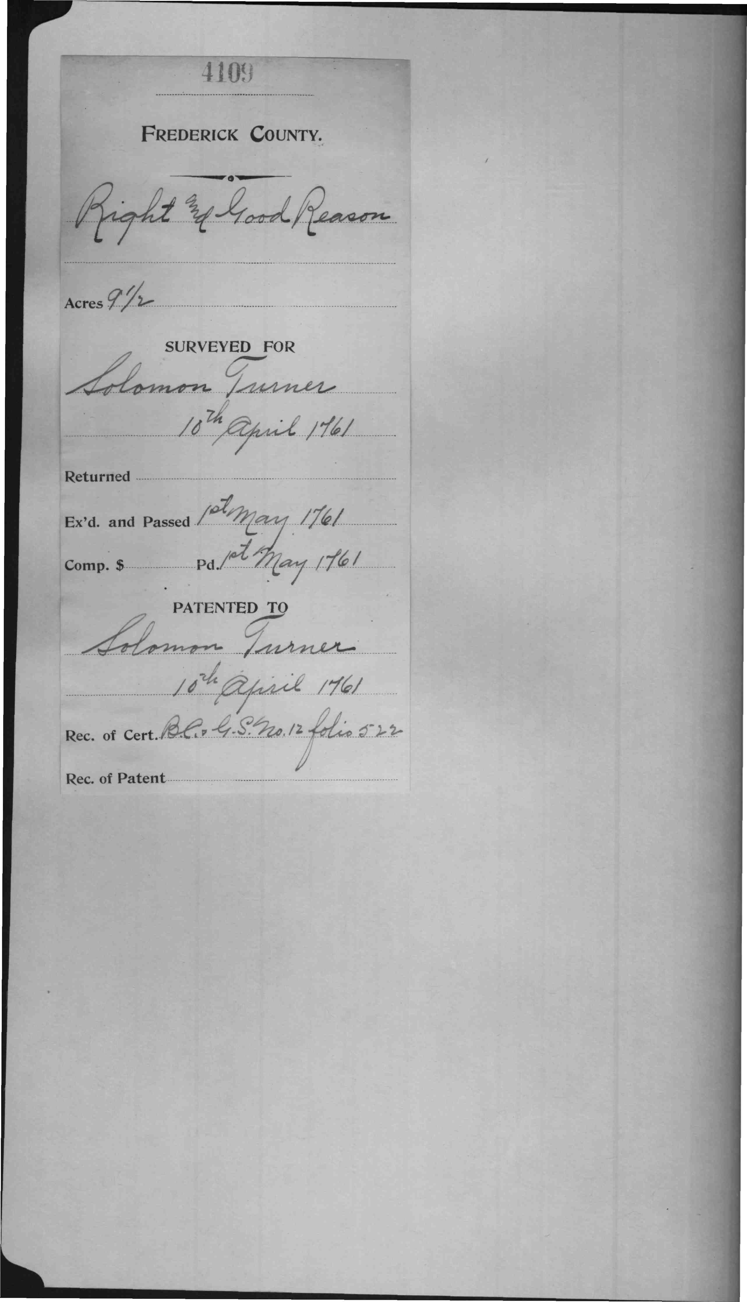
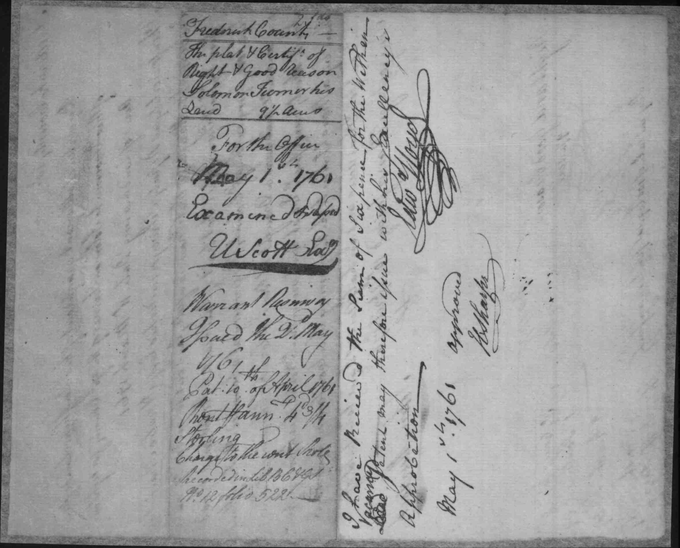
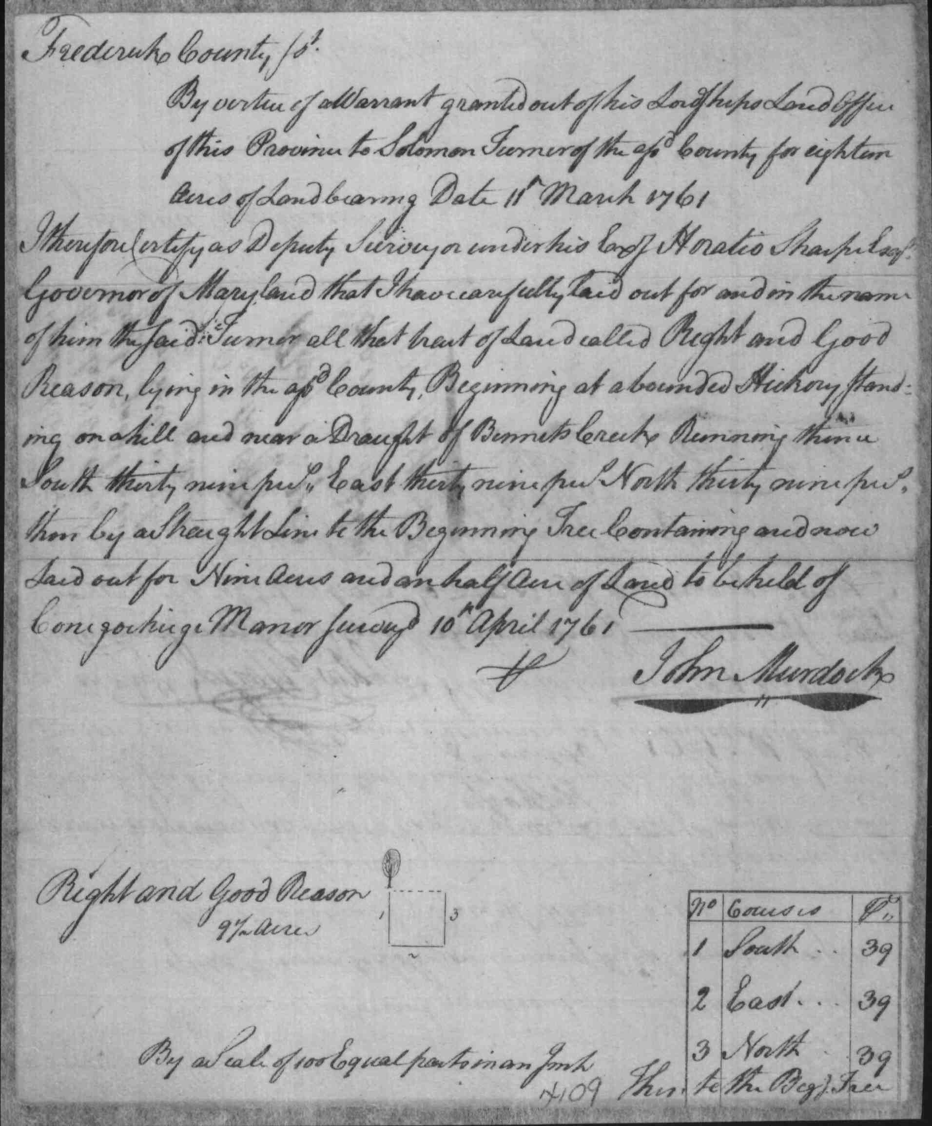
| Frederick Co. MD | 1761/04/10 | Solomon Turner |
Right and Good
Reason, 9 1/2 Acres, Patented
Certificate 4109 (resurveyed by Thomas Johnson in 1763) Resurvey On
Right And Good Reason, Acres 2429 1/2, Certificate
|
   |
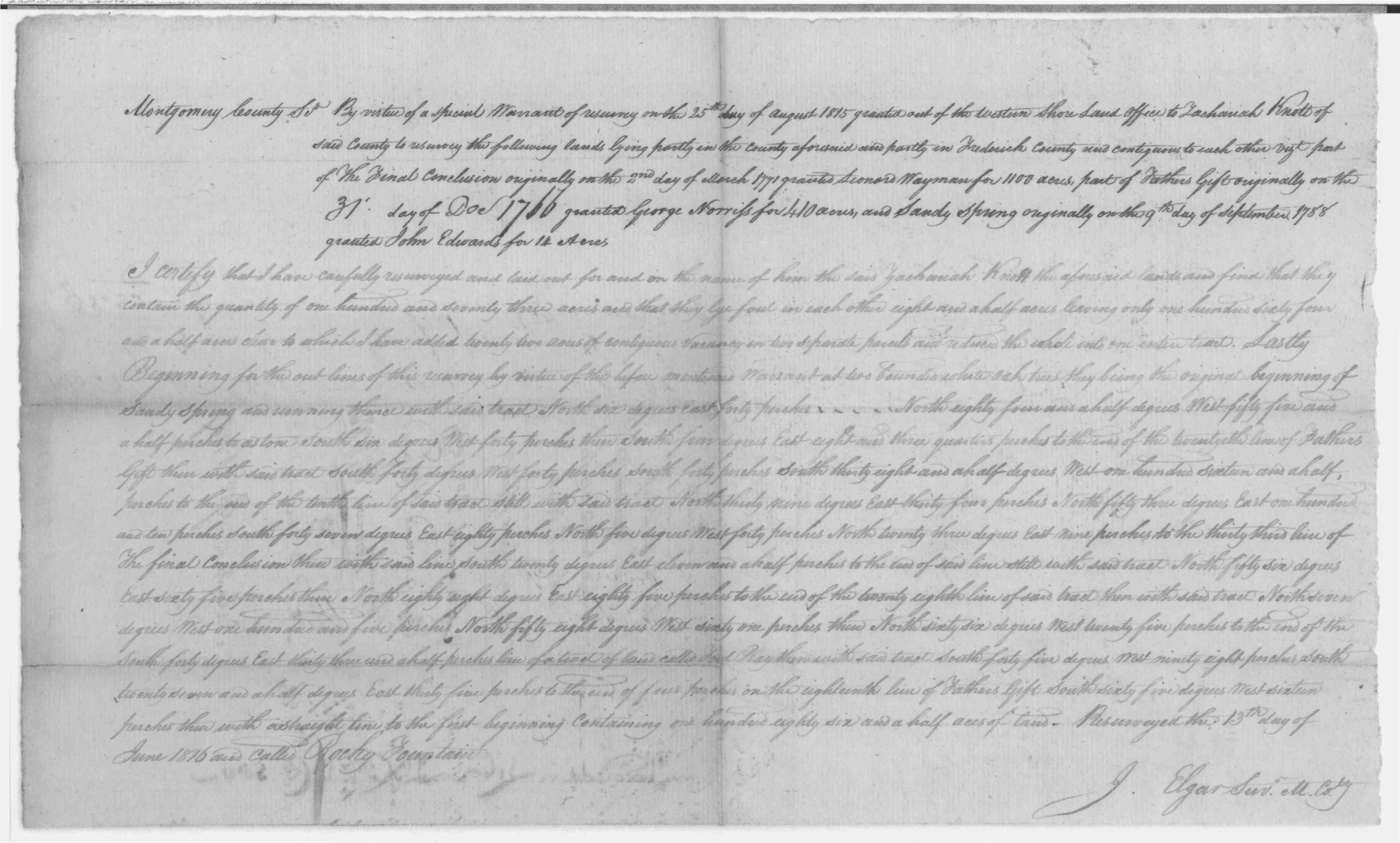
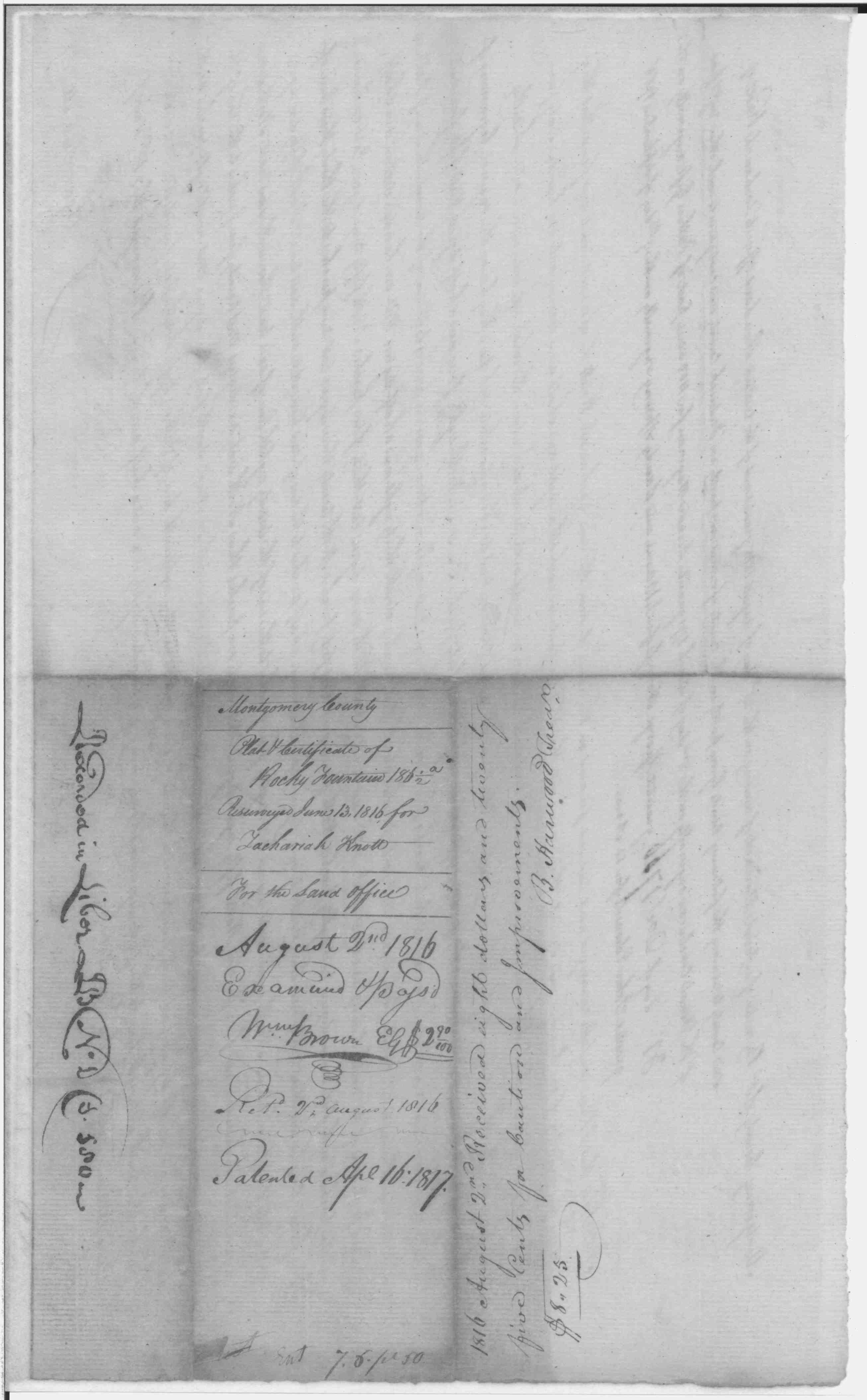
| Montgomery Co., MD | 1817/04/16 | Knott, Zachariah |
Rocky
Fountain; 186 1/2 Acres Patented Certificate 426
|
    |
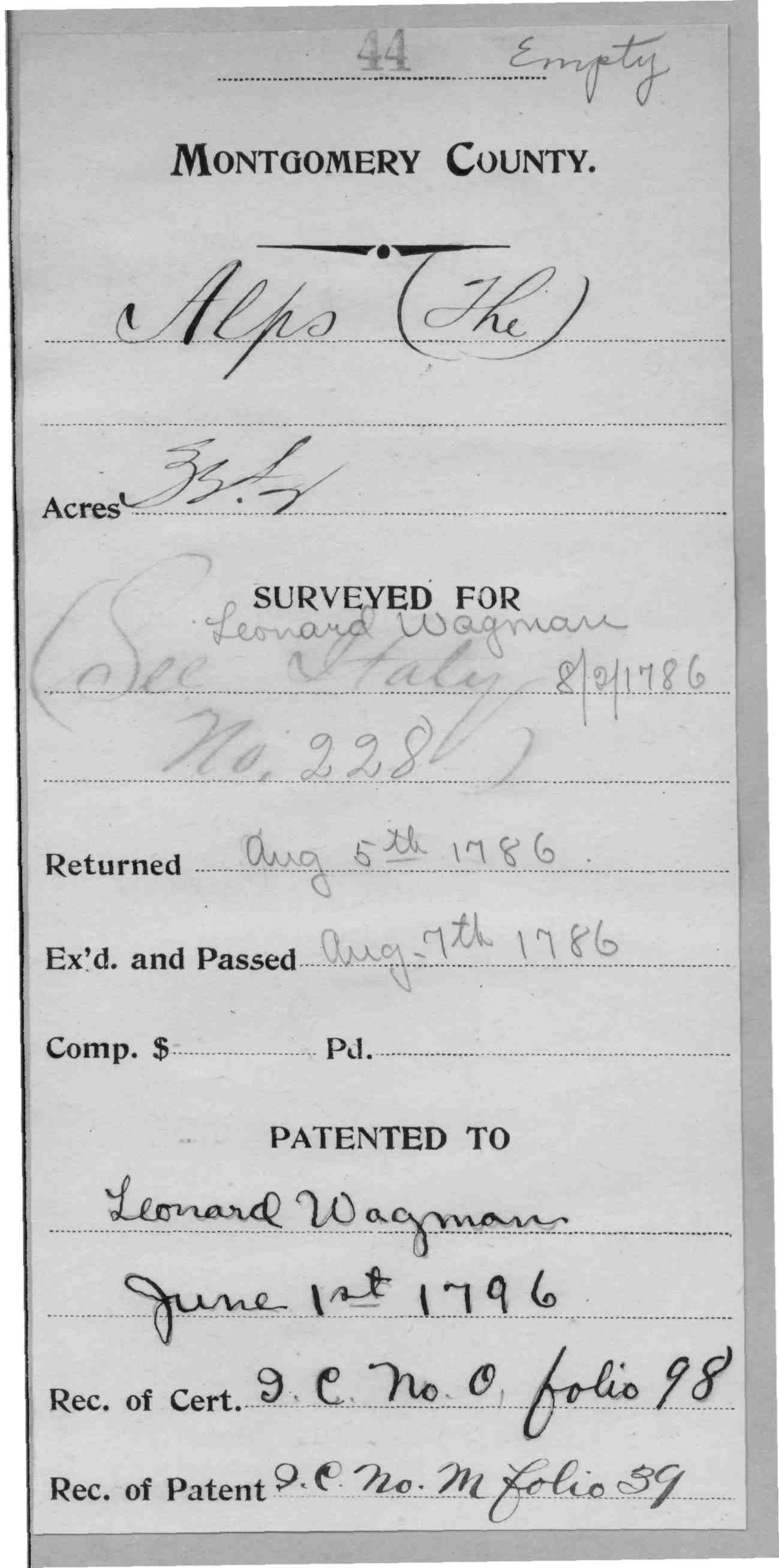
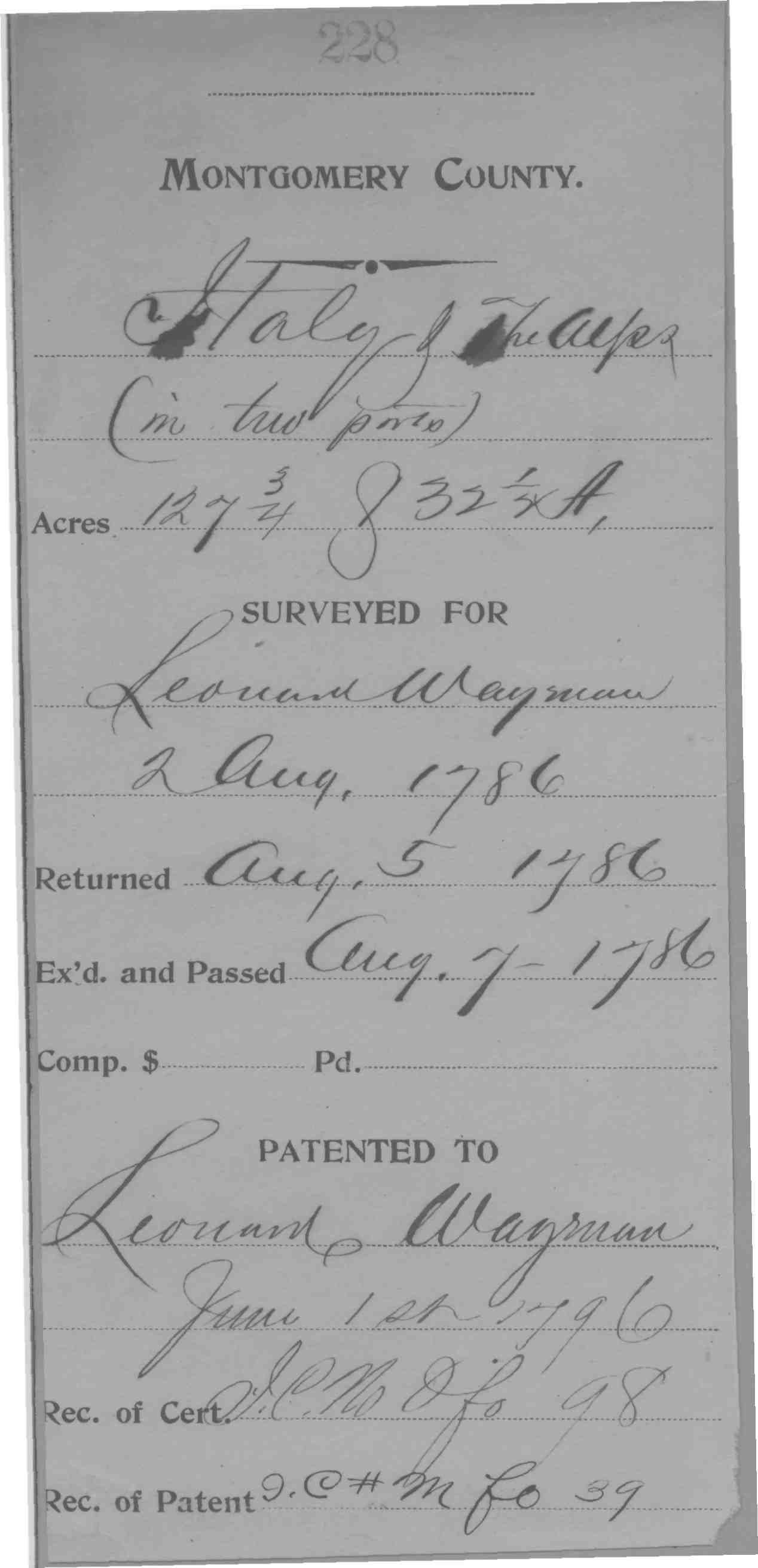
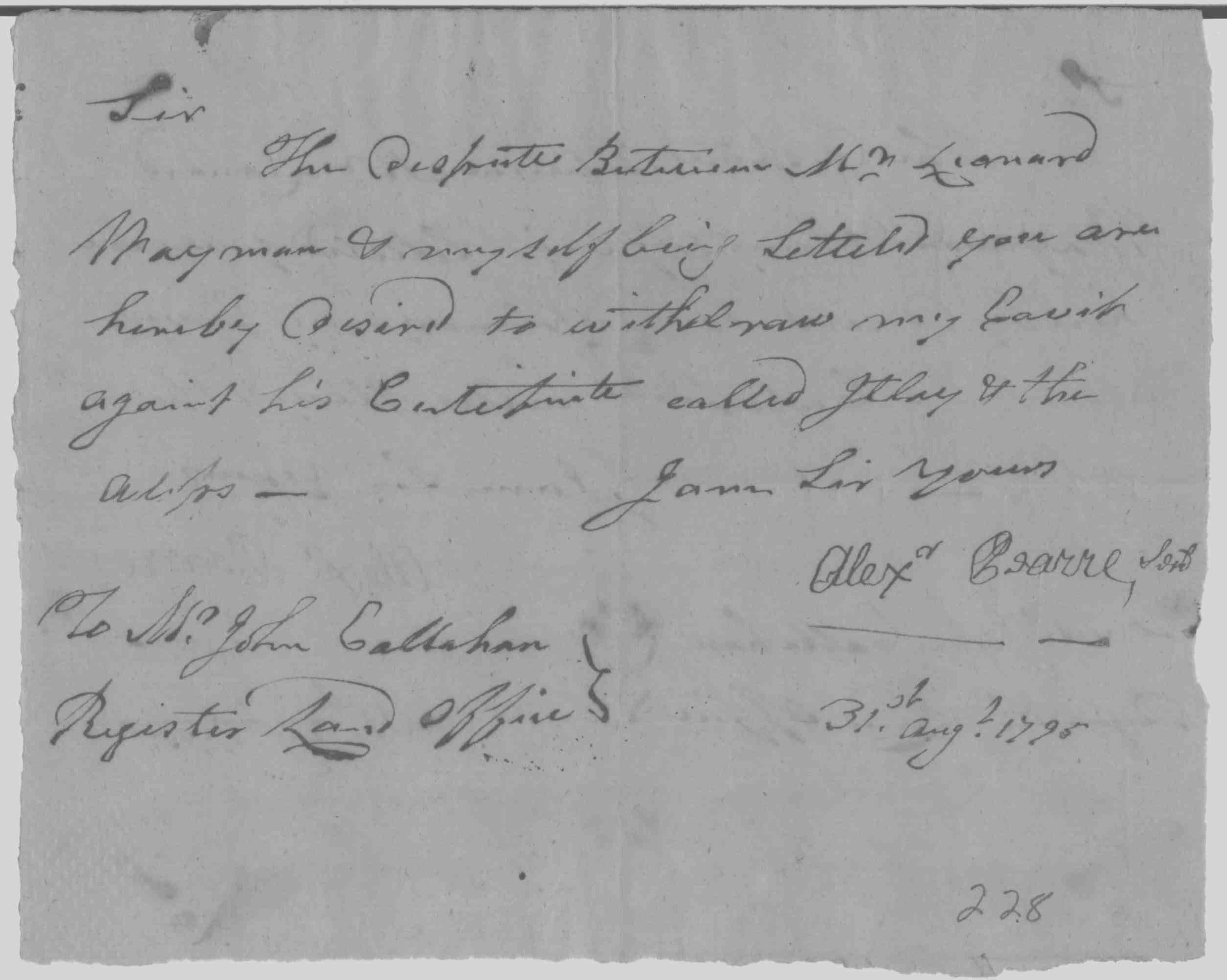
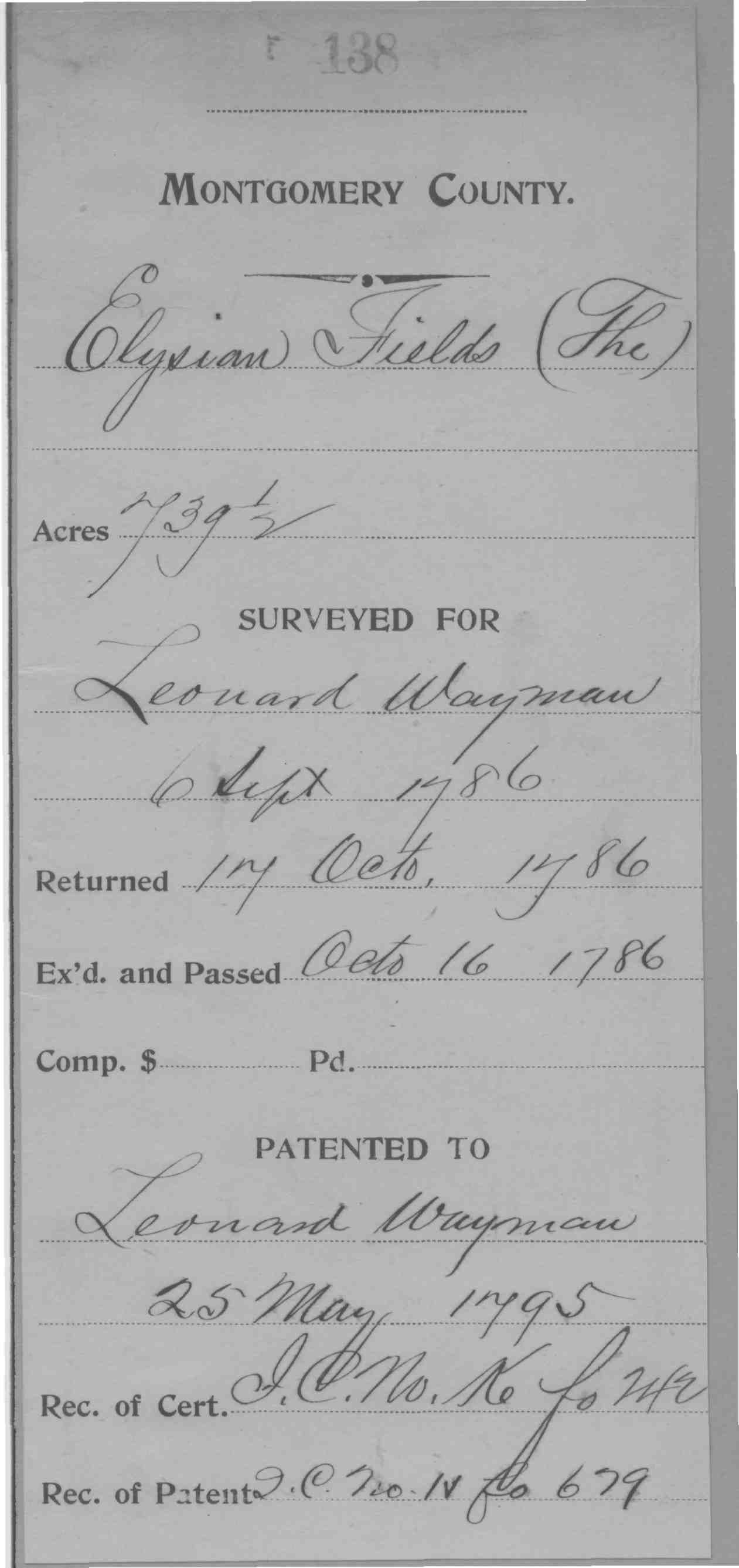
| Montgomery Co., MD | 1796 | Wagman, Leonard |
Italy and the
Alps Patented Certificate 228
|

 |
| Montgomery Co., MD | 1796/06/01 | Wagman, Leonard |
Alps, The; 33
1/2 Acres Patented Certificate 44
|
 |
| Montgomery Co., MD | 1796/06/01 | Wayman, Leonard |
Italy and
The Alps (in two parts); 127 3/4 Acres and 32 1/2 Acres Patented
Certificate 228
|
  |
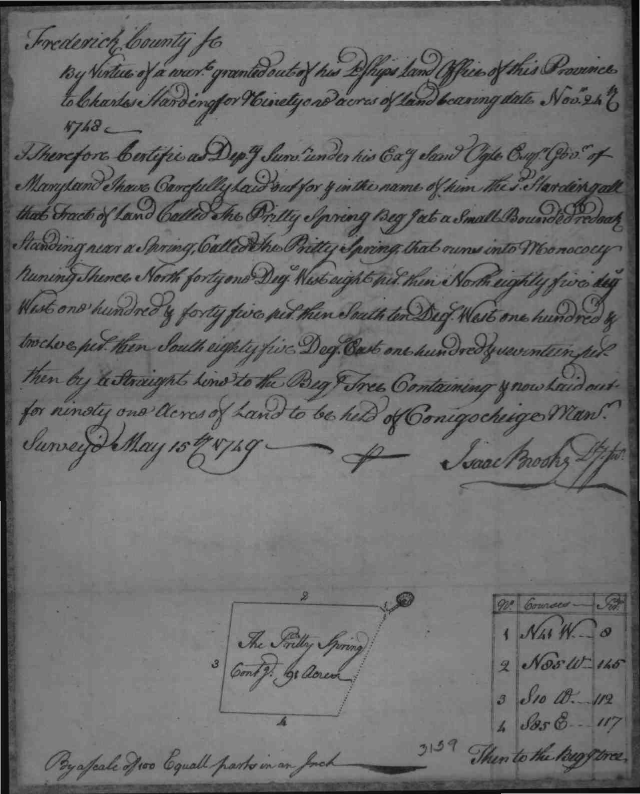
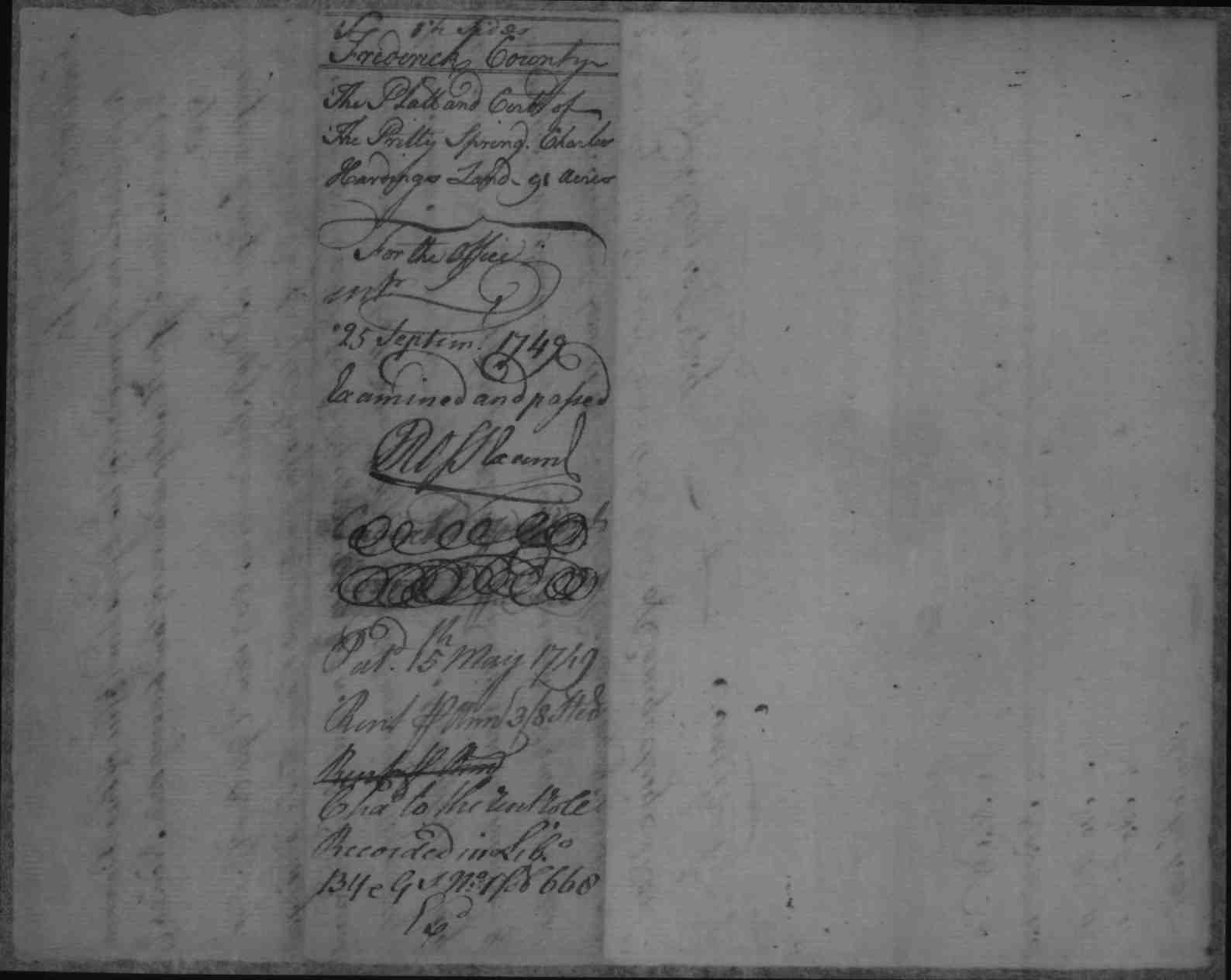
| Frederick Co. MD |
Pretty Spring,
Charles Harding, 91 Acres 1749/05/15 Patented Certificate 3159 Patent Record BY and GS 1, p. 668 Patent Record T I 4, p. 606
|
  |
||
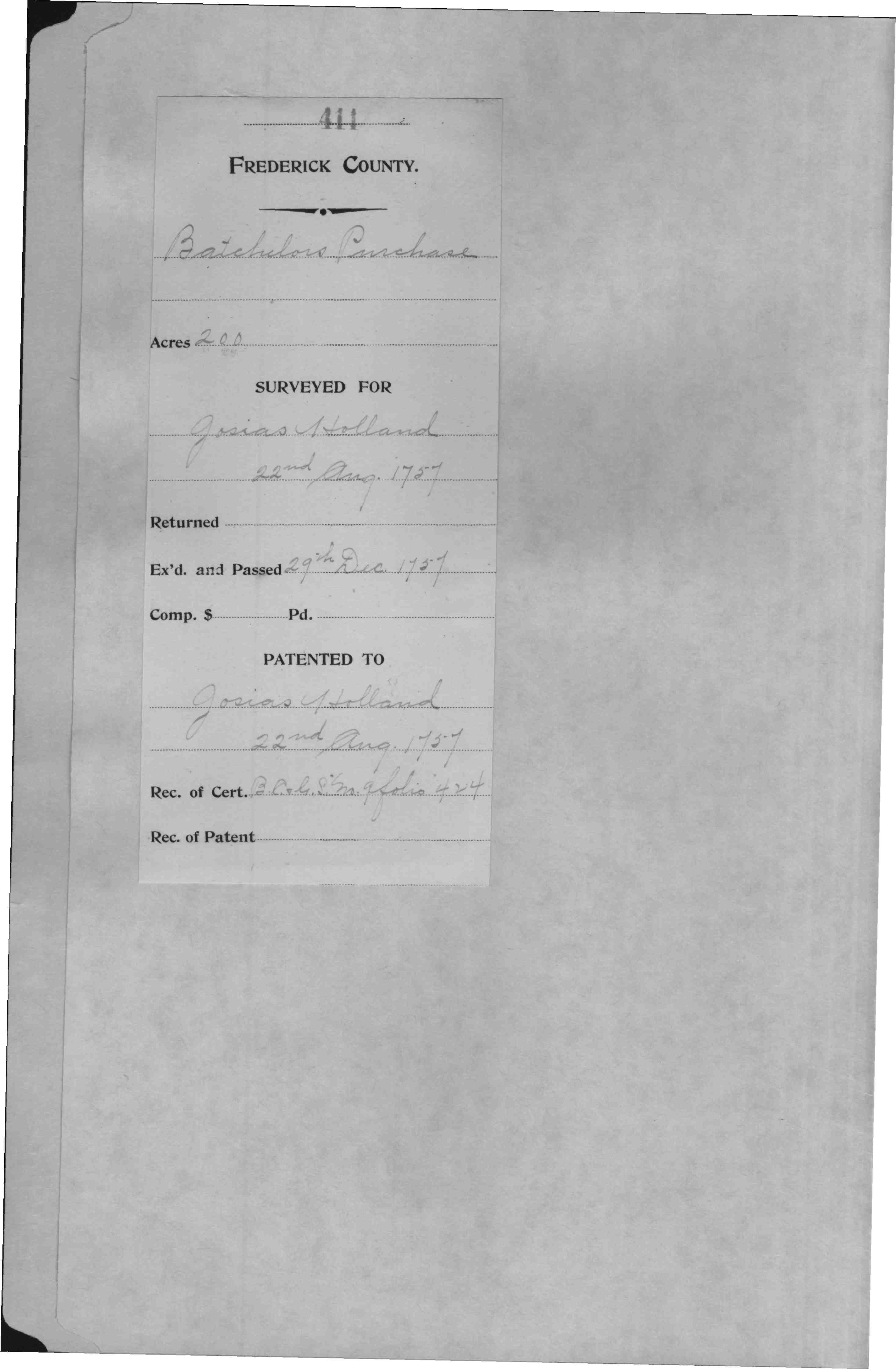
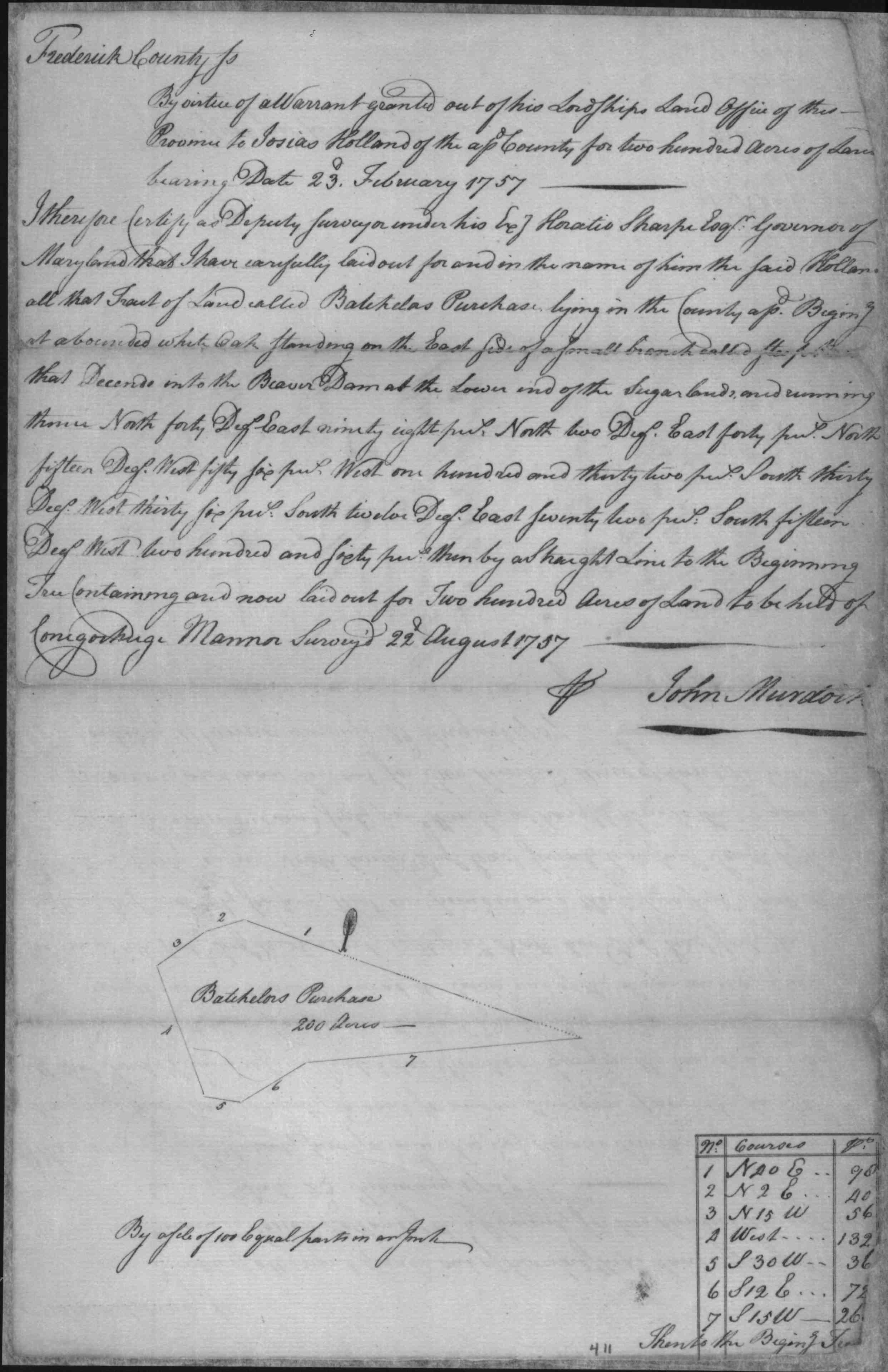
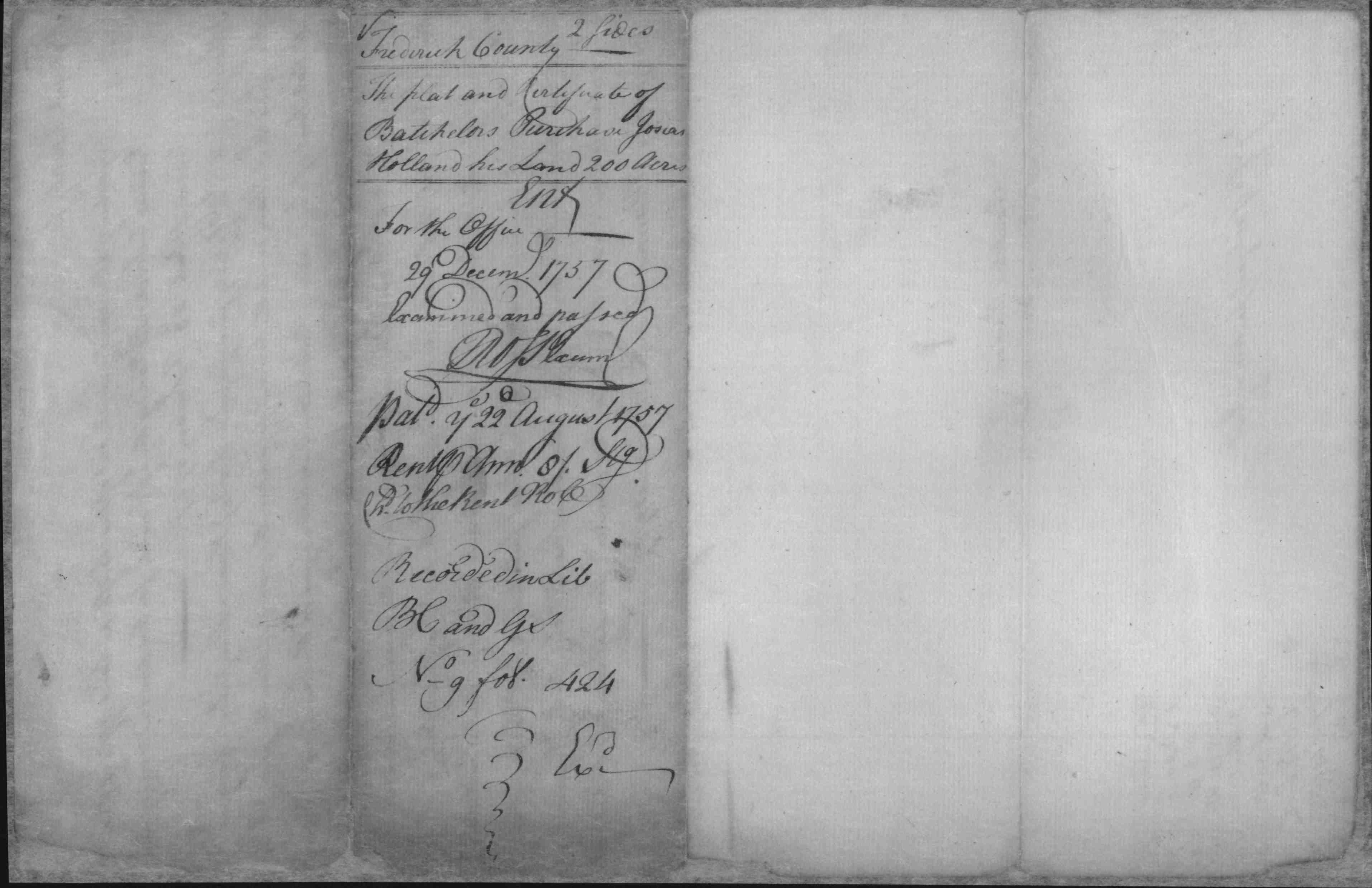
| Batchelors Purchase |
   |
|||
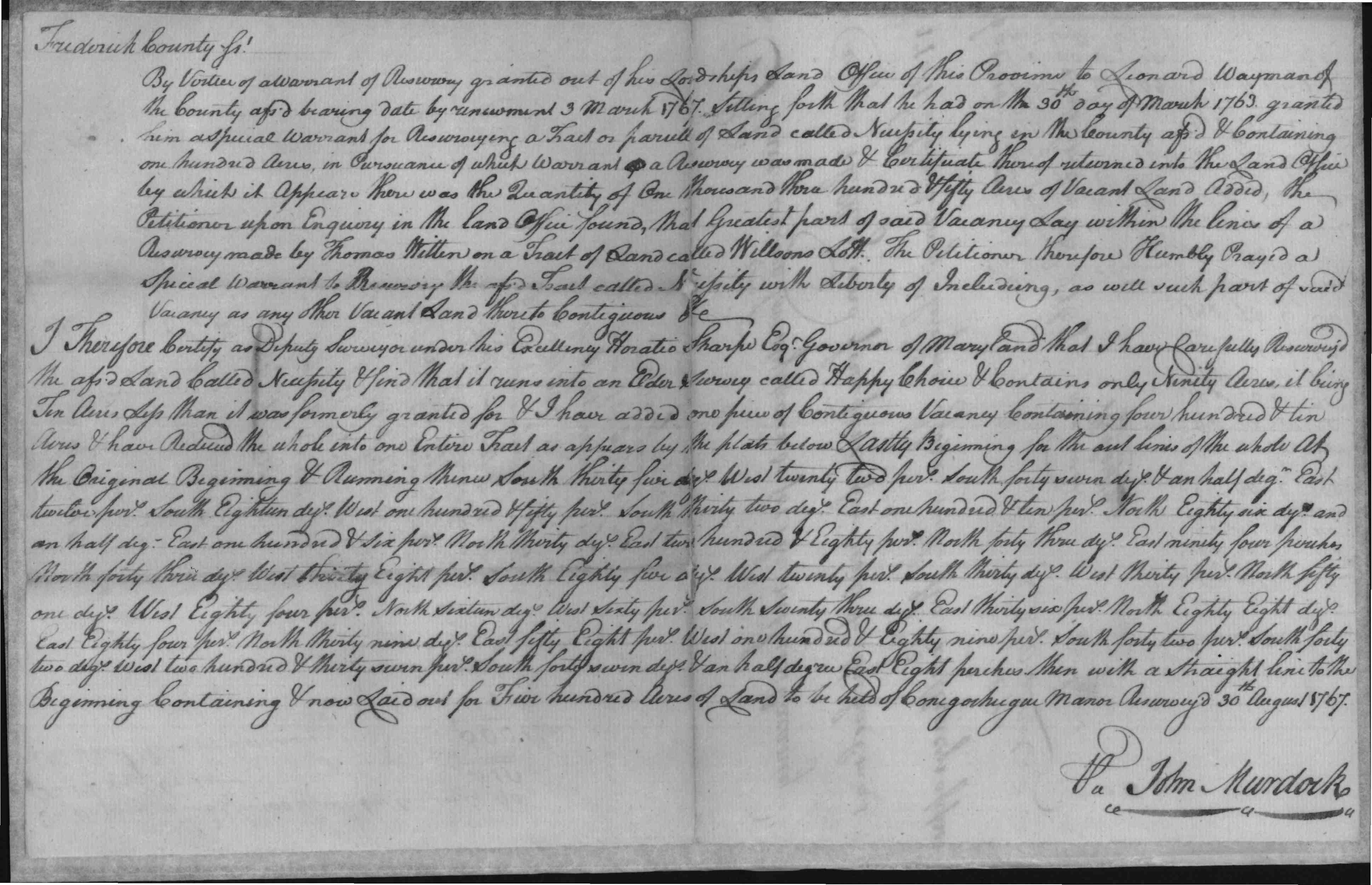
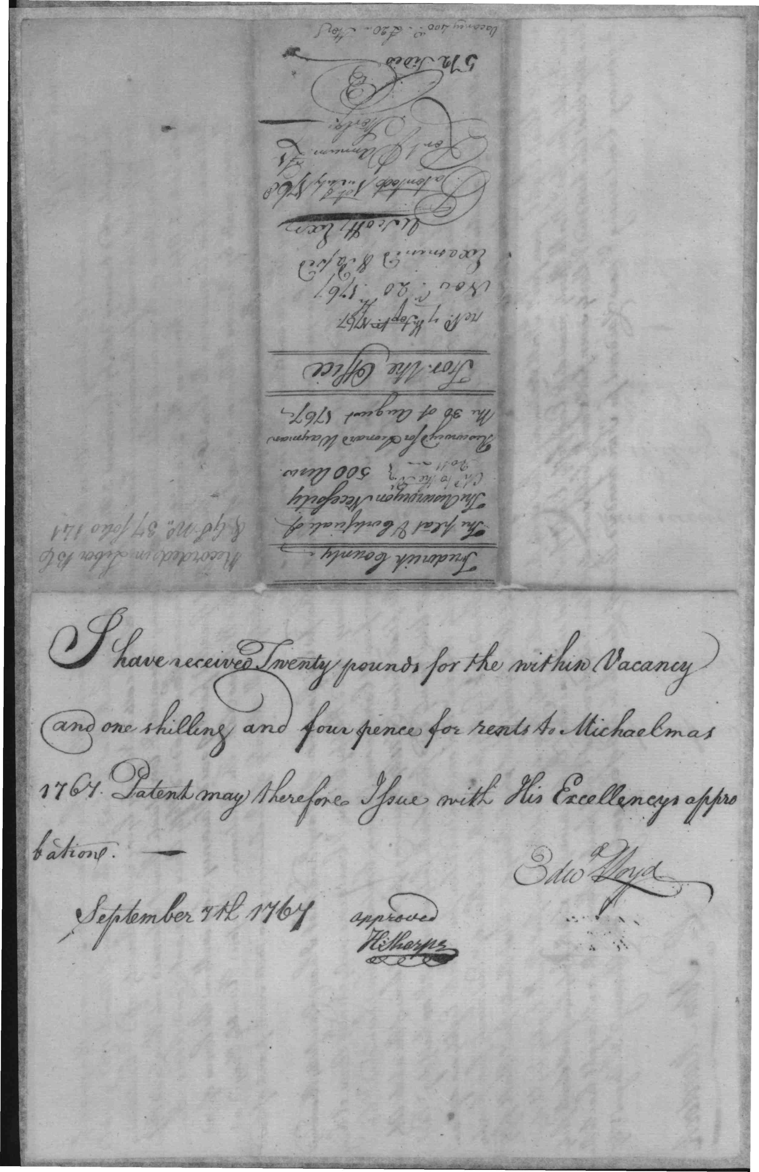
| Resurvey on Necessity |
    |
|||
| Bealls Good Will |
   |
|||
|
1759-1761
|
White, Zachariah |
Resurvey on
Partnership, 301 Acres; Patent Record BC and GS 14, p. 67 Patent Record BC and GS 13, p. 715 1761/03/02 Patented Certificate 3693 |
   |
|
| 1765/08/16 |
William
McClary
|
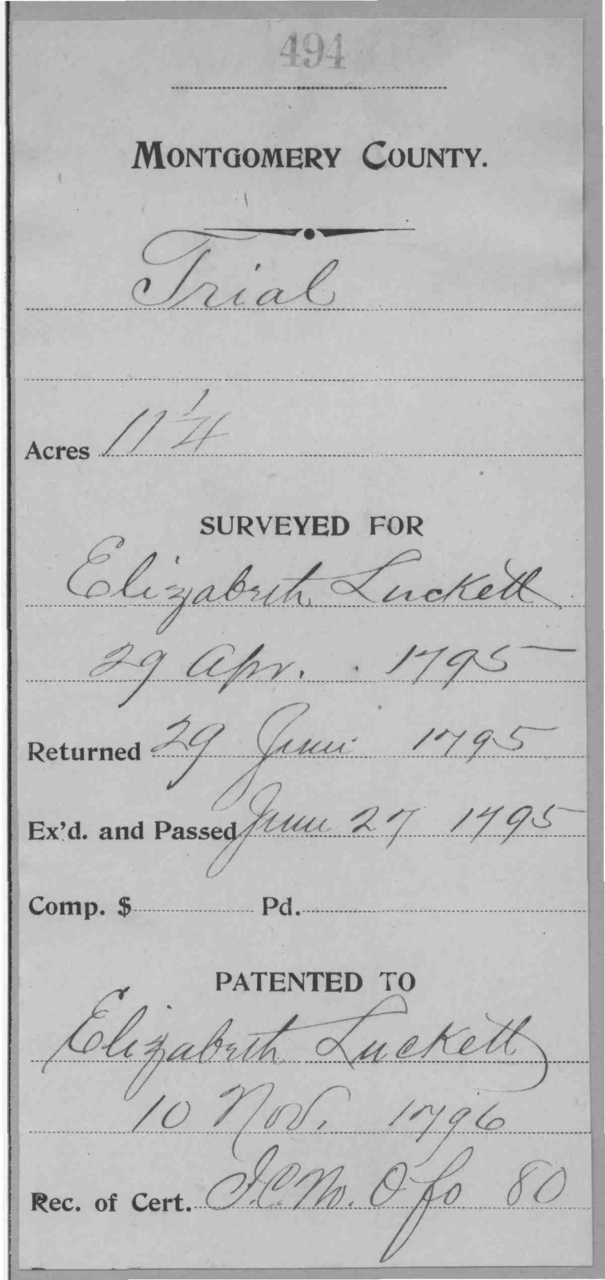
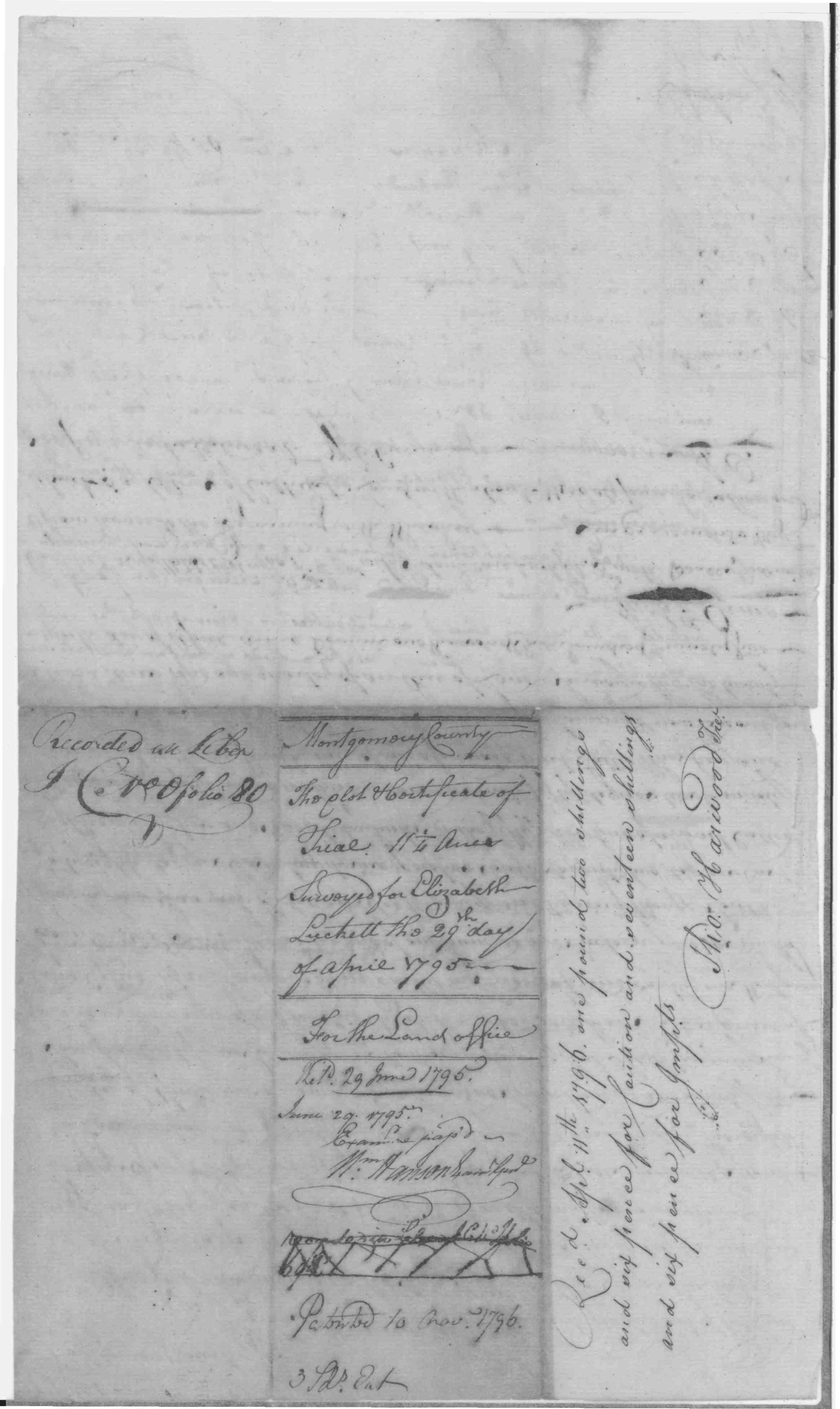
Trial, 5 Acres Patented Certificate 4841 |
   |
|
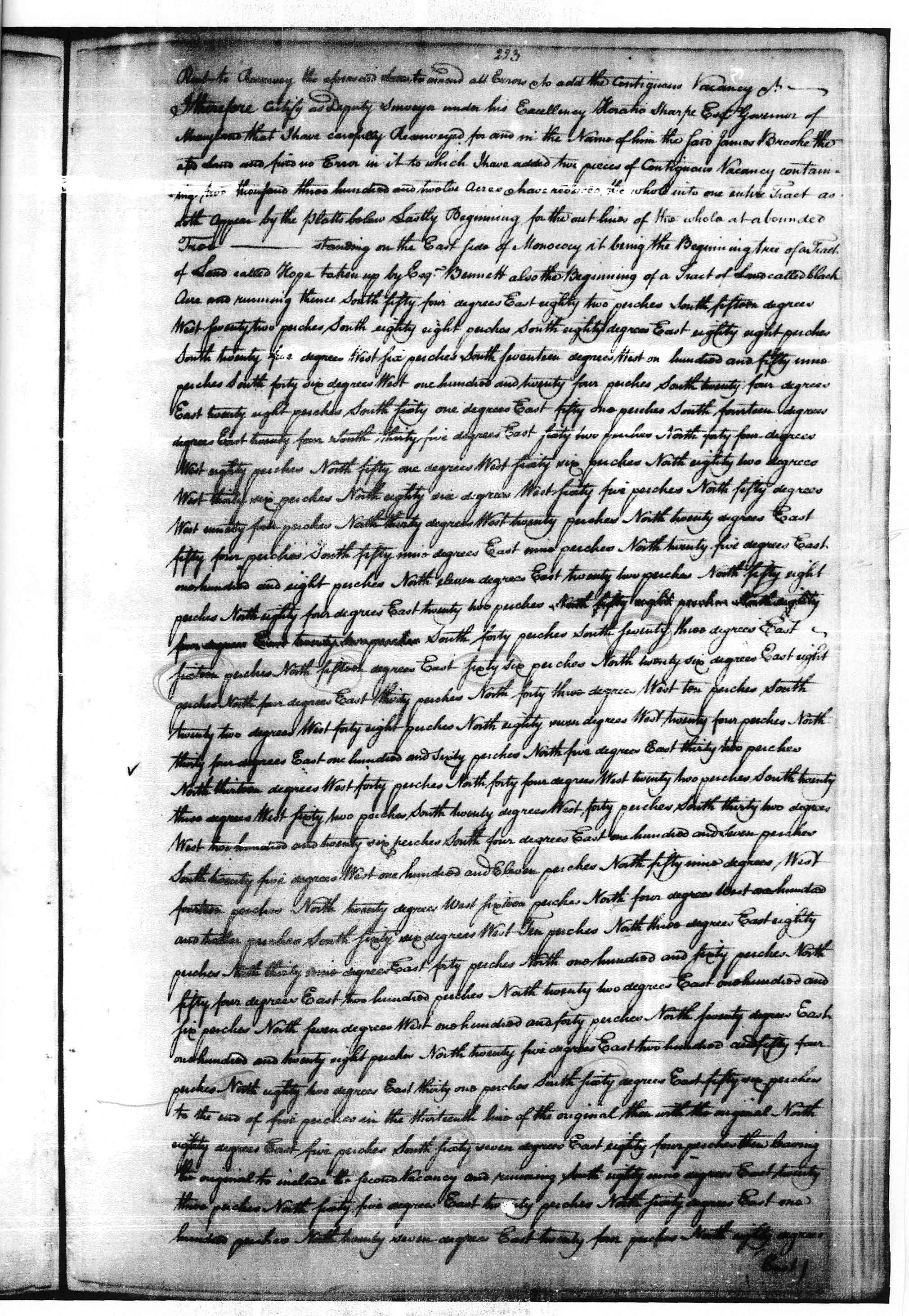
| 1752 |
Brook, James,
Jr. Certificate 2306 3 0
|
Knee Deep, 150
Acres;Patent Record Y and S 7, p. 130 Patent Record BY and GS 3, p. 365 Patented Certificate 2306 |
   |
|
| Montgomery Co., MD | 1795 |
Wayman, Leonard |
Elysian
Fields, 739 1/2 Acres; Patent Record IC K, p. 242
Patent Record IC H, p. 679 Patented Certificate 138 |
 |
| 1768/11/20 | Leonard Hays | Forced Hobsons Choice, , 77 Acres Patented Certificate 1430 |
   |
|
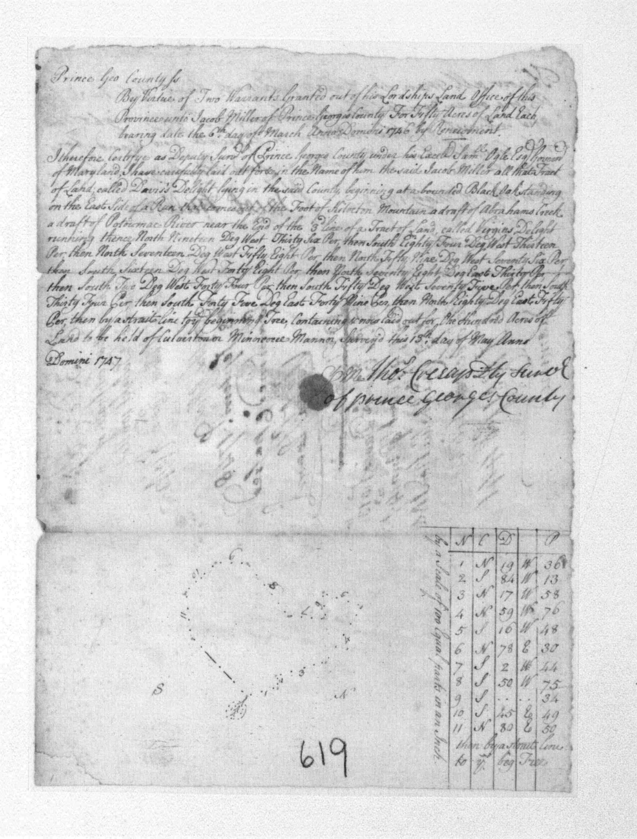
| 1747/05/13 | Davis, Charles |
Davis Delight; 100 Acres Patented Certificate 619 3 Patented Certificate 619 |
   |
|
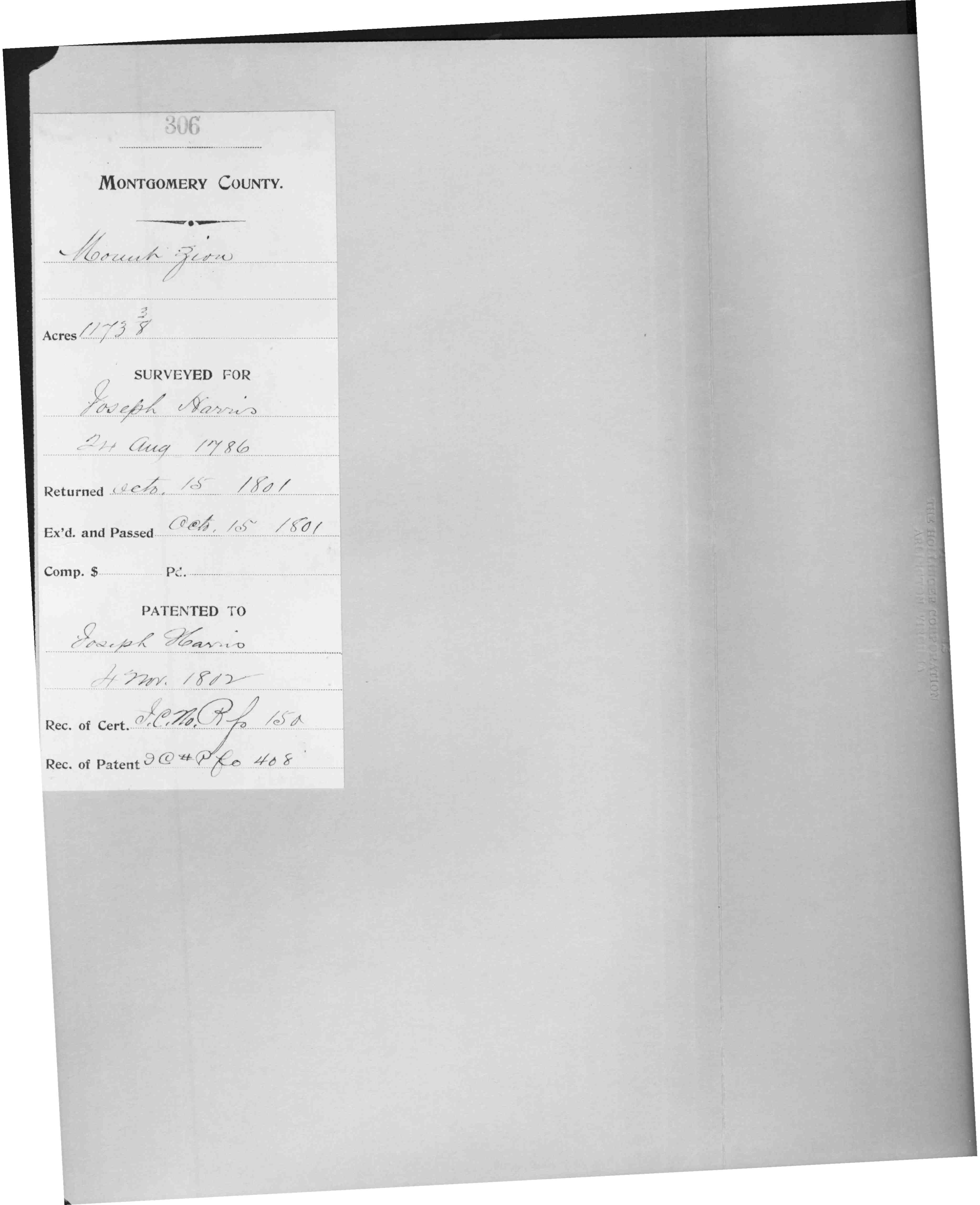
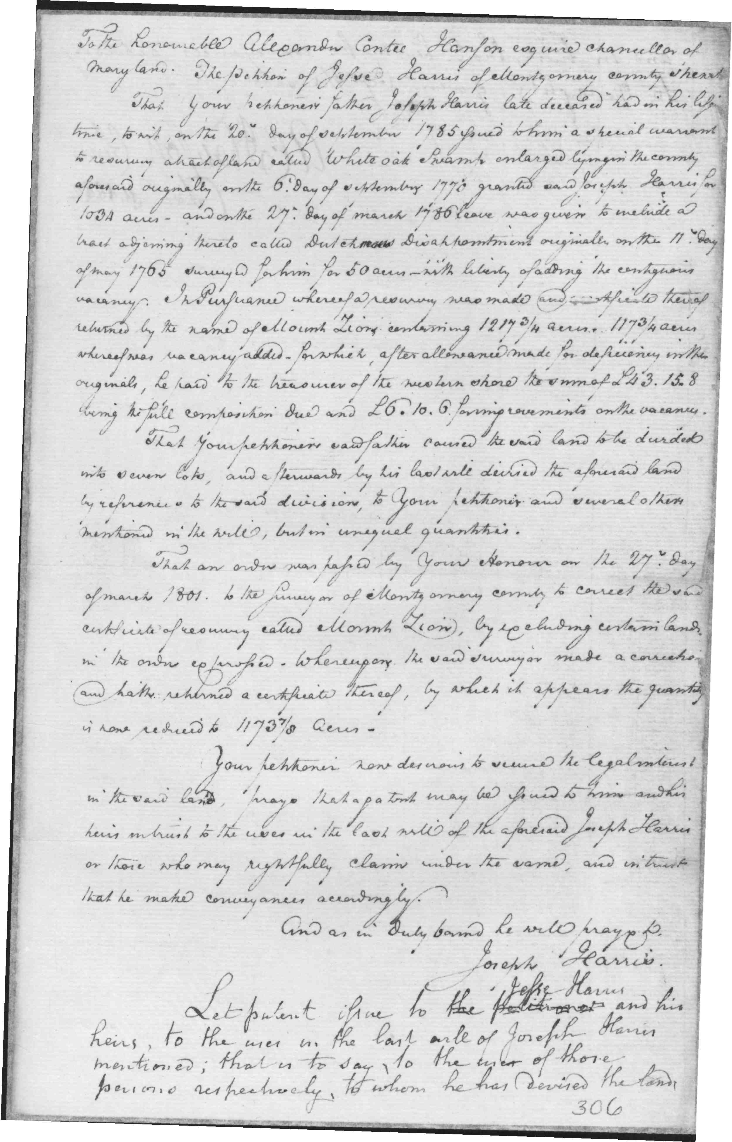
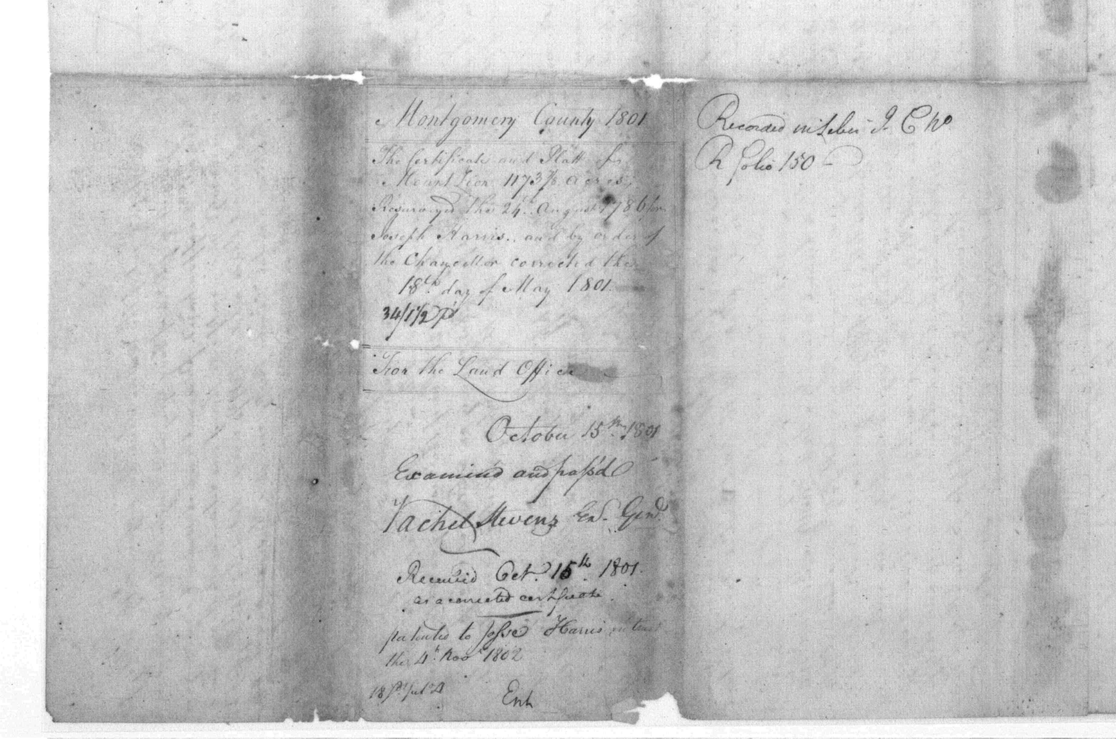
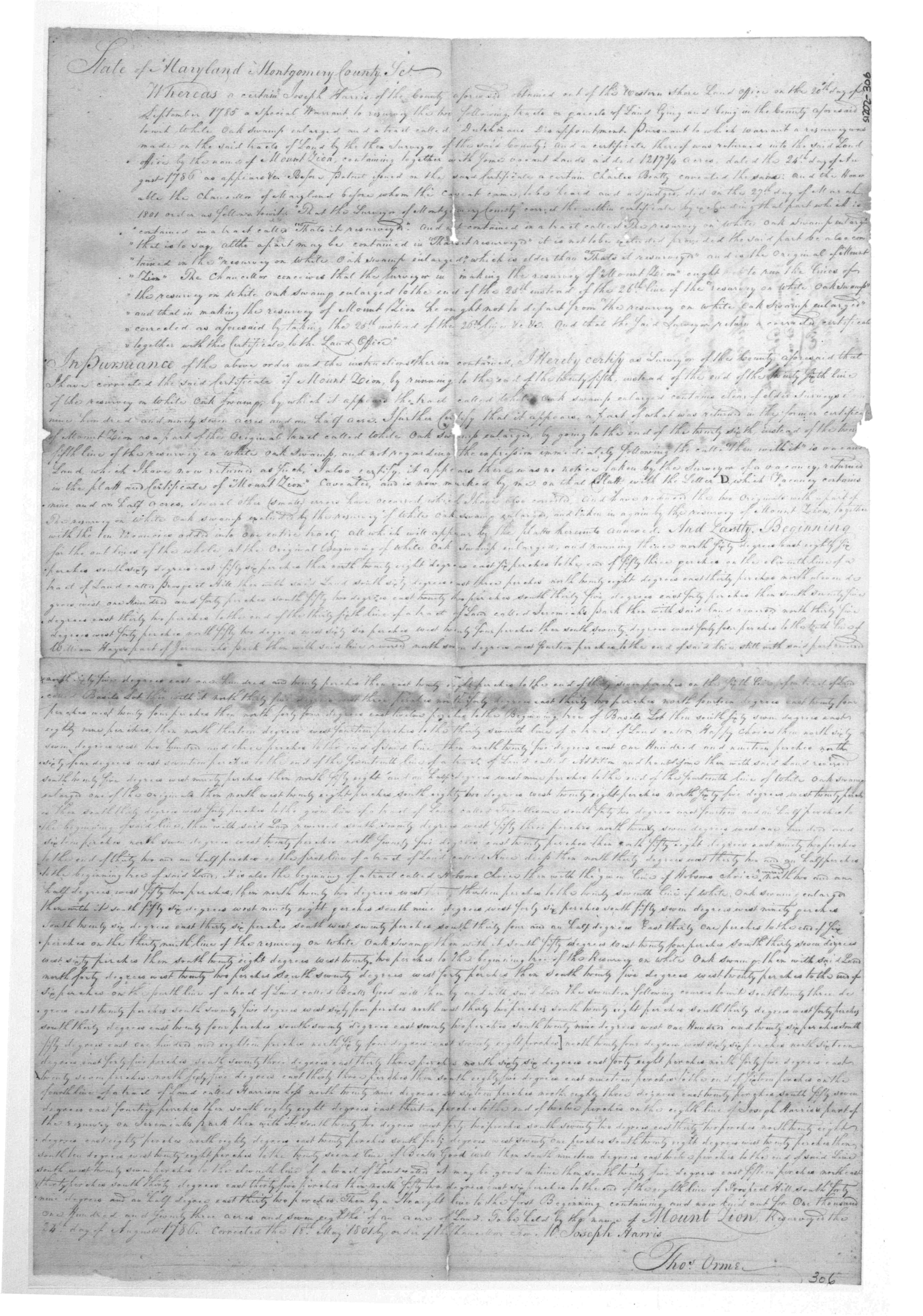
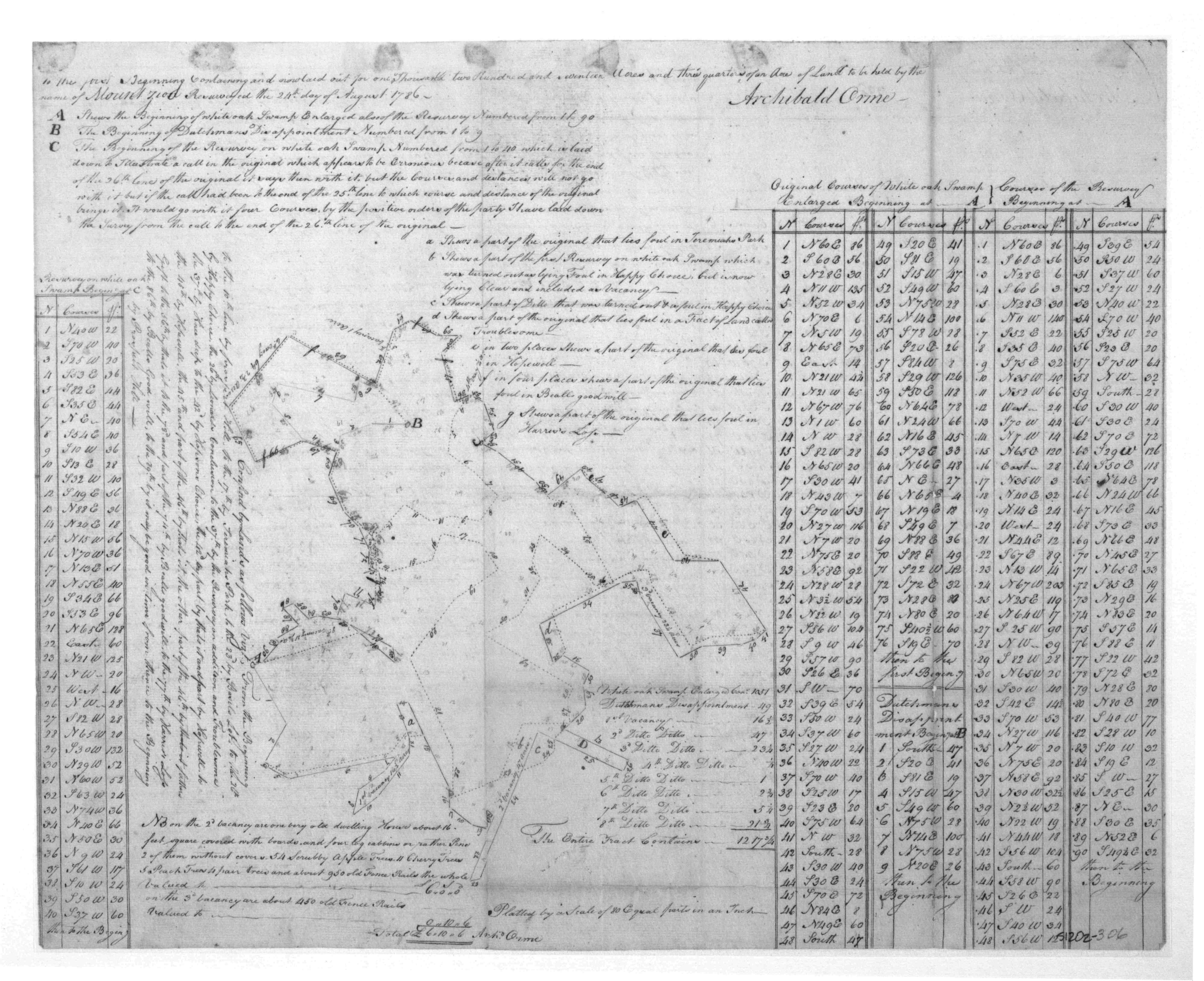
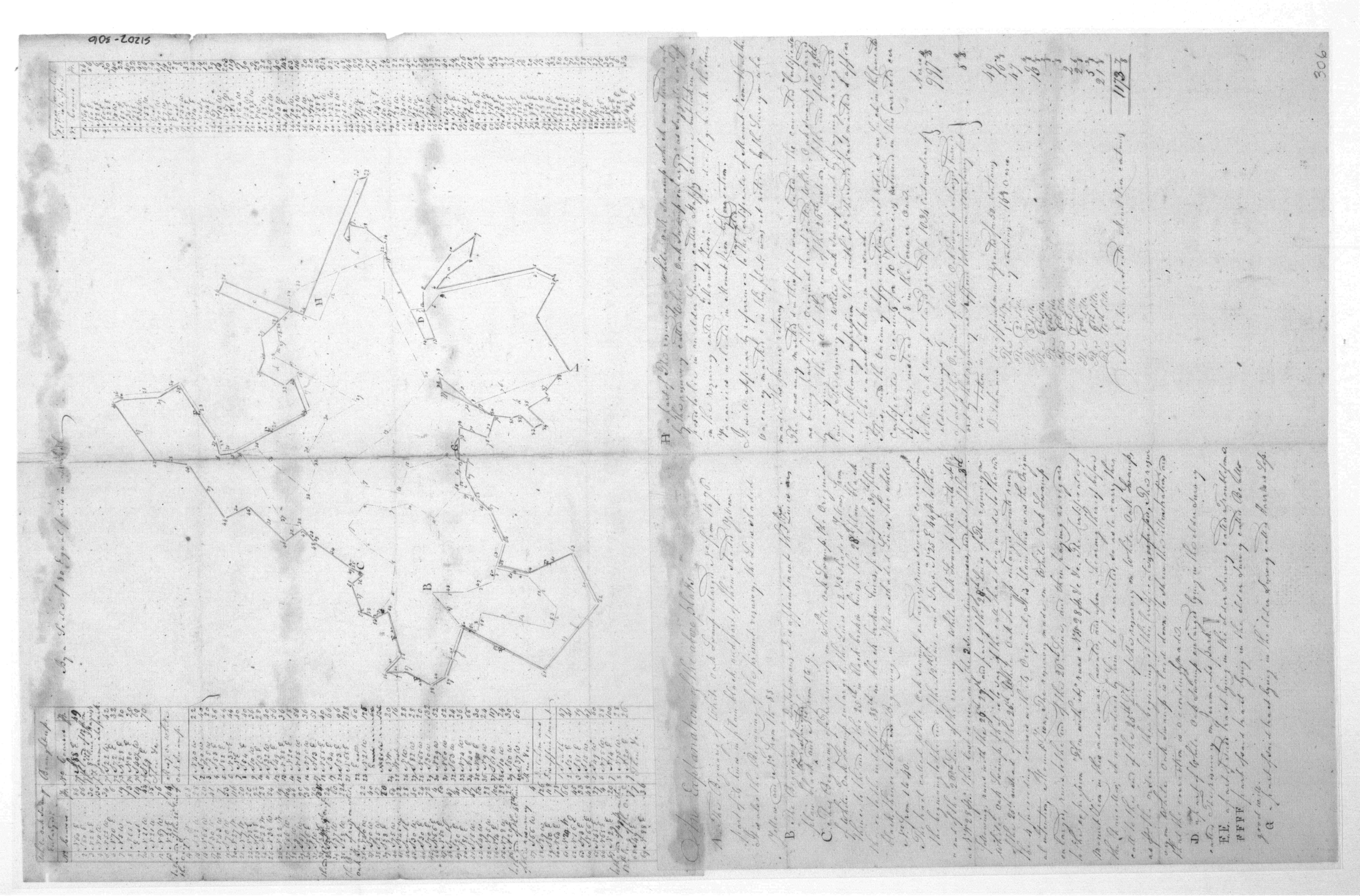
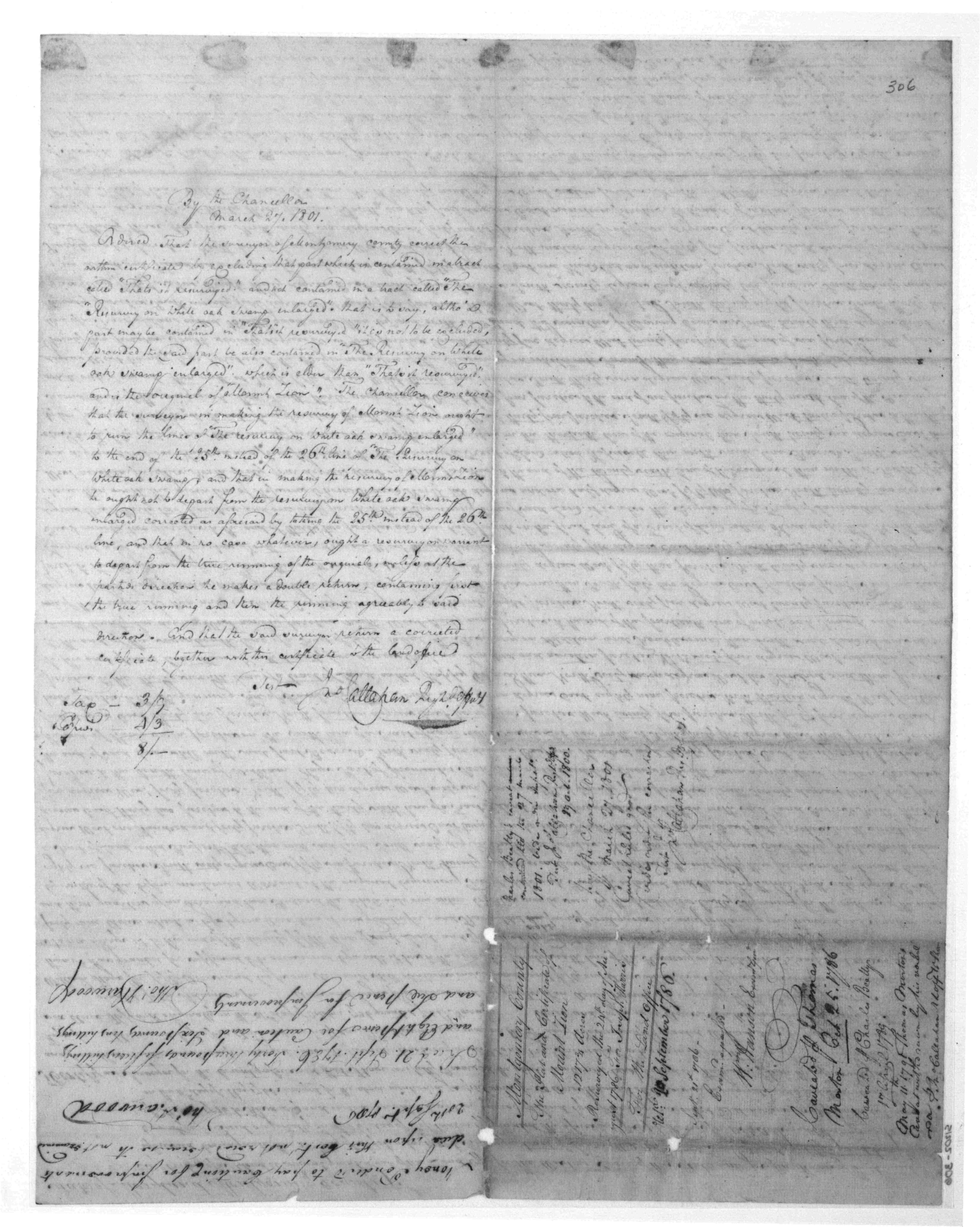
| 1802/11/04 |
Joseph Harris |
Mount Zion; 1173 3/8 Acres Patented Certificate 306 |
          |
|
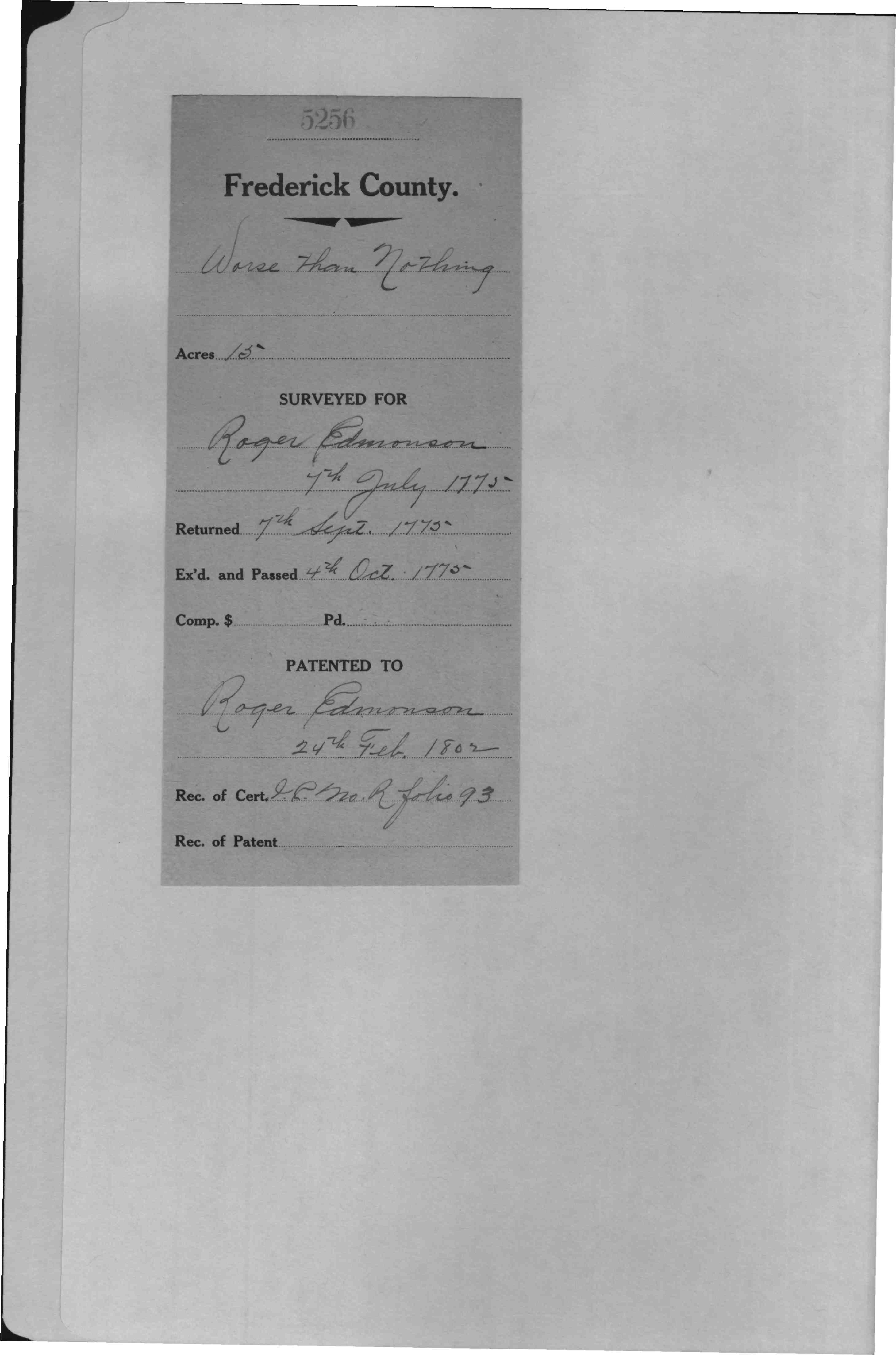
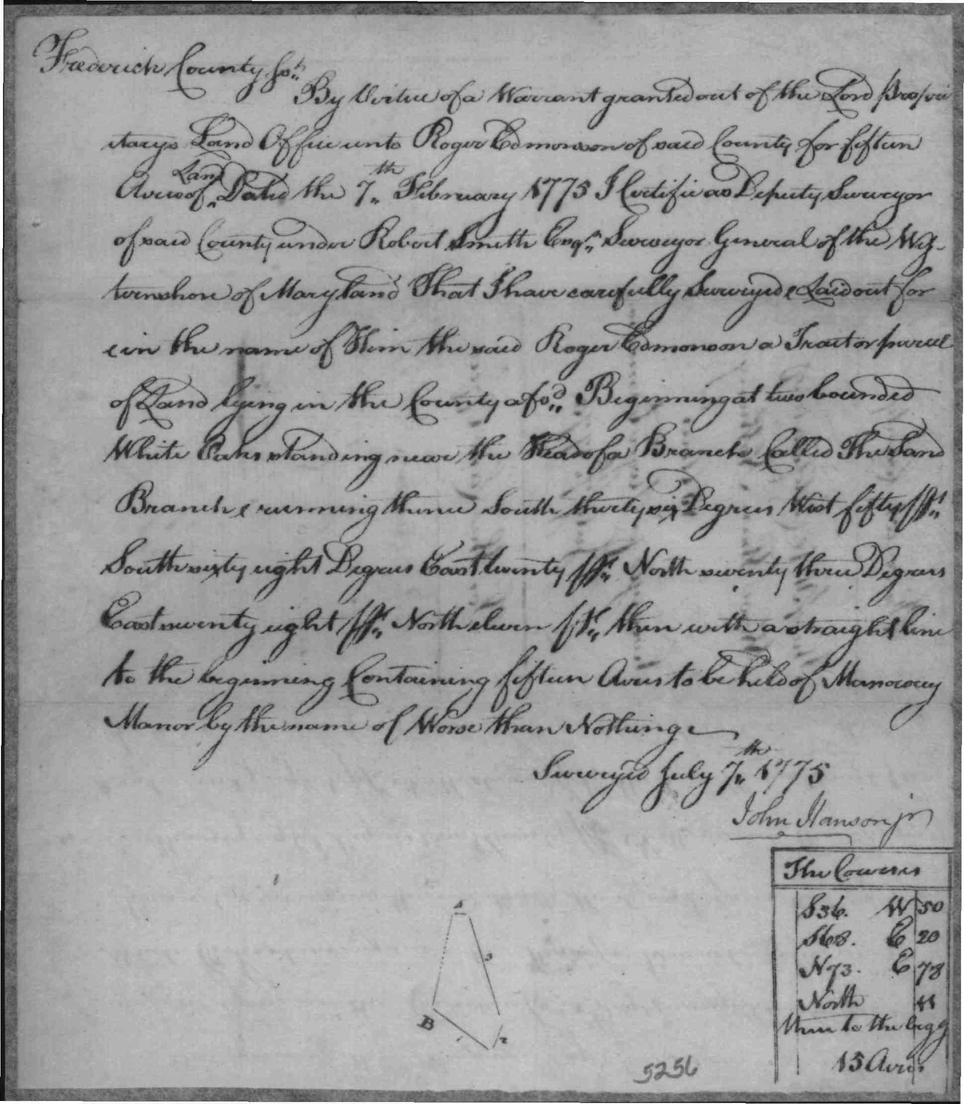
| 1802 | Roger Edmonson |
Worse Than Nothing, 15 Acres; Patent Record IC R, p. 93 Patent Record IC L, p. 711 |
   |


Other Sugarloaf Mountain tracts: Resurvey on Right and Good Reason (Thomas Johnson 1763), Bloomsburg (Bloomsbury--Thomas Johnson), Resurvey on Chargeable (an extension of Black Acre all the way to Greenfield Mills, Orlando Griffith).
More Land Records for:
Maryland Anne Arundel/Calvert Eastern Shore Frederick Harford/Baltimore Montgomery Prince Georges