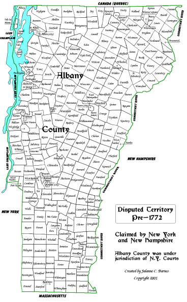
Vermont continues to be disputed territory belonging to New York and New
Hampshire. Vermont is now four counties: Albany, Charlotte, Cumberland
and Gloucester, which are still claimed by New York.
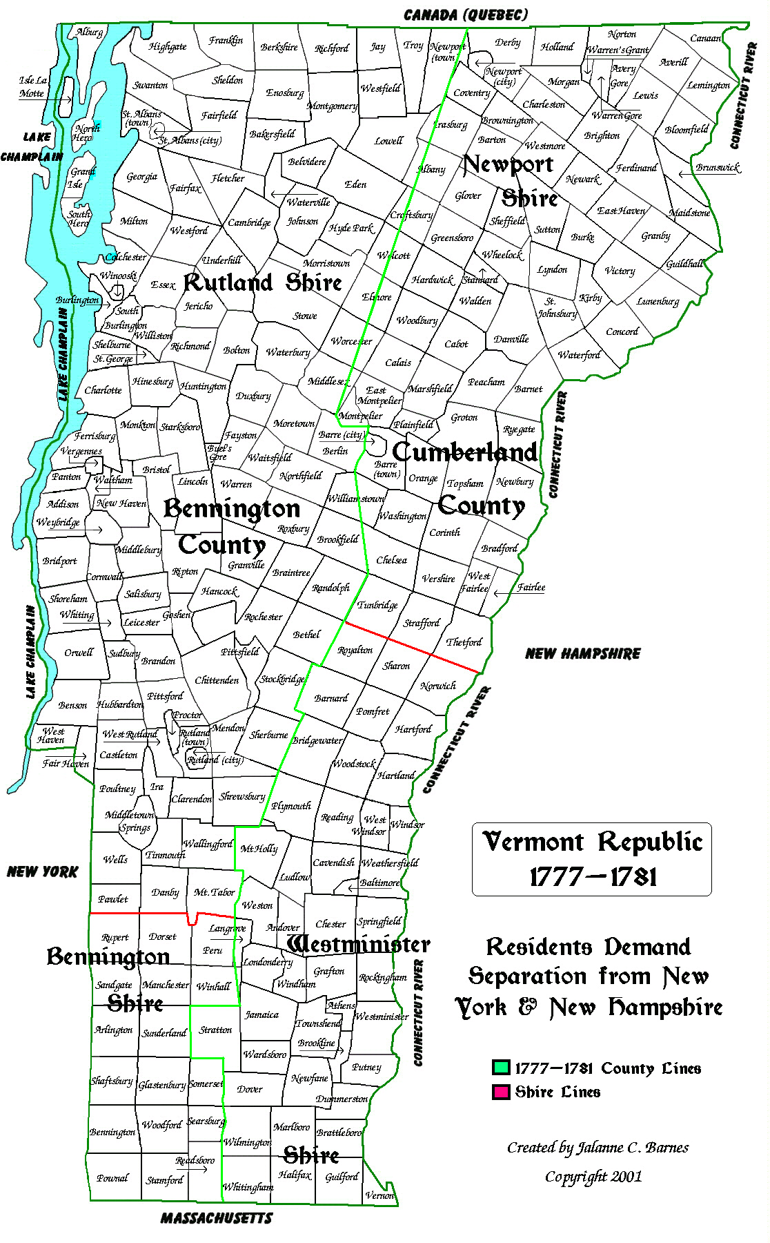
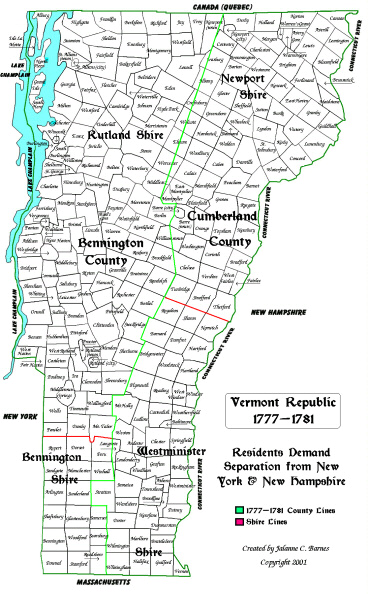
The Republic of Vermont. The residents demand separation from New York
and New Hampshire. Vermont now consists of two counties: Bennington County
(Bennington Shire in the south, Rutland Shire in the north) and Cumberland
County (Westminister Shire in the south, Newport Shire in the north).
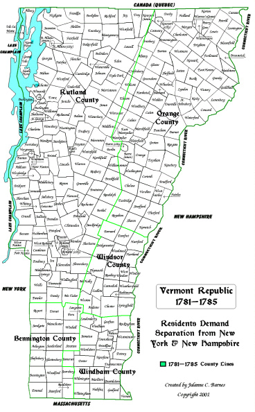
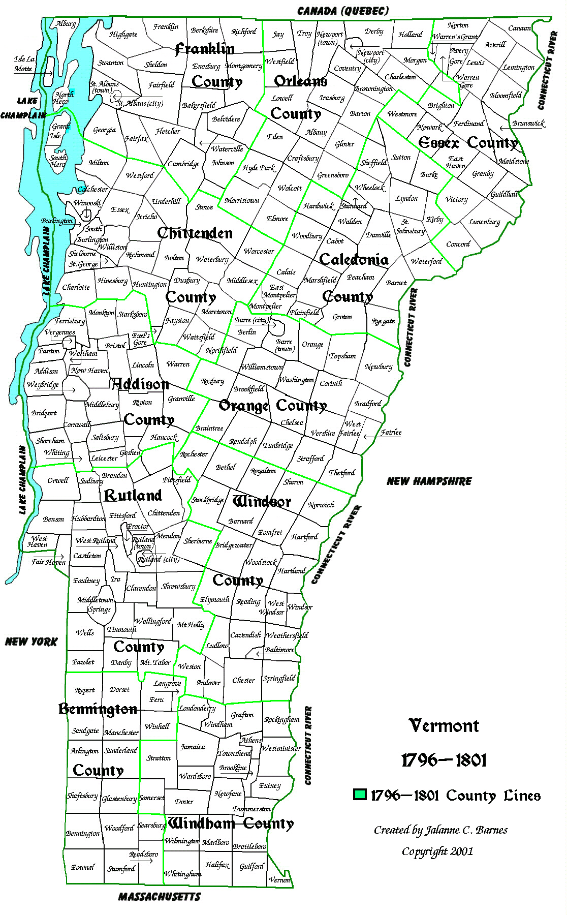
The State of Vermont. Chittenden County is formed. Vermont now has seven
counties: Addison, Bennington, Chittenden, Orange, Rutland, Windham and
Windsor.
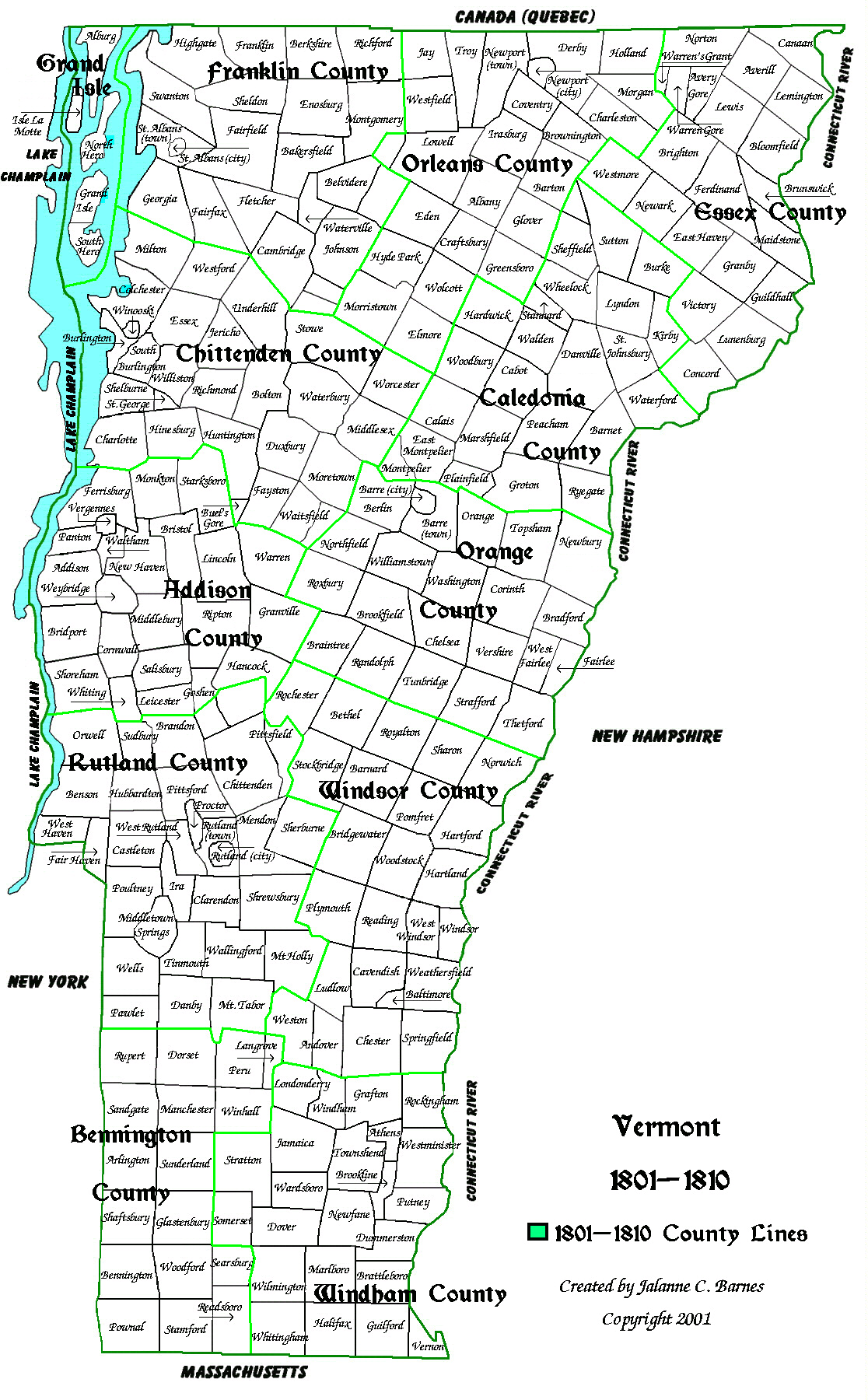
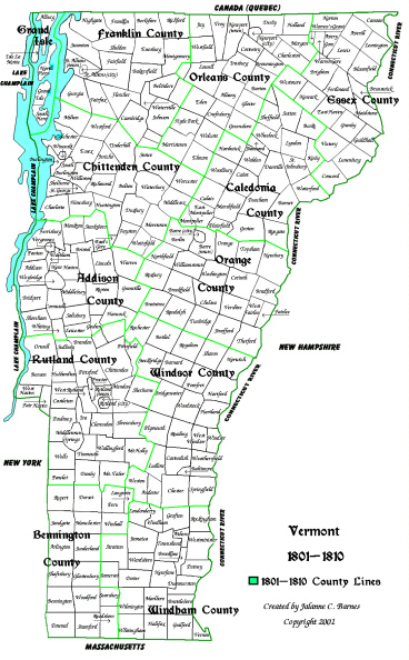
The State of Vermont. Caledonia, Essex, Franklin and Orleans Counties are
formed. Vermont now has eleven counties: Addison, Bennington, Caledonia,
Chittenden, Essex, Franklin, Orange, Orleans, Rutland, Windham and Windsor.
The State of Vermont. Grand Isle County is formed. Vermont now has twelve
counties: Addison, Bennington, Caledonia, Chittenden, Essex, Franklin,
Grand Isle, Orange, Orleans, Rutland, Windham and Windsor.
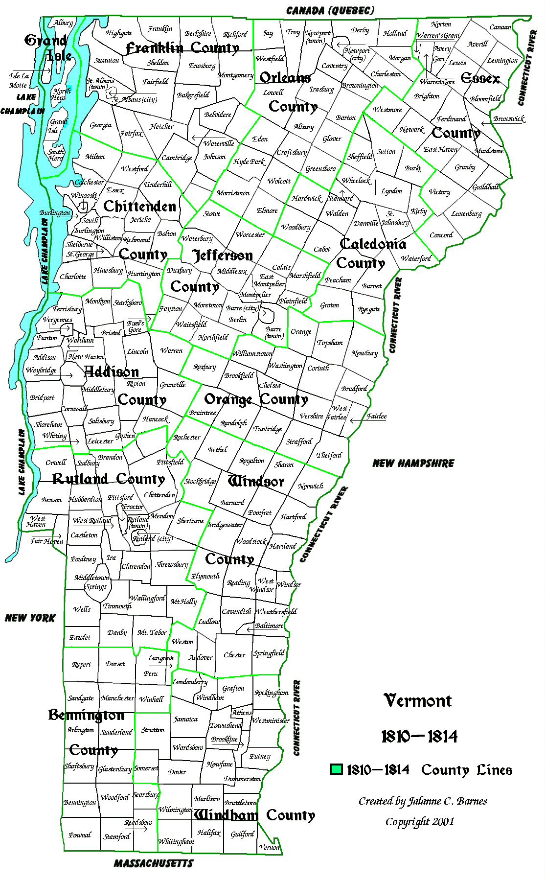
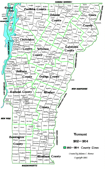
The State of Vermont. Jefferson County is formed. Vermont now has thirteen
counties: Addison, Bennington, Caledonia, Chittenden, Essex, Franklin,
Grand Isle, Jefferson, Orange, Orleans, Rutland, Windham and Windsor.
The State of Vermont. Jefferson becomes Washington County. Vermont
still has thirteen counties: Addison, Bennington, Caledonia, Chittenden,
Essex, Franklin, Grand Isle, Orange, Orleans, Rutland, Washington, Windham
and Windsor.
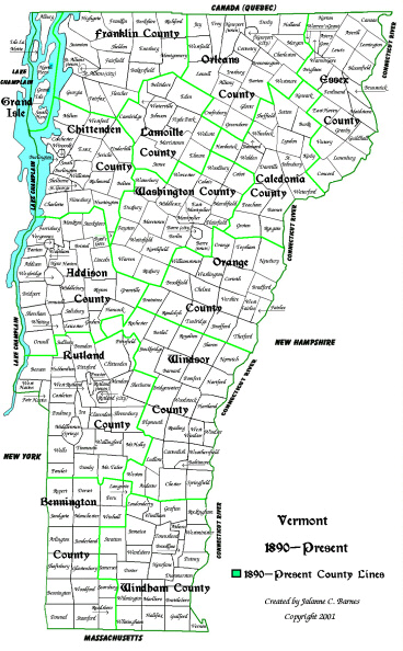
The State of Vermont. Lamoille County is formed. Vermont now has
fourteen counties: Addison, Bennington, Caledonia, Chittenden, Essex, Franklin,
Grand Isle, Lamoille, Orange, Orleans, Rutland, Washington, Windham and
Windsor.
The State of Vermont. Slight changes in county lines. Vermont still has
fourteen counties: Addison, Bennington, Caledonia, Chittenden, Essex, Franklin,
Grand Isle, Lamoille, Orange, Orleans, Rutland, Washington, Windham and
Windsor.
This site is generously hosted by: This Site was created by Jalanne C. Barnes. If
you know about a web site that contains information on Vermont
Genealogy that is not included here or you find
a link that doesn't work, email the URL with a description of the
web site/problem to me at: <[email protected]> and I will make
the changes when I do my next update.


