September 29, 1998 Highway E turns east in Savannah, MO at the school. We followed this road to its end at Highway D, turning north. Just after D turns right (east), we turned on a two lane gravel road, County Road 185, and continued north.
The next road turning left (west) is County Road 190, a one lane gravel road leading into the Happy Holler Wildlife Area. Across the road from Wildlife Area, the wooded area to the northeast where this road turns north into County Road 186 is land (36-60-35) that Reuben GEORGE Jr. and his wife Nancy (MCCOTTER) GEORGE once owned. On February 21 1845, they bought the W half of the NE quarter of section 36 in Nodaway township (28.7 acres) from Jacob ADAMS.
Walnut Farm (click to enlarge)
The Walnut Farm house from the road (Andrew County Road #187) was once owned by William Jesse and Jessie Ann (Colburn) ELLIOTT, and perhaps Jessie's parents, George and Fannie (George) COLBURN, before them. Walnut Farm seems to have been deserted for several years. If there was a wrap-around porch on the house, which faces south, it has fallen down.
Looking south (click to enlarge)
Looking south from the Elliott's Walnut Farm over land Jessie (COLBURN) ELLIOTT's parents had once owned. The land on the west side of County Road 186 (25-60-34) was owned by John R. COLBURN until 1865, when he sold it to his son George and Fanny (GEORGE) COLBURN. This was the east half of the southwest and the east half of the northwest of the section, in Nodaway township.
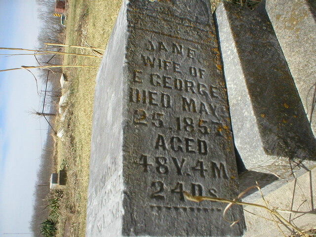
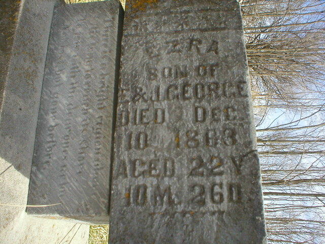
The small McGlothlin Cemetery is a few miles north of Walnut Farm. This is where Jessie's grandfather, Enoch GEORGE, and some of his family are buried. This picture was taken from the south. The tall stone to the right is for Emma Kate George ASHLEY, who died in 1893. The stone for Enoch, her father, is several feet farther north, and pictured below.
McGlothlin Cemetery (click to enlarge)
McGlothlin Cemetery (click to enlarge)
Looking at McGlothlin Cemetery from the west on the road (Andrew County Road 182). The tall stone in the back is for someone in the Hobson family, and can also be seen from the previous cemetery picture.
This is what is left of Enoch George's tombstone. Three parts are piled on top of each other. When we visited before, several years ago, you could tell that cattle had gotten among the stones and knocked them over. Now (September 1998), the cemetery is fenced in to prevent that, and someone is mowing the open stretches between stones.
Enoch George's grave (click to enlarge)
NOTE from 2005: The Andrew County Tombstone Project members have taken photos (click to enlarge them) of McGloghlin Cemetery tombstones, including those for