MISCELLANEOUS:
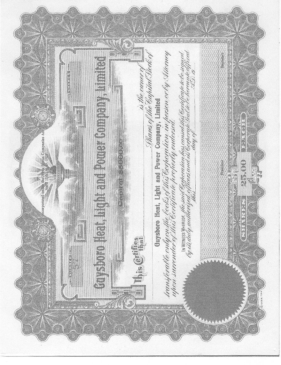
The Guysborough Heat, Light and Power Company
Stock Certificate
VILLAGES:
*Guysborough**Cook's Cove*
*Isaac's Harbour and Goldboro*
Many of the place names of Guysborough County are the original names used by the Mi'kmaq people and many others were dropped for French or English names.
The founding of the settlement dates from 1636 when Nicholas Denys, a French trader established a fishing station here and called it "Chedabouctou", after the Micmac name for the area. By 1683 Fort St.Louis had been built, and Chedabouctou had become a major center in Acadie, boasting a population of one hundred and fifty Acadians. In 1690 New England privateers sacked Fort St.Louis, which diminished strong Acadian presence at Chedabouctou, and by the signing of the treaty of Utrecht in 1713, Port Royal, Minas and Canso were the main settlements with Acadian presence. The Acadians continued to lived in the area farming,trading,and boat building until after the Expulsion in 1755.
English presence at Chedabucto started by the 1760's with the arrival of the "Nine Old Settlers". Captain Joseph Hadley received a grant of land at Chedabucto for his role in the Seige of Louisburg. Others who came from New England including the Callahans, Cooks, Godfreys, Hortons,Ingersols, Pearts, and Tobys settled on a piece of land at the head of Chedabucto Bay bordered on one side by Cook's Cove and on the other by Ingersol's Cove. To this settlement they gave the name Milford and to the harbour just inside Hadley's beach the name Milford Haven was given. Today it is known as Guysborough Harbour but the river flowing from the Intervale is still called the Milford Haven River.
The largest group of settlers came at the end of the American Revolution. Lands were granted to soldiers of disbanded regiments and to settlers from former American colonies who had remained loyal to the British crown. These loyalists both black and white are the ancestors of many of the residents in the county today. These groups included The Duke of Cumberland's Regiment, The Associated Departments of the Army and Navy, The Sixtieth Regiment, The Hallowell Grant Settlers, and The St. Augustine Loyalists. On the west side of Milfred Haven a town was laid out by the surveyors and many of the loyalists were given a town lot and a country lot. The name Guysborough was given to this settlement in honour of Sir Guy Carleton, commander-in-chief of the British forces in America and the governor general of Canada during the 1780's.
The Black Loyalists arrived with the Associated Departments of
Army and Navy on June 21, 1784. Some were servants of the white Loyalists and some were Free Blacks holding certificates. However, free or not the Black Loyalist was at the bottom of the pecking order for the British land and supplies and many perished during the first winters in their promised land. Despite the unfair distribution system, poor land, few tools, no guns and scant wages, the Black Community at Guysborough rebounded from
around 200 souls in 1786 to over 900 in 1872. These numbers populated settlements in Sunnyville, Birch Town, Cook's Cove, Canso, Country Harbour, Old Guysborough Road, Upper Big Tracadie, Rear Monestary, and along the Tracadie River.
Throughout the 1800's Guysborough developed as an administrative
and service center for the surrounding agricultural and fishing community. The town's fine harbour encouraged the growth of shipping,shipbuilding and lumbering. Merchants from Halifax came and set up business, trading schooner-loads of merchandise, for cured fish and other foods to take back to Halifax in the fall. As late as the 1940's and 50's this practise continued in many of the coastal communities.
Although Guysborough has gone through much change since the turn
of the century, many of the changes were no different than in other areas of the province.
The school system evolved from the one room school house with
a pot- bellied stove, slates, an outhouse and a teacher paid with chickens and yarn, to a modern academy with the latest in telecom, audio/video,internet computer courses and teachers paid with automatic deposits, and retirement pension plans.
Light and power was first provided for by the towns own power
company using a coal fired generator. This system was eventually taken over by the provincial power company and a hydro system built at Dickies Brook.
Although traditional employment opportunities like shipbuilding,
fishing, farming, and lumbering are quickly disapearing, our area may have been blessed with the fact that these were not replaced with smoke stacks and industrial plants. We have one of the cleanest, unspoiled, beautiful areas of the province and recent indications predict that tourism will become a vital factor in the economic well being of Guysborough.
The development of modern highways provided a cheaper and faster
means of transporting freight and people but it also brought an end to the commercial useage of our harbour. Gone are the days when schooners and later the steamer's horn would bring the townsfolk running to the wharf to unload goods from Halifax and Boston or to greet friends and relatives who came to visit for the summer. This romantic period is only seen now in collections of old photographs and in the minds eye of our most senior
residents.

THE ACADIANS OF TOR BAY, GUYSBOROUGH COUNTY, (Larry's River, Charlos Cove and Port Felix):
The Chezzetcook Connection
by Brad Pellerin
Nestled on the shores of Tor Bay, Guysborough County, are three small communities that were first settled by Acadians after the deportation of 1755.
Where did these Acadians come from and why would they have settled in this area of Nova Scotia so far remote from the other Acadian settlements? The first question is much easier to answer than the last. Originally, these people had settled in the Annapolis Valley and were well established farmers on the rich marshlands of the Bay of Fundy. Then in 1755 the English ordered all Acadians to be deported and their property destroyed. Some of them escaped expulsion by fleeing into the woods, however, they were eventually captured and imprisoned in Halifax where they remained until 1763. Shortly after the Treaty of Paris was signed in 1763, which officially ended the deportation, a number of these Acadians made their to way to the Chezzetcook area.
With the influx of American Loyalists to the area it was feared that the new settlers (the Loyalists) would be given priority to the land in the Chezzetcook. At this point some individuals decided to look elsewhere for land. In the 1770s they petitioned the government in Halifax for lands in what was then called Tor Bay. The names on the first petitions, BOUDREAU, ROI, DAVID, MANNETTE, PETITPAS, PELLERIN, RICHARD, are names that are common to the area today.
As a result of this migration east to the shores of Tor Bay, the 3 small villages of Larry's river, Charlos Cove and Port Felix were formed. Larry's River was named after an Irish moose hunter from Halifax, Larry Keating, who had a log cabin on the east bank of the river. Port Felix was named in honour of a Belgian priest, Felix Van Blerk, who had served the parishioners during the 1860s. It had originally been named Havre M�lasse. It got this name from the fact the early settlers had found a large barrel molasses of on the shore of the harbour, undoubtedly lost by a passing ship. Charlos Cove was named after one of the original settlers, Charles Richard.
Why did they choose the remote area of Tor Bay? This remains a difficult question. One can only speculate. It is possible that when the Acadians finally decided to move from Chezzetcook the choices were probably getting limited. Other Acadians had already established themselves in the northern part of the province, in the region of Cheticamp and Ile Madame and to the south in Digby and Yarmouth counties. And by the early 1770s Acadians had already settled in Pomquet, Havre Boucher and Tracadie.
Exactly how many came is difficult to determine. In 1815, Monseigneur Plessis, bishop of Qu�bec, made a pastoral visit to the area. On July 11, 1815, he wrote in his diary, " About 8 to 10 leagues south of Cape Canso are located 19 catholic Acadian families, 7 in a port named by themselves as Havre M�lasse and 12 in a neighbouring area known as Torbay." In his entry the next day, Bishop Plessis indicates that he and he and 2 other priests administered the sacraments to about 30 people. It is safe to say that by 1815 there must have been about 50 Acadians living along these shores.
Bishop Plessis urged the group to move from the area and join the Acadians who had settled in Arichat. He suggested that they would not be as isolated there and they would have the services of a priest at all times. However, for most of them, moving again was not an option and so they stayed. The BREAUs, the BONINs, and the ROMAINs, who were among the first settlers, must have heeded the bishop for these names do not appear in any census during the 19th century. In 1871 there were close to 700 people of French Acadian origin in the 3 communities. By then they were a large enough number to warrant the services of a full time priest.
Preserving a culture within a larger, more dominant one, is not an easy task. Many small Acadian communities in Nova Scotia, including Larry's River, Charlos Cove, and Port Felix have reached a point of no return in the process of assimilation. This is assured when the heritage, culture and language of a people are not passed on to the younger generation. In these 3 villages today you will find Acadians by the name of BOUDREAU, PELLERIN, PETITPAS, DAVID, RICHARD, BELLEFONTAINE, MANNETTE, FOUGERE; all can trace their ancestry to the settlers who came from Chezzetcook in the late 1700s and early 1800s. Unfortunately, family names and a few of the older residents who still speak French are all that remain that is Acadian.
dedicated to the families of the Torbay area,
Port Felix, Larry's River and Charlos Cove
TORBAY SITE
A HISTORICAL SKETCH OF THE VILLAGE OF WHITEHEAD, GUYSBOROUGH COUNTY
by Peggy Feltmate ([email protected])
Whitehead sits on the coast between Port Felix to the west and Little Dover and Canso town to the east, hugging the western shore of double-pronged Whitehaven (or White Head) Harbour - exceptionally deep-watered and large enough to shelter a whole navy, as Guysborough historian A.C. JOST remarked. The east side of the harbour is the now-abandoned site of the village of Yankee Cove.
Surf crashes on white granite headland marking the eastern extremity of Tor Bay. The French c.1699 called it Tete Blanche and the English continued calling it White Head. From 1655 until the 1770's, the harbour was called Martingo, its deep fog-bound indentations well-suited to smuggling and piracy. Circa 1779, J.F.W. DES BARRES surveyed it, calling it Whitehaven on one map, and writing "A Sketch of Whitehead Harbour". He mentions that the wood on the east side was burned by the French and Indians in 1744.
The village stretches inland along route 316 and the Northwest Arm of the harbour, narrow as a river; villagers located there are said to live "Up the River" in Upper Whitehead.
Whitehead proper is on a branch road off 316, and was also called The Haul-Over, at least as early as 1860. Here fishermen hauled their boats over a narrow beach between Whitehead and Molasses (now Port Felix) Harbour to avoid the long trip around the headland. In the mid-1800's, residents petitioned for a small canal to be cut across this isthmus, still useable today.
Lower Whitehead is more properly called Lower Whitehaven. The village here is mostly on a small island once reached by bridge, now by causeway and no longer recognizable as an island. The island's official name is Deming Island. It lies at the mouth of the harbour, along with White Head (or "Big") Island with its light house (erected 1854), Three-Top Island (incorrectly called Tree Top on some maps) with its small light, and Doliver's Island (known locally as Charlie's Island). The latter gave its name to Doliver's Cove, and around this lies the lower village sometimes known simply as "down in The Cove".
Around 1800, the Acadian French settlements along Torbay were established, and the English settlement at New Harbour. Whitehead was apparently settled next by Moses CAHOON who came from Queens County c 1818. This was the year that Assistant Surveyor-General of N.S., Anthony LOCKWOOD, described Whitehaven thus:
"The lands around are hideously barren, appearing the resort only of crows, eagles and monsters...The fishermen resort hither from Arachat (sic) and the western extremity of the Province, during the spring and summer, for the purpose of catching mackarel (sic), herring, and gasperaux; the American fishermen and privateers have hitherto used it, both in peace and war. "
Mr and Mrs Thomas MUNRO, Mr and Mrs John MUNRO, and Mr and Mrs Robert SPEARS arrived from Shelburne, Nova Scotia, in 1819. Historian Harriet HART says they built log cabins about eight miles "up the river", and were hospitably received by the local Micmac Indians and the French BOUDROT family of Molasses Harbour next door. Soon Mr and Mrs William DEMING of Shelburne and their four children, and the DOLIVER family (JOST wonders if the latter should be TALIAFERROS) were in residence, giving their names to the islands. Then came Mr COFFIN, and Mr McDUFF from Tusket, and the TRAVERS family. Interestingly, E. CROWELL's History of Barrington Township (Shelburne Country) mentions that in 1806 Deborah COFFIN, daughter of Tristram, married a DeMINGS and the family eventually moved to Whitehead.
In the 1830s, John FELTMATE, his wife Elizabeth (DEICKHOFF) and 6 children arrived, moving from the south shore of nearby Chedabucto Bay. John's father had been Frederick FELTMATE, late of the South Carolina Royalists, arriving at Country Harbour April 1784, removing to the Chedabucto shore c.1811
In the 1850s a postal way office, a customs house and several ice houses were established. Ice was cut from the local lakes. By the 1860s, the census and the A.F.CHURCH map provides the following surnames of residents in Whitehead, additional to those mentioned above: the CASEY family who once lived at Raspberry Cove just down the coast, CONWAY, CROFT, DIGGDON, DILLON, FITZGERALD, FRASER, perhaps GAMMON (Gammon's Ledge is just offshore), GEORGE (many descendants say the name was originally USEL - research suggests there may be some connection to the name SCELES - but was changed to GEORGE!), HAINES/HAYNE, HAWBOLT, HEFFERNAN, HUSHER, perhaps MARSHALL (giving the name to Marshall Cove), McDONALD, McKENZIE, PRICE (who gave their name to an island), SNOW, ULOTH, WHALEN. Across the Harbour in Yankee Cove lived Frances (Frank) SELFF of Portuguese origin, William RHYNOLD, and William PEITZSCH, along with additional FELTMATEs and MUNROEs. Many of these names are extant in the area today.
In spring 1866 in defence against the threatened Fenian Raids, the Third Guysborough Regiment of local militia was raised and Company No. 3 served in Whitehead.
In 1868, blacksmith Thomas DUNCAN of Cape Sable Island, Shelburne County, removed to Whitehead with his second wife and "second" family of eight children under the age of 14, (including new-born twins!), his elder son John DUNCAN age 17, and his step-son James Randall NEWELL age 21.The first task on arrival was the baptism of the twins by the Anglican minister Reverend W.E.GELLING in the home of Hugh MUNROE. It is said that Mr and Mrs DUNCAN took in an Indian foster-child as well, who had superb woodland skills - tracking, trapping, hunting - as well as wood-working skills: he helped in the forge, carefully carving the axe-handles.
The first school in Whitehead was built in 1868 at what is known locally as Deep Cove and burned in 1891. A new school was built in 1893 at Ghost Brook, and one that is still standing but unused near the village fire hall. A school was built at Upper Whitehead in 1905.
By 1871, residents had been joined by EHLER, FLYNN, HALEY (who gave their name to an island), McLEOD, and SNIDER. PHALEN and CONRAD were other early village names.
Doubtless the settlers had arrived by boat. Land travel was on mere foot- and horse-paths. Boat travel along this coast was not without its dangers, of course. In the August Gale of 1873 alone, several ships ran aground on the points, islands and ledges around the mouth of the harbour.
Circa 1873, Sidney Jasper GROVER and his 1st wife Mary Elizabeth (HYDE) moved to Whitehead from Cole Harbour, probably to be closer to the fishing grounds. Sidney, with Mary and his 2nd wife Nancy JAMIESON, fathered a dozen children. Two of Sidney's brothers (John James in 1866, and Aaron Isaac in 1869) had married girls from Whitehead, (Hannah MacKENZIE and Lydia DUNCAN respectively), his sister Susan married Whitehead's John MacKENZIE (brother of Hannah), and another brother William E. married Marcella Maria McDUFF of Whitehead in 1876. So Whitehead became well-populated with GROVERs. The Anglican Reverend W.L.CURRIE served the Whitehead district at this time.
A government wharf was constructed in 1875. This was the year that a diptheria epidemic took many lives, particularly in the households of John Henry FELTMATE and William A.PEITZSCH in Yankee Cove. In 1879 the Whitehead residents sent to the Provincial Parliament a "petition from James H. FELTMATE and others asking for a sum of money to open a road from Canso Road to Dolivers Cove Whiteheaven (sic)", a distance of about ten miles (PANS RG 5 Series P Vol 112 No 168). The petition states that:
"the best part of the road in that distance is very inferior and almost impassable to drive a carriage over. Its two miles...about the middle of the settlement were never opened...In these 2 miles travellers will have to follow the beach and bypaths and to wade over 2 creeks at low water and at high water will have to wait until the tide pleases to ebb and the beach is soft in places that teams get stuck that ventures over it. Also the children in this part of the section cannot attend school on account of having to wade over these said creeks."
Although the road was gradually improved, as recently as 1943 the Anglican minister was using a dog team for winter travel.
In the 1880s, money was raised to build a Methodist church in Whitehead. Circa 1888 a school house was created in Yankee Cove, built partly from the fish store of William PEITZSCH. The first school teacher at it was Helen MARTIN of Loch Harbour In 1889, Holy Trinity Anglican Church was built by the villagers, particularly ULOTHs and GROVERS, under the leadership of Rev.W.J.ARNOLD. (The church bell was purchased in 1895 by Rev. T.C. MELLOR for $40.00 raised at a pie sale). The village was bustling. Sidney GROVER, son of Sidney Jasper mentioned above, spoke on tape in 1968 about his childhood in Whitehead. He was born in 1884:
" I've always lived in Whitehead...It was good when I was a boy; I'll tell you, you didn't want to go to a better place to have any sport if you had any sport in you, 'cause there was lots of dances and lots of fun, in any kind, any way. I know when I was a kid you couldn't help havin' a good time because there were sixty-odd sail o'vessels would anchor in there in the spring, seiners. Plenty of money, they didn't mind payin' five or ten dollars for a house to have a dance; some had their own fiddlers and some didn't. Yes I play the fiddle a bit but I never played the fiddle at that time. I played a little bit on the accordion. Once in awhile I played for the dances. Oh well, we used to have good fun, for all, now. I tell you, it don't take a good fiddler for to make you have a good time. Just a common fiddler and you can have all the fun you like. "
The Baptist church at Upper Whitehead was erected in 1887. A Whitehead school photo dated 1890 shows 39 children of the surnames DUNCAN, FELTMATE, GEORGE, GROVER (including young Sidney, quoted above), McDONALD, McDUFF, MUNROE, PRICE, ULOTH, and WELLS. (Teacher Joe MATTHEWSON). There were several fish plants and merchants set up in the harbour, including the lobster-packing plant at Raspberry, eastward along the coast, where the young folk would go by boat to dances. In the 1880s and '90s, steam-boat service was established among the coastal settlements from Guysborough to Halifax. In 1902, the Blamandan, a German ship out of Hamburg bound for New York went aground off Whitehead laden with toys, dishes and musical instruments. Many a household in Whitehead still owns a violin or pretty little cup or bowl from the Blamandan.
The earliest cemetery was on Spears' Hill south of Spears' Lake and now completely overgrown and obliterated. Only two or three headstones remain visible, although oldtimers say the hillside was once white with markers and was used as a landmark from out at sea. Today the tiny Baptist cemetery is still kept and visible at roadside up the river, although the tiny church has been moved away, and the well-kept Anglican and Methodist/United cemeteries are side by side on a hill in the woods opposite Holy Trinity Anglican church.
By 1932, my aunt boasted there were three churches (Holy Trinity Anglican, Grace United, and the tiny Baptist church up the river), seven stores, Custom House office, Telegraph office, and three post offices. Electricity came at this time. There was also a school house in both Whitehead and in Yankee Cove. Deming Island was the site of a military station and barracks during World War II, and a LORAN station for many years following.
In the 1950s the shore was lined with wharves and fish stores or sheds, and landlubbers were awakened at dawn by the growl of the fishing boats heading out of the harbour to sea. The population in 1956 was: Whitehead 98, Upper Whitehead 69, Lower Whitehaven 125. Today the fishing is slow to non-existent, children must bus to New Harbour or Canso for school, the Baptist church has been closed and moved, the fish plants are gone (although replaced now by a scallop factory and a mussel farm), and the villagers must travel to Larry's River to find a post office, and to Port Felix for a small variety store. But to hundreds of descendants, Whitehead is still
"down home".
![]()