 Off-line site accessed via Archive.org. Note: These are not live sites. Off-line site accessed via Archive.org. Note: These are not live sites.
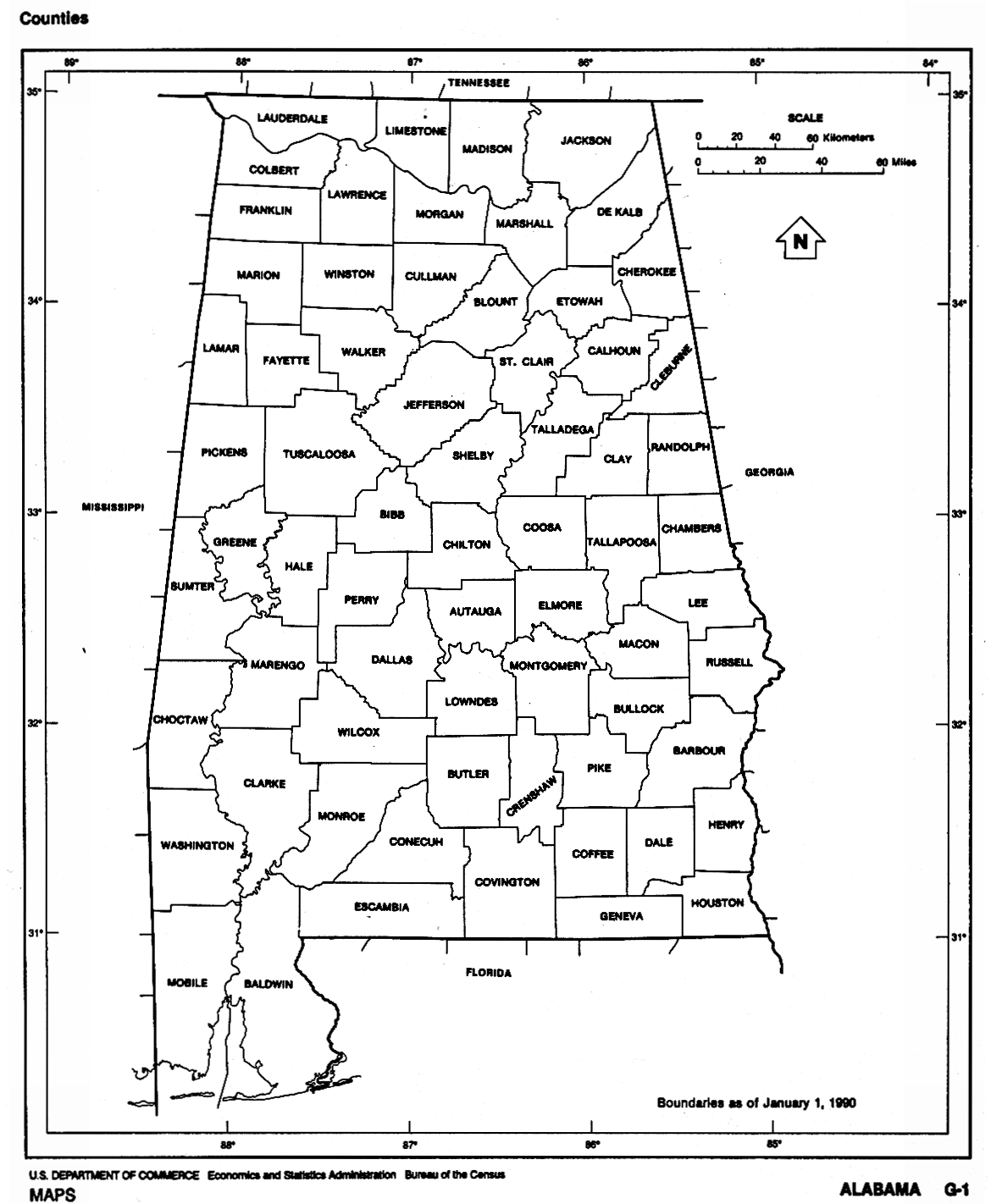
ALABAMA
- Removal of the American Indians - 1830-1835 . Maps.com.
- USGenWeb Alabama Digital Map Library. See 1891 map of Alabama.
- Alabama South of the Old Federal Road. Southeast Alabama.
 From Pam Rietsch's 1895 Atlas site From Pam Rietsch's 1895 Atlas site
- Printed maps available from the Alabama Dept. of Transportation. Excellent inexpensive modern maps.
 From American Memory at Library of Congress: From American Memory at Library of Congress:
- County Formation Maps
from Southeastern Genealogy Online.
 From the Historical Map Index, University of Alabama. From the Historical Map Index, University of Alabama.
Alabama historical maps collections for:
Before 1826,
1826 - 1840,
1841 - 1855,
1856 - 1870,
1871 - 1885,
1886 - 1900,
After 1900
Alabama counties 1820-1890. PDF and JPEG. Great maps.
- Mississippi
Territory 1799 from the ALGenWeb maps page. (Gold Bug).
- Washington Co.
AL USGenWeb page
- MS Territory 1798
- MS Territory 1803
- Alabama 1818 (Great map!)
- From Lowery
Genealogy:
-
Early
Alabama roads, shown on map of modern counties, from a former ALGenWeb
maps page, .
- Alabama
1819, at statehood, from the ALGenWeb maps page. (Gold Bug).
- Elmore Co.
USGenWeb page
AL 1831, 1832, 1866 and 1875 (Gold
Bug).
Click "back" to return here.
 Alabama 1839
[122k] A portion of the large (493K)1839 map of AR, TN, w.NC, SC,
GA, AL, MS, and LA, from
Hargrett Collection, U. of GA. Click "back" to return here.
From Elmore Co.
ALGenWeb maps page. Alabama 1839
[122k] A portion of the large (493K)1839 map of AR, TN, w.NC, SC,
GA, AL, MS, and LA, from
Hargrett Collection, U. of GA. Click "back" to return here.
From Elmore Co.
ALGenWeb maps page.
- Alabama
1860 on the
ALGenWeb maps
page.
- Elmore County AL formed in 1866 from parts
of Montgomery, Autauga, Coosa, and Tallapoosa counties. AniMap note. Another Detailed Elmore map [93k] showing former county lines, and historical locations
- Bradford's
1835 map of MS and AL from The Maps Our
Ancestors Followed A TNGenWeb genealogy history project.
- Chilton Co. USGenWeb page.
AL 1867, 1868 and 1875. (Gold
Bug). Click "back" to return here.
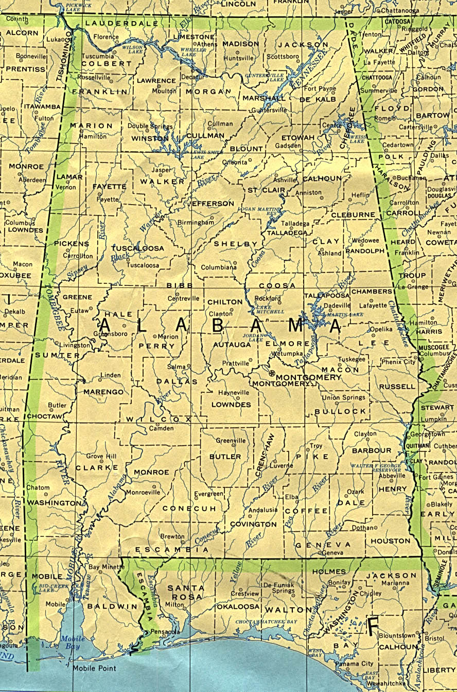
 From Univ. of Texas Library Alabama maps. From Univ. of Texas Library Alabama maps.
- From the University of Alabama
- Historical Changes for Houston and Geneva Counties
|

![Alabama 1839 [122k]](https://sites.rootsweb.com/~alelmore/al1839.jpg)
![Detailed Elmore map [93k]](https://sites.rootsweb.com/~alelmore/tmelmore.gif)