Stonehenge
Click on the thumbnail picture to see the large
version, then click BACK on your browser.
Upon leaving Avebury, we headed in a somewhat southern direction. The roads continue to change and not always for the better. The dual carriage roads are divided with two lanes each directions, and then generally only for a few miles. Near as we could tell, the “dual” signifies the divided concept. Except for the dual carriage areas and the ‘freeways’ around London, most of the roads are two lane that aren’t as good as an average two lane in the states. In fact, US 60 from Phoenix to Wickenburg or the FM roads in Texas are as good if not better than those around here.
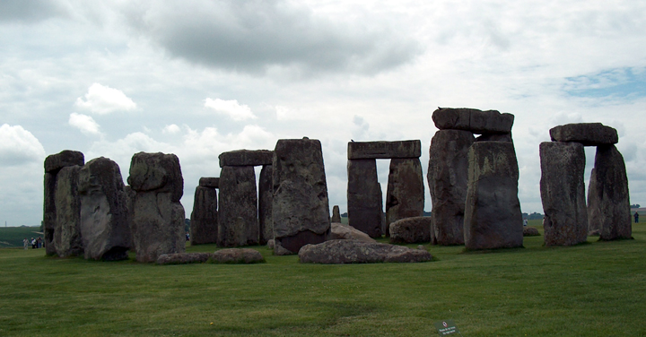
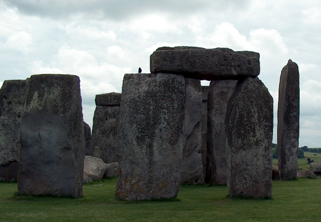
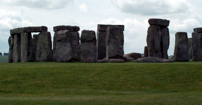
We traveled first to the area known as Stonehenge. Due to the restrictions on how close a person can get to it, we couldn’t touch it but could get within about 30 feet in some areas. The tour kept telling what the different aspects of it were and what it was used for. The truth is they don’t really know. There is no one alive who can tell us what it’s purpose was, and there is no real written record. They do believe it may have been used for a study of the stars, the seasons, and to help in determining the time or duration of a year like a calendar. None the less, we got several good pictures of it. GPS location 51-10-49 N by 001-49-44 W.
![]()

![]()
![]()
![]()
![]()
Danebury Hill Fort
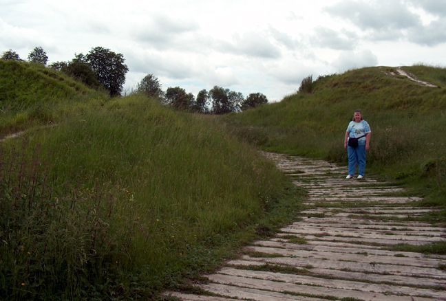
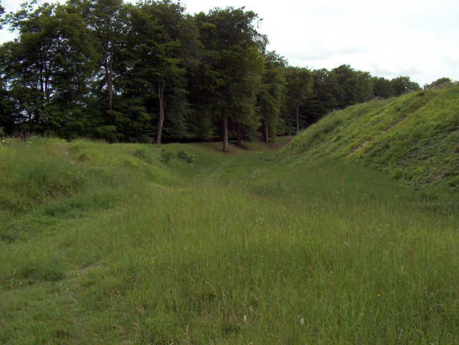
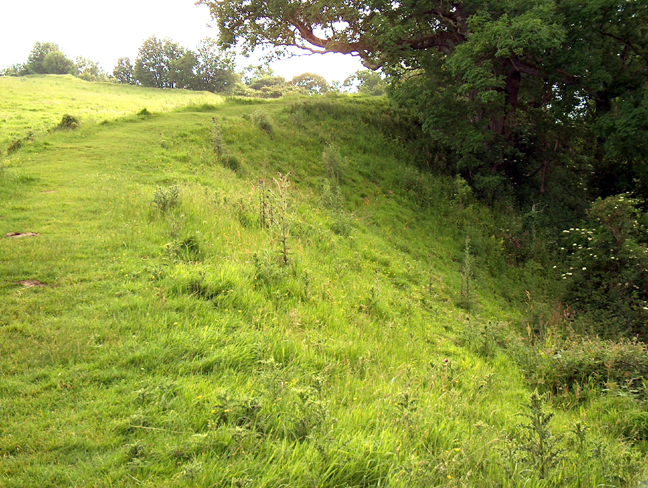
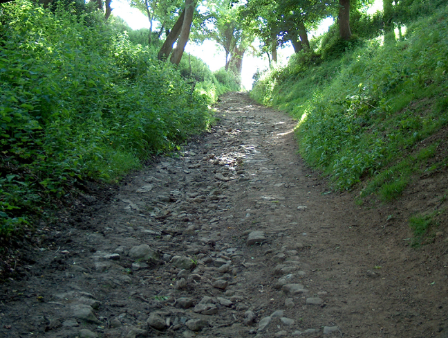
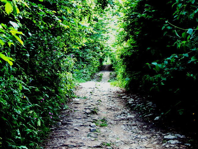
From there the road took us to Danebury. This is an area where they are supposed to have found thousands of pits where grain and other things were stored. These pits were described as being an average of 3 feet wide and 6 feet deep, with a hardened clay lid. They were lined with chalk rock, which would keep them very dry inside, and could hold a ton of grain. We walked up to the top of the hill, passing through a series of three ridges, which served for defense. The outside of each ridge was rather steep whereas the inside was more gentle. There were no ruins in the area, but the area would have been good for a fortress. We didn’t find any pits nor see any signs of them. GPS location 51-08-18 N by 001-31-51 W.
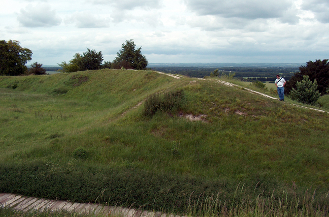
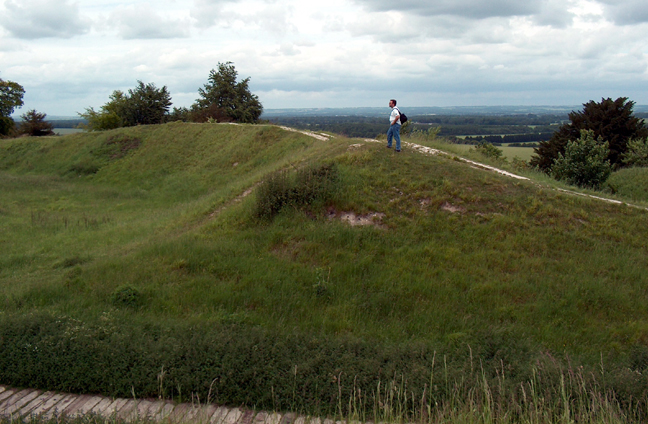
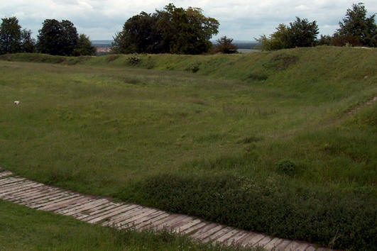

This hill fort is ringed by three
defensive walls,
and can only be approached by a winding footpath watched by
sentries.


Cadbury Castle Hill Fort
After almost getting lost, we found what some believe is the location of Camelot. The area is called Cadbury Castle. There is about 230 feet altitude difference between the top and the parking area. This also had a series to three ridges that a person had to overcome in order to get to the top. The top ridge was built up and you could see what looked like a stone wall a few feet high under the earth. Except on the back side where the slope is more gentle, the slope was very steep. The view was commanding what one could see through the trees. GPS location 51-01-27 N by 002-31-58 W.


This fort also has three defensive
walls, and is on top of an extremely high and steep hill.
This may have been the site of King Arthur's Camelot.
We proceeded to Glastonbury. This is an area that once was a large lake or marsh with several hills spotting the landscape. It is also the area the legends of the Lady of the Lake came from. With only minor effort (once we stopped and found a map) we were able to find the place where we have reservations for the next three nights.