|
Date |
Place |
Names |
Event |
Remarks |
Oct 2, 1778/ Dec 20, 1782
Jan 13, 1779 |
Washington Co. TN
Cherokee River |
Moses Brock
George Brock |
No. 466, Moses Brock
enters 150 acres of land on Muddy branch the waters of
Cherokee Creek beginning on a conditional line made by
George Brock
running down the said branch including the plantation where
the said Brock now lives
No. 243, 20 Dec 1782
No. 466, State of N Carolina Washington County 2nd Oct 1778
To the Surveyor of said County, you are hereby required to
measure and lay off according to Law for Moses Brock
one hundred and fifty acres of land on the Middle branch the
waters of Cherokee Creek beginning on a conditional line
made by George Brock & Moses Brock
running down the said Branch including the plantation where
Moses Brock now lives, Given under my hand this 13th day of
January 1779. John Carter ET, W 150 Acres Surveyed for Moses
Brock, By James Stuart C. S. 1st Oct 1779 (IMAGE) |
This land was sold to
John Bayless in 1784
(See
deed);
John Bayless inturn sold this land to Reece Bayless in 1812 |
|
Nov 5, 1779 |
Washington Co.
Cherokee River |
George Brock
John North |
2128, State of N Carolina
Washington County Nov 5th 1779, To the Surveyor of said
County Greeting, you are hereby Reqd to admeasure and lay
off according to law One hundred acres of land for Capt John
North joining Lewis's survey on the South and Aaron Pensons
On the waters of Cherokee Creek said land Entered per
George Brock and transferred to said North
per order of said Brock. Given at office this 1st day of May
1788
100 acre surveyed for John North
by John Shields DS this 23th day of January 1789 |
|
|
Oct 2, 1778 |
Washington Co. TN
Drinking Creek |
Capt George Brock
Christopher Cunningham |
No. 479, Christopher Cunningham enters 200 acres of land
joining Capt George Brocks line on the head
of drinking Creek known by the name of the Buffaloe land
including his former Survey
Correction from
Washington Co TN DB 2 P. 193/FHL Film #Film # 007902186
Image 338
Correction: "on the head of Sinking Creek known
by the name of Buffaloe Vally Beginning at a white oak
thence on a Dividing line between said Cunningham and
Captain George Russell" |
Correction made to original transcription. Joining line was
with a Capt George Russell not George Brock. |
|
Oct 23, 1783 |
Greene Co. TN
Nolichucky River |
George Brock |
No 261,
in Green County on the No Side of Nolichucky Beginning below
the mouth of the Spring Branch and turning up the river to
include a Island in the river and likewise including my
field house and other Improvements where I now live at,
Warrt Issue June 7th 1787
[Greene Co TN Bk 5 Pg 303-305]
Warrant No 295, State of North Carolina, No. 261, Know
ye that we have given and granted unto George Brock
a tract of land containing two hundred and eleven acres
lying in our County of Green on the North side of
Nolichuckey River....
Dated 20 Sept 1787
Warrant No
295, Surveyed by Isaac Taylor wm Meek & Allen Brock |
This land was sold to John Lewis Sears in 1787.
In 1783 Greene Co. was formed from Washington Co. |
|
1785 |
|
Joseph Brock |
Registration Date: 1785; On the south side of Cumberland &
adjoining an entry of Martin Anthony & Joseph Brocks
on the dividing ridge between Carneys creek and the east
fork of yellow creek which includes an Iron mine & runing
according to law Jos Brock
Tennessee, Early Land
Registers, 1778-1927, Series-11 Book-2 Middle Tennessee
1780, P. 143 |
|
|
Oct 5, 1786 |
|
David Brock |
Warrant 2564, Anthony Crutcher assignee of the heirs of the
David Brock assigns to Howell [ ] & George Walker; On the
south east corner of James MCain [ ] on a branch of the west
for of [Martin] Creek running East and north for Complement;
(signed) Jas. MCain, Surveyor George Walker |
Very hard
to read, no county listed. |
|
May 1, 1788 |
Washington Co. TN |
Capt John North with adjoining line to George Brock |
No 2128, State of N Carolina Washington County Nov 9th 1779
To the Surveyor of said County Greeting, you are hereby Reqd
to admeasure and lay off according to law One hundred acres
of land for Capt john North joining Lewis's survey on the
[
] and Pensions On the water of Cherokee Creek said land
Enters for George Brock and transferred to
said North for order of said Brock Given at Office this 1st
day of May 1788
W 100 Acres Surveyed for John North by
John Childs DS the 24th January 1789 |
|
|
May 17, 1788 |
Washington Co. TN |
Joseph Penson with adjoining line to Moses Brock on Cherokee
Creek |
No. 2573, State of N Carolina Washington County May 30th
1780 To the Surveyor of said county Greeting, you are hereby
Reqd to admeasure and lay off according to law one hundred
acres of land for Joseph Penson on the waters of Cherokee
Creek joining his own land that he lives on, on the West
side [Lik-----] joining John Bayles and Moses Brocks
and Includes the vacant land between said lines for [ ]
Given at Office this 17th day of may 1788, W 150 Acres
Surveyed for Moses Brock, by James Stuart C. S. 1st Oct 1779 |
|
|
May 9, 1789 |
Washington Co. TN
|
John Bayles with adjoining land to George Brock |
No 308, State of N Carolina Washington County august the
10th 1779
To the Surveyor of sd county Greeting you are
reqd to measure and lay off according to law fifty acres of
land for John Bayles joining Aron Lewis a track of land where
George Brock now lives On the south to extend along
Lewis's West line, sd land entered for john jameson and
transferred to Aaron Lewis and from said Lewis to George
Brock and from sd Brock to sd John Bayles. Given at Office
this 9th day of May 1789.
|
|
|
May 9, 1789 |
Washington Co. TN
Cherokee Creek |
John Bayles with adjoining line to George Brock |
No. 713, State of N Carolina Washington County Decb the 19th
1778 To the Surveyor of sd County, Greeting. you are hereby
reqd to [ ] and lay off according to Law one hundred and
fifty Acres John Bayles on the W fork of Cherokee Creek
including a big Spring of Thos Pinson Junr Beginning at a
black Oak marked A L said Land Entered per Jeremiah Lewis
and transferred to Aaron Lewis and from A. Lewis to
George Brock and from sd Brock to sd John Bayles
Given at Office this 9th Day of May 1789. J Carter E. J.,
150 Acres Surveyed for Jno Bayles. By F Ramsey D. S. 15th
May 1789 |
|
|
Sept 29, 1789 |
Sullivan Co. TN |
Grant for John Allen, James Brock, surveyor |
No 2192, State of N Carolina Washington County 12 Nov 1779,
To the surveyor of Sullivan County greeting, you are hereby
Required to measure and lay off according to law
for John
Allen Six hundred and forty acres of land in Powels Valley,
adjoining Joseph Williams Senr Entry Including the above
place for compliments Given under my hand this 29 Sept 1789
Surveyed for Walter King & James Brock by
Stockly Donelson sur 17th Nov 1792 |
|
|
Jan 21, 1790 |
Washington Co. TN |
James Pickens land with improvements of Moses Brock
mentioned |
No 2426,
State of North Carolina Washington County February 15th
1780, To the Surveyor of Sullivan County, Greetings, you are
hereby Reqd to measure and lay off according to law one
hundred Acres of Land for James Pickens on Cherokee Creek
joining Aaron Pinson and Wm Meeks lines running down the
creek the fork including Moses Brocks
Improvements, given this 21st day of Jany 1790 |
|
|
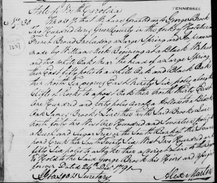
Dec 26, 1791 |
Knox Co. TN |
George Brock |
No. 68,
Book A page 3 & 4, State of North Carolina, No 930,
Book 77, Page 252
Know
ye that for and in consideration of the sum of fifty
shillings for every hundred acres hereby Granted paid unto
our Treasury by George Brock have Given and
Granted and by these presents do give and Grant unto the
said George Brock a tract of Land
containing two hundred Acres lying & being in our County of
Green in the fork of Holston and French Broad including a
large spring and on Improvement made by William Meek
Beginning at a Black Walnut & two white oaks near the head
of a large spring then east fifty poles to a white oak &
Black oak - then north ten degrees east ninety six poles
along the cliffs of Rocks to a post Oak - then North thirty
degrees East one hundred and forty poles across a hollow to
a Black oak James Brocks line thence with
said Brocks line north forty two west one hundred seventeen
poles to a Beach & Sugar tree on the South Bank of the Swan
pond Creek = then South twenty Six West two hundred and
fifty Six poles to a Stake then a direct line to the
Beginning As by the plat hereunto annexed doth appear -
Together with all woods waters mines minerals hereditaments
and appurtenances to the said land belonging or ascertaining
- To hold to the said George Brock his heirs and assigns
forever - yielding and paying to as such Terms of Money
yearly or otherwise As our General Assembly from time to
time may direct - Provided always that the said George Brock
shall cause this Grant to be Registered in the registers
office of our Said county of Green within thirteen Months
from the date hereby otherwise the Same Shall be void and of
no effect - In Testimony whereof we have caused these our
Letters to be made patent and our Grant Seal to be hereunto
affixed - Witness Alexander Martin Esquire Our Governor
Captain General and commander in Chief to Newbern the 26th
day of Dec in the 16th year of our Independence and in the
year of our Lord one thousand Seven hundred and ninety one |
|
|
Jan 14, 1793 |
Hawkins Co. TN |
James Brock |
State of North Carolina
No 302
Know ye that we have Granted unto James Brock One
Hundred fifty acres of land in Hawkins County on the South
fork of the Swan pond Creek Beginning at black oak and
cogwood near George Wolfs Spring then West one hundred and
twenty poles at a stake then South Sixty poles to a Stake
then West Sixty poles to a Stake then South ninety four
poles to a stake then East one Hundred and Eighty poles to a
Stake then a direct line to the Beginning to Hold to the
Said James Brock his Heirs and Assigns forever the 14th day
of Jany 1793 |
|
|
Sept 9, 1796 |
Hawkins Co. TN |
James Brock Grant with adjoining line to George Brock |
No 148, Book A Page 225, State of North Carolina
No. 736
To all to whom these presents shall come Granting Know ye
that we for and in Consideration of the Sum of fifty
Shillings for every hundred acres hereby Granted paid into
our treasury by James Brock have Given And
granted and by these present do give and Grant unto the Said
James Brock a tract of land containing two
hundred Acres and Lying and being in the County of Hawkins
on the Swan pond Creek a water of Holston River being the
land the said James Brock now lives on Beginning at a Black
oak and two Hicorys on George Brock's line
running thence with said line North forty seven West one
hundred and forty four pole to a Beach and Sugar tree on the
Bank of the Creek thence North thirty Six East sixty pole to
a chestnut tree thence north Seventy Seven East eighty Six
pole to a pine tree thence north fifty four East Seventy
five poles to a pine thence South fifty four East one
hundred and thirty poles crossing the Creek to a stake -
from thence to the Beginning as by the plat hereunto annexed
doth appear - Together with all woods waters mines minerals
hereditaments and appurtenances to the Said land belonging
of ascertaining To hold to the said Grantee his heirs and
assigns forever - Yielding and paying to us such sums of
money yearly or otherwise as our general assembly from time
to time may divet - Provided always that the Said Grantee
shall cause the grant to be registered in the registers
office of our said County of Hawkins within registers office
of our Said County of Hawkins within twelve months from the
date herof otherwise the same shall be void and of no effect
- In testimony whereof we we have caused these our letters
to be made patent and our great seal to be hereunto affixed
- Witness Samuel Ashe Esquire our Governor Captain General
and Commander in Chief at Raleigh the 9th day of September
in the 21 year of our Independence & in the year of our Lord
one thousand seven hundred and niney six
Sam Ashe
by
Command
J Glasgow Secretary
Regd June 6th 1797
State of North Carolina, N. 736, Know ye that We have
granted unto James Brock Two hundred acres
of land in Hawkins County lying on the Swan pond Creek a
water of Holston River, being the tract that said James
Brock now lives on Beginning at a black oak and two Hicorys
on George Brocks line.....9th day September
1796
|
This
appears to be the same land as having a line with George
Brock in his 1791 grant. However, that land is listed
in Greene Co. TN. Both lands are on Swan Pond. |
|
Oct 2, 1796 |
French Broad
Holston River |
Hugh Dunlap
George Brock |
No 263, Hugh Dunlap granted 500 acres lying in the Eastern
District between French Broad and Holston River including
Tanners Cabbins and two large Sinking Springs ...to a stake
on Colonel Whites line....to a stake on or near
George Brocks line... |
|
|
Nov 30, 1803 |
Hawkins Co. TN |
James Brock
Walter King |
No 292, ..Walker King & James Brock a tract
of land containing six hundred and forty acres lying and
being in the County of Hawkins on the Swan pond Creek about
three miles above the mouth Beginning on the South Bank of
said creek at a sugar tree & Beach at George Brocks
upper corner |
|
|
Aug 17, 1808 |
Jackson Co. TN |
Allen Brock |
...survey for Thomas Hopkins assignee of Allen Brock three
hundred acres his occupant claim situated in the County of
Jackson on the fall water of the Cany Fork including where
the said Brock now lives....
Tennesse, Early Land
Registers, 1778-1927, Series 03: Plats and Surveys, P. 201 |
|
|
Feb 2, 1811 |
Grainger Co. TN |
Leonard Brock |
Leonard Brock enters 50 acres of land in
Grainger County lying near the head of Freleys branch on the
south side of the copper ridge Beginning on a white oak
turning south then west for compliment where Samuel Cane now
lives entered on part of a certificate No 2 for 250 acres
dated 25th Nov 1809; Entered 2 Feby 1811 |
|
|
Sept 11, 1811 |
White Co. TN |
George Brock |
...Morgan Rice & Lutz assignee of George Brock
by virtue of part of warrant No 192 for 100 acres of land in
the 3rd District of County of White on the East Side of Cow
Creek of the Cany Fork Beginning on a Beach marked M. R. L.
... |
|
|
Sept 7, 1812 |
White Co. TN |
Jesse Brock |
No 1963 Jesse Brock assignee of Woodson P
White [?] eight acres of land By virtue of a certificate No
421 for 100 acres in White County on the waters of Cane
Creek of [?] Caney fork Beginning north east of a spring
.... coming down said creek to a survey in the name of Wm
Brown...will include said spring...7th day of Sep 1812 Jesse
Brock
Tennessee, Early Land Registers, 1778-1927, Series
02 Book 42, 3rd Surveyor's District, 1807-1809, P. 101 |
|
|
Aug 16, 1814 |
Dickson Co. TN |
Perry G Brock |
By vertue of Entry No 11852 dated 25th of Oct 1813 founded
on Certificate Warrant No 1251 issued by the Register of
West Tennesse. I have surveyed for Perry G Brock assignee
originally of John C MLemore and James Vaule 20 acres of
lands in Dickson County on the headwaters of Jones Creek;
surveyed the 16th day of August 1814; Survey team: James
Brock & Perry G Brock; transferred by Perry G Brock to James
L Scott |
|
|
Sept 7, 1814 |
Dickson Co. TN |
James Brock Senr |
Sep 7, 1814, James Brock Senr: No 13314, 10 acres West of
Piney R; No 13315, 10 acres Dickson Co. |
|
|
Dec 21, 1814 |
Military Warrant |
Private James Brock |
No 2006 ... "do hereby certify that William Searcy is
entitled to enter and obtain a grant for two hundred and
forty acres of land within the State in leu of so much of a
Military Warrant Issued to James Brock a
private N4573 and dated the 9th day of February 1797 for 640
acres"
Tennessee, Early Land Registers,
1778-1927,Series-8 Book-9, Certificates West Tennessee |
|
|
Dec 21, 1814 |
Military Warrant |
Private James Brock |
No 2008..."do hereby certify that William Searce is entitled
to enter and obtain a grant for two hundred acres of land
within the state in leu of so much of a Military Warrant
issued to James Brock a private No 4573 and
dated the 9th day of February 1797for 640 acres"
Tennessee, Early Land Registers, 1778-1927,Series-8 Book-9,
Certificates West Tennessee |
|
|
Sept 29, 1815 |
falling water of Caney Fork Cumberland River |
Allen Brock |
No 4165, "he falling water of the caney fork of cumberland
River Beginning at the north west corner of Thomas Hopkins
occupant survey assignee of Allen Brock...include the
Quantity and the part of the [?] made by Allen Brock an left
out of Thos Hopkins occupant Survey as Pped of Allen Brock
|
|
|
Aug 21, 1829 |
Military Warrant |
John Brock |
"A list of Military Warrants issued since the 19th August
1820"; No 447, the Present & Trustees of the University of N
Carolina for the services of John Brock a
pt, 84 months of service, 640 acres, 21st August 1820, drawn
by Col Thos Henderson alto for the Trustees
Tennessee
Early Land Registers, 1778-1927, Series-10 Book 17,
Warrants, North Carolina |
|
|
May 13, 1822 |
Marion Co. TN |
George A. Brock |
Warrant 488, George A. Brock, 25 acres of land by virtue of
part of Warrant No 643 for 600 acres, corner of East
Tennessee, Marion County & 3rd District, south east side of
Sequachee River |
|
|
Nov 6, 1829 |
White Co. TN |
John Brock |
No 1714 dated March 10th 1829, surveyed for John
Brock fifty acres of land on Cane Creek in White
County on the waters of Cany Fork, beginning at a beech
corner of Grant
W2248 about 15 poles from a dry branch
running west up branch 20 poles to a dogwood on a bluff then
south 30 poles to a sugartree and beech at a rocky bluff,
then east leaving bluff 20 poles to a gum, then 39 poles to
a stake at bluff, then east [?] poles to a beech then south
31 ples to a poplar, then east 62 pole to a beech on Cane
Creek, then north crossing the creek and east of a small
bottom, in all 139 poles to a white oak on a hill side, then
west crossing the creek 56 poles to a stake on Cranes line,
then south up the creek and with 46 poles to a poplar, then
south 10 poles to the beginning, excluding an older claim of
23 acres and and including bottom eas of said creek,
surveyed Nov 6, 1829
Survey Team: [?]uel Brock
and [?]mes Brock |
|
|
Jun 14, 1830 |
White Co. TN |
John Brock
James Brock |
No 1719 dated Mar 30, 1829, survey for Robert Gamble
37 1/2 acres in White county on the waters of Cane Creek,
Survey team: John Brock & James Brock |
|
|
Dec 12, 1874 |
Henderson Co. TN |
James Brock |
No 3654 Know ye that we have granted unto James
Brock twenty acres of land in Henderson County on
the waters of Cleos creek adjoining the lands of Allen Case
and others: Beginning on 2 Chestnuts - Oaks in Case and
Edminsons Jones corner and runs E.40 poles to a stake in P.
Brock's line thence S.22 W.26 poles to a stake, thence S. 30
E. 29 poles to a stake, J.H. Justices corner, then South 45,
W. 20 poles to a Chestnut, said Cases corner thence W. 10
poles to a stake in Cases and Edmonstons line thence North
with the same to the Beginning. Entered to 5th day of
October A.D. 1873. To hold to the said James Brock his heirs
and assigns forever. Dated the 12th day of December A.D.
1874 |
|