(click on thumbnails to view full images)
?
NEW!! Web Family Cards--detailed information on individuals and family trees
Newspaper and Obituary Archive
Vital Records and Wills Archive
Immigration, Naturalization, Passports, Travel
New! Google Maps showing family locations
?
Hamerschlag and Brummel Families
| Place | Date | Name | Description |
Page Image (may be large file) and Transcription (where applicable) |
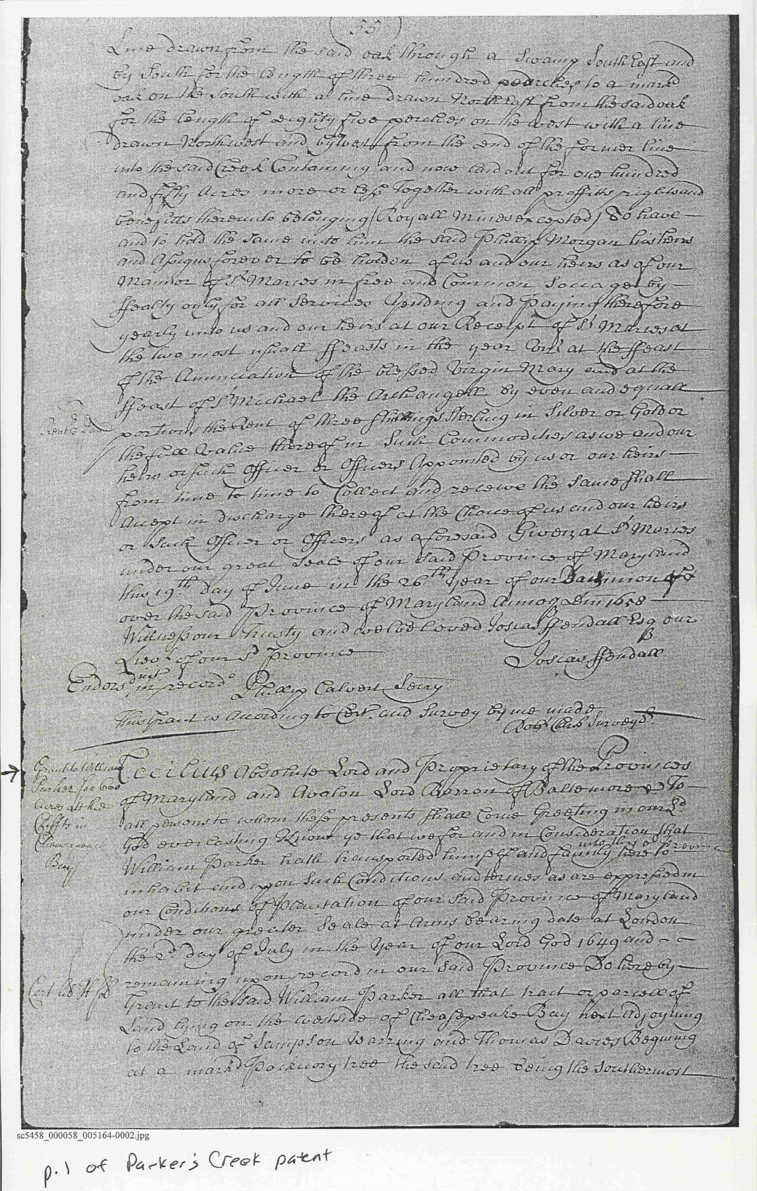
| Calvert | 1658 | Parker, William | Parker's Creek (1st Page) |
 |
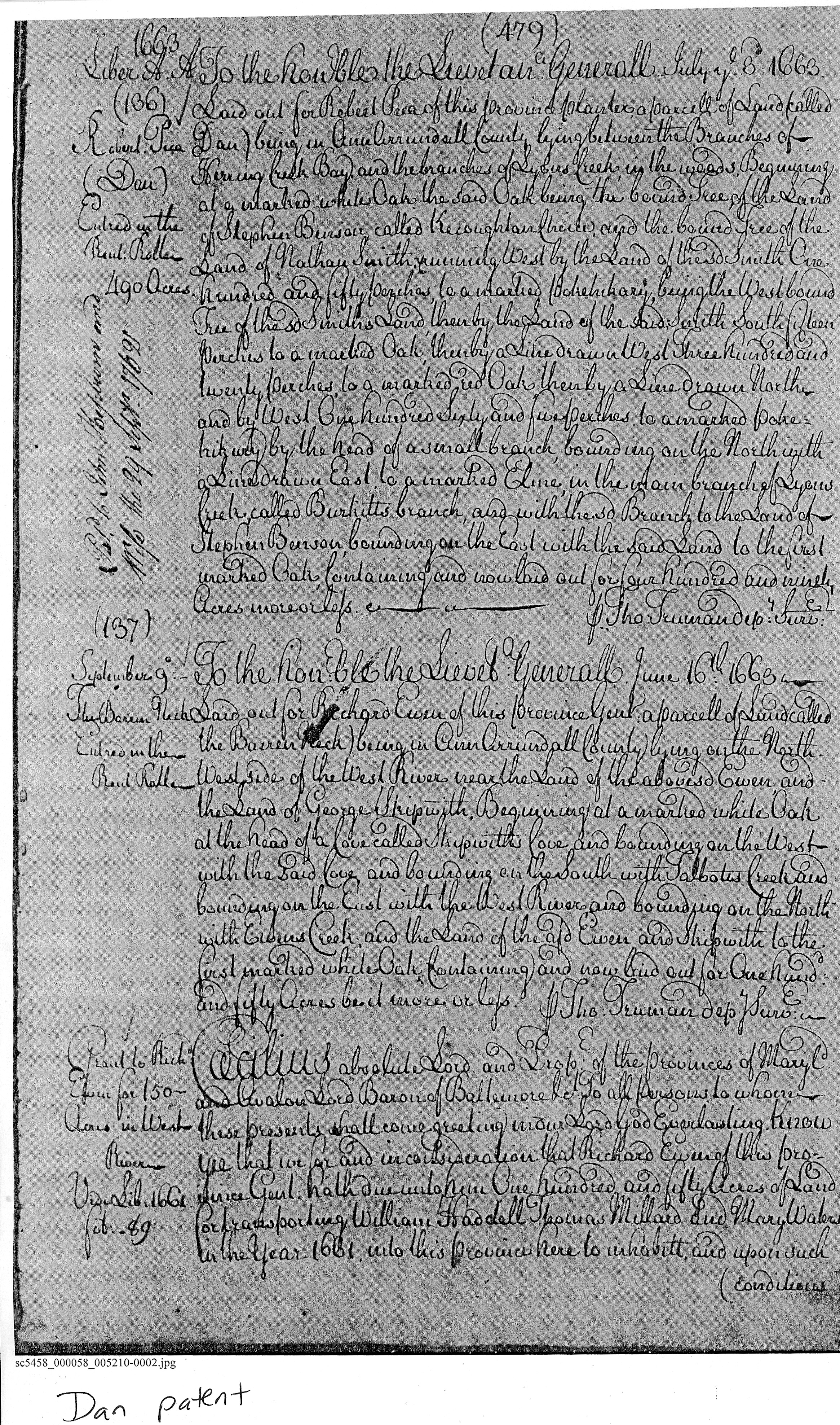
| AA | 1661 | Paca, Robert | Dan |
 |
|
AA near Tracy's Landing on Herring Creek |
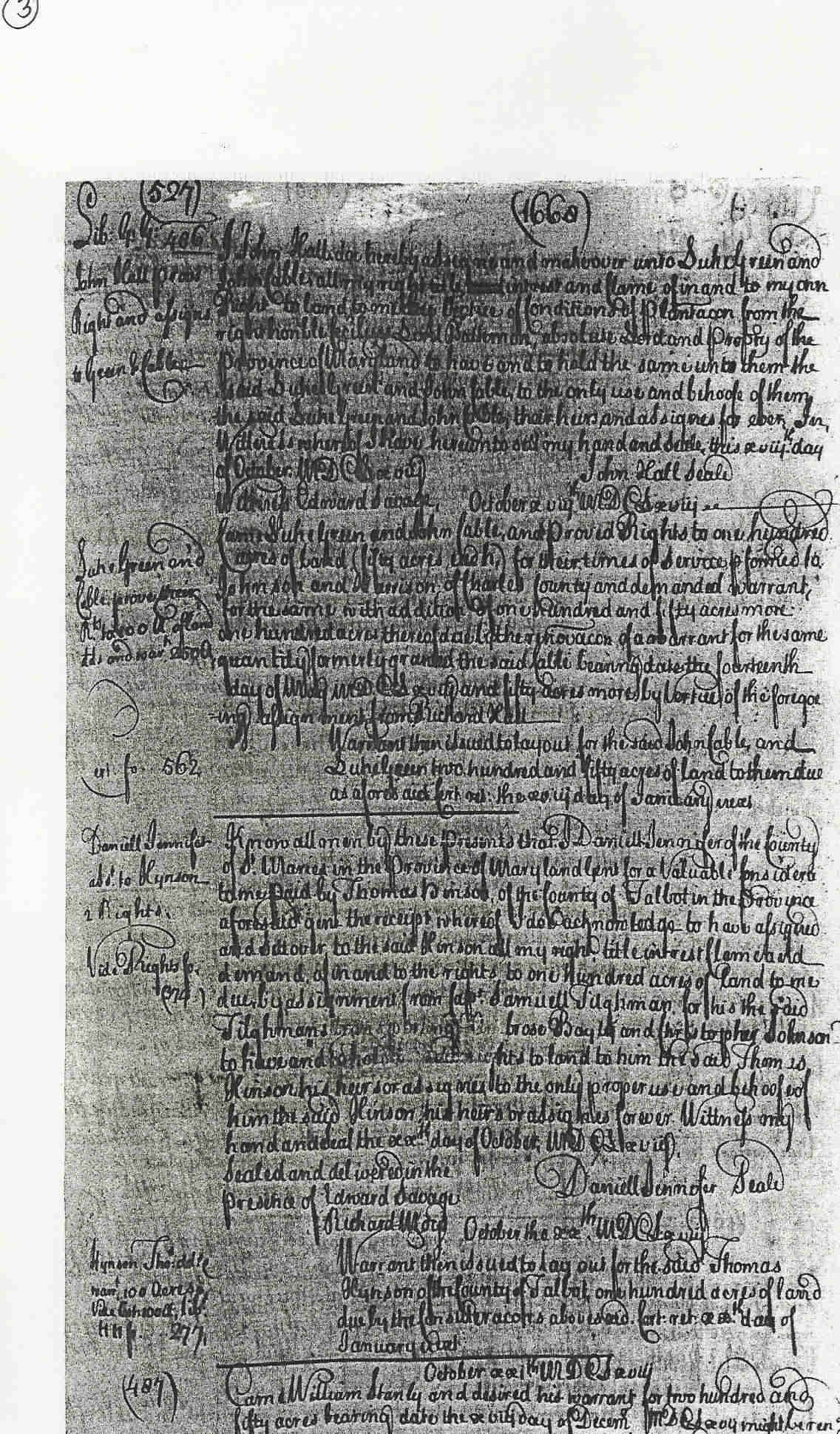
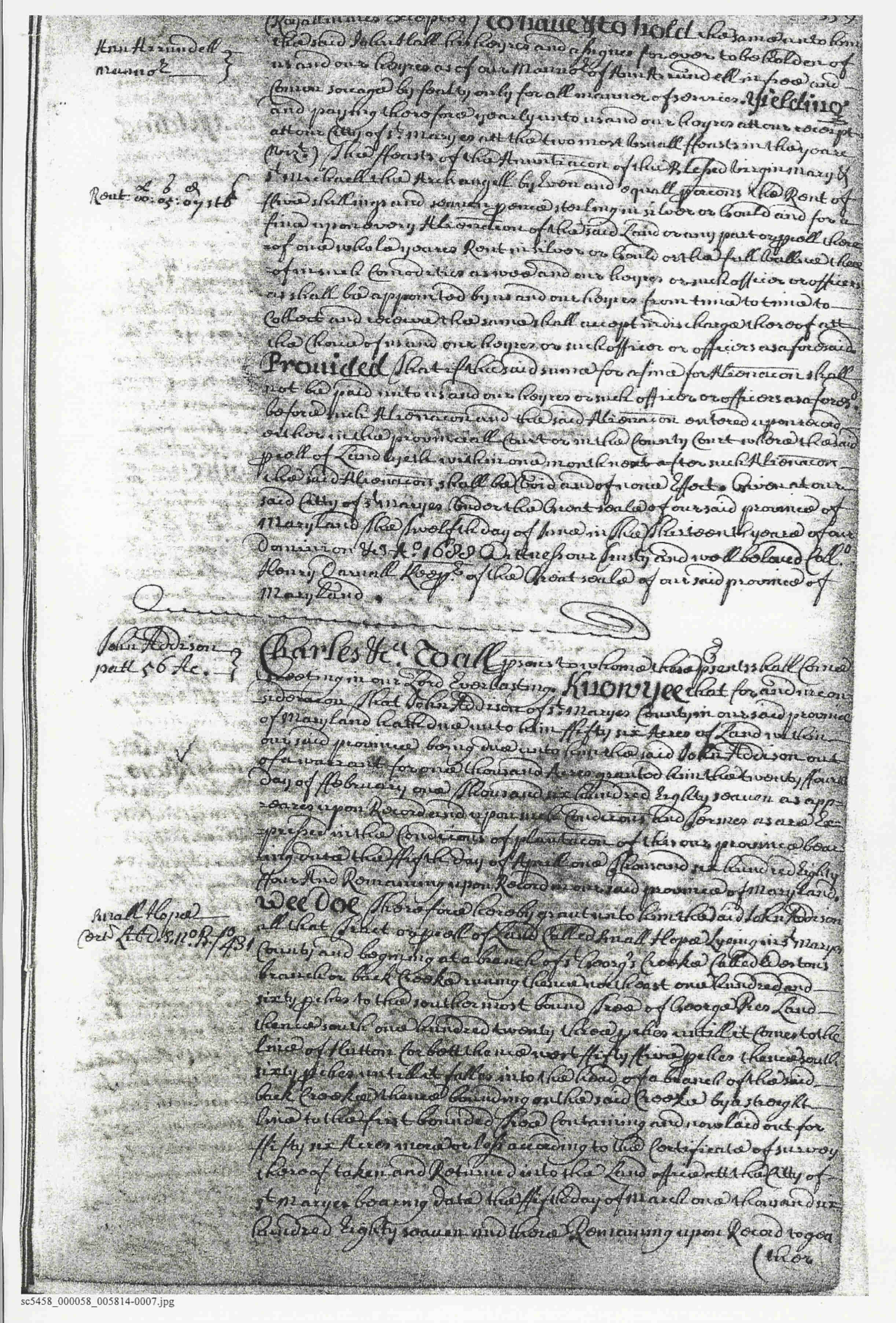
1661 | Hall, John |
Marshes Seat,
150 Acres; Patent Developer/Owner: Hall, John Patent Record 5, p. 51 |
  |
| Anne Arundel Co. | 1666 | William Burgess |
Burgeses Choice, 400 Acres; Certificate Developer/Owner: Burgess, William 1666 Patent Record 9, p. 95 0 0 MSA S 1581-810 Burgeses Choice, 400 Acres; Patent Developer/Owner: Burgess, William 1666 Patent Record 9, p.471 0 0 MSA S 1581-811 Burgeses Choice, 400 Acres; Patent Developer/Owner: Burgess, William 1666 Patent Record 10, p. 421 0 0 MSA S 1581-812 Burgeses Choice, 400 Acres; Patent Developer/Owner: Burgess, William 1666 Patent Record 19, p. 333 |
|
| AA | 1668 | Hall, John |
GG:486 Film
No.: One right by 1668 Transcript. 11:527 MSA SC 4341-
|
 |
| AA | 1668 | Paca, Robert |
|
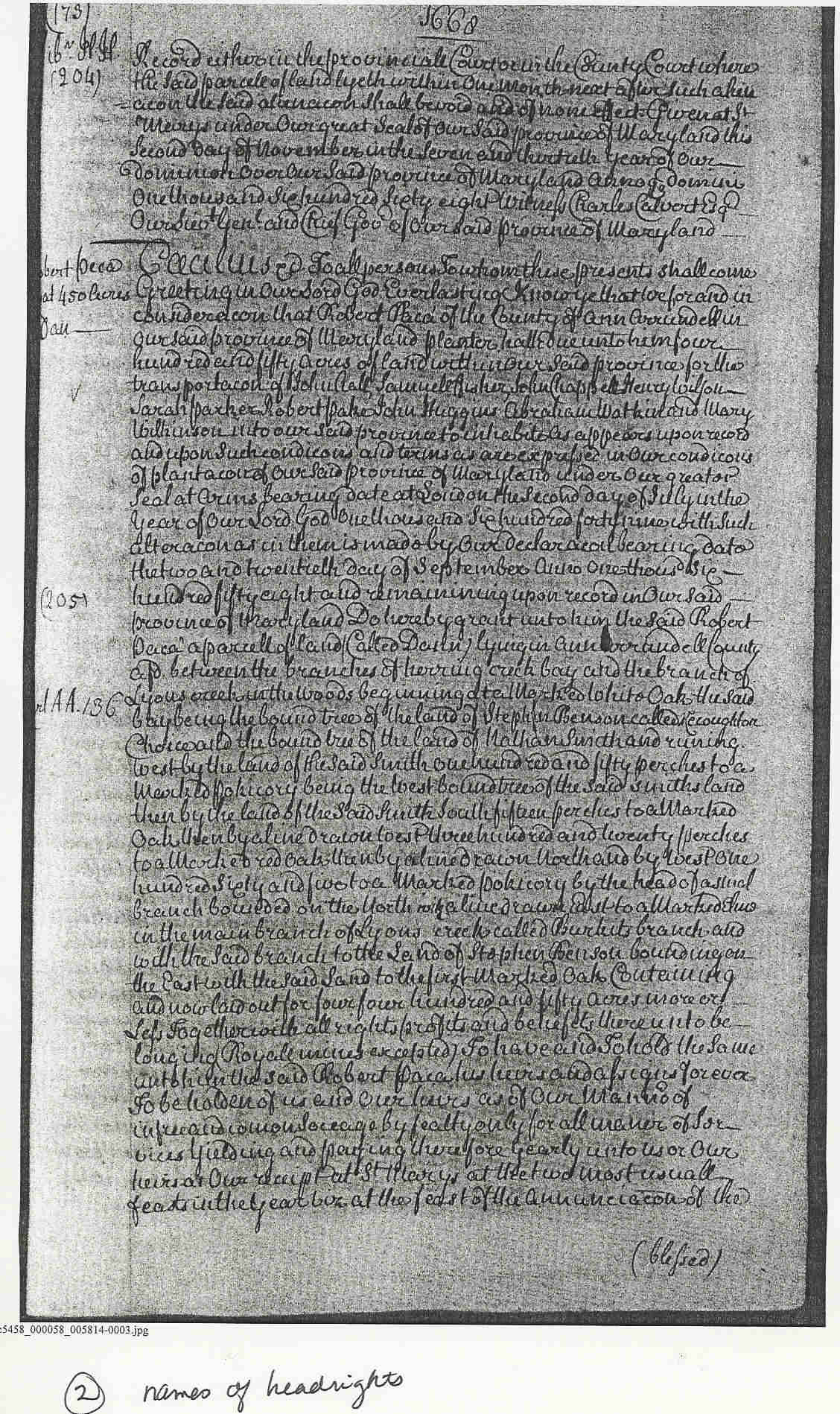 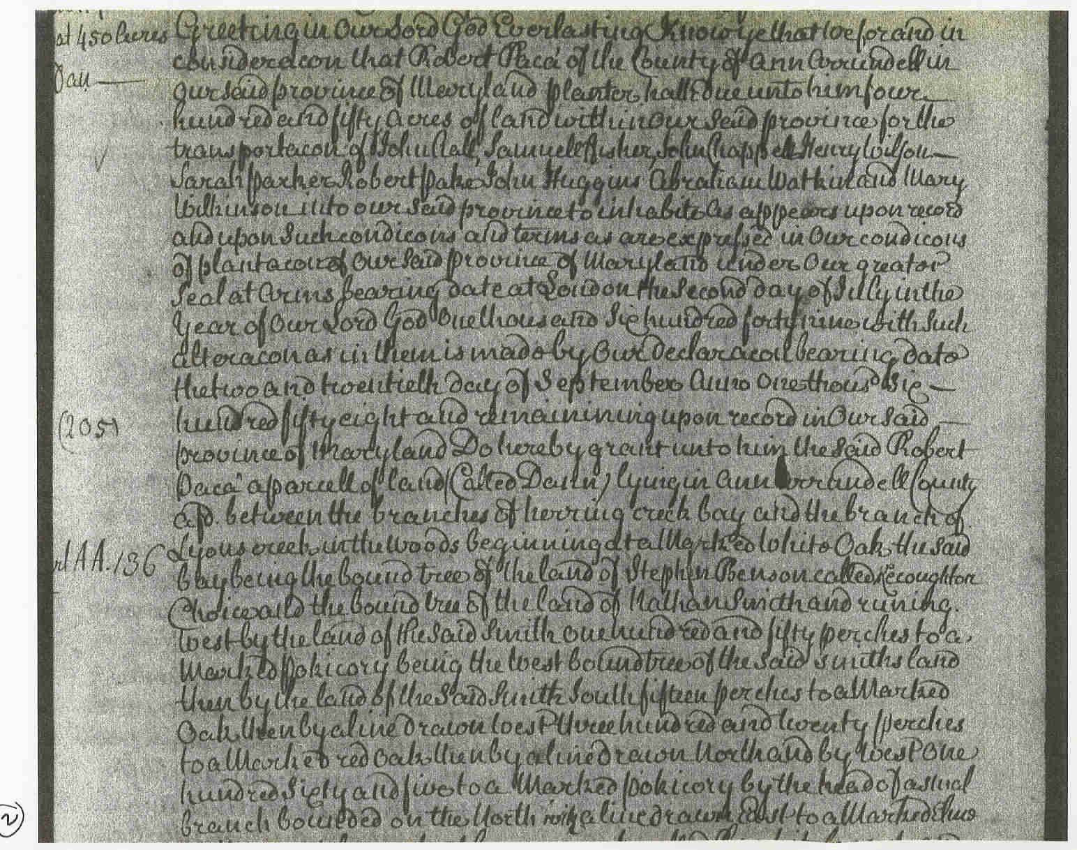 (detail of above showing names of headrights)
 |
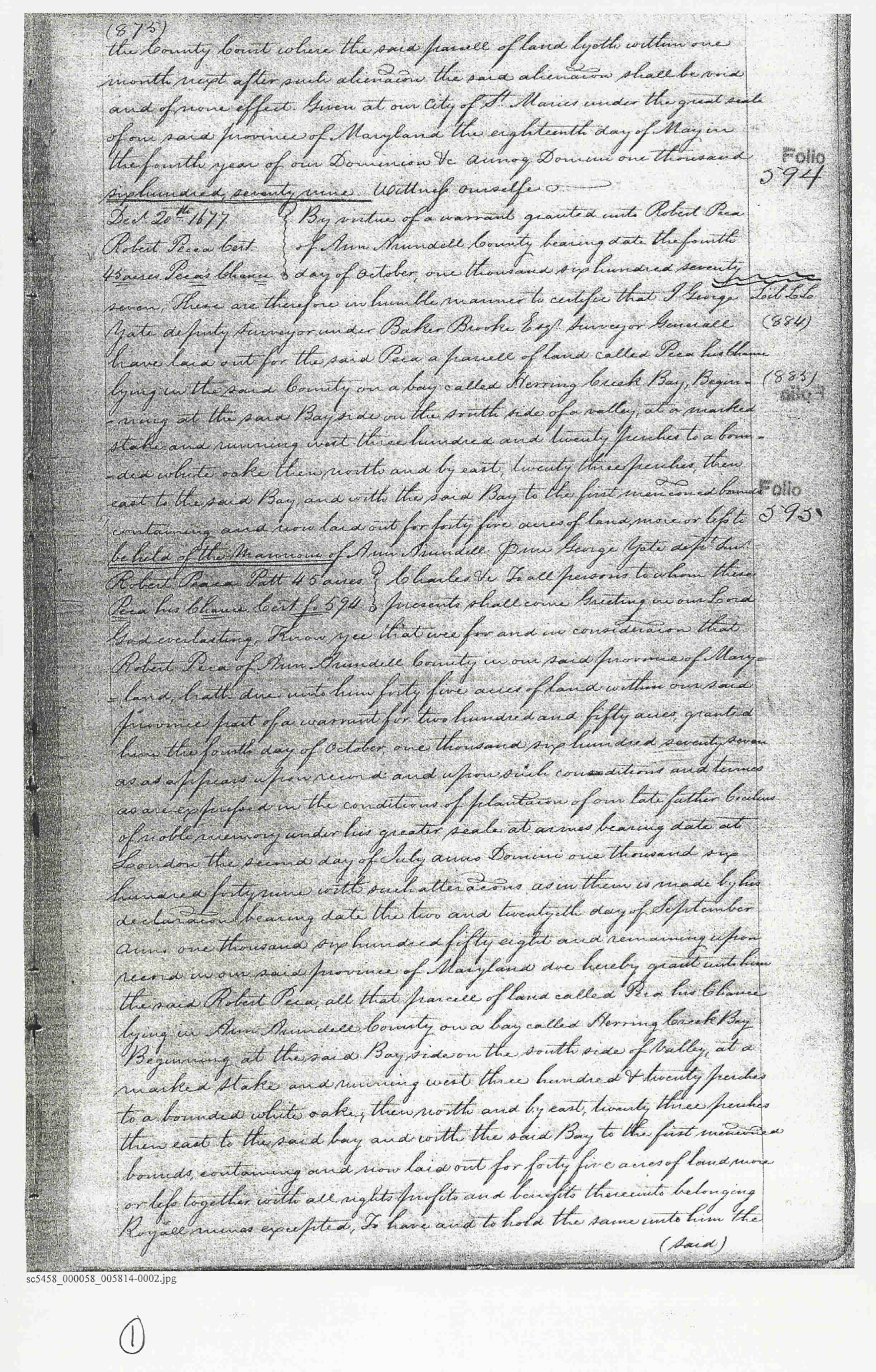
| AA | 1677 | Peca, Robert |
LL:884-85 Film
No.: Of Anne Arundel County by 1677, when 45 acres on Herring Creek Bay were surveyed for him Transcript. 15:594-95 MSA SC 4341-
|
 |
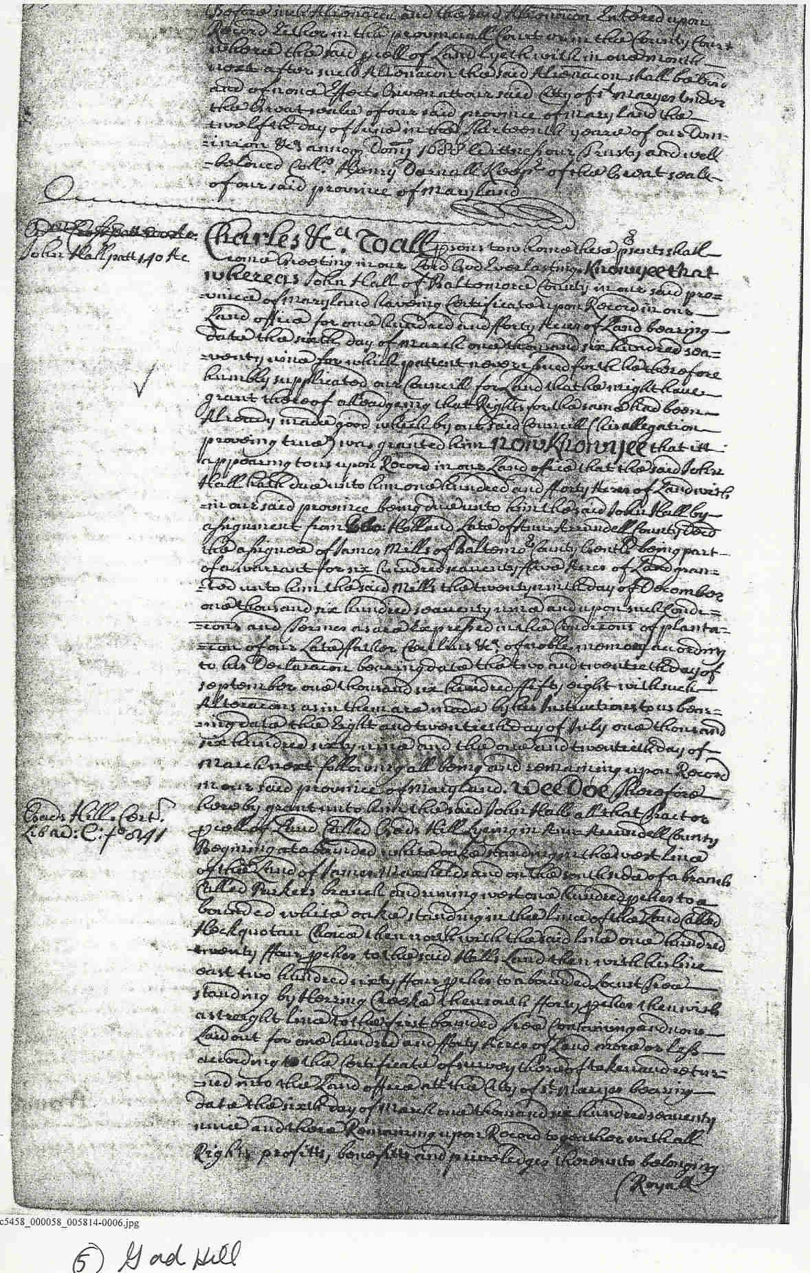
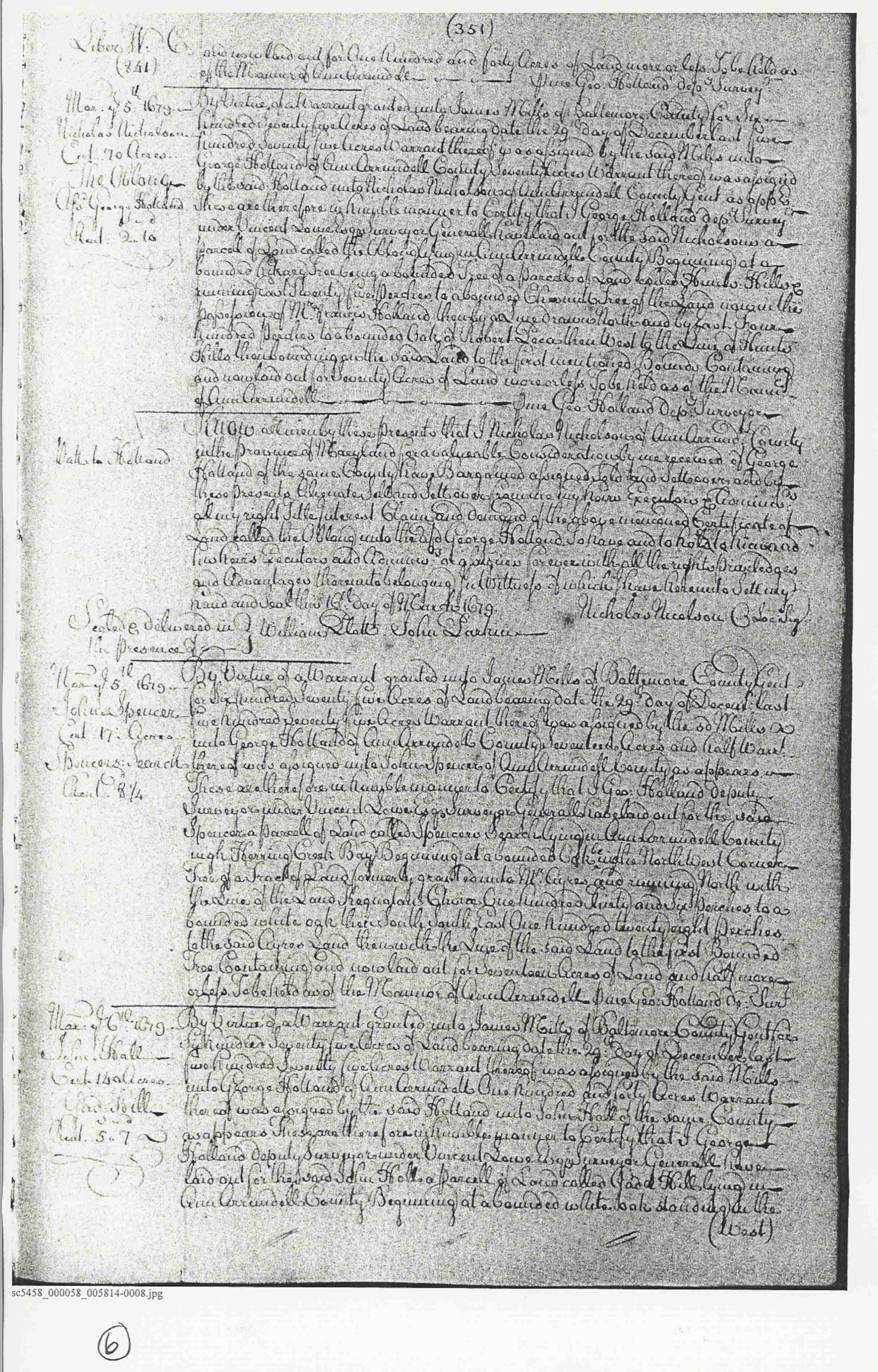
| AA | 1688 | Hall, John |
Gad Hill, 140
Acres; Patent Developer/Owner: Hall, John Patent Record NS B, p. 558 Patent Record 20, p. 351 |
   |
Burgess, John; G rubby Hill; 12 Acres 1812/04/03 Patented
Certificate 194 0 0 MSA S 1202-267
Grubby Hill, 12 Acres; Patent
Developer/Owner: Burgess, John 1812 Patent Record IB A, p. 167 0 0 MSA S
1595-1490
Burgess, John; Inclosure, The; 20 Acres 1803/09/24 P
