MD Historical County Lines
Return to HISTORICAL COUNTY LINES home page
AL
AK
AR
AZ
CA
CO
CT
DE
DC
FL
GA
HI
ID
IL
IN
IA
KS
KY
LA
ME
MD
MA
MI
MN
MS
MO
MT
NE
NV
NH
NJ
NM
NY
NC
ND
OH
OK
OR
PA
RI
SC
SD
TN
TX
UT
VT
VA
WA
WV
WI
WY
Off-line site accessed via
Archive.org
. Note: These are
not
live sites.
MARYLAND
County Formation Maps
from
Northeastern Genealogy Online
.
Maryland County Formation Maps
from
The O'Neal Genealogy Association
. 1680, 1730, and 1790.
From Univ. of Alabama
Historical Map Index
:
Historical maps of Maryland
1876 maps of Maryland'd East Shore
from Hitch Genealogy.
From
Somerset Co USGenWeb map page, including
:
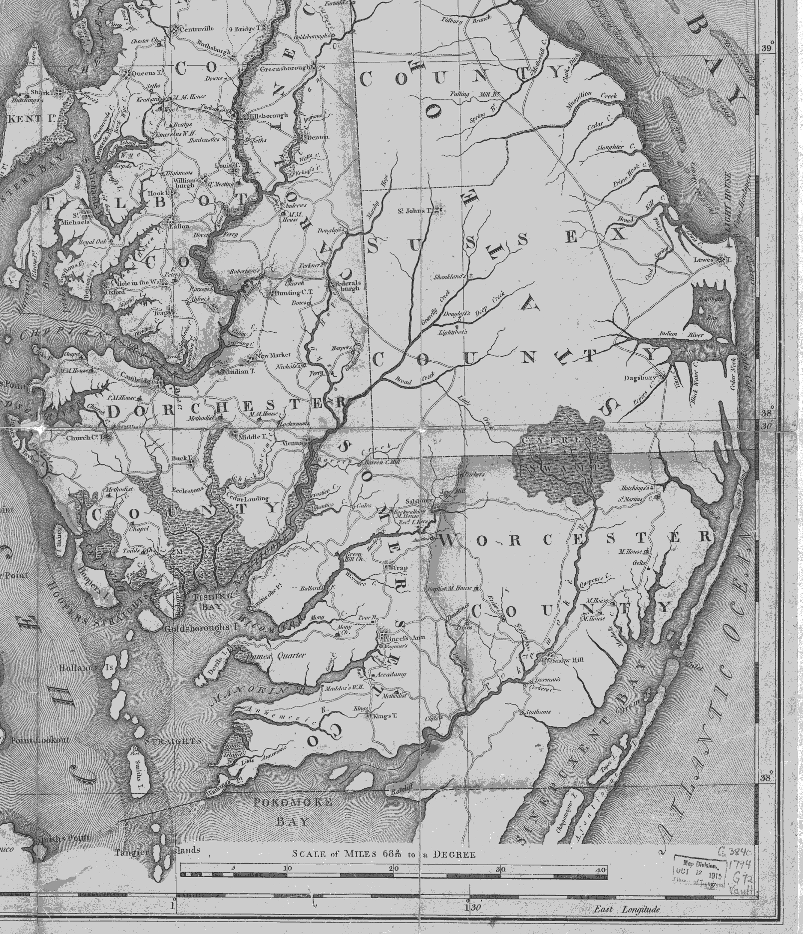
Lower Eastern Shore, 1794
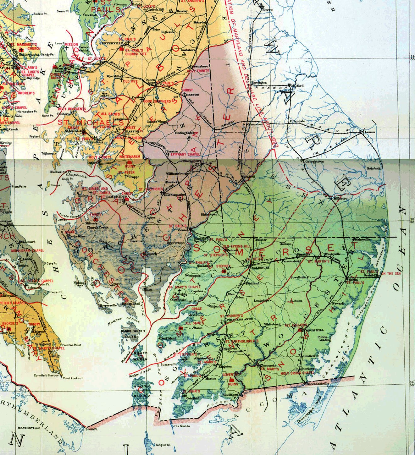
Eastern Shore Parishes
of 1694, counties of 1923.
Lower Shore area, 1840
USGenWeb Digital Map Library for Maryland
. Maryland 1881 RR map. [480kb]
The evolution of Kent Co. boundaries
from the
Descendents of Wm. Ashley
website.
St. Mary's Co. MD USGenWeb page
MD/DE 1642, 1650, 1658 (
Gold Bug
). You will need to click on "back" to get back here. To get to the current host page, you need to go
here.
Somerset Co. MD created 1666
showing daughter counties and creation dates. You will need to click on "back" to get back here. The host page is Handley's Eastern Shore Genealogy Project's
Eastern Shore Maps Page
.
From Pam Rietsch's
1895 Atlas site
Index to City/Town data
State map
County maps
From
Univ. of Texas Library
Maryland maps.
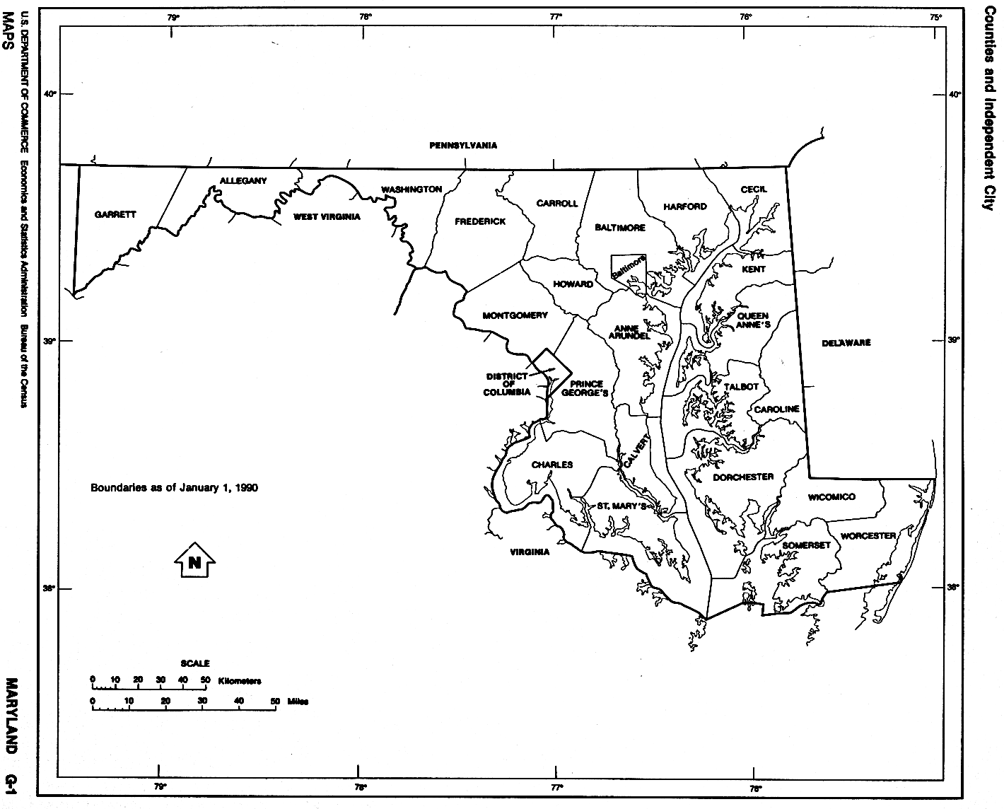
B&W county outline map, 1990
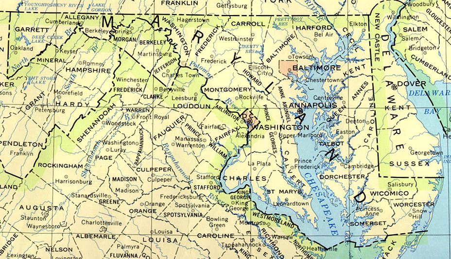
Counties, county seats and streams, 1990
Continue to Massachusetts
State menu
Main page
Your suggestions for links are most welcome. Send email to
John Robertson
.
All links verified with
LinkChecker
FireFox extension
2/7/2007 10:42AM
