 Off-line site accessed via Archive.org. Note: These are not live sites. Off-line site accessed via Archive.org. Note: These are not live sites.
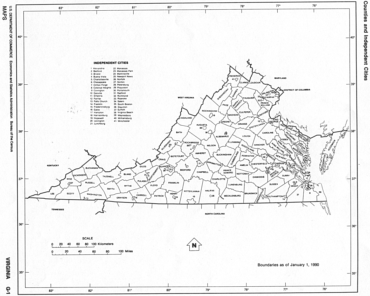
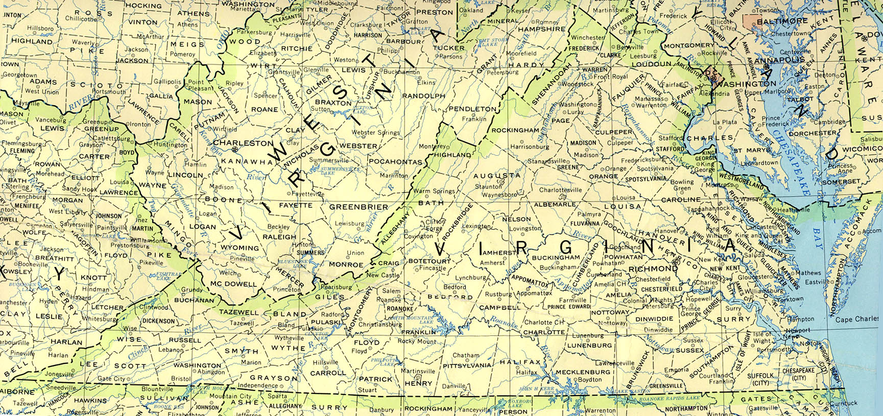
VIRGINIA
- Interactive map, from Atlas of Historical County Boundaries, Newberry Library. Close window (click red X button, the lower if there are 2) to return.
[For advanced users only: Download zipped folder containing the following files for each state: 1 shapefile (polygons) for use with GIS programs (requires special mapping s/w), a database (MS Access required), and at least 3 supplemental texts (HTML documents).]
- History of Virginia and West Virginia Counties. No maps, but much detailed info. From The Harrison Genealogy Repository
- County Formation Maps
from Southeastern Genealogy Online.
- Virginia County Formation Maps. Same as above.
 From Univ. of Alabama Historical Map Index: From Univ. of Alabama Historical Map Index:
 From American Memory at Library of Congress: From American Memory at Library of Congress:
- VA USGenWeb page: VA/WV 1634,
1738,
1770,
1776,
1791,
1792. (Gold Bug). You will need to click on
"back" to get back here. To get to the host page, you need
to go here.
- From the old Accomack
Co. VA USGenWeb page: VA/WV 1634
- Augusta Co.
VA USGenWeb page VA/WV 1738, 1770, 1776, 1791 (Gold Bug). You will need to click on
"back" to get back here. To get to the host page, you need
to go here.
- Gloucester
Co. VA USGenWeb page VA/WV 1651, 1790 (Gold Bug). Click on "back" to get back
here.
- Henry
Poole's POOLE page. Click on the "Flatt Creek VA (Map)&" to
see Virginia "county lines" in 1703 (Gold
Bug). You will need to hit your "back" button a couple
of times to get back here.
-
King George
Co. VA USGenWeb page, also
here
VA, WV 1720, 1730, 1777 (Gold Bug).
Click on "back" to get back here.
- Southwest
Virginia boundary changes from the
Lee County VA USGenWeb
page
- From former Northhampton Co.
VA USGenWeb page. VA/WV
1643,
1661
1738
1792
(Gold
Bug). Lots of good maps here.
- Washington Co.
VA USGenWeb page VA/WV 1776, 1777, 1786 (Gold Bug). Click on "back" to
get back here.
- Migration
from Virginia Great Wagon Road & Wilderness Road, PA, VA, NC, SC,
1783, plus informative articles.
 From Pam Rietsch's 1895 Atlas site From Pam Rietsch's 1895 Atlas site
 From Univ. of Texas Library Virginia maps. From Univ. of Texas Library Virginia maps.
- Library of Virginia: County and City Formations
- Virginia Grows and West Virginia is Born. 13 AniMap maps from 1738 through 1856.
Continue to Washington
State menu
Main page
Your suggestions for links are most welcome.
Send email to John Robertson.
|
